
Strong to severe thunderstorms capable of producing large to very large hail, damaging wind gusts and a few strong tornadoes are likely from the Midwest to the Mid-Atlantic tonight. Moderate Risk (level 4 of 5) of severe thunderstorms is outlooked for the Midwest. A widespread heat wave will peak in the South and East on Friday, with many temperature records expected to be broken. Read More >
Louisville, KY
Weather Forecast Office
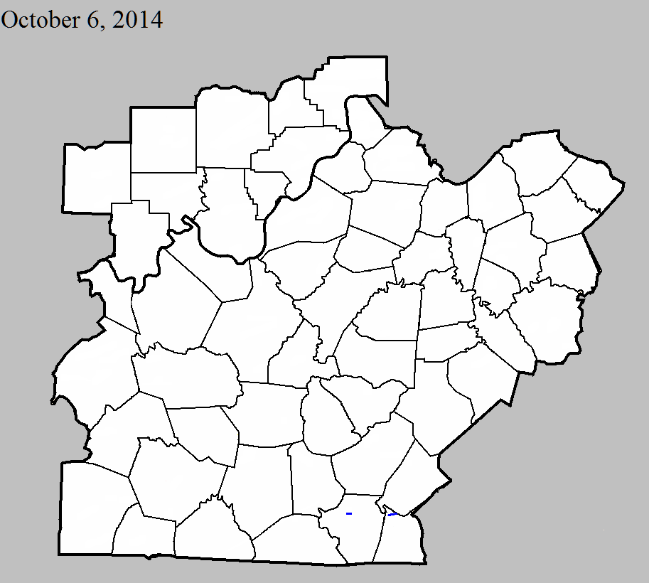
October 6, 2014
County: Cumberland
EF-Scale: EF1
Deaths: 0
Injuries: 0
Path width: 100 yards
Path length: 0.2 mile
Time: 6:02pm CDT
Notes: Two hundred trees were uprooted on a ridge top near the end of Dug Road north of Burkesville.
October 6, 2014
County: Clinton
EF-Scale: EF1
Deaths: 0
Injuries: 0
Path width: 150 yards
Path length: 2.3 miles
Time: 6:13pm - 6:17pm CDT
Notes: This tornado struck about 11 miles NNW of Albany in the northwest tip of Clinton County. Numerous trees were snapped or uprooted. The only non-tree damage was to power poles along US 127. A couple in a vehicle on US 127 was trapped when trees fell across the highway both north and south of them.
Current Hazards
Hazardous Weather Outlook
Storm Prediction Center
Submit a Storm Report
Advisory/Warning Criteria
Radar
Fort Knox
Evansville
Fort Campbell
Nashville
Jackson
Wilmington
Latest Forecasts
El Nino and La Nina
Climate Prediction
Central U.S. Weather Stories
1-Stop Winter Forecast
Aviation
IDSS Forecast Points
Air Quality
Fire Weather
Recreation Forecasts
1-Stop Drought
Event Ready
1-Stop Severe Forecast
Past Weather
Climate Graphs
1-Stop Climate
CoCoRaHS
Local Climate Pages
Tornado History
Past Derby/Oaks/Thunder Weather
Football Weather
Local Information
About the NWS
Forecast Discussion
Items of Interest
Spotter Training
Regional Weather Map
Decision Support Page
Text Products
Science and Technology
Outreach
LMK Warning Area
About Our Office
Station History
Hazardous Weather Outlook
Local Climate Page
Tornado Machine Plans
Weather Enterprise Resources
US Dept of Commerce
National Oceanic and Atmospheric Administration
National Weather Service
Louisville, KY
6201 Theiler Lane
Louisville, KY 40229-1476
502-969-8842
Comments? Questions? Please Contact Us.


 Weather Story
 Weather Map
 Local Radar