
Numerous severe thunderstorms are expected across a broad region from the Ohio Valley to the Mid-Atlantic and Northeast States today into tonight. Swaths of damaging wind gusts are expected and some tornadoes are possible. Bertha is expected to bring tropical storm conditions to portions of the Gulf Coast from the Florida Panhandle westward to southeastern Louisiana later today and Wednesday. Read More >
Important Disclaimer
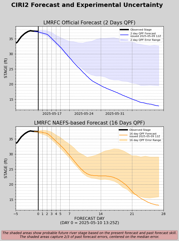
The following plots are experimental and not an official forecast product. They were created as a test based upon user feedback as a way to display 28-day forecasts for locations along the Lower Mississippi and Lower Ohio Rivers. Although 28-day forecasts using 2 days of forecast rainfall (QPF) are considered operational, 28-day forecasts using 16 days of forecast rainfall remain experimental.
Experimental products may not always update in a timely manner and may be discontinued at a future date. Experimental products may not always reflect accurate, quality controlled information and should be used with caution.
Official forecasts remain available from the main LMRFC web page or AHPS (water.weather.gov).
Click here for important information about uncertainty in long range Mississippi River forecasts


 Water Story