Overview
|
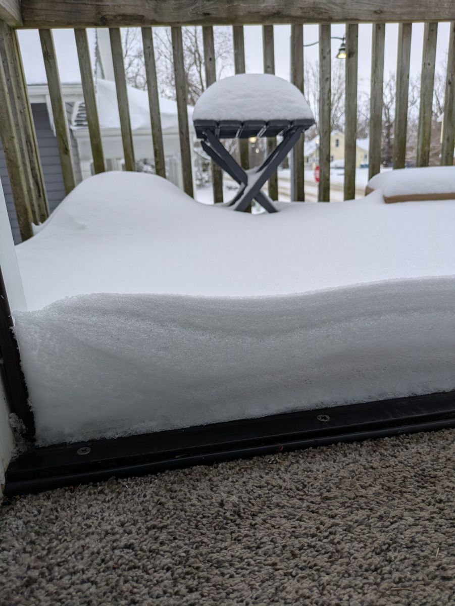
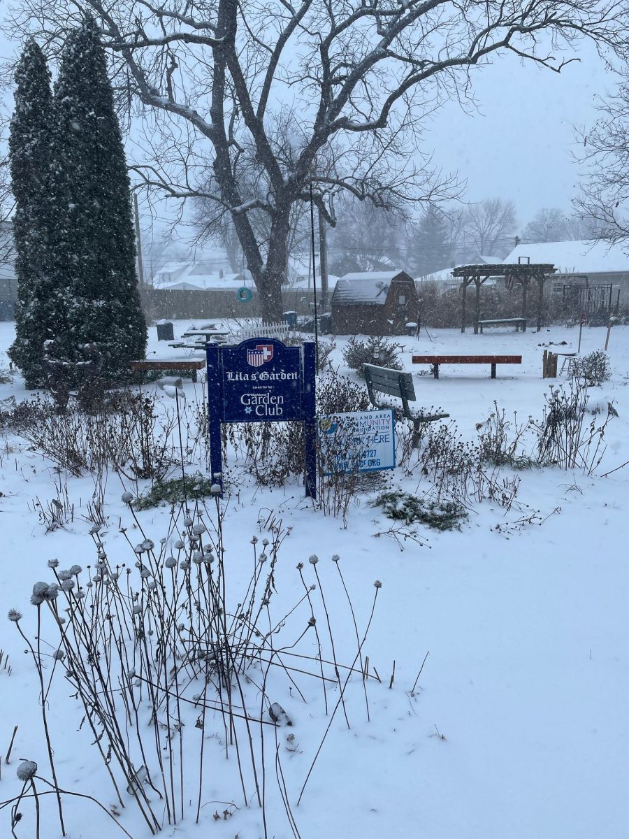
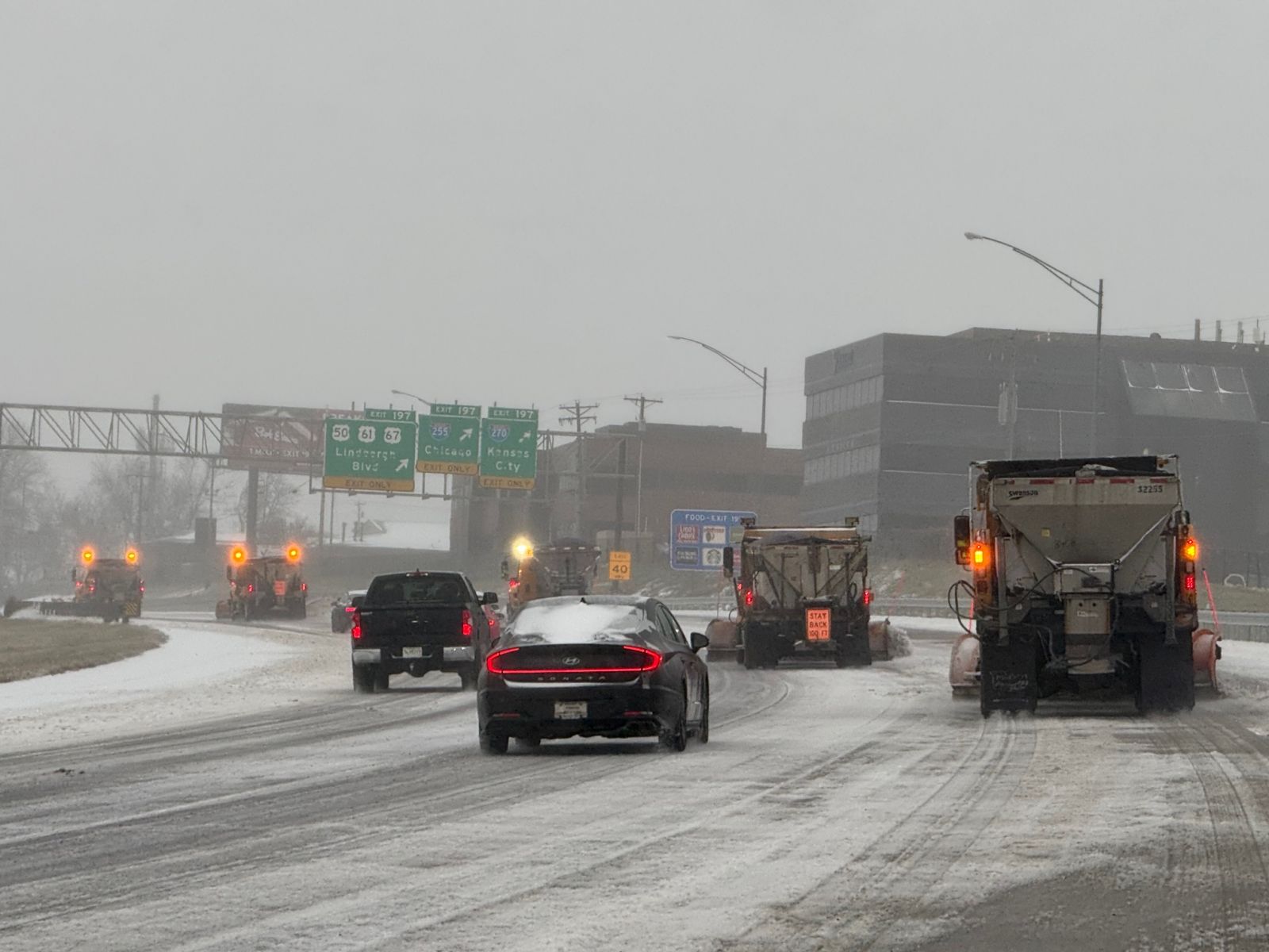
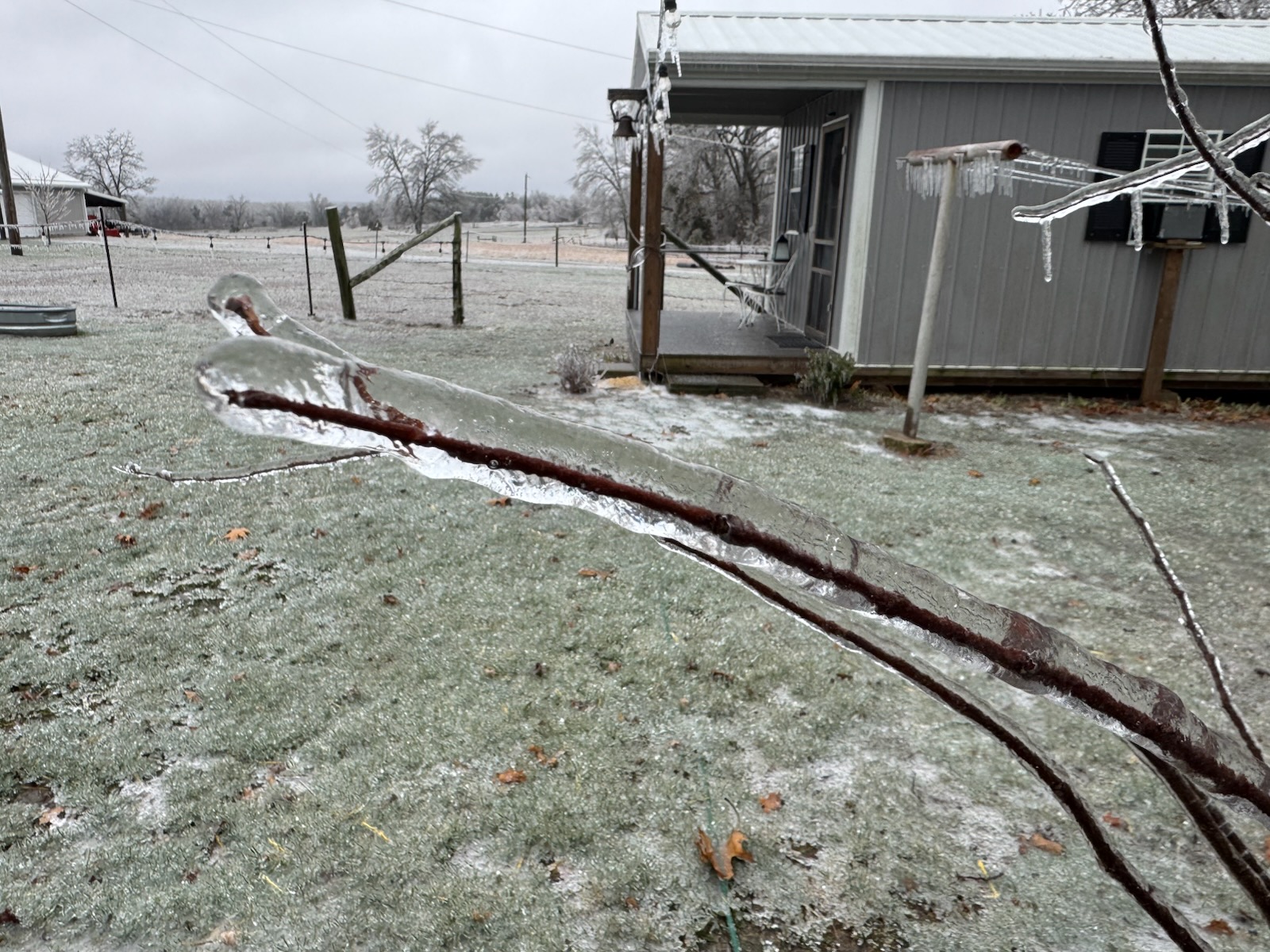
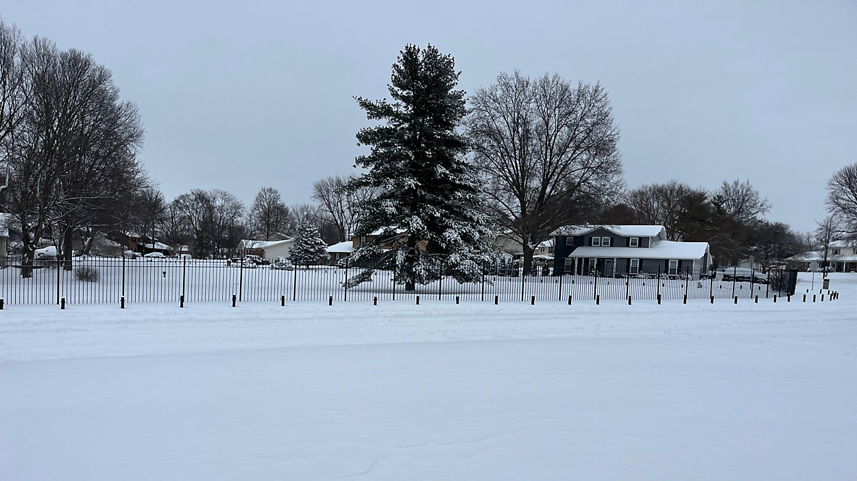
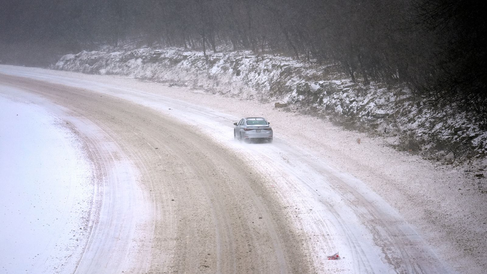
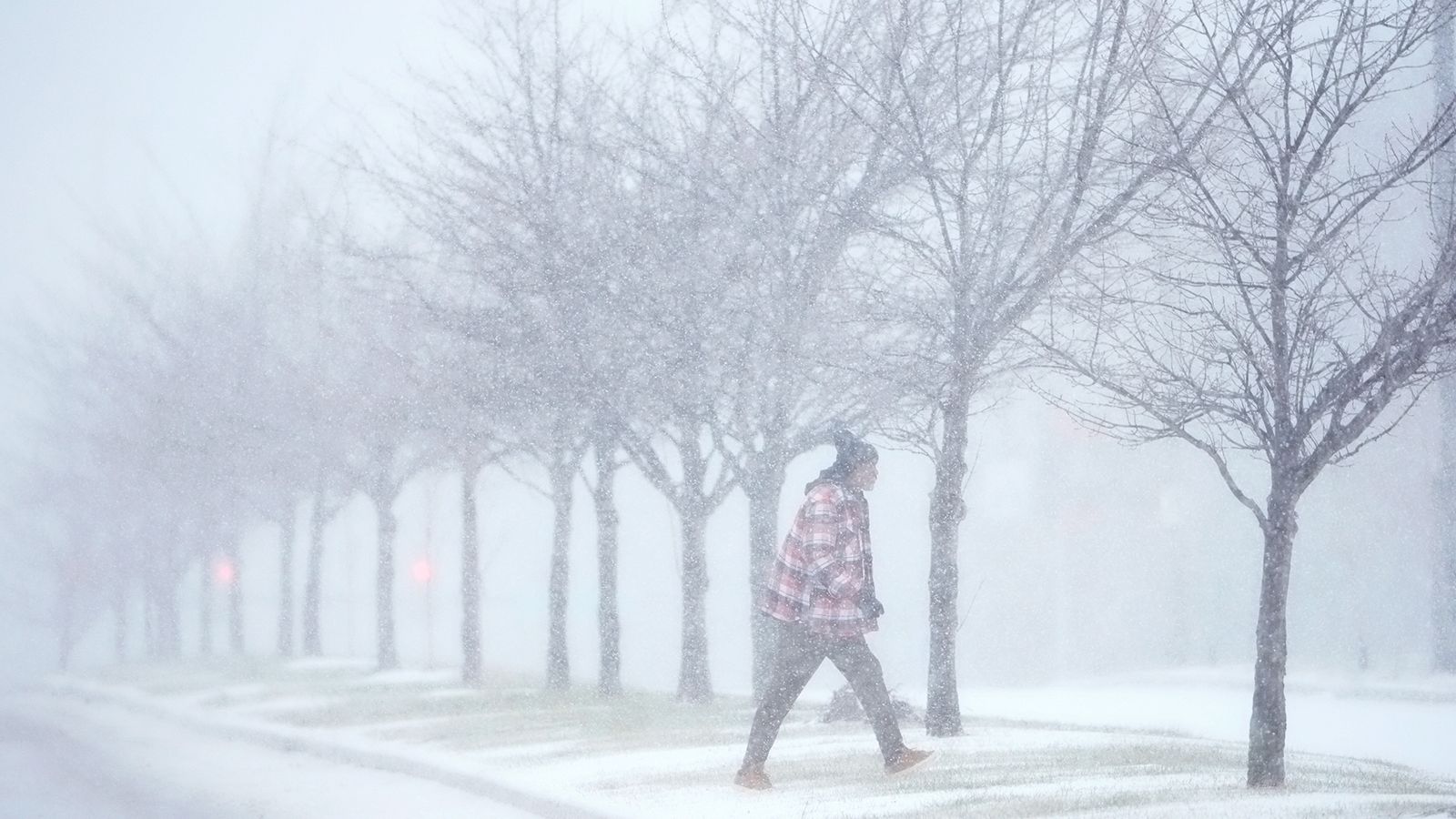
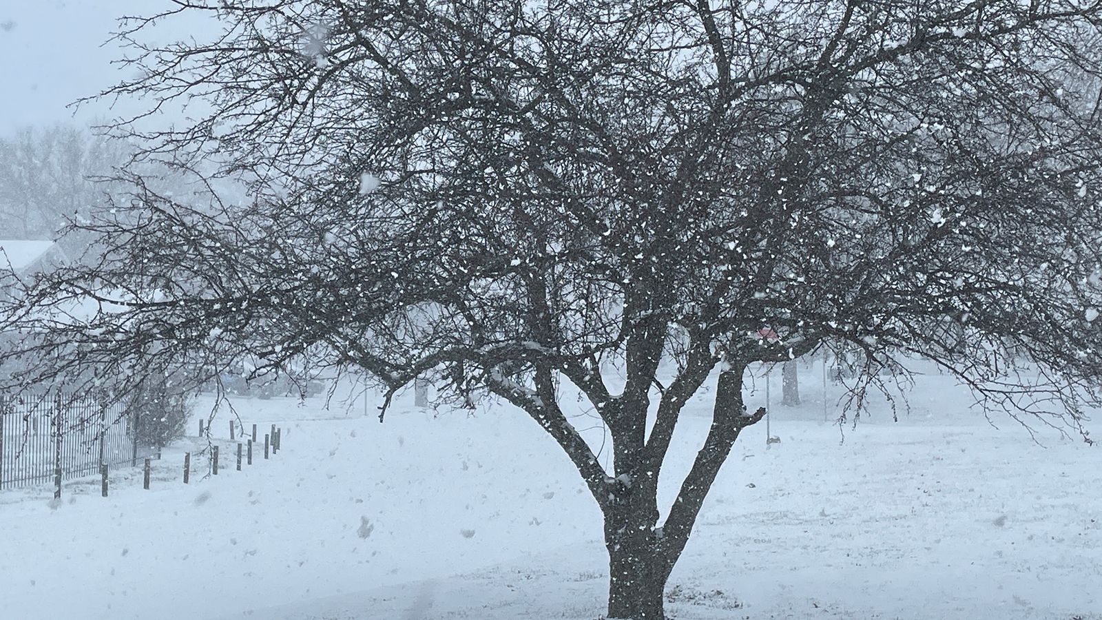
Between Saturday, January 4 and Monday, January 6, 2025, a dynamic winter storm produced widespread heavy snow, sleet, and freezing rain from the Central Plains to the mid-Atlantic coast, along with severe thunderstorms and tornadoes across the lower Mississippi Valley. Across our local area, a broad area of between 4 to 12 inches of snow was observed, with between ¼ and ½ inch of freezing rain and impactful sleet accumulations also observed south of I-70. This event led to widespread significant impacts, some of which lingered for a few weeks due to the prolonged period of below average temperatures and an unusually persistent snowpack that followed. The accumulating freezing rain across southern Missouri and southern Illinois led to numerous power outages, while a layer of sleet under several inches of snow resulted in hazardous travel conditions along the busy I-70, I-44, and I-55 corridors in the region. The cold temperatures, combined with the layer of sleet and freezing rain that fell in some areas before the snow, exacerbated the treacherous road conditions, keeping ice stuck to pavement for weeks after the storm. In some areas, schools closed for several days due to the unsafe road conditions. |
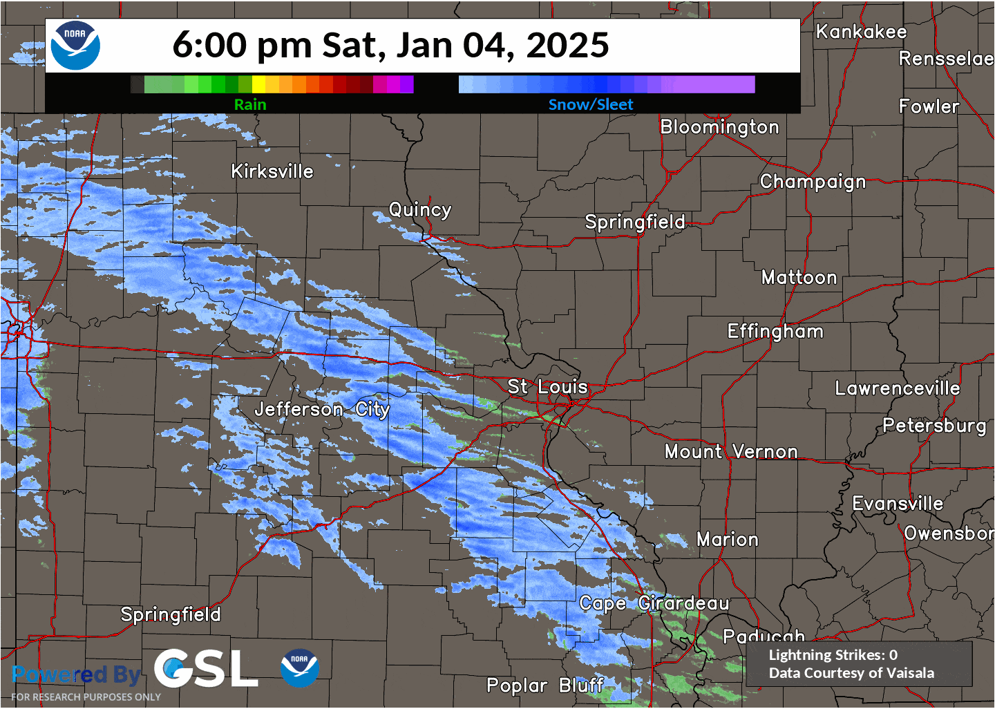 |
| A radar mosaic loop of the winter storm with estimated rain and snow delineation and lightning strikes from 6 pm January 4th through 9 am January 6th. |
Photos & Video
 |
 |
 |
 |
| Snowfall in Alton, IL. (Photo courtesy of Charo Stovall) |
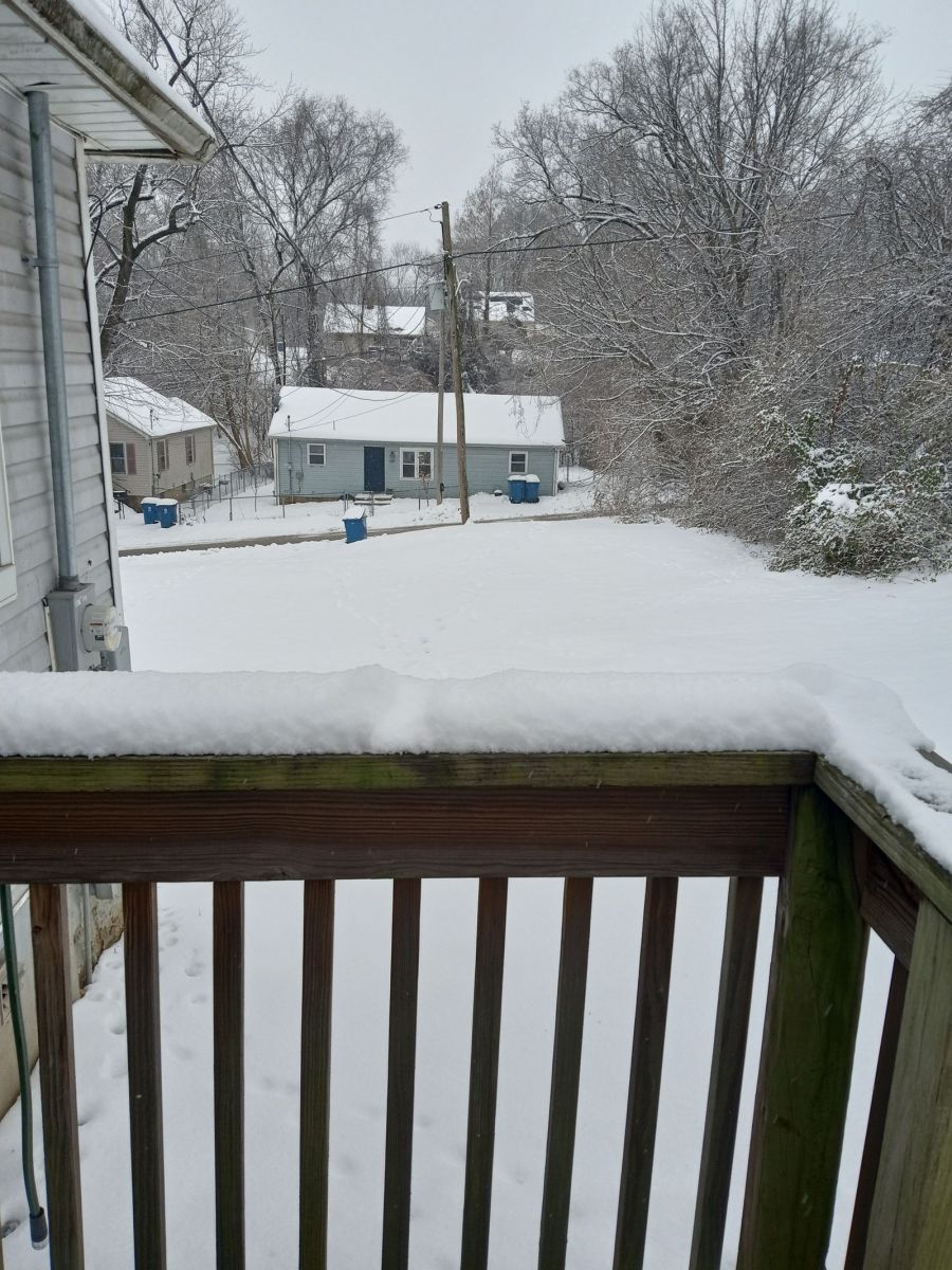
Snowfall in Bel-Nor, MO (Photo courtesy of Sandra Brown) |
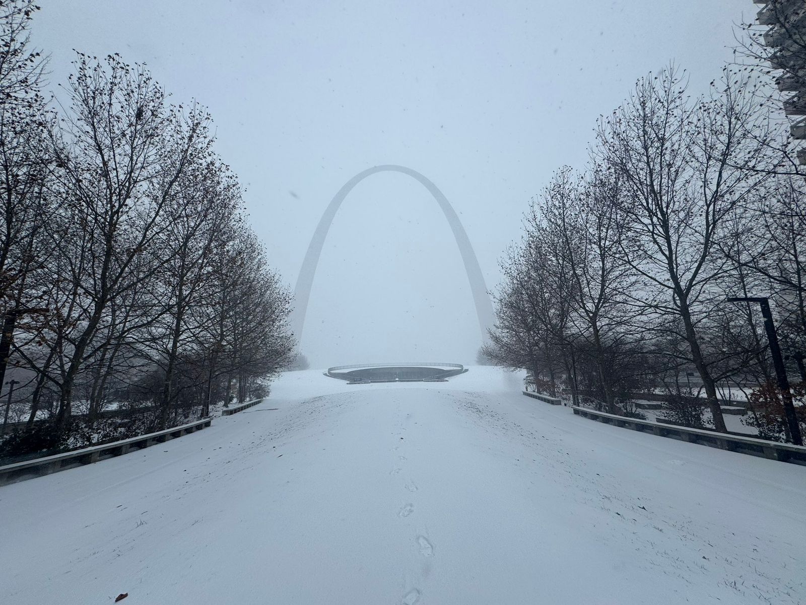
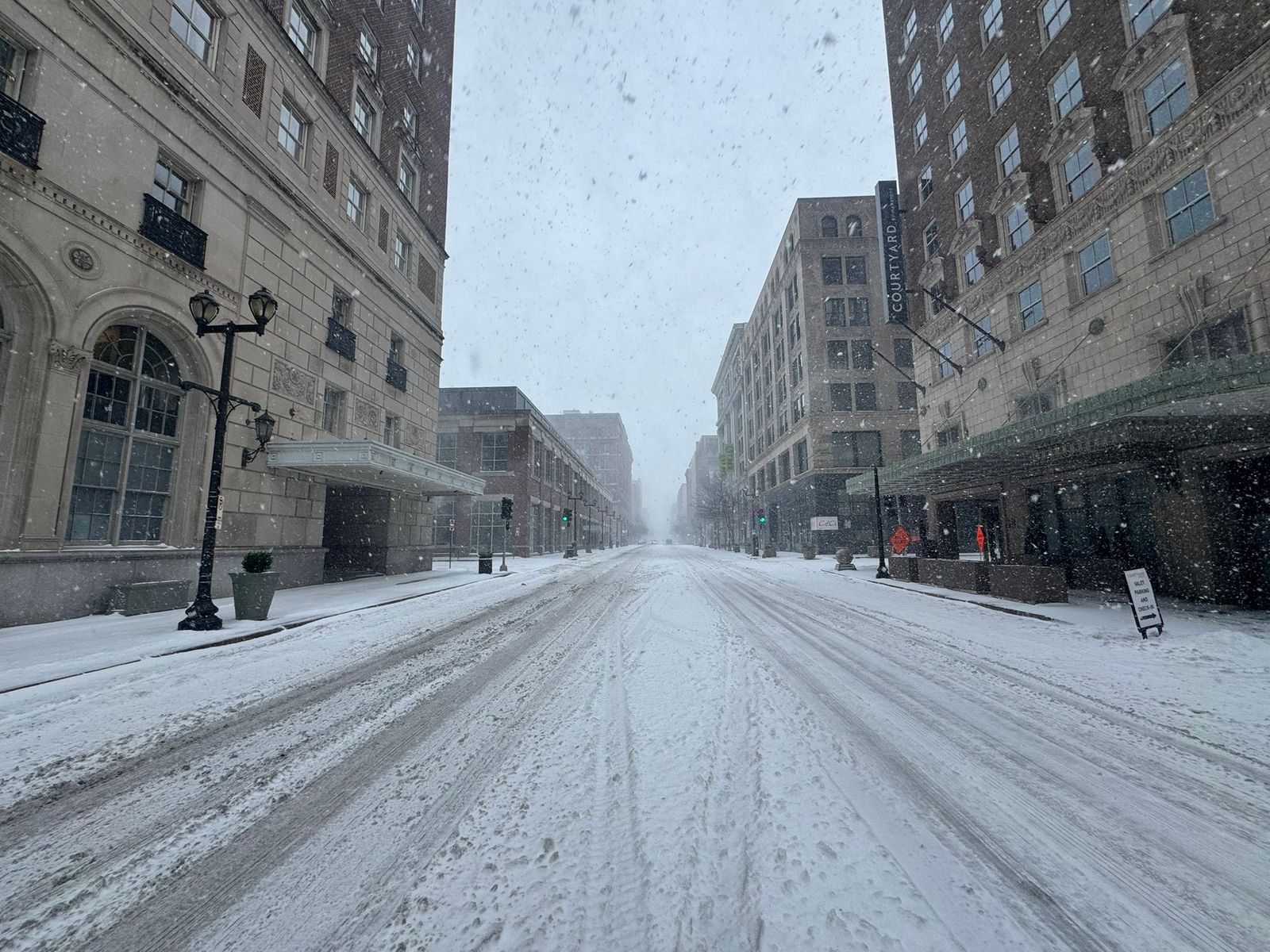
Snowfall in downtown St. Louis, overlooking the Gateway Arch. (Photo courtesy of Joe Dumayas) |
Snowfall in Edwardsville, MO. (Photo courtesy of Haleigh Heuermann) |
 |
 |
 |
 |
| Heavy snow falling in Highland, IL. (Photo courtesy of Spectrum News) |
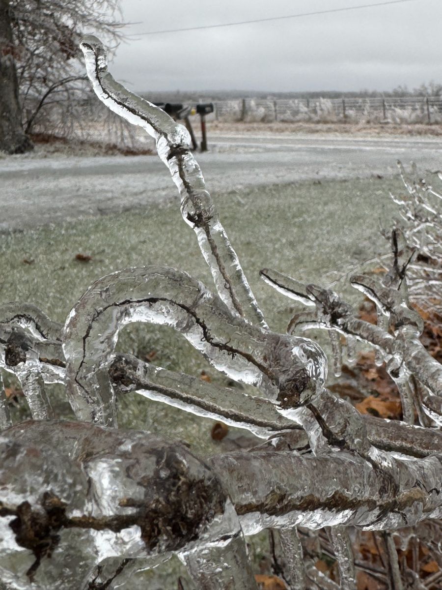
Cars and snowplows on a snow-covered I-55 near Mehlville, MO. | Ice accretion on a tree branch near Fredericktown, MO. (Photo courtesy of the Turners) |
Ice accretion on a tree branch near Fredericktown, MO. (Photo courtesy of the Turners) |
 |
 |
 |
 |
| The Gateway Arch in heavy snow. (Photo courtesy of Denis Beganovic) |
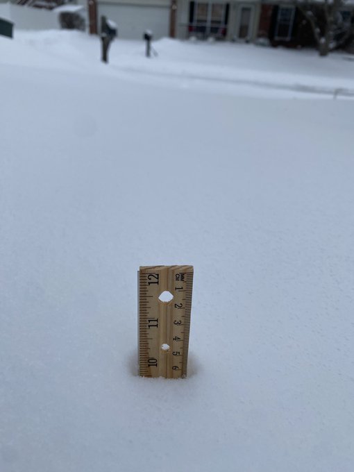
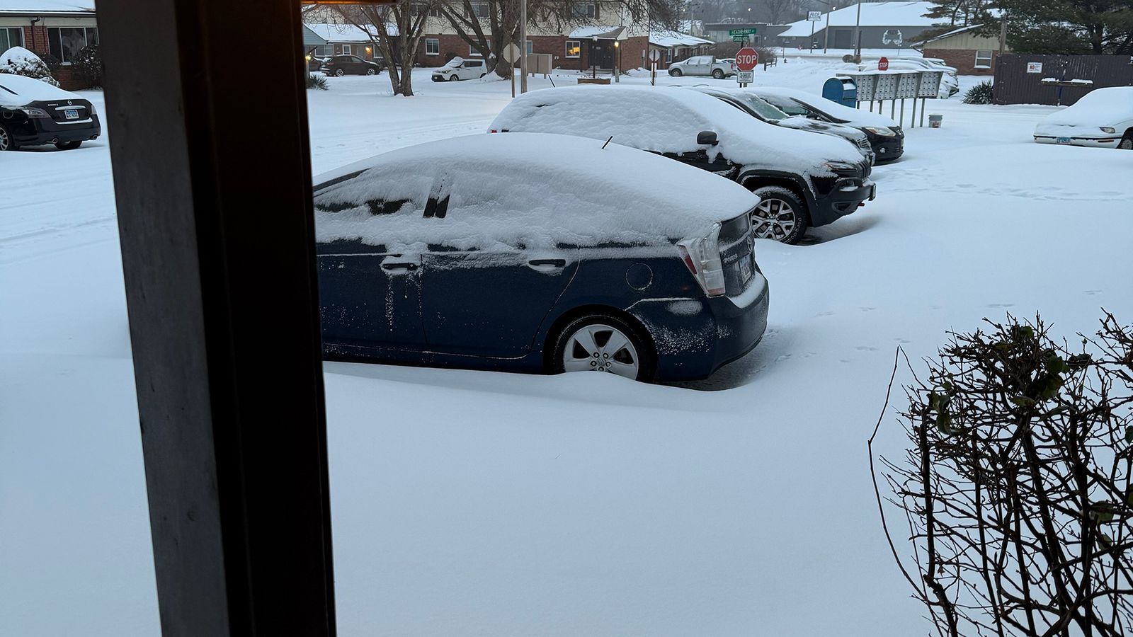
Snowfall measured around 10" in St. Peters, MO. (Photo courtesy of X user @jen_preuss) |
Snowfall in Moscow Mills, MO. (Photo courtesy of Angela Bluhm) |
Snow falling in downtown St. Louis, MO. (Photo courtesy of Denis Beganovic) |
 |
 |
 |
 |
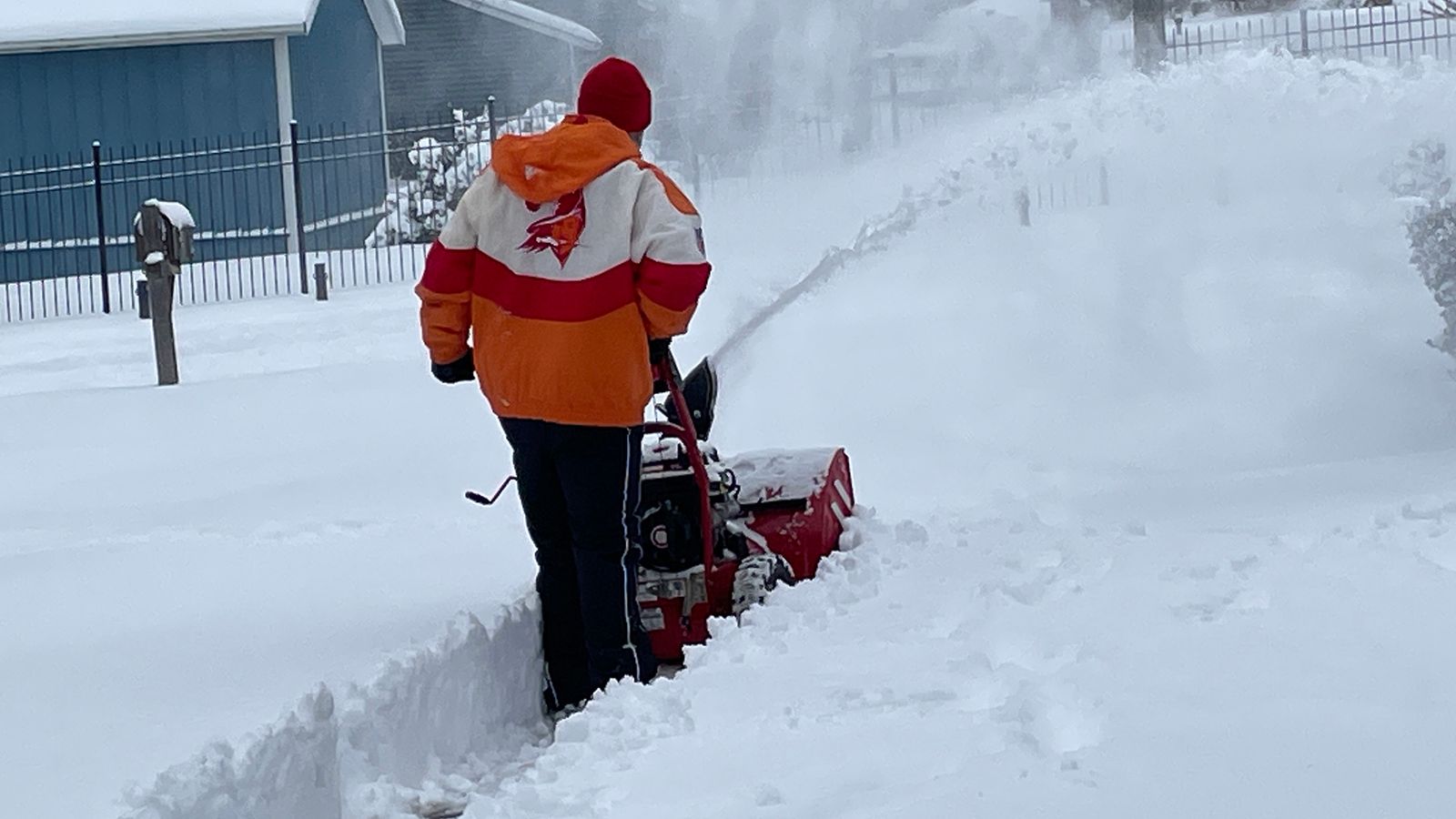
| A person removing snow with a snowblower in St. Charles, MO. (Photo courtesy of Spectrum News) |
Snowfall in St. Charles, MO. (Photo courtesy of Stacy Lynn) |
A car driving on a snow-covered interstate in St. Louis, MO. (Photo courtesy of Jeff Roberson) |
A person walking in the snow in St. Louis, MO. (Photo courtesy of Jeff Roberson) |
 |
 |
 |
 |
| Heavy snow falling in St. Peters, MO. (Photo courtesy of Spectrum News) |
Snow-covered streets in downtown St. Louis, MO. (Photo courtesy of Denis Beganovic) |
Snowfall in Wood River, IL. (Photo courtesy of Angelica Hutchison) |
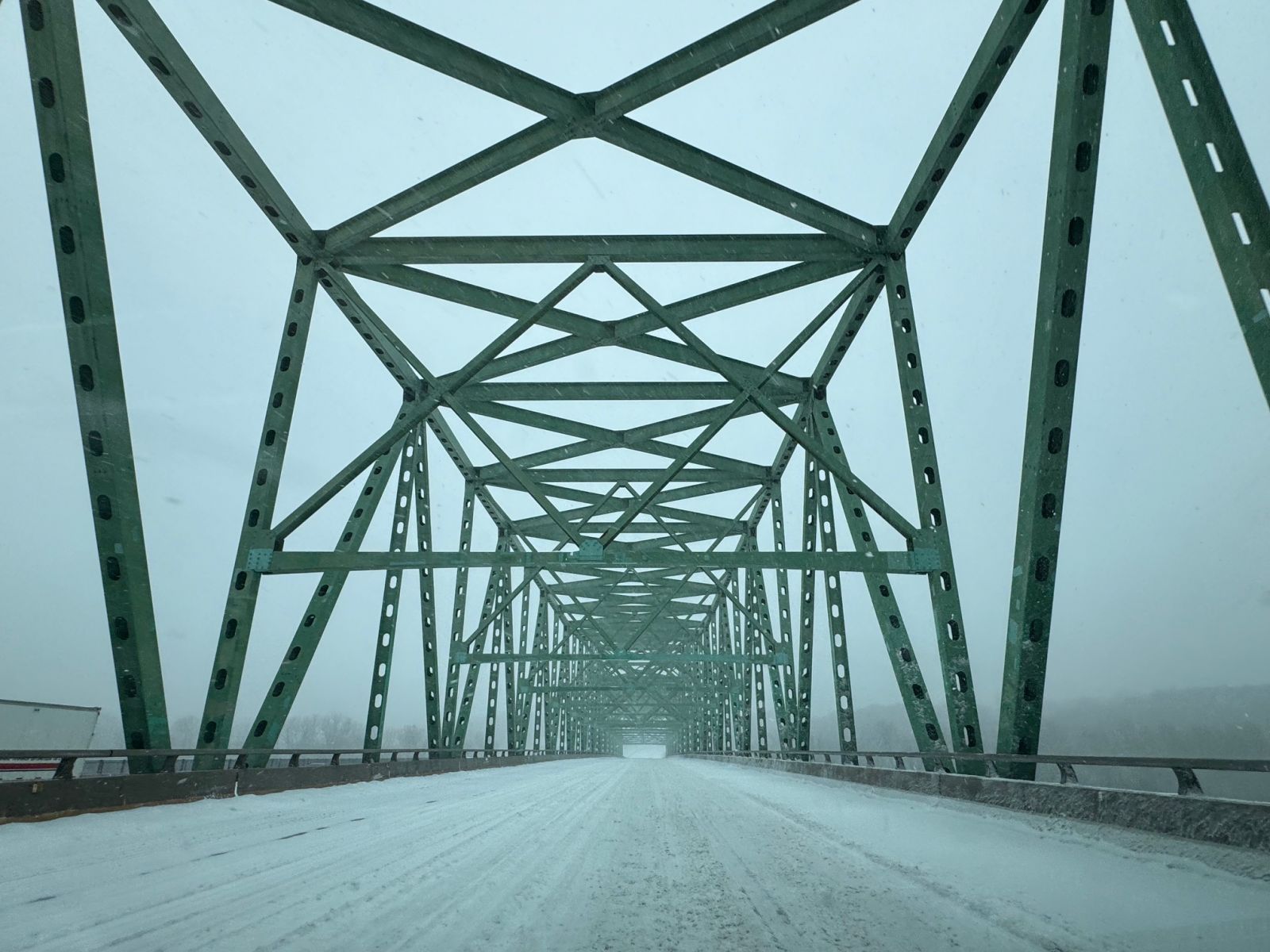
Snow-covered I-64/US 40 across the Daniel Boone Bridge over the Missouri River |
Storm Total Snowfall and Ice Accretion
 |
 |
| Storm total snowfall. | Storm total ice accretion. Note that these amounts may not be fully representative of the corridor of highest amounts in southeast Missouri due to interpolation of sparse ice reports. |
| Report Time | Location | Event Type | Magnitude |
|---|---|---|---|
|
Illinois |
|||
| Adams | |||
| 1/6 11:42 AM | Quincy | SNOW | 9 |
| Bond | |||
| 1/6 11:50 AM | 1 WNW Greenville | SNOW | 6 |
| Clinton | |||
| 1/6 11:35 AM | Saint Rose | SNOW | 10.3 |
| 1/6 8:45 AM | 2 WNW Centralia | SNOW | 7.8 |
| Fayette | |||
| 1/6 11:22 AM | 2 SSW Vandalia | SNOW | 8.5 |
| Jersey | |||
| 1/6 8:00 AM | 1 ENE Elsah | SNOW | 12 |
| 1/6 9:29 AM | 3 SSW Otterville | SNOW | 11.5 |
| 1/6 11:20 AM | 2 SSW Mcclusky | SNOW | 9.3 |
| 1/6 7:59 AM | Jerseyville | SNOW | 8.5 |
| Macoupin | |||
| 1/6 8:20 AM | Staunton | SNOW | 10 |
| 1/6 11:44 AM | Palmyra | SNOW | 7.1 |
| 1/6 9:44 AM | Carlinville | SNOW | 6.8 |
| Madison | |||
| 1/6 11:30 AM | 1 NNW Godfrey | SNOW | 12 |
| 1/6 9:30 AM | Wood River | SNOW | 11 |
| 1/6 9:05 AM | 1 SSW Glen Carbon | SNOW | 8 |
| 1/6 9:30 AM | 1 N Troy | SNOW | 4.5 |
| Monroe | |||
| 1/6 10:46 AM | 2 SSE Columbia | SNOW | 6 |
| Montgomery | |||
| 1/6 10:32 AM | Nokomis | SNOW | 6.5 |
| St. Clair | |||
| 1/6 1:50 PM | O'Fallon | SNOW | 8 |
| 1/6 9:09 AM | Belleville | SNOW | 7.1 |
| 1/6 10:33 AM | 3 N Freeburg | SNOW | 6.5 |
| 1/6 10:33 AM | 3 N Freeburg | SNOW | 5.8 |
| Washington | |||
| 1/6 8:02 AM | Nashville | SNOW | 5 |
|
Missouri |
|||
| Audrain | |||
| 1/6 8:27 AM | 1 WNW Thompson | SNOW | 3.8 |
| Boone | |||
| 1/6 6:00 AM | 3 NNE Ashland | SNOW | 5.6 |
| Callaway | |||
| 1/6 11:54 AM | Mokane | SNOW | 10.5 |
| 1/6 3:00 AM | 1 NNE Lake Mykee | SNOW | 4 |
| 1/5 11:05 PM | 1 SW Holts Summit | SNOW | 3 |
| Cole | |||
| 1/6 6:00 AM | 3 NNW Jefferson City | SNOW | 5.3 |
| 1/6 6:00 AM | 3 NW Jefferson City | FREEZING RAIN | 0.19 |
| Franklin | |||
| 1/6 9:18 AM | Pacific | SNOW | 7 |
| 1/6 9:29 AM | 3 N Union | SNOW | 4.5 |
| 1/6 10:00 AM | Robertsville | SNOW | 4.3 |
| 1/6 6:00 AM | 1 N Villa Ridge | SNOW | 2.5 |
| 1/6 6:00 PM | 1 N Villa Ridge | FREEZING RAIN | 0.1 |
| Jefferson | |||
| 1/6 7:00 AM | Arnold | SNOW | 6 |
| 1/6 7:41 AM | 1 NE Barnhart | SNOW | 4.6 |
| 1/6 8:15 AM | 2 N Valles Mill | SNOW | 4.5 |
| Lincoln | |||
| 1/6 7:00 AM | 5 ENE Moscow Mills | SNOW | 10 |
| 1/6 9:56 AM | 1 E Silex | SNOW | 10 |
| 1/6 7:00 AM | Troy | SNOW | 9.5 |
| 1/6 9:55 AM | Moscow Mills | SNOW | 8 |
| 1/6 8:06 AM | 3 S Hawk Point | SNOW | 6.5 |
| Marion | |||
| 1/5 11:25 PM | 2 E Hannibal | SNOW | 8.5 |
| Pike | |||
| 1/6 9:20 AM | Eolia | SNOW | 14.7 |
| St. Charles | |||
| 1/6 6:00 AM | 2 WSW Weldon Spring | SNOW | 12.7 |
| 1/6 8:49 AM | 3 SSW Kampville | SNOW | 11.5 |
| 1/6 7:00 AM | Lake Saint Louis | SNOW | 11 |
| 1/6 9:09 AM | 2 SSW Saint Charles | SNOW | 11 |
| 1/6 10:28 AM | Flint Hill | SNOW | 11 |
| 1/6 7:50 AM | 1 WSW Saint Charles | SNOW | 10.3 |
| 1/6 7:37 AM | 2 S Orchard Farms | SNOW | 10 |
| 1/6 8:20 AM | 3 NNE Saint Charles | SNOW | 10 |
| 1/6 8:52 AM | 1 SE Wentzville | SNOW | 10 |
| 1/6 8:59 AM | 1 WSW Dardenne Prairie | SNOW | 10 |
| 1/6 9:23 AM | 2 WSW Saint Charles | SNOW | 10 |
| 1/6 8:20 AM | 2 ENE Saint Peters | SNOW | 9.8 |
| 1/6 8:18 AM | 1 NNW Dardenne Prairie | SNOW | 9.5 |
| 1/6 12:00 AM | 2 WSW Weldon Spring | SNOW | 9.3 |
| 1/6 7:00 AM | Dardenne Prairie | SNOW | 9 |
| 1/6 8:18 AM | 2 NNE O'Fallon | SNOW | 9 |
| 1/6 8:45 AM | 1 WSW Dardenne Prairie | SNOW | 9 |
| 1/6 9:30 AM | 1 NNW Saint Peters | SNOW | 9 |
| 1/6 12:00 AM | 1 N Harvester | SNOW | 6.5 |
| St. Francois | |||
| 1/6 6:00 AM | 2 ENE Farmington | SNOW | 2 |
| 1/6 7:44 AM | 1 ESE Knob Lick | FREEZING RAIN | 0.38 |
| 1/6 6:00 AM | 2 NE Farmington | FREEZING RAIN | 0.25 |
| St. Louis | |||
| 1/6 9:19 AM | 1 SE Bel-Ridge | SNOW | 9 |
| 1/6 1:00 PM | 2 ENE Chesterfield | SNOW | 9 |
| 1/6 6:00 AM | 1 NNW Woodson Terrace | SNOW | 8.5 |
| 1/6 8:43 AM | Ferguson | SNOW | 8.5 |
| 1/6 11:11 AM | Ferguson | SNOW | 8.5 |
| 1/6 9:26 AM | 1 W Spanish Lake | SNOW | 8 |
| 1/6 12:00 PM | 1 NW Ballwin | SNOW | 8 |
| 1/6 7:00 AM | 1 W Lemay | SNOW | 7.8 |
| 1/6 7:38 AM | 2 SW Saint Ann | SNOW | 7.8 |
| 1/6 7:00 AM | Saint Ann | SNOW | 7 |
| 1/6 8:44 AM | Wildwood | SNOW | 7 |
| 1/6 10:45 AM | 2 WSW Lakeshire | SNOW | 7 |
| 1/6 3:00 PM | Jennings | SNOW | 7 |
| 1/6 4:29 PM | 1 NE Glendale | SNOW | 7 |
| 1/6 11:00 AM | 1 SE Affton | SNOW | 6.4 |
| 1/6 9:10 AM | Crestwood | SNOW | 6.1 |
| 1/6 10:46 AM | Creve Coeur | SNOW | 6.1 |
| 1/6 10:45 AM | Ballwin | SNOW | 6 |
| St. Louis City | |||
| 1/6 7:00 AM | 3 NNE Lemay | SNOW | 8.5 |
| 1/6 9:01 AM | 3 N Lemay | SNOW | 8 |
| 1/6 9:00 AM | 2 E Shrewsbury | SNOW | 7 |
| 1/6 9:10 AM | 2 NNE Lemay | SNOW | 6.5 |
| 1/6 12:55 PM | 1 WNW Saint Louis | SNOW | 6.4 |
| Warren | |||
| 1/6 8:28 AM | 2 S Truxton | SNOW | 8 |
Observations are collected from a variety of sources with varying equipment and exposures. We thank all volunteer weather observers for their dedication. Not all data listed are considered official.
Meteorology
Between Saturday, January 4 and Monday, January 6, 2025, a deepening trough of low pressure aloft moved from west to east across the central U.S., bringing with it a strong surface surface low that roughly paralleled the Missouri/Arkansas state line. Ahead of this system, relatively warm, moisture-rich air streamed northward and over the top of a nearly stationary warm front, leading to several hours of enhanced lift over a broad area of Missouri and Illinois.
 |
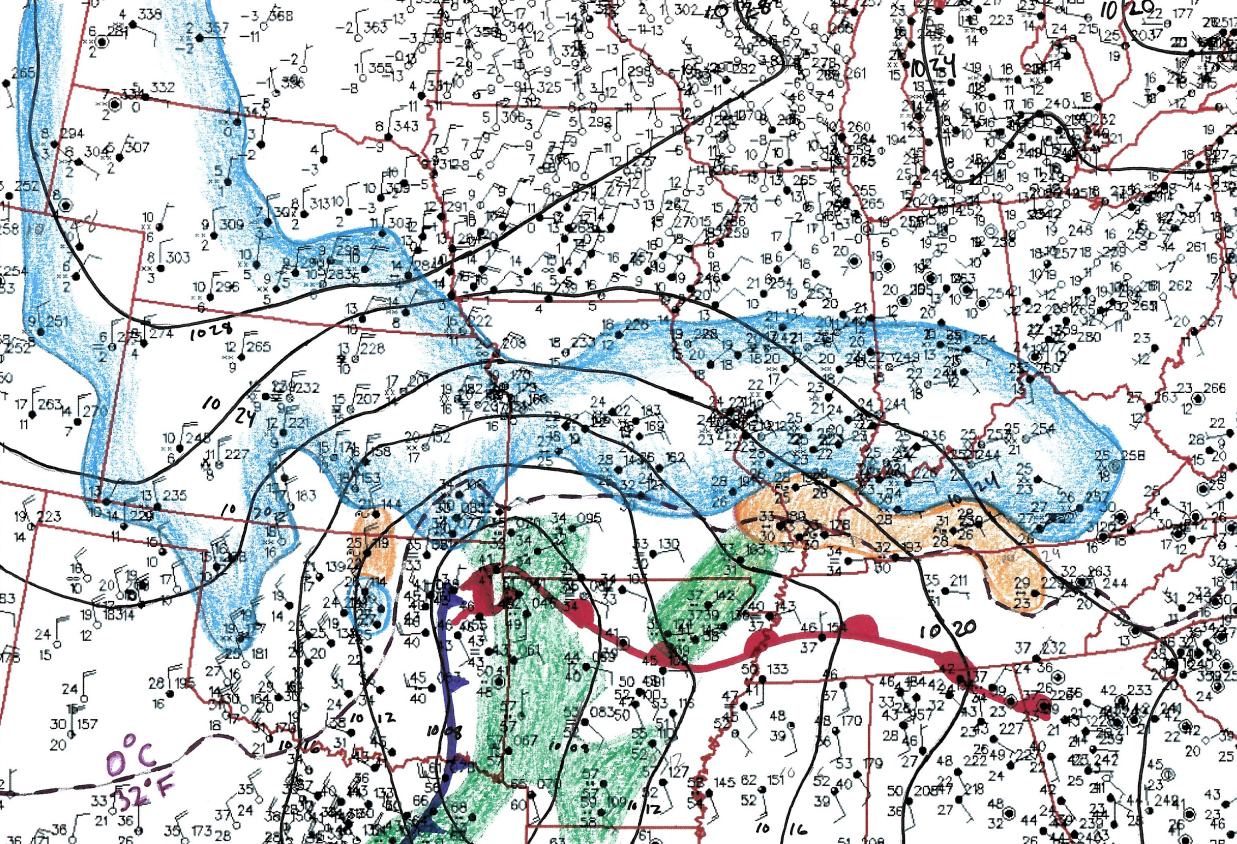 |
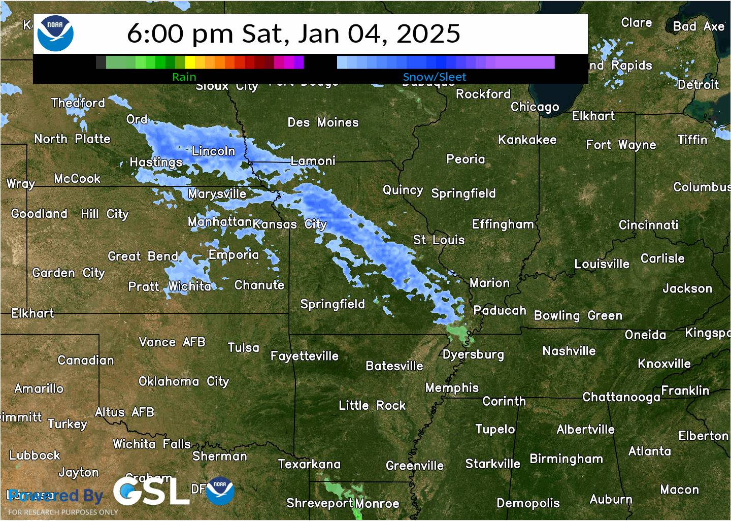
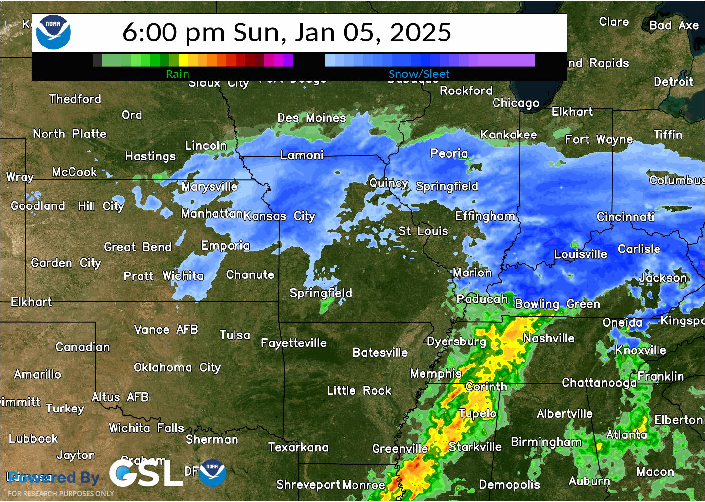
| A radar composite with precipitation types for the first half of the event (6 pm Saturday, 1/04 - 6 pm Sunday, 1/05). Some of the heaviest snowfall rates and a majority of the local sleet and freezing rain accumulations occurred during this period. | This is a hand-drawn analysis of surface observations taken near the peak of the storm intensity, which was roughly 9 AM Sunday morning. Note the broad area of snow (blue shading) stretching from the high plains to eastern Kentucky, mixed precipitation across southeast Missouri and southern Illinois (orange shading), and both rain (green shading) and thunderstorms across far southern Missouri and Arkansas. |
While it took several hours for precipitation to work its way through the very dry air that was initially in place across the area, eventually widespread and persistent precipitation developed between late Saturday evening and early Sunday afternoon. This included moderate to heavy snow across much of the northern 2/3rds of Missouri and central/southern Illinois. Meanwhile, the melting line (32° surface temperatures) remained draped just south of the I-70 corridor for much of the event, leading to significant sleet and freezing rain accumulations across a large portion of the Ozarks and southern Illinois. The St. Louis metro area in particular saw a wide range of precipitation types during the initial period of this storm, with impactful snow, sleet, and freezing rain accumulations all observed.
 |
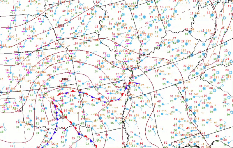 |
| After a lull in precipitation during the mid to late afternoon Sunday, a second round of primarily snow brought a second round of impactful accumulations. (6 pm Sunday, 1/05 - 6 pm Monday, 1/06). | This surface analysis time-series shows the west-to-east progression of the surface low pressure system, along with the position of a nearly stationary warm front near and south of the Missouri/Arkansas border for much of the event. |
After a brief lull in precipitation rates during the mid to late afternoon Sunday, another round of mostly light to moderate snow filled into the area during the evening and overnight as the surface low moved east of the Mississippi River. As this occurred, colder air also began to filter into the area, largely putting an end to sleet and freezing rain accumulations across southeast Missouri and southern Illinois. While snow rates were slightly lower with this second round overall, this added several more inches of snow to the event total, including in areas that had previously only observed sleet or freezing rain during the initial stages of the event.
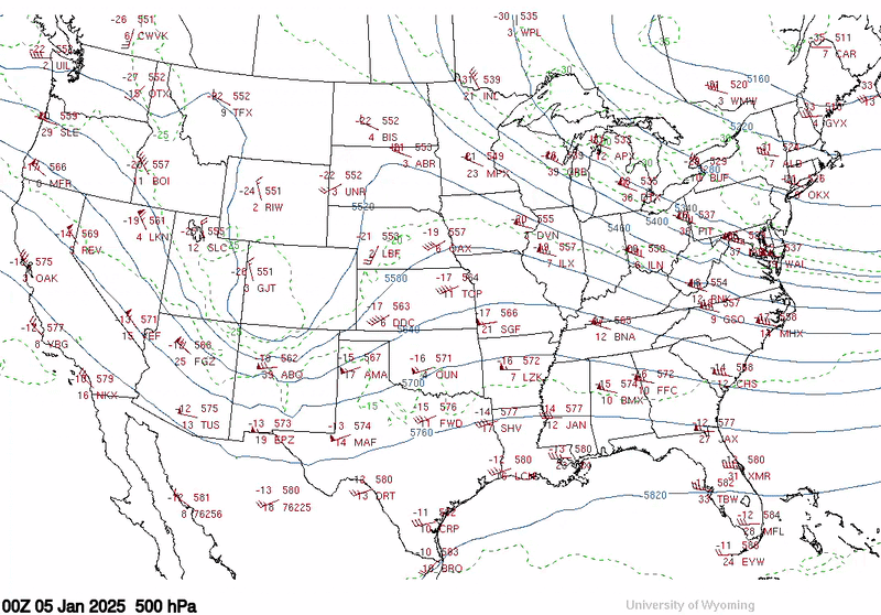 |
| This loop shows the west-to-east progression of a deepening 500 mb trough (contours). Note the strong wind barbs along the base of this trough, which is indicating a powerful jet streak with winds reaching near 110 mph as it passed through the area. |
Impactful snow accumulations finally came to an end by Monday morning, but this storm would go on to produce widespread heavy snow as far east as the mid-Atlantic Coast before drifting into the Atlantic Ocean late Monday. While the snow came to an end by the morning of January 6, an extended period of below average temperatures allowed measurable snow to remain on the ground for more than two weeks after the event, leading to prolonged impacts.
 |
Media use of NWS Web News Stories is encouraged! Please acknowledge the NWS as the source of any news information accessed from this site. |
|


 Weather Story
 Weather Map
 Local Radar