
A heat wave over the Southwest will intensify this week, peaking and expanding into the Intermountain West and northern High Plains this weekend. Critical to extremely critical fire weather conditions are forecast from the Northwest and the northern Great Basin this weekend. Particularly Dangerous Situation Red Flag Warnings have been issued. Read More >
Overview
|
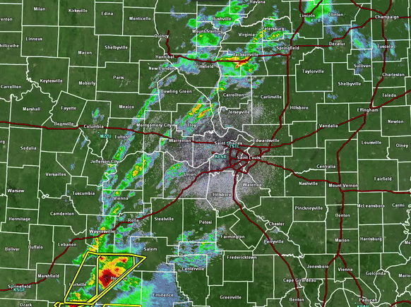
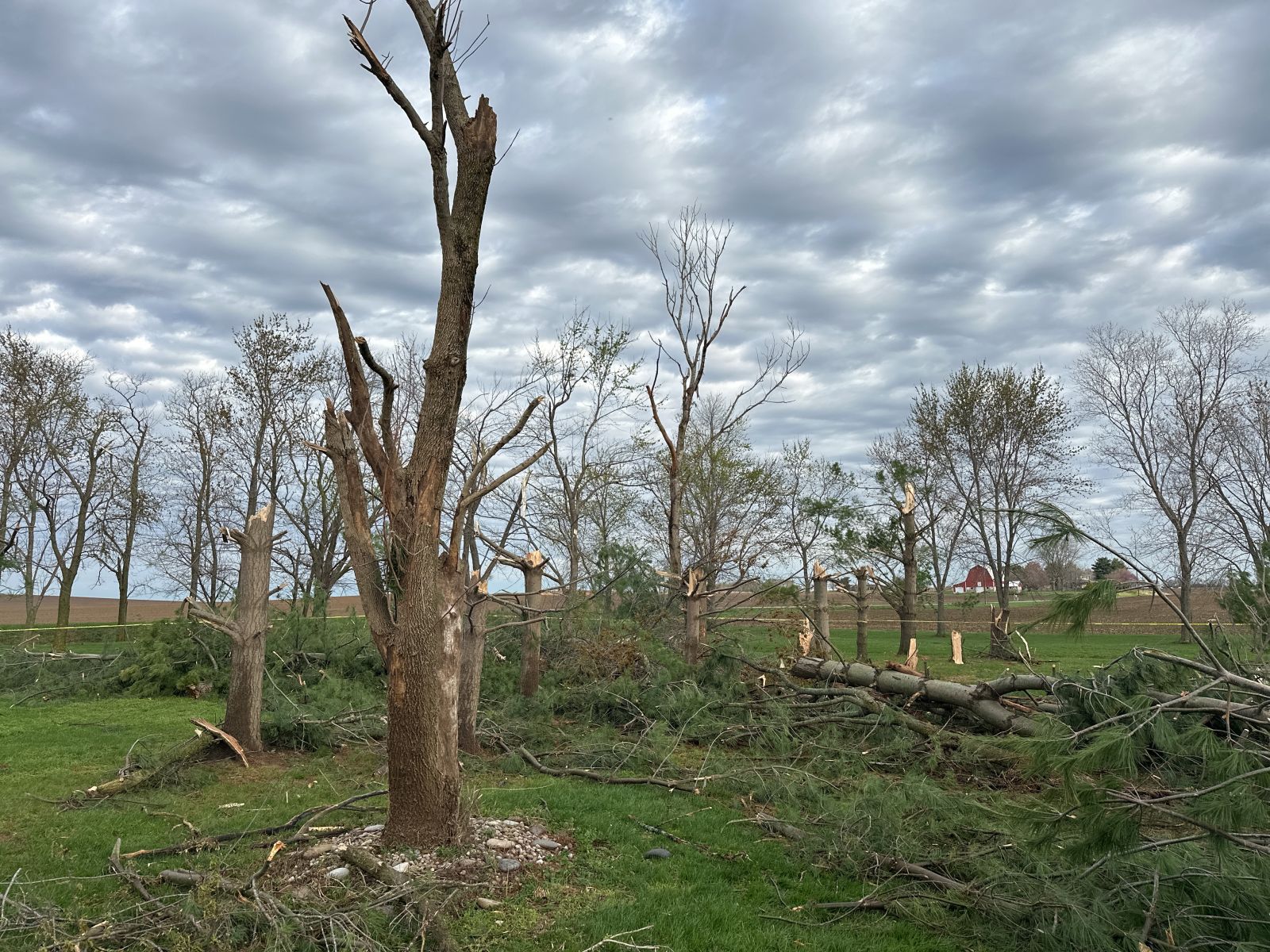
During the afternoon and early evening of April 2, 2025, numerous strong to severe thunderstorms impacted southeast and east-central Missouri as well as south-central Illinois. Large hail, damaging wind, and a few tornadoes were observed. This activity occurred on the northwest extent of a significant tornado outbreak later that evening across the Ohio River Valley. Below is a summary of the severe weather that occurred that day, along with details on the two tornado surveyed by NWS St. Louis.
KLSX Base reflectivity and warnings from the afternoon and evening of April 2, 2025. |
  |
 |
 |
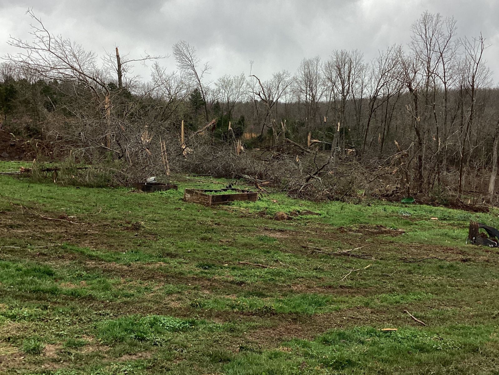 |
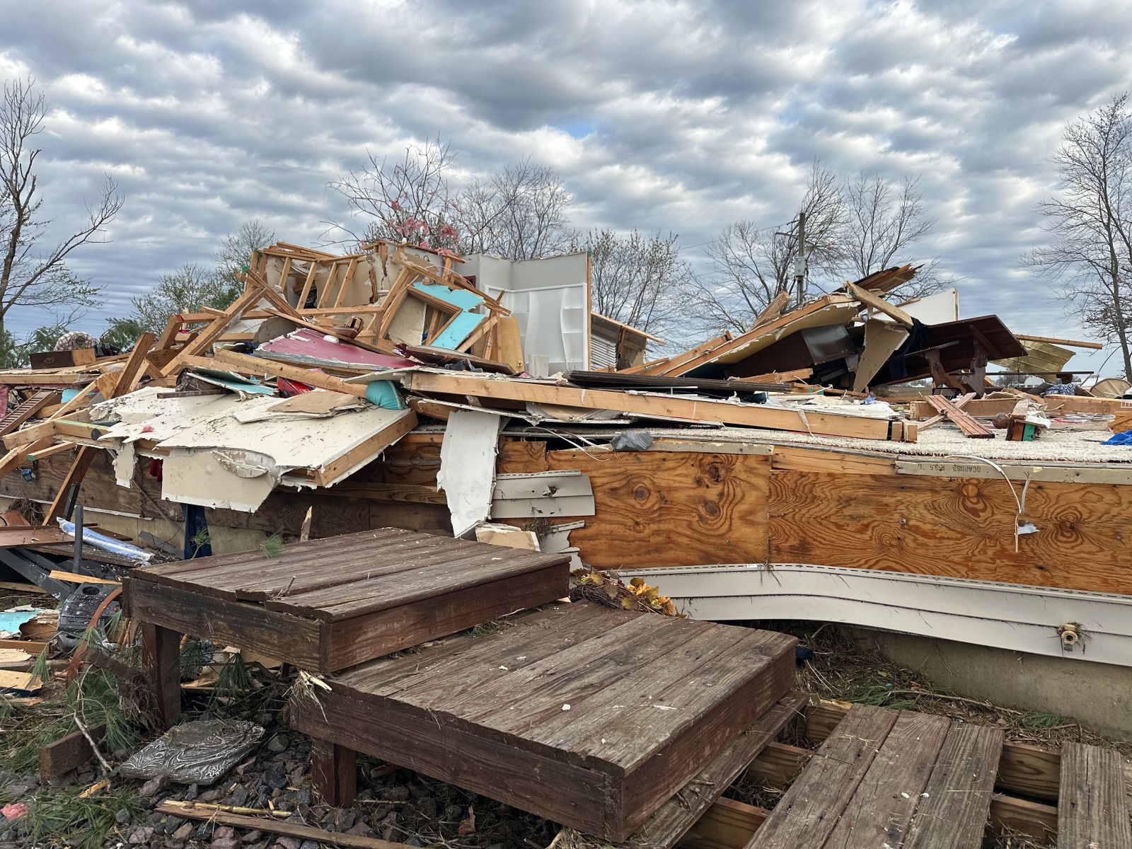
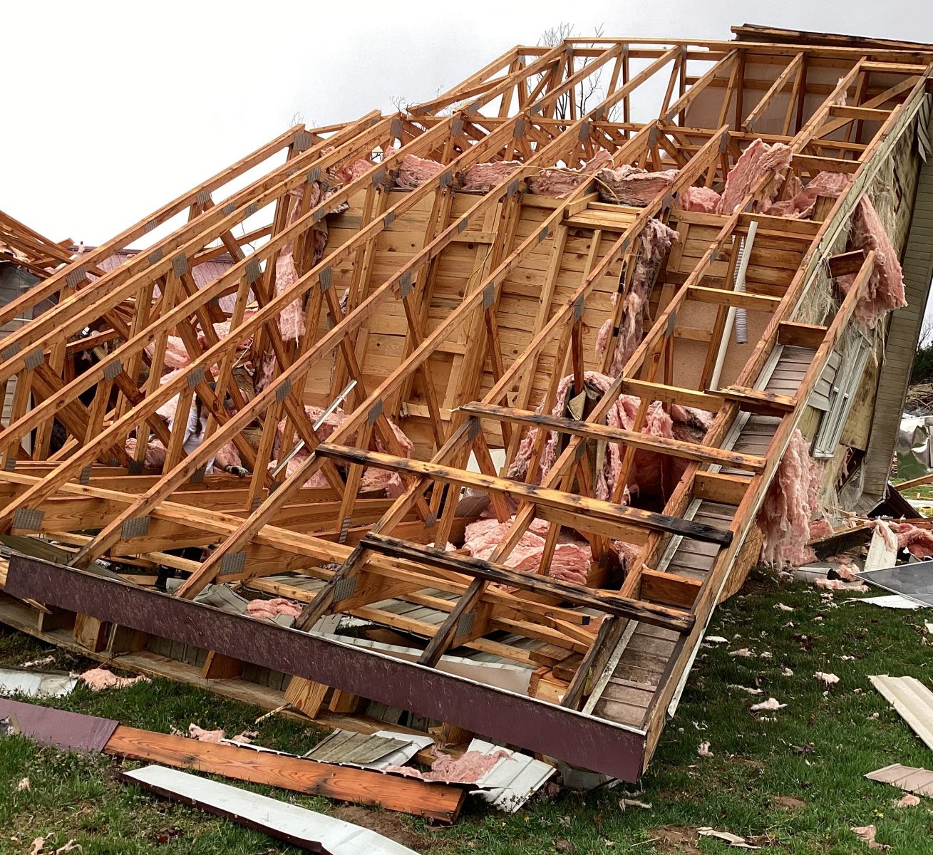
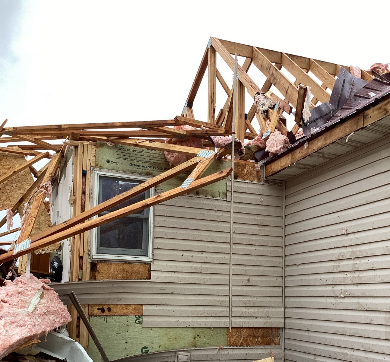
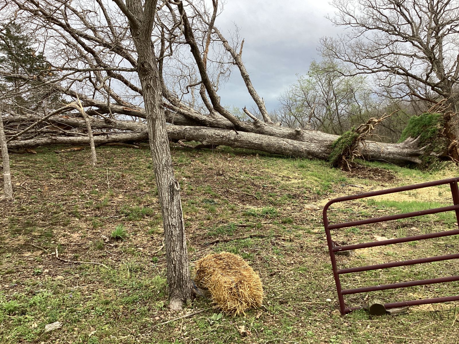
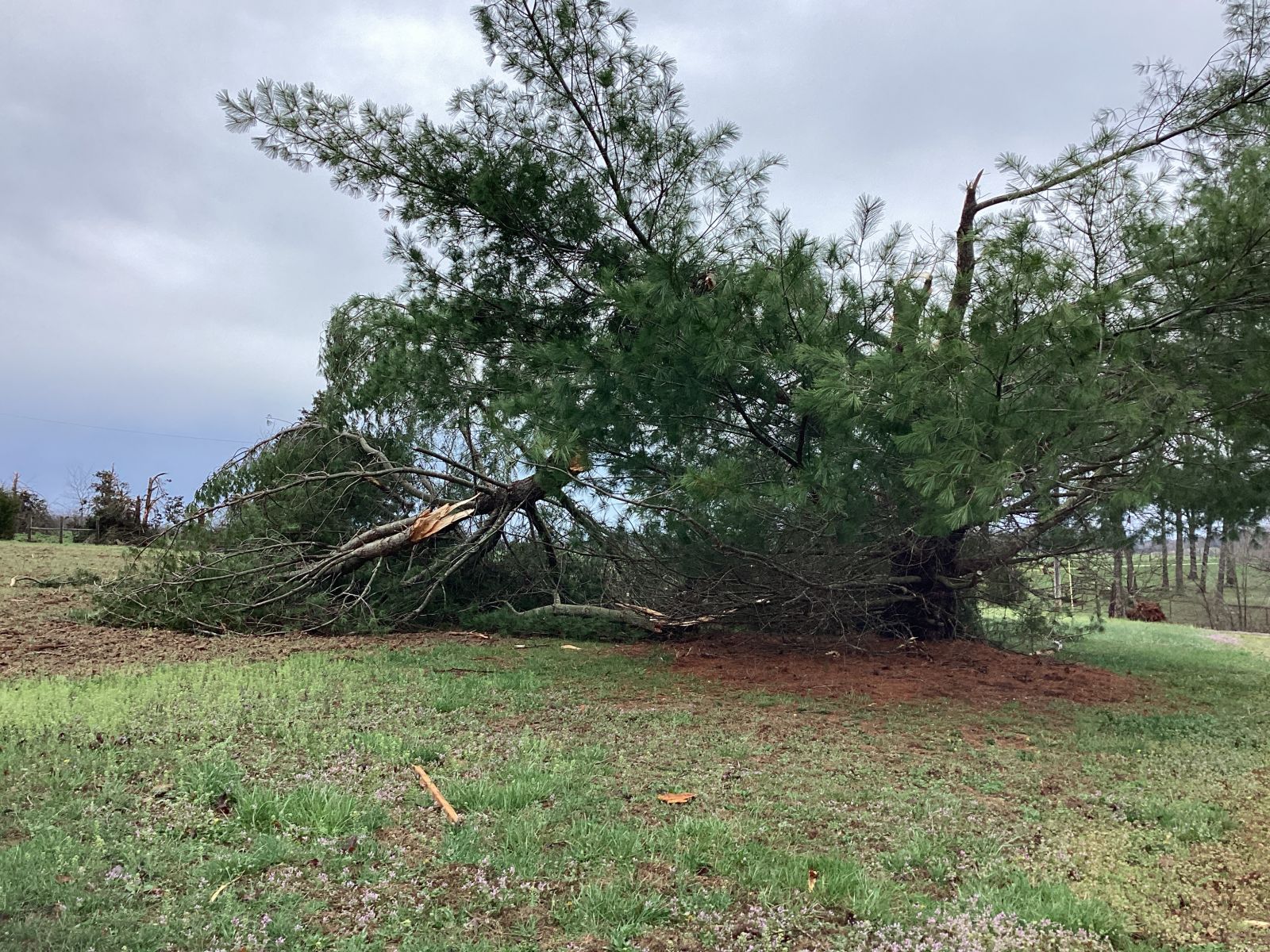
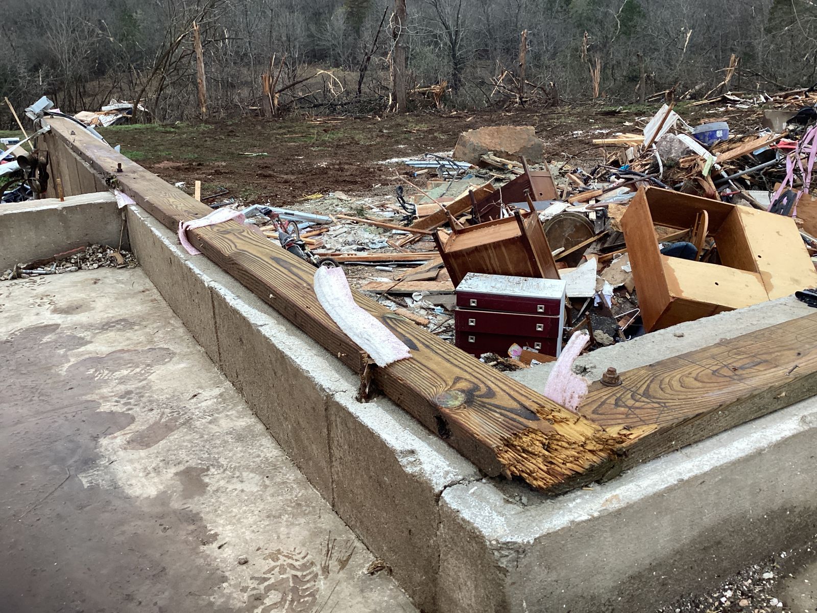
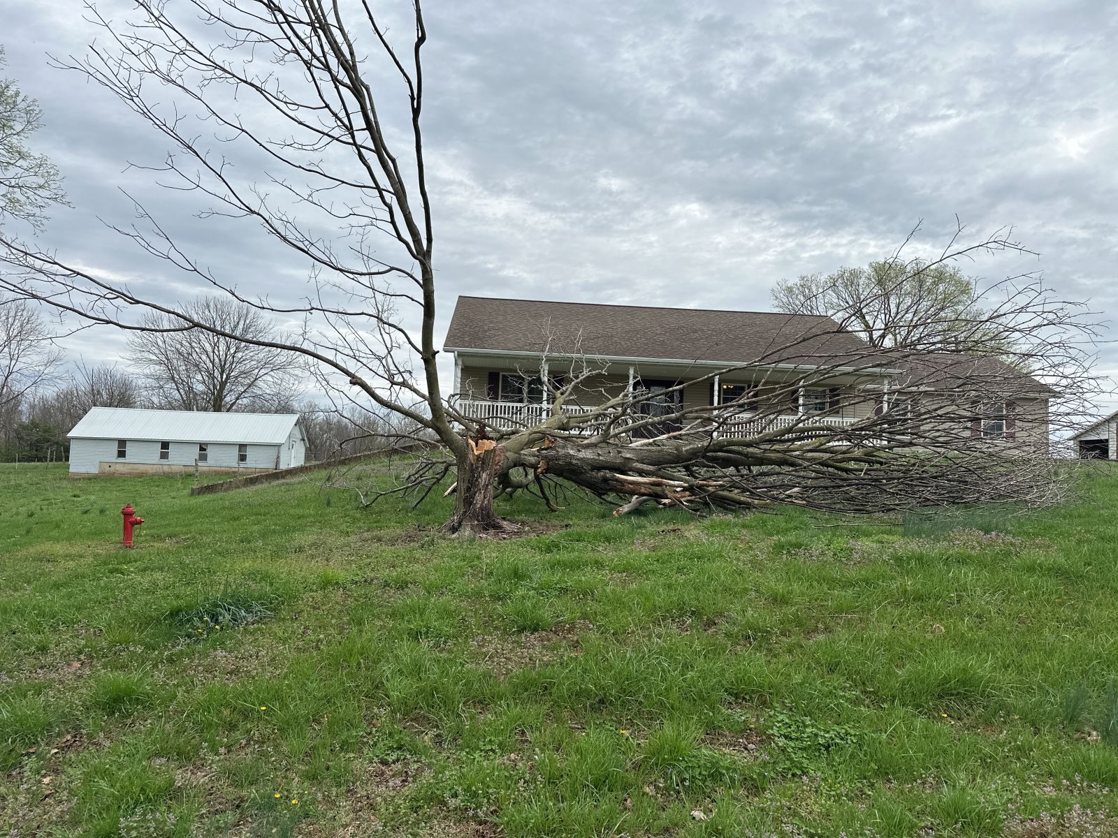
| A home destroyed by the Greenville tornado. Photo courtesy of NWS Storm Survey team. | A home destroyed by the Potosi tornado. Photo courtesy of NWS Storm Survey team. | Trees sheared off by the Potosi tornado. Photo courtesy of NWS Storm Survey team. |
Tornadoes
|
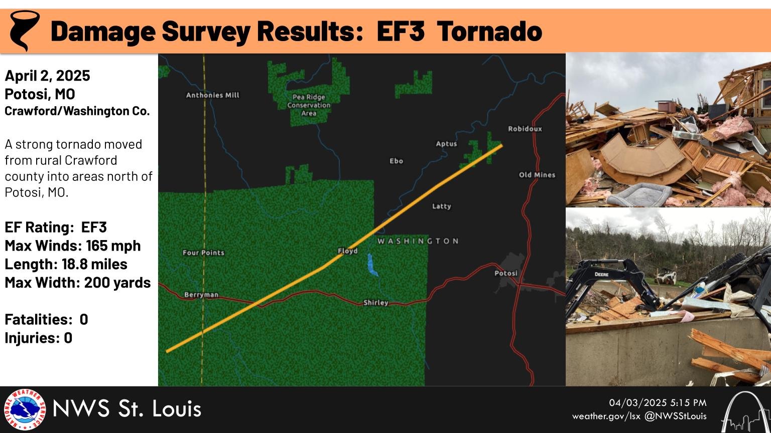
Tornado - Potosi, MO
Track Map  
|
||||||||||||||||
|
||||||||||||||||
|
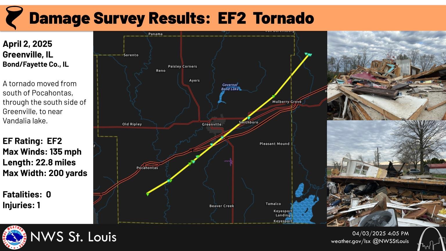
Tornado - Greenville
Track Map 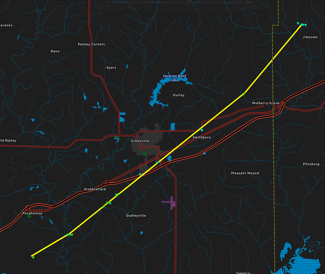
|
||||||||||||||||
|
||||||||||||||||
The Enhanced Fujita (EF) Scale classifies tornadoes into the following categories:
| EF0 Weak 65-85 mph |
EF1 Moderate 86-110 mph |
EF2 Significant 111-135 mph |
EF3 Severe 136-165 mph |
EF4 Extreme 166-200 mph |
EF5 Catastrophic 200+ mph |
 |
|||||
Storm Reports
Below is a list of observed wind gusts and hail sizes from across the region. This list may not be comprehensive and is considered preliminary. Thank you for all of the reports!
----
Preliminary Local Storm Report...Summary
National Weather Service St Louis MO
1108 AM CDT Fri Apr 4 2025

..TIME...   ...EVENT...      ...CITY LOCATION...     ...LAT.LON...
..DATE...   ....MAG....      ..COUNTY LOCATION..ST.. ...SOURCE....
            ..REMARKS..

0432 PM     Tstm Wnd Gst     1 ENE Cahokia           38.57N 90.16W
04/02/2025  M64 MPH          St. Clair          IL   ASOS

            REPORTED AT CPS.

0443 PM     Tstm Wnd Gst     1 NE Farmington         37.79N 90.41W
04/02/2025  M60 MPH          St. Francois       MO   Amateur Radio


0440 PM     Tstm Wnd Gst     3 WNW Belleville        38.55N 90.05W
04/02/2025  E60 MPH          St. Clair          IL   Public


0444 PM     Hail             2 N O'Fallon            38.62N 89.92W
04/02/2025  M1.75 Inch       St. Clair          IL   Public

            Report from mPING: Golf Ball (1.75 in.).

0438 PM     Hail             1 W Fairview Heights    38.60N 90.03W
04/02/2025  E1.25 Inch       St. Clair          IL   Public

            Report from mPING: Half Dollar (1.25 in.).

0421 PM     Hail             2 NE Oakville           38.47N 90.30W
04/02/2025  E1.00 Inch       St. Louis          MO   Public

            Report from mPING: Quarter (1.00 in.).

0422 PM     Hail             1 SE Oakville           38.43N 90.31W
04/02/2025  M1.00 Inch       St. Louis          MO   Public

            Report from mPING: Quarter (1.00 in.).

0420 PM     Hail             1 SW Oakville           38.44N 90.33W
04/02/2025  M0.88 Inch       St. Louis          MO   Public


0455 PM     Hail             Saint Jacob             38.72N 89.77W
04/02/2025  E0.70 Inch       Madison            IL   Trained Spotter


0355 PM     Tstm Wnd Dmg     4 WNW Lesterville       37.48N 90.89W
04/02/2025                   Reynolds           MO   Law Enforcement

            Trees down over Highway N at Highway 21 near
            Lesterville.

0313 PM     Tornado          5 NNE Davisville        37.87N 91.13W
04/02/2025                   Crawford           MO   NWS Storm Survey

            NWS Survey Team found that an EF-3 tornado
            formed in rural east-central Crawford County
            and track northeastward into Washington
            County, dissipating just east of Highway 21
            north of Potosi.

0425 PM     Tstm Wnd Dmg     Dupo                    38.51N 90.21W
04/02/2025                   St. Clair          IL   Emergency Mngr

            A few powerlines down on main street in
            Dupo.

0416 PM     Funnel Cloud     1 ENE Fountain          38.36N 90.28W
04/02/2025                   Monroe             IL   Emergency Mngr


0600 PM     Tstm Wnd Dmg     Salem                   38.63N 88.95W
04/02/2025                   Marion             IL   Law Enforcement

            Reports of sporadic tree damage throughout
            the county, as well as a few downed
            powerlines near Salem.

0537 PM     Tstm Wnd Dmg     Ramsey                  39.14N 89.11W
04/02/2025                   Fayette            IL   Law Enforcement

            Minor roof damage to a home.

0512 PM     Tstm Wnd Dmg     Albers                  38.54N 89.62W
04/02/2025                   Clinton            IL   Law Enforcement

            Trees down.

0521 PM     Tstm Wnd Dmg     Bartelso                38.54N 89.47W
04/02/2025                   Clinton            IL   Law Enforcement

            Trees down.

0522 PM     Tstm Wnd Dmg     Beckemeyer              38.61N 89.43W
04/02/2025                   Clinton            IL   Law Enforcement

            Trees down.

0505 PM     Tornado          1 ENE Pierron           38.79N 89.54W
04/02/2025                   Bond               IL   NWS Storm Survey

            *** 1 INJ ***
            NWS survey team found that an EF-2 tornado
            formed in southwestern Bond County and
            generally tracked along I-70 northeastward
            into Fayette County.
 |
Media use of NWS Web News Stories is encouraged! Please acknowledge the NWS as the source of any news information accessed from this site. |
|


 Weather Story
 Weather Map
 Local Radar