Tornado - Bourbon, MO
CRAWFORD COUNTY
| Date |
5/07/2024 |
| Time (Local) |
3:44 - 3:45 AM |
| EF Rating |
EF0 |
| Est. Peak Winds |
80 mph |
| Path Length |
0.72 miles |
| Max Width |
75 yards |
| Injuries/Deaths |
0/0 |
|
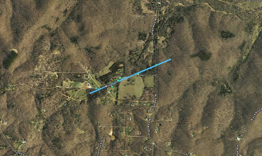
Summary:
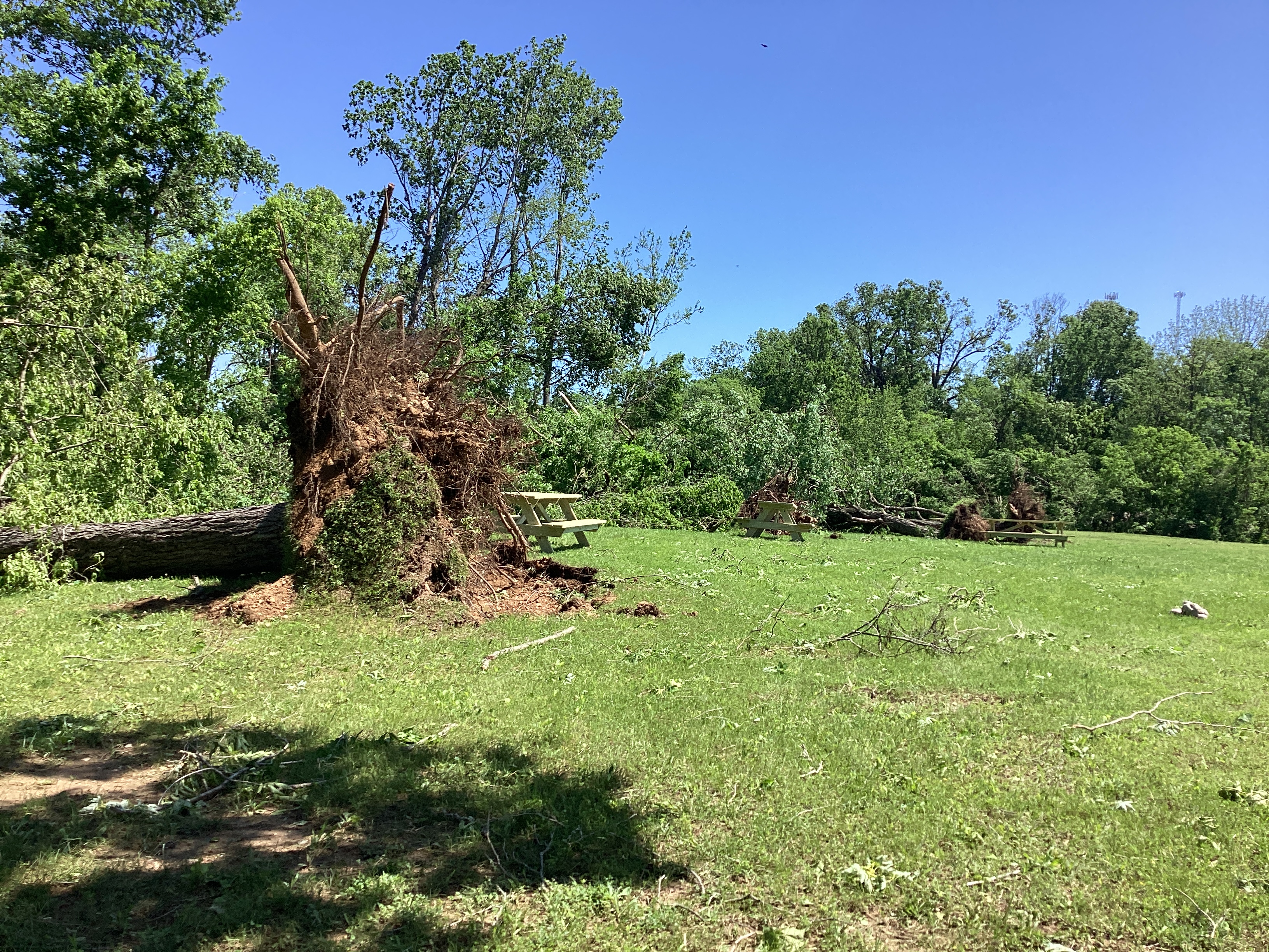
An EF0 tornado with maximum winds of 80 mph touched down southeast of Bourbon, MO before tracking northeast through the Blue Springs Creek Conservation Area from 3:44 AM to 3:45 AM. Tree damage of varying from downed branches to snapped trunks was observed.
|
Track Map
|
Tornado - Sullivan, MO
FRANKLIN COUNTY
| Date |
5/07/2024 |
| Time (Local) |
3:45 - 3:46 AM |
| EF Rating |
EF1 |
| Est. Peak Winds |
100 mph |
| Path Length |
0.31 miles |
| Max Width |
150 yards |
| Injuries/Deaths |
0/0 |
|
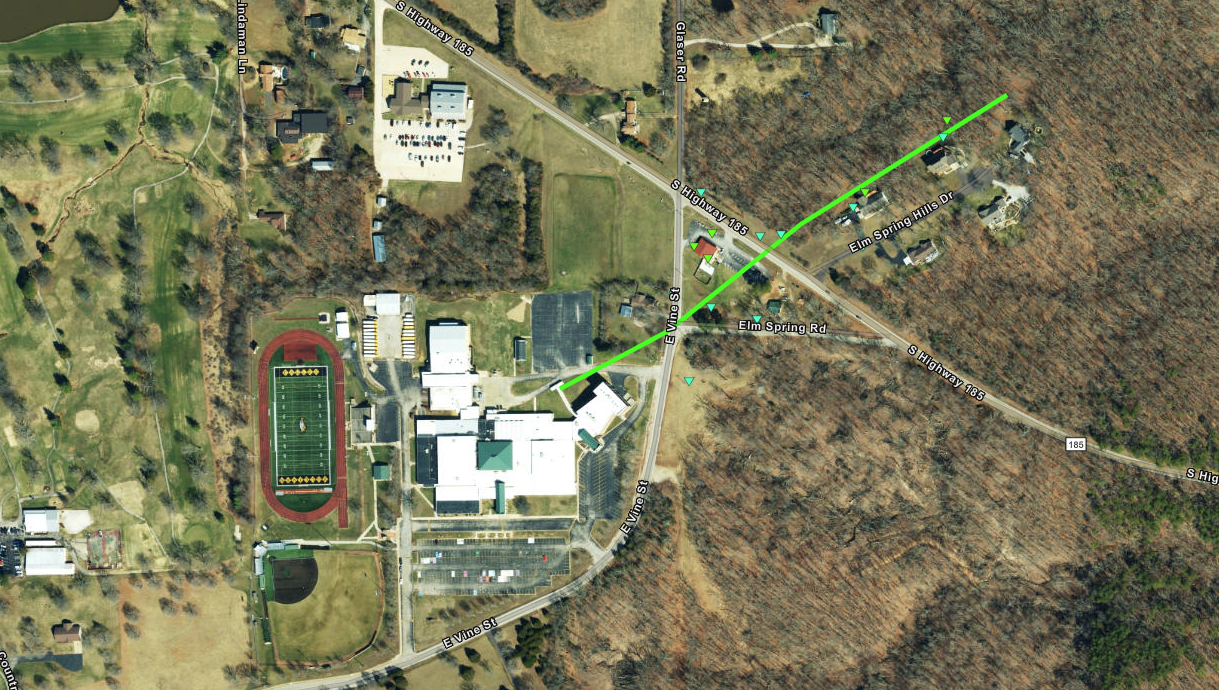
Summary:
An EF1 tornado with maximum winds of 100 mph touched down at Sullivan High School and tracked northeast, crossing South Highway 185. As it did, it damaged a restaurant and an electrical pole before damaging a few trees. The tornado was on the ground for about one minute from 3:45 AM to 3:46 AM.
|
Track Map
|
Tornado - Defiance, MO
ST. CHARLES COUNTY
| Date |
5/07/2024 |
| Time (Local) |
4:21 - 4:22 AM |
| EF Rating |
EF0 |
| Est. Peak Winds |
76 mph |
| Path Length |
2.23 miles |
| Max Width |
50 yards |
| Injuries/Deaths |
0/0 |
|
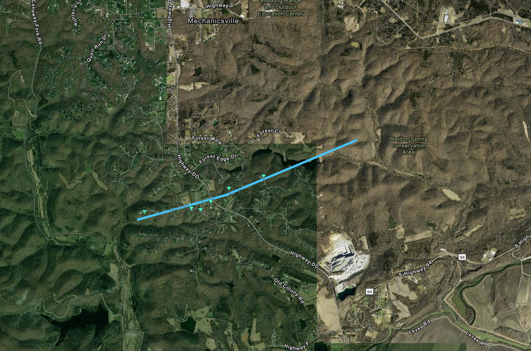
Summary:
An EF0 tornado with maximum winds of 76 mph touched down northwest of Defiance, MO and tracked east-northeast from 4:21 AM to 4:22 AM. Tree damage of varying from downed branches to uprooted trees were observed as the tornado crossed Highway DD before lifting near the Weldon Spring Conservation Area.
|
Track Map
|
Tornado - Cuba, MO
CRAWFORD COUNTY
| Date |
5/08/2024 |
| Time (Local) |
11:04-11:08 AM |
| EF Rating |
EF1 |
| Est. Peak Winds |
95 mph |
| Path Length |
2.24 miles |
| Max Width |
282 yards |
| Injuries/Deaths |
0/0 |
|
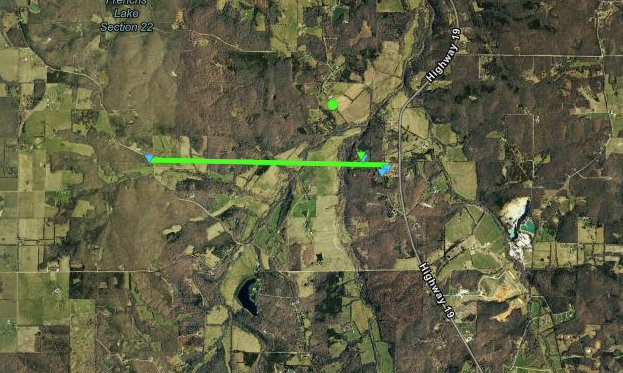
Summary:
An EF-1 tornado with peak winds of 95 mph touched down along Jakes Prairie Road northwest of Cuba. The tornado tracked east for four minutes, producing tree damage across 2.24 miles before lifting just before Highway 19 and Pleasant Valley Road.
|
Track Map
|
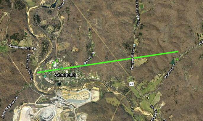
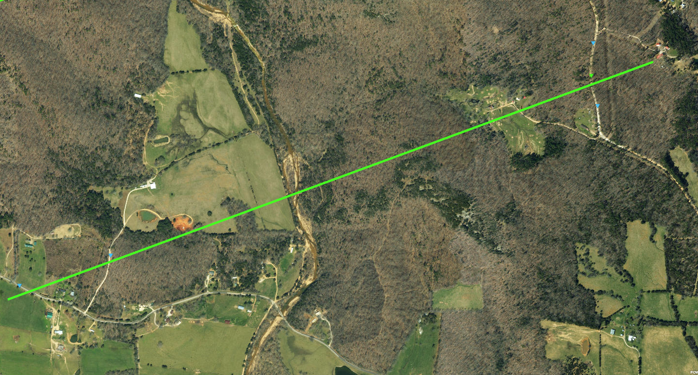
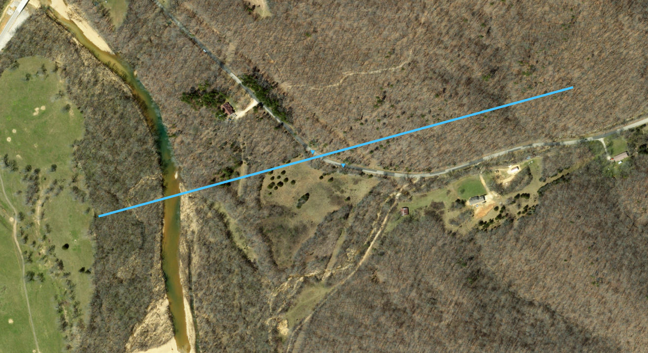
Tornado - Annapolis, MO
IRON COUNTY
| Date |
5/08/2024 |
| Time (Local) |
8:49 - 8:51 PM |
| EF Rating |
EF1 |
| Est. Peak Winds |
110 mph |
| Path Length |
2.27 miles |
| Max Width |
250 yards |
| Injuries/Deaths |
0/0 |
|
Summary:
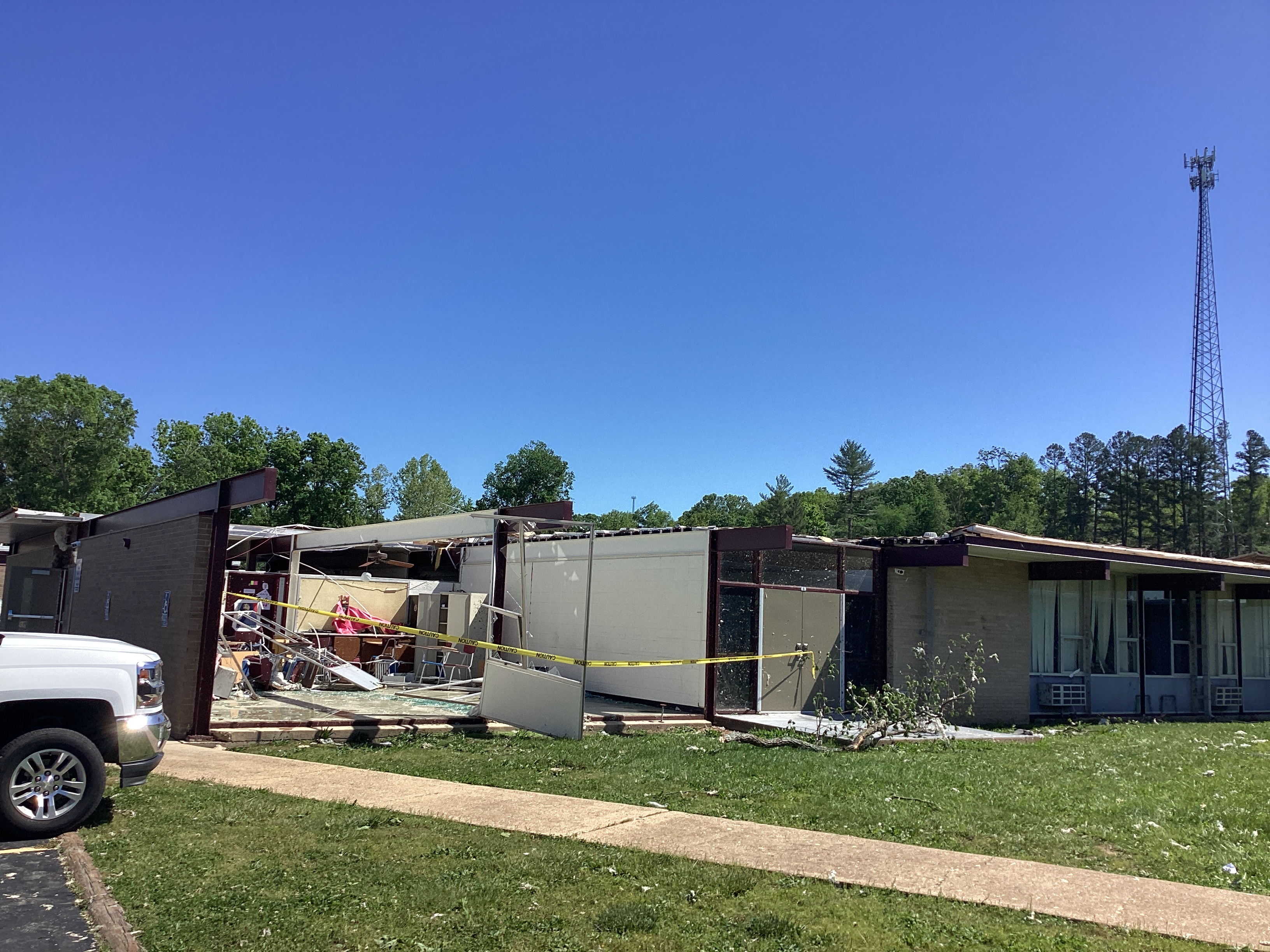
An EF1 tornado with maximum winds of 110 mph touched down just west of Annapolis, MO during the evening of May 8. The tornado then tracked east-northeast across County Road 143 into the city, where it uprooted and/or damaged several trees and severely damaged a school. The tornado continued on its track, crossing Highway 49 and County Road 139 before lifting around Highway C at 8:51 PM.
|
Track Map
|
Tornado - Vulcan, MO
IRON COUNTY
| Date |
5/08/2024 |
| Time (Local) |
8:53 - 8:56 PM |
| EF Rating |
EF1 |
| Est. Peak Winds |
93 mph |
| Path Length |
1.67 miles |
| Max Width |
150 yards |
| Injuries/Deaths |
0/0 |
|
Summary:
An EF1 tornado with maximum winds of 93 mph touched down east of Vulcan, MO around 8:53 p.m. the evening of May 8. The tornado then tracked northeast from Hwy F through County Road 135 before dissipating near Leo King Road around 8:56 p.m. Multiple trees were damages and/or uprooted along the path.
|
Track Map
|
Tornado - 2 SE Annapolis, MO
IRON COUNTY
| Date |
5/08/2024 |
| Time (Local) |
8:50 - 8:51 PM |
| EF Rating |
EF0 |
| Est. Peak Winds |
85 mph |
| Path Length |
0.59 miles |
| Max Width |
75 yards |
| Injuries/Deaths |
0/0 |
|
Summary:
An EF0 tornado with maximum winds of 85 mph touched down 2 miles southeast of Annapolis at 8:50 p.m. the evening of May 8. The tornado's short path tracked it east-northeast across County Road 165 before lifting just north of County Road 165 at 8:51 p.m. Trees were uprooted and damaged along the path.
|
Track Map
|
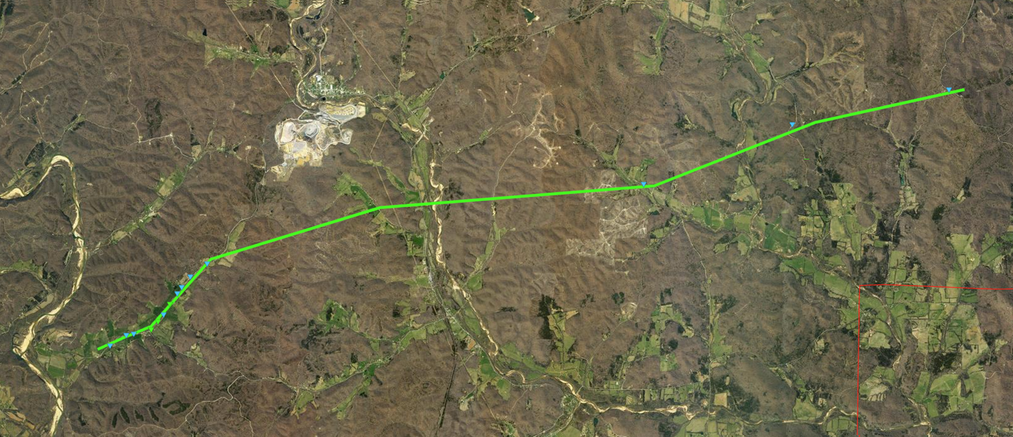
Tornado - 6 ESE Redford, MO
REYNOLDS, IRON & MADISON COUNTY
| Date |
5/08/2024 |
| Time (Local) |
8:44 - 8:58 PM |
| EF Rating |
EF1 |
| Est. Peak Winds |
93 mph |
| Path Length |
14.07 miles |
| Max Width |
150 yards |
| Injuries/Deaths |
0/0 |
|
Summary:
An EF1 tornado with maximum winds of 93 mph developed just west of the Reynolds-Iron County line around 8:44 p.m. near County Road 456. The tornado carved a path east-northeast, uprooting several trees and damaging the roof to a residence along Funk Branch Road. The tornado continued through southern sections of Iron County and moved into southwestern Madison County before lifting near State Hwy FF around 8:58 p.m.
|
Track Map
|
Tornado - Arcadia, MO
IRON & MADISON COUNTY
| Date |
5/08/2024 |
| Time (Local) |
9:01 - 9:09 PM |
| EF Rating |
EF1 |
| Est. Peak Winds |
94 mph |
| Path Length |
12.01 miles |
| Max Width |
150 yards |
| Injuries/Deaths |
0/0 |
|
Summary:
An EF1 tornado with maximum winds of 94 mph touched down in Arcadia just west of Route 21 at 9:01 p.m. The tornado continued east over the Arcadia Valley Country Club, through Killarney Shores and nearly parallel to Route 72 before lifting around 9:09 p.m. at Madison 529. The tornado snapped and uprooted several large trees along the 12 mile path.
|
Track Map
|
Tornado - 1 S Arcadia, MO
IRON COUNTY
| Date |
5/08/2024 |
| Time (Local) |
9:01 - 9:04 PM |
| EF Rating |
EF1 |
| Est. Peak Winds |
93 mph |
| Path Length |
4.08 miles |
| Max Width |
100 yards |
| Injuries/Deaths |
0/0 |
|
Summary:
A second EF1 tornado with maximum winds of 93 mph touched down on the south side of Arcadia at 9:01 p.m. The tornado meandered to the east along Route 72 and in the vicinity of the Battle of Pilot Knob State Historic Site before dissipating Stouts Creek near Rainbow Road around 9:04 p.m. The tornado damaged multiple trees before ending.
|
Track Map
|
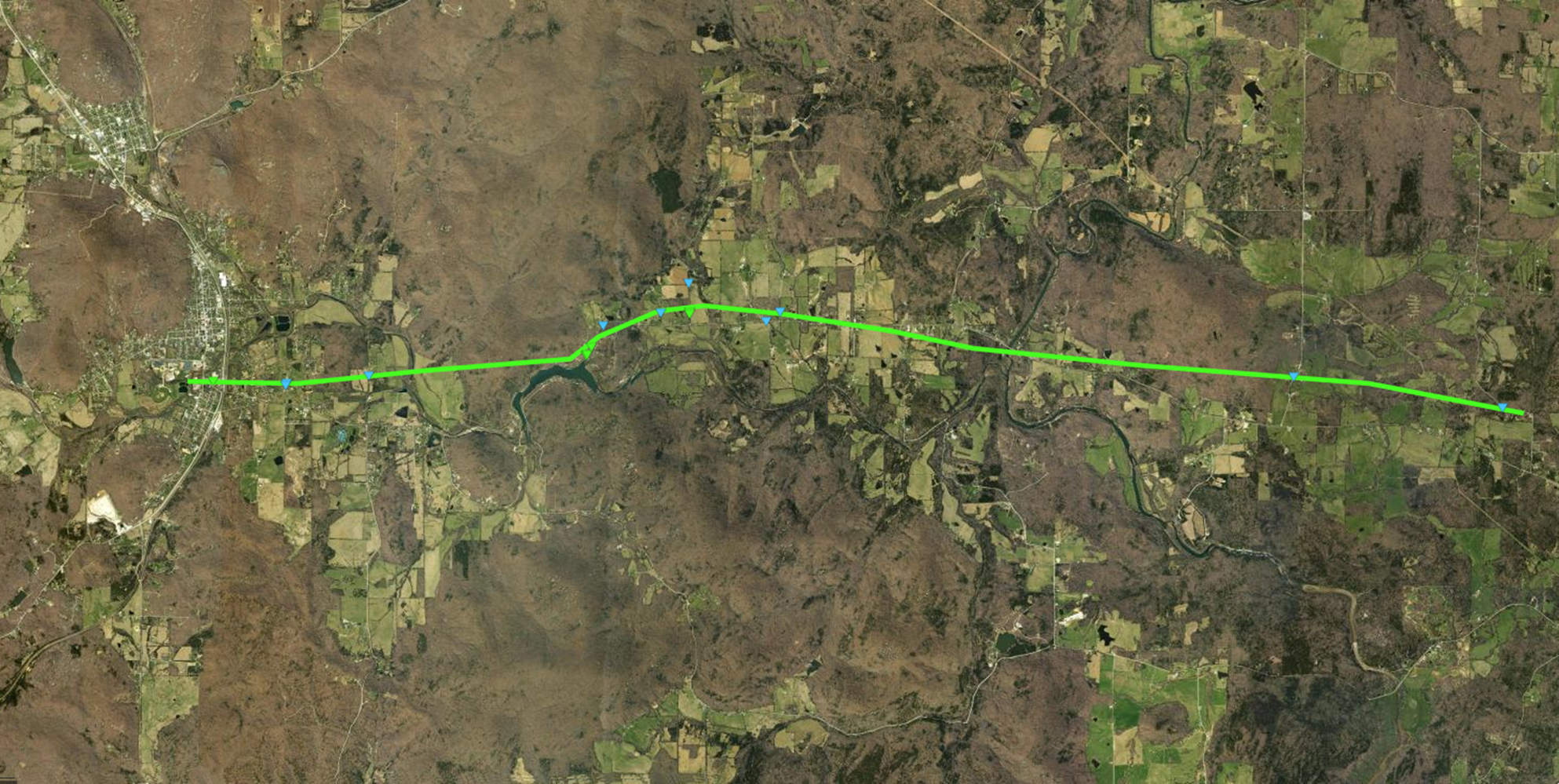
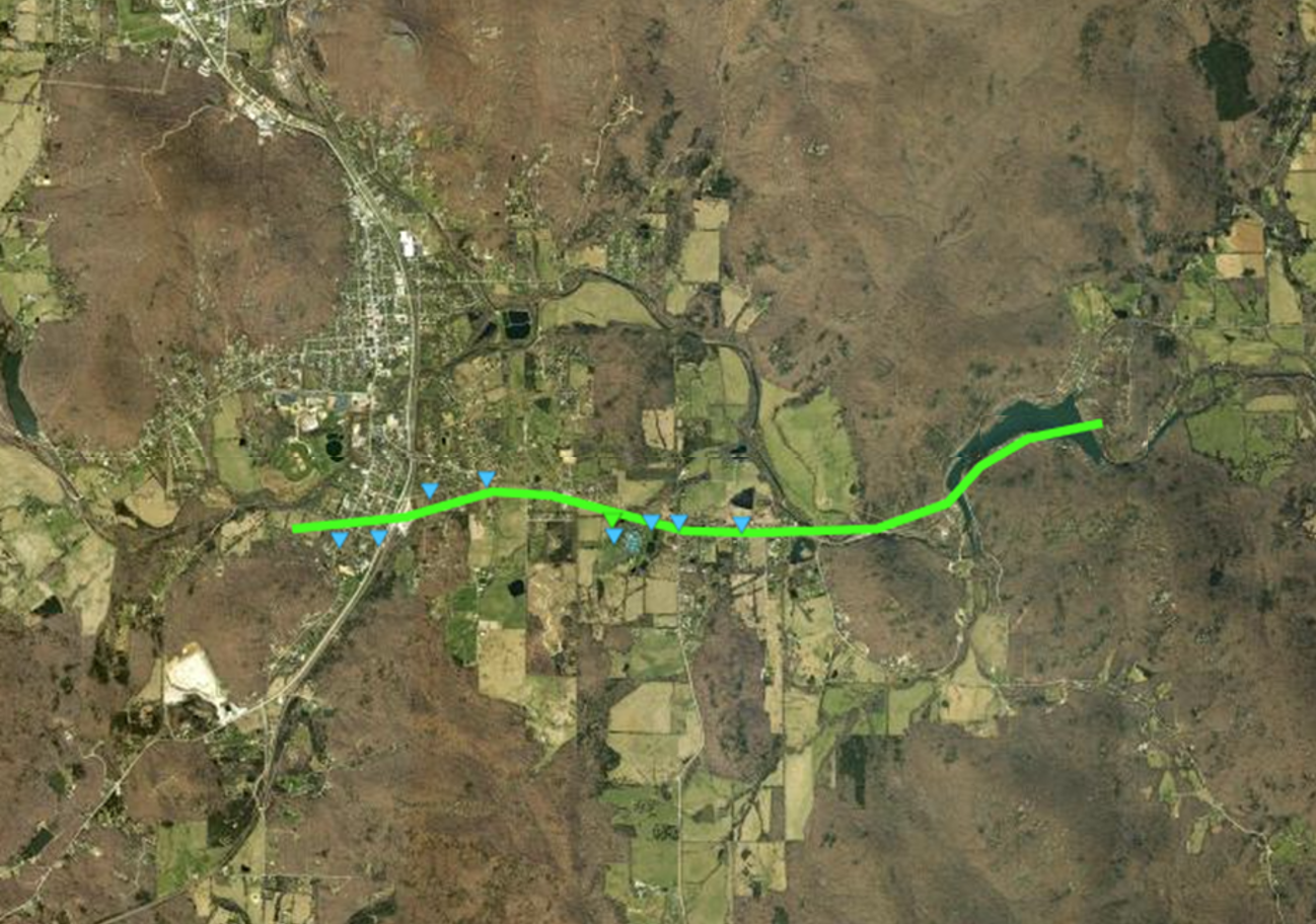
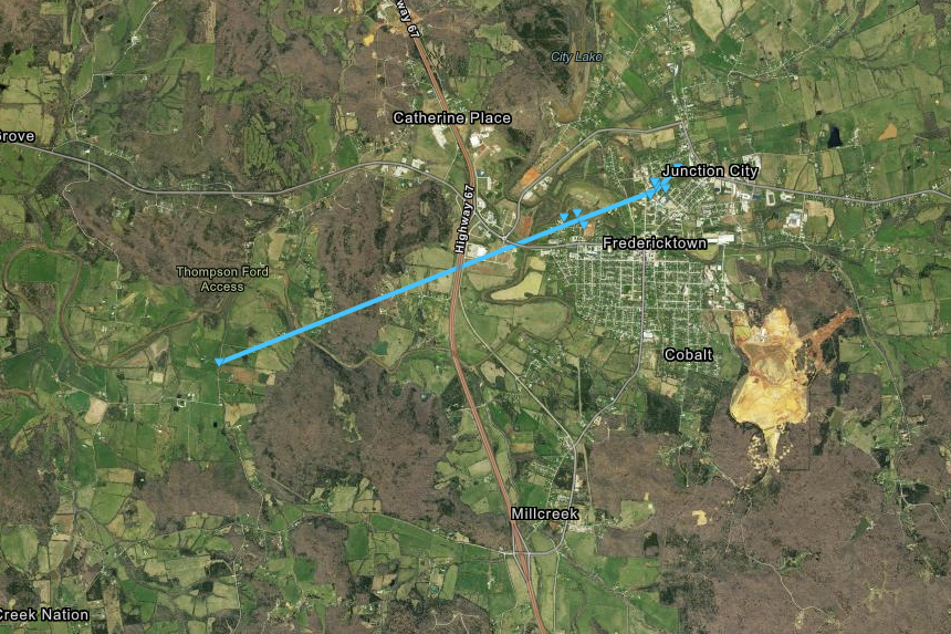
Tornado - Fredericktown, MO
MADISON COUNTY
| Date |
5/08/2024 |
| Time (Local) |
9:06 - 9:10 PM |
| EF Rating |
EF0 |
| Est. Peak Winds |
85 mph |
| Path Length |
4.27 miles |
| Max Width |
334 yards |
| Injuries/Deaths |
0/0 |
|
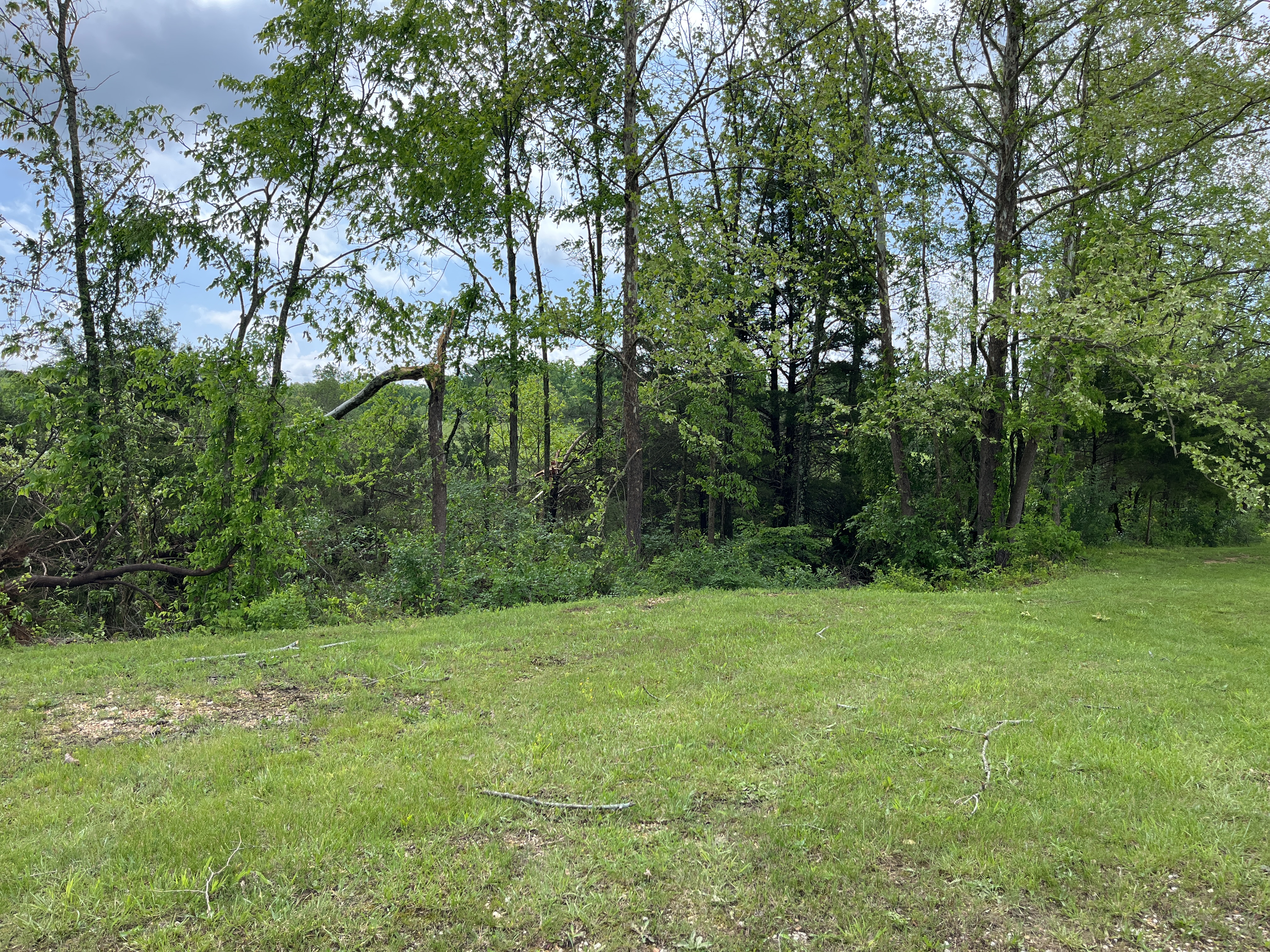
Summary:
An EF-0 tornado with peak winds of 85 mph touched down along Madison County 503 north of the intersection with Madison County Road 505, just to the west of Fredericktown. The tornado produced tree damage and minor damage to homes and farm outbuildings across 4.27 miles before lifting four minutes later on the north side of Fredericktown along Schulte Lane.
|
Track Map
|
|


 Weather Story
 Weather Map
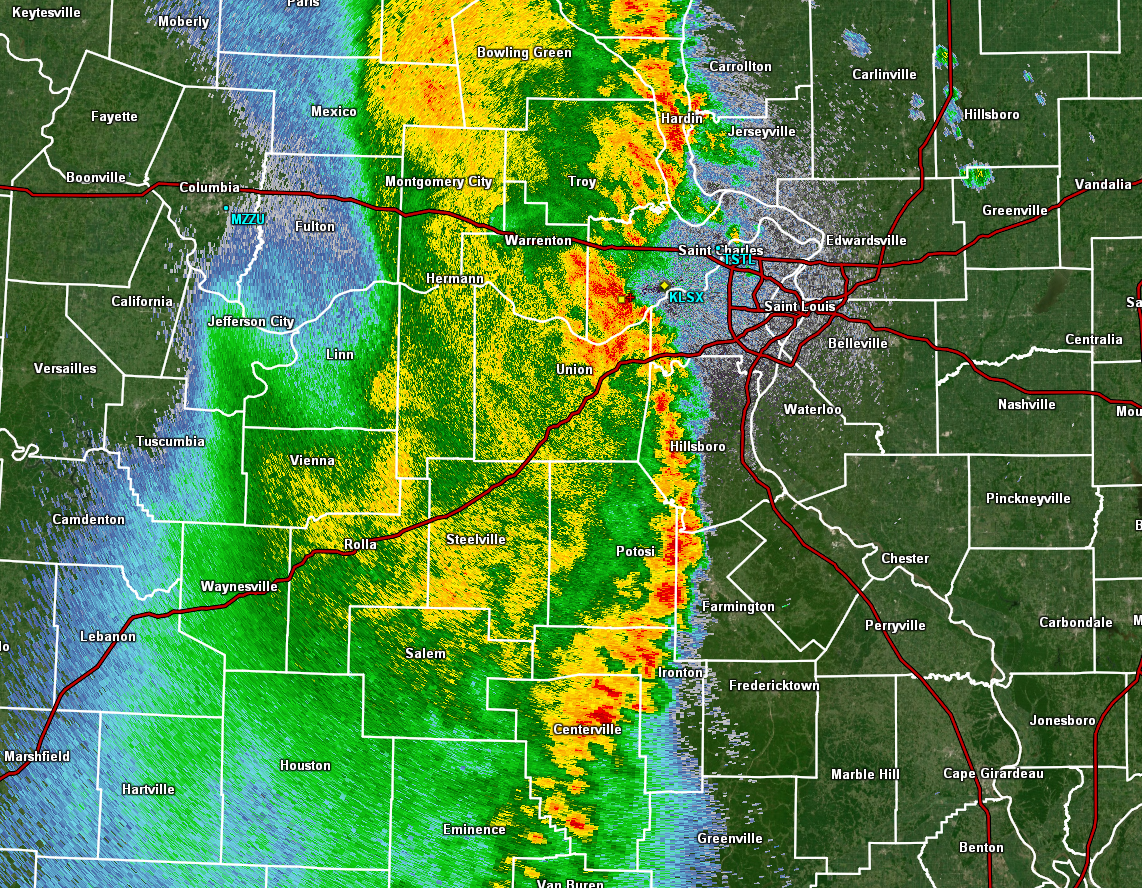
 Local Radar