Overview
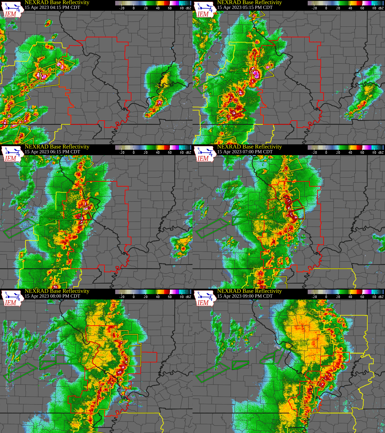
Several strong to severe thunderstorms moved into eastern Missouri in the afternoon hours of April 15. These storms were initially producing copious large hail, but rapidly transitioned into tornadic storms. The first tornado was associated with a supercell ahead of a congealing line of convection moving rapidly toward the Mississippi River. A portion of this line of storms rapidly surged eastward, resulting in numerous tornadoes in Jefferson county in Missouri, and Monroe, Madison, St. Clair, and Washington counties in Illinois. In total, 12 tornadoes have been identified, including 3 EF-1s, 6 EF-0s, and 3 tornadoes of unknown intensity that produced no damage.
For a walkthrough of the event, check out our ArcGIS StoryMap.
Downloadable KMZ File
Tornadoes:
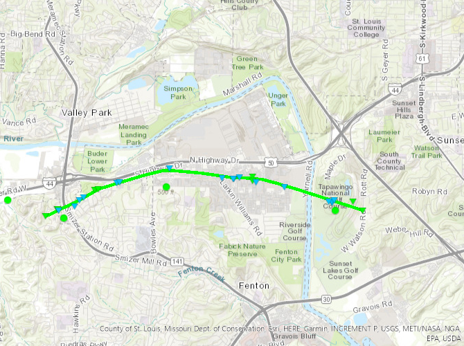
Tornado - Fenton to Sunset Hills
St. Louis County, MO
| Date |
04/15/2023 |
| Time (Local) |
6:19 PM - 6:27 PM |
| EF Rating |
EF-1 |
| Est. Peak Winds |
100 mph |
| Path Length |
4.5 miles |
| Max Width |
100 yards |
| Injuries/Deaths |
0/0 |
|
Summary:
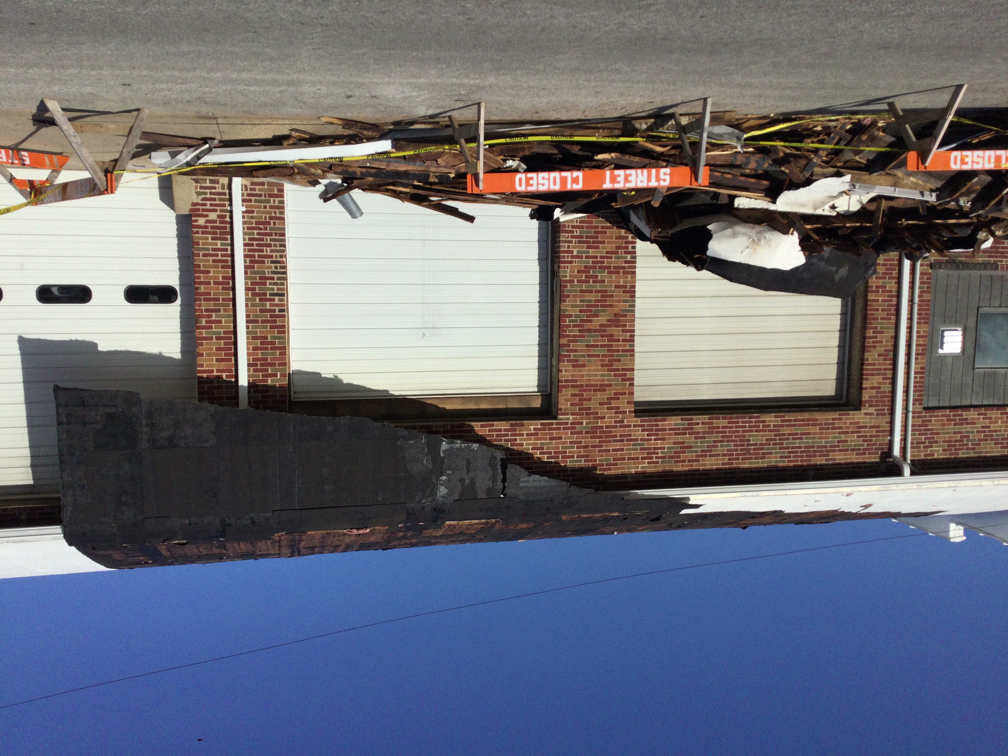
A weak tornado moved from near I-44 and Highway 141 to Tapawingo National Golf Course causing damage to numerous trees and minor structural damage.
|
Track Map
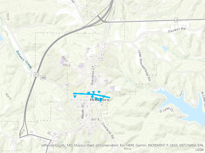
Tornado - Hillsboro
Jefferson County, MO
| Date |
04/15/2023 |
| Time (Local) |
6:24 PM - 6:25 PM |
| EF Rating |
EF-0 |
| Est. Peak Winds |
77 mph |
| Path Length |
0.6 miles |
| Max Width |
200 yards |
| Injuries/Deaths |
0/0 |
|
Summary:
A weak tornado moved through northern Hillsboro causing damage to numerous trees and minor structural damage.
|
Track Map
Downloadable KMZ File
|
|
Tornado - Festus to Herculaneum
Jefferson County, MO
| Date |
4/15/2023 |
| Time (Local) |
6:30 pm - 6:35 pm |
| EF Rating |
EF-1 |
| Est. Peak Winds |
100 mph |
| Path Length |
4.0 miles |
| Max Width |
300 yards |
| Injuries/Deaths |
0/0 |
|
Summary:
A weak tornado moved from northwest of Festus to Herculaneum causing damage to numerous trees and minor to moderate structural damage.
|
Track Map

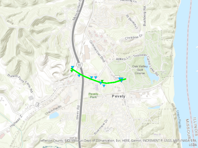
Tornado - Pevely
Jefferson County, MO
| Date |
4/15/2023 |
| Time (Local) |
6:34 PM - 6:36 PM |
| EF Rating |
EF-1 |
| Est. Peak Winds |
100 mph |
| Path Length |
0.9 miles |
| Max Width |
150 yards |
| Injuries/Deaths |
0/0 |
|
Summary:
A weak tornado moved through Pevely causing damage to numerous trees and minor structural damage.
|
Track Map
|
|
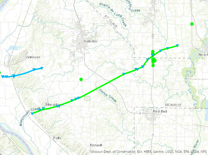
Tornado - Maeystown to Hecker
Monroe and St. Clair County, IL
| Date |
4/15/2023 |
| Time (Local) |
6:34 PM - 6:59 PM |
| EF Rating |
EF-1 |
| Est. Peak Winds |
100 mph |
| Path Length |
19.5 miles |
| Max Width |
100 yards |
| Injuries/Deaths |
0/0 |
|
Summary:
A weak tornado moved from southwest of Maeystown through and to the northeast of Hecker damage to numerous trees, wood power poles, and minor to moderate structural damage.
|
Track Map
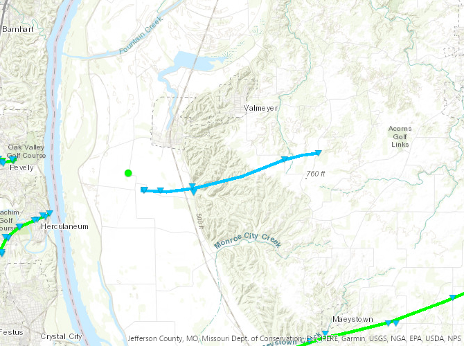
Tornado - Valmeyer
Monroe County, IL
| Date |
4/15/2023 |
| Time (Local) |
6:39 PM - 6:46 PM |
| EF Rating |
EF-0 |
| Est. Peak Winds |
85 mph |
| Path Length |
5.0 miles |
| Max Width |
100 yards |
| Injuries/Deaths |
0/0 |
|
Summary:
A weak tornado moved from the Mississippi river bottoms southwest of Valmeyer to southeast of Valmeyer causing damage to numerous trees and minor structural damage.
|
Track Map
|
|
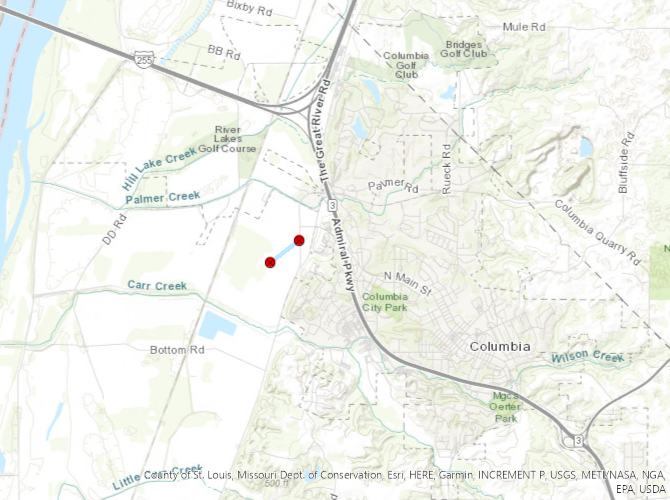
Tornado - Columbia
Monroe County, IL
| Date |
4/15/2023 |
| Time (Local) |
6:43 PM - 6:43 PM |
| EF Rating |
Unknown |
| Est. Peak Winds |
Unknown |
| Path Length |
0.3 miles |
| Max Width |
25 yards |
| Injuries/Deaths |
0/0 |
|
Summary:
A tornado briefly touched down in the Mississippi river bottoms near Columbia, IL. The only evidence of this tornado was a video provided via local media. No damage was found.
|
Track Map
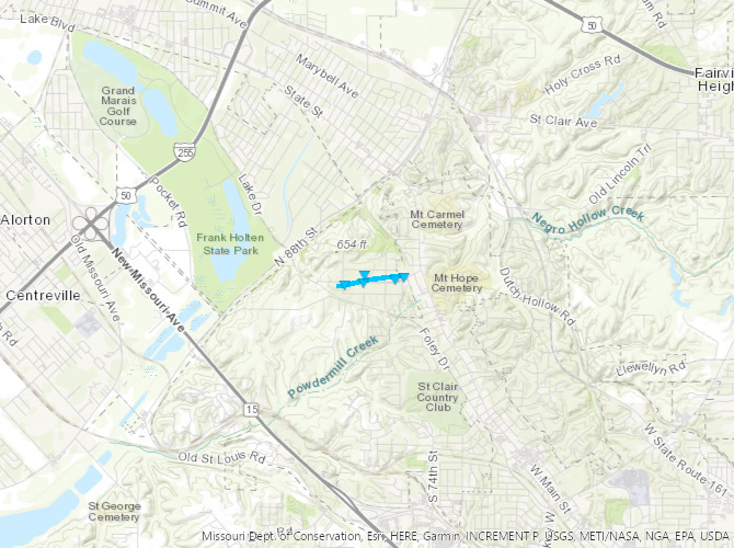
Tornado - Signal Hill
St. Clair, IL
| Date |
4/15/2023 |
| Time (Local) |
6:59 PM - 7:00 PM |
| EF Rating |
EF-0 |
| Est. Peak Winds |
84 mph |
| Path Length |
0.6 miles |
| Max Width |
100 yards |
| Injuries/Deaths |
0/0 |
|
Summary:
A weak tornado through Signal Hill causing damage to numerous trees and minor structural damage.
|
Track Map
|
|
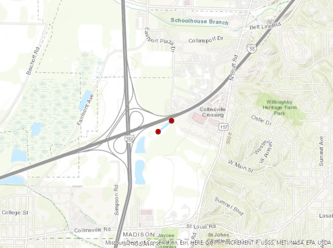
Tornado - Collinsville
Madison County, IL
| Date |
4/15/2023 |
| Time (Local) |
7:01 PM - 7:01 PM |
| EF Rating |
Unknown |
| Est. Peak Winds |
Unknown |
| Path Length |
0.2 miles |
| Max Width |
25 yards |
| Injuries/Deaths |
0/0 |
|
Summary:
A tornado briefly touched down near Collinsville, IL. The only evidence of this tornado was a video provided via local media. No damage was found.
|
Track Map
Tornado - Belleville
St. Clair County, IL
| Date |
4/15/2023 |
| Time (Local) |
7:03 PM - 7:07 PM |
| EF Rating |
EF-1 |
| Est. Peak Winds |
98 mph |
| Path Length |
3.0 miles |
| Max Width |
200 yards |
| Injuries/Deaths |
0/0 |
|
Summary:
A weak tornado moved through Belleville causing damage to numerous trees and minor structural damage. Several of the trees fell on buildings, causing more significant structural damage.
|
Track Map
|
|
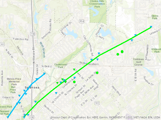
Tornado - Swansea
St. Clair County, IL
| Date |
4/15/2023 |
| Time (Local) |
7:03 PM - 7:04 PM |
| EF Rating |
EF-0 |
| Est. Peak Winds |
85 mph |
| Path Length |
1.1 miles |
| Max Width |
90 yards |
| Injuries/Deaths |
0/0 |
|
Summary:
A weak tornado moved through Swansea causing damage to numerous trees and minor structural damage.
|
Track Map
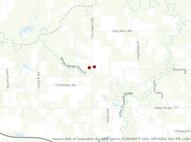
Tornado - Covington
Washington County, IL
| Date |
4/15/2023 |
| Time (Local) |
7:33 PM - 7:33 PM |
| EF Rating |
Unknown |
| Est. Peak Winds |
Unknown |
| Path Length |
0.2 miles |
| Max Width |
50 yards |
| Injuries/Deaths |
0/0 |
|
Summary:
A tornado briefly touched down near Covington, IL. The only evidence of this tornado was a video provided via social media. No damage was found.
|
Track Map
|
|
The Enhanced Fujita (EF) Scale classifies tornadoes into the following categories:
EF0
Weak
65-85 mph |
EF1
Moderate
86-110 mph |
EF2
Significant
111-135 mph |
EF3
Severe
136-165 mph |
EF4
Extreme
166-200 mph |
EF5
Catastrophic
200+ mph |
 |
Radar
15 minute radar data from 4:15 PM - 9:00 PM
Storm Reports
All tornadoes and several damaging wind reports






 Weather Story
 Weather Map
 Local Radar
 Follow us on X
 Follow us on Facebook
 Follow us on YouTube
 LSX RSS Feed