Overview
A persistent pattern set up over the Mid Mississippi River Valley during May 21-23. Upper level winds were consistently southwesterly, providing large scale lift and moisture to the area. Converging air along frontal boundaries at the surface provided sufficient low level lift to initial storms each night. During the afternoon of May 22, 2019 specifically, a warm front was moving north into southern Missouri, increasing low level moisture. At the same time a cold front was approaching from the west. Storms developed along the cold front as it pushed southeastward through Missouri. The significant low level wind produced storms favorable for hail and tornadoes.
Over three days these storms produced five tornadoes in our county warning area; two EF-0 tornadoes, two EF-1 tornadoes, and the EF-3 tornado which hit Jefferson City. The storms also produced straight line winds, damaging homes and trees across the area.
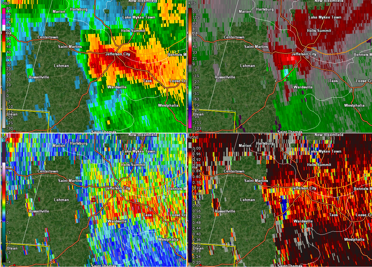
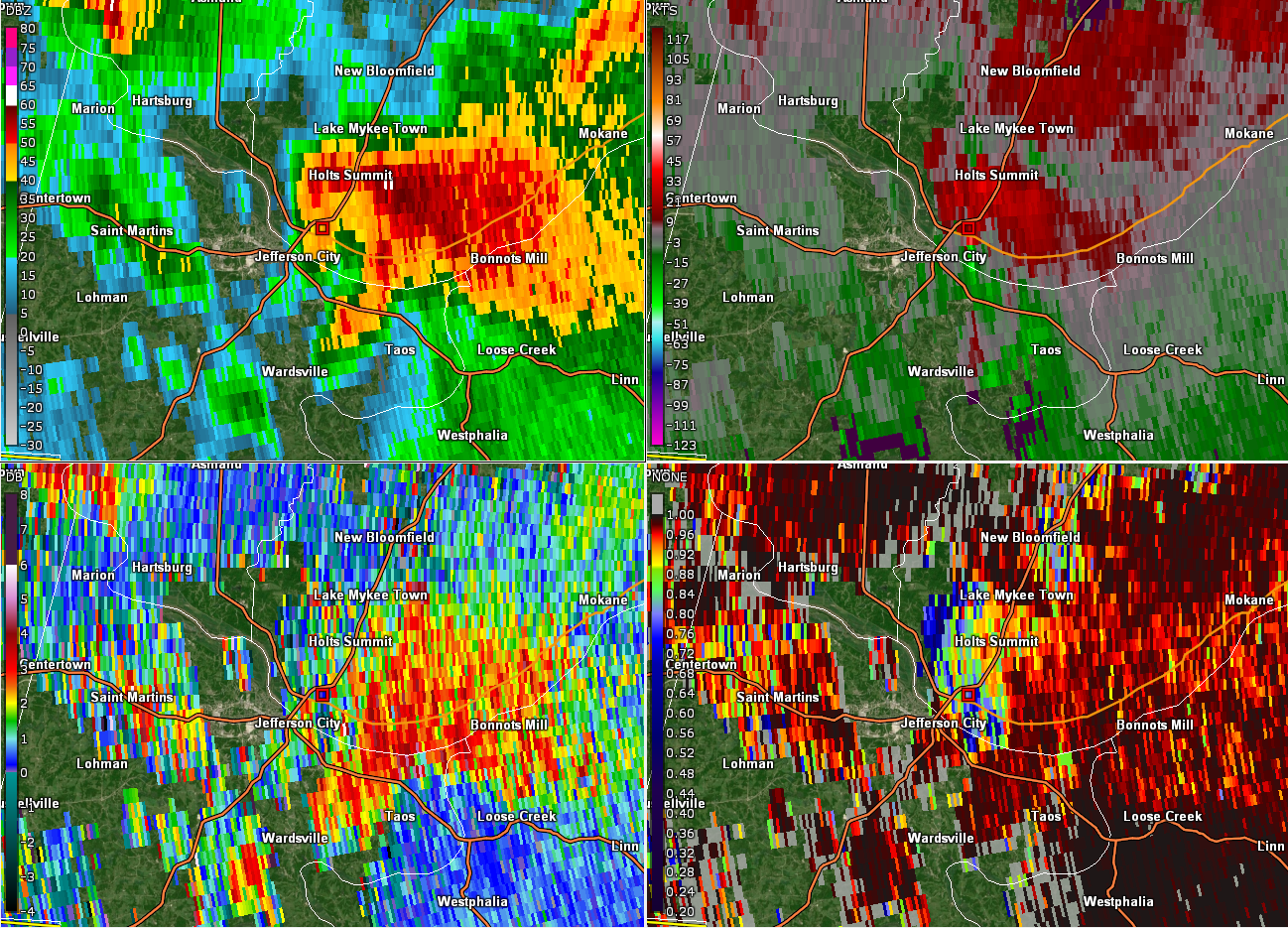
Learn more about the EF-3 Jefferson City Tornado, which resulted in the first-ever Tornado Emergency issuance from our office, using our interactive GIS-based event summary.
MRM/BSH
Tornadoes
Tornado - Jefferson City, MO
Cole and Callaway County
| Date |
5/22/2019 |
| Time (Local) |
10:56 - 11:51 PM |
| EF Rating |
EF-3 |
| Est. Peak Winds |
160 mph |
| Path Length |
32.63 miles |
| Max Width |
1500 yards |
| Injuries/Deaths |
33/0 |
|
Summary:
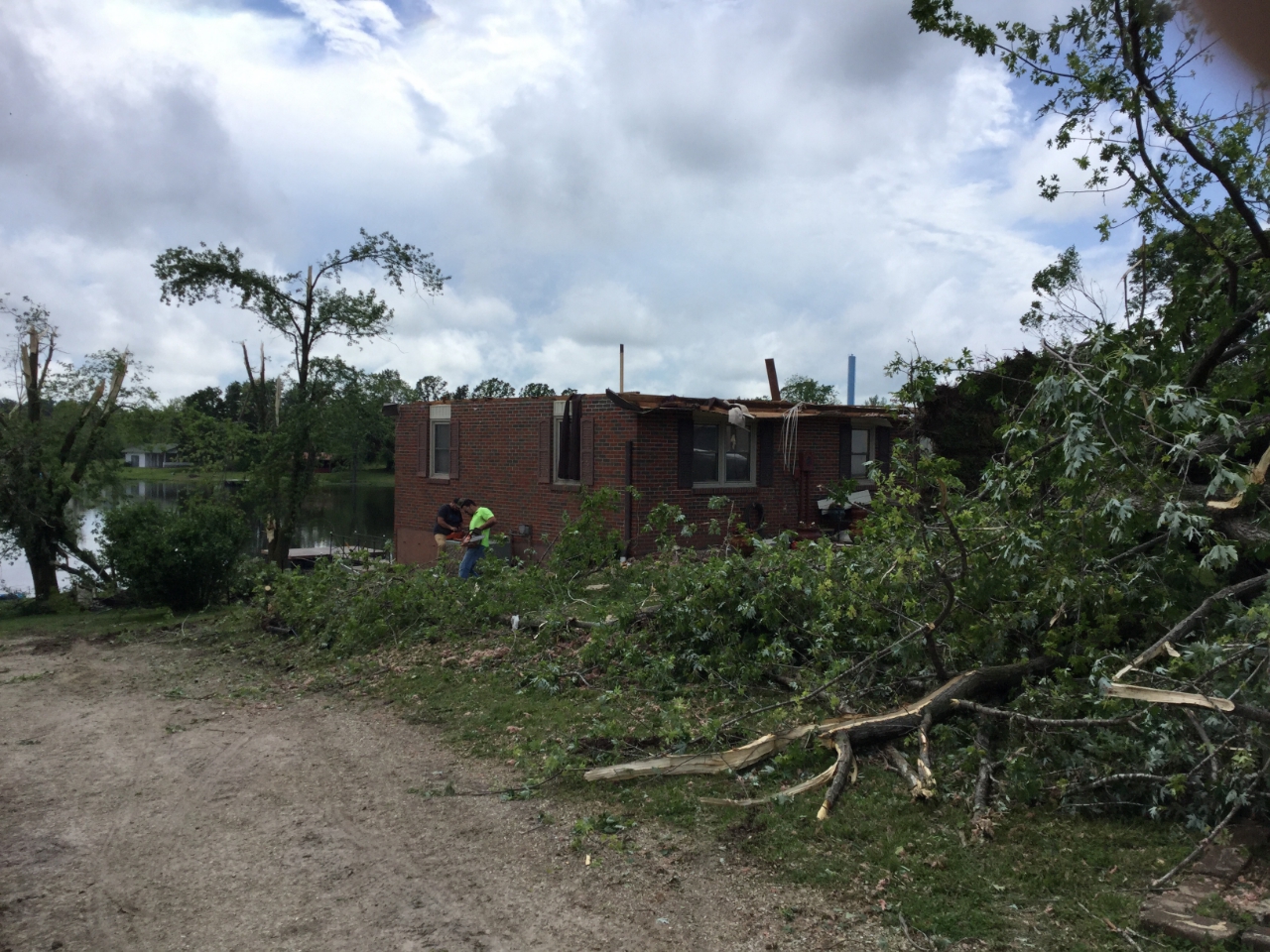
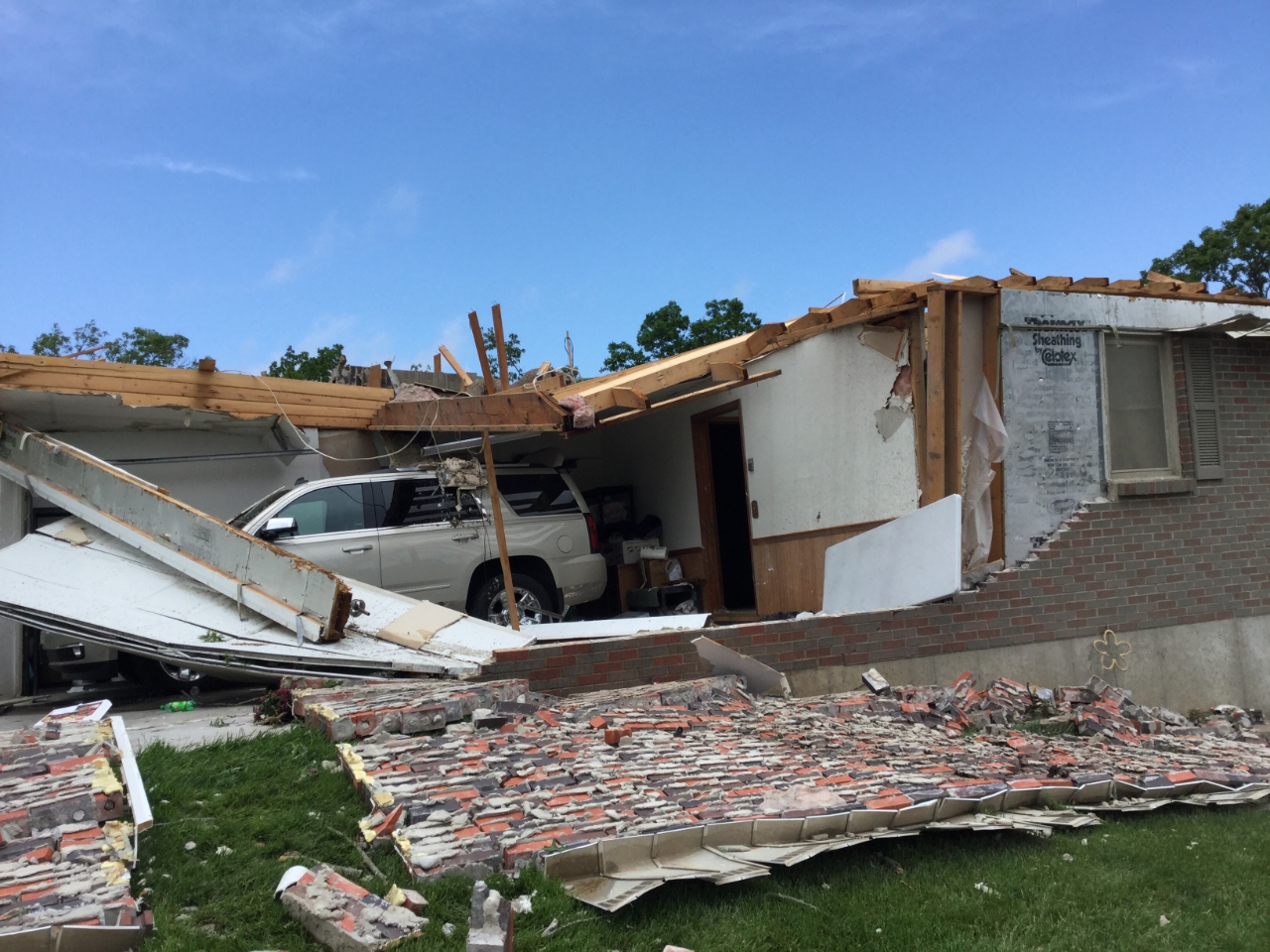
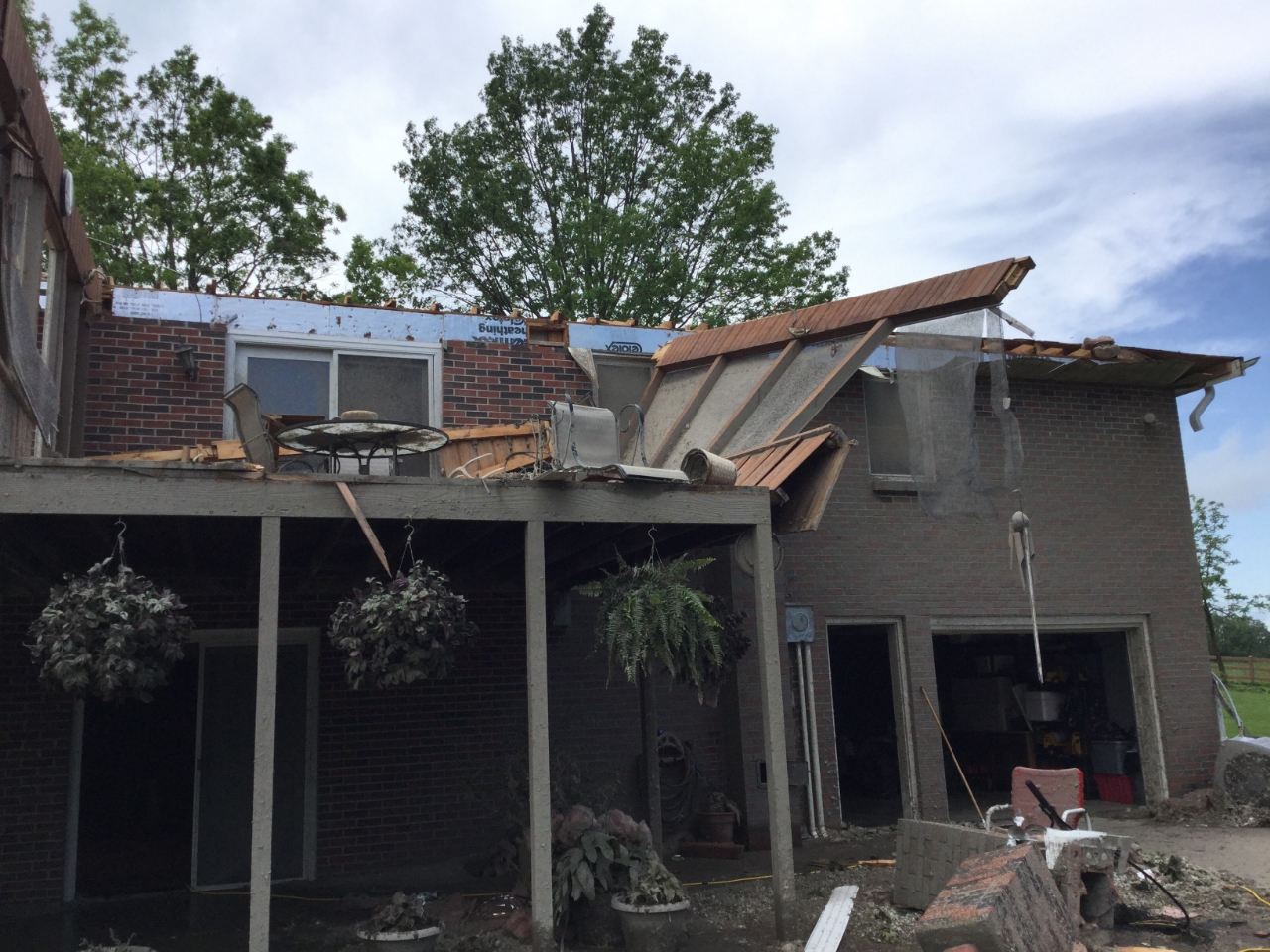
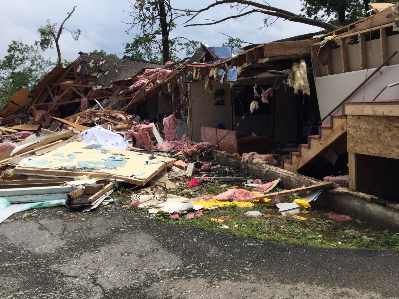
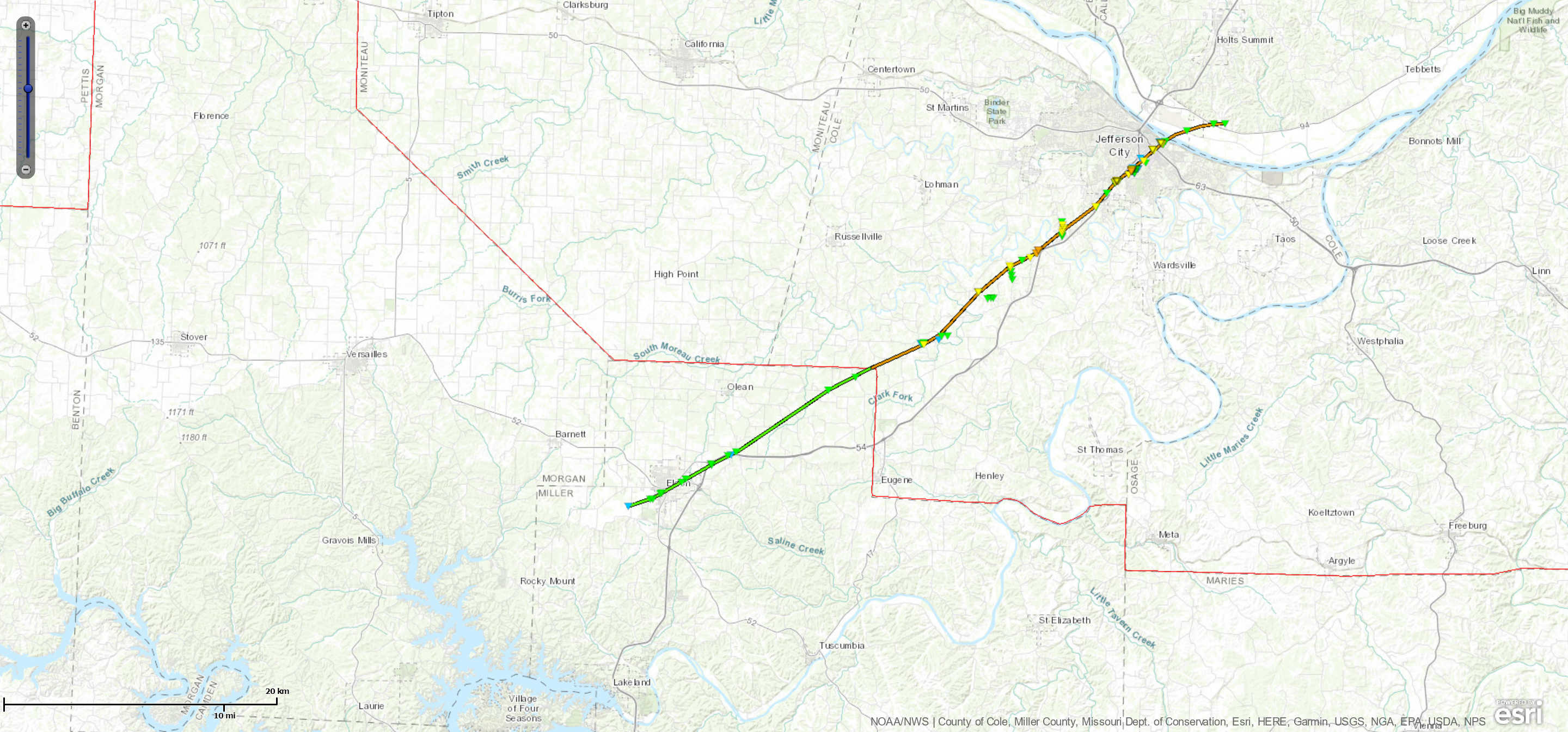
On May 22, 2019, the tornado touched down west of the Eldon Country Club and damaged numerous homes across the southern and eastern sections of Eldon. One injury occurred in this area. The tornado then tracked northeast, crossing Highway 54 twice, and uprooted or snapped numerous trees as it moved across rural areas in northeastern Miller County before crossing Highway AA at Spring Garden and entering Cole County west of Shipman Road. As the tornado tracked to the northeast it crossed Lake Carmel and tore the roof off of a one story home on the northeast shore of the lake. Numerous trees were either snapped off or uprooted in the area as well. Damage to the home was rated EF2. Further northeast another one story home lost its roof on Highway D just northwest of intersection with Cole Brook Lane. Damage to this home was rated EF2. The tornado strengthened from an EF-2 to an EF-3 as it moved into a subdivision off of Heritage Highway just west of U.S. Highway 54, indicated by the complete collapse of a home and complete destruction of a double wide manufactured home. As the tornado moved northeast into the Jefferson City area it destroyed or greatly damaged a warehouse and car dealership, where at least 750 cars were totaled. As it moved into downtown Jefferson City, it caused severe damage to well made residential structures. The tornado crossed the Missouri River and entered Callaway County just to the east-northeast of Jefferson City. After it crossed the Missouri River, the only observed damage was to numerous trees before it lifted and dissipated near the Railwood Golf Club. Throughout its 32.63 mile path the tornado caused severe damage or completely destroyed numerous homes and businesses, and uprooted or snapped countless trees. Overall the tornado was rated EF3 with a path length of 32.63 miles and a max path width of 1500 yards. Thirty three people sustained injuries from this tornado.
|
|
 |
 |
 |
 |
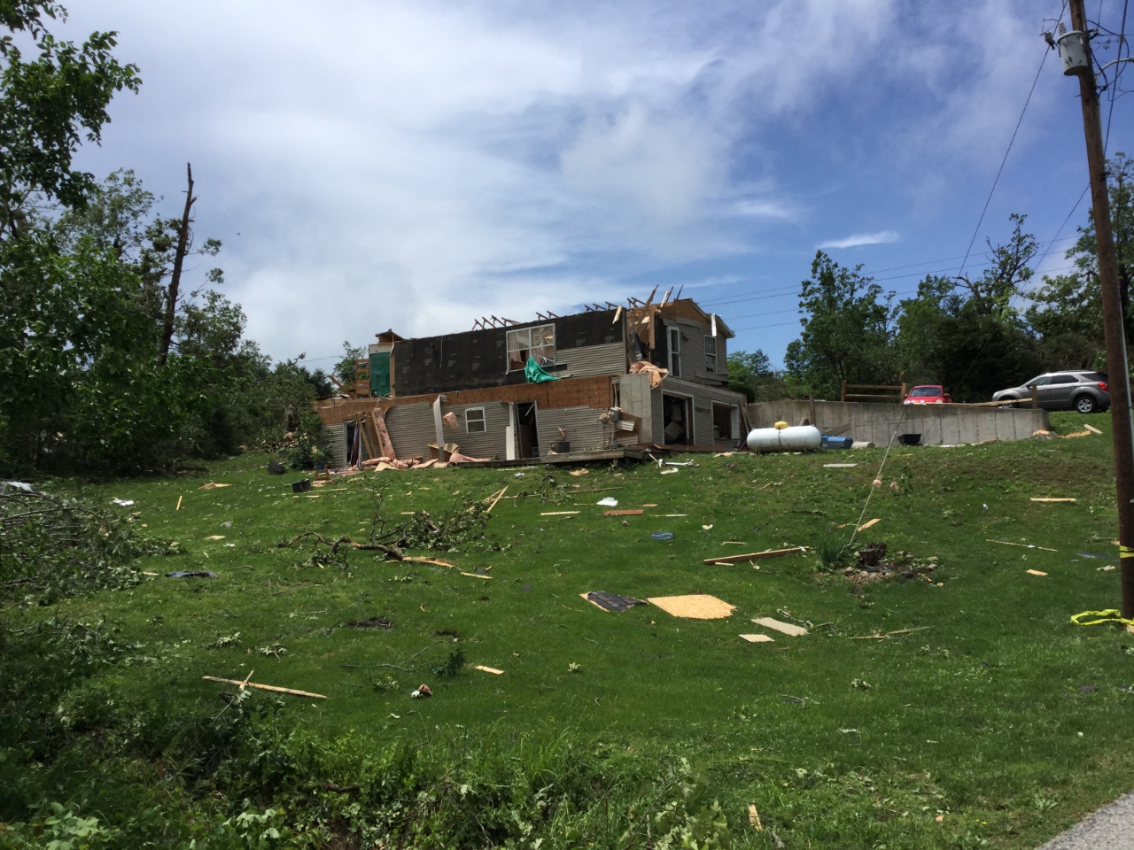
| Large sections of the roof were removed by 130 mph winds. |
Large sections of this house's roof were removed by 130 mph winds. |
Large sections of the roof and porch walls were removed by 130 mph winds. |
Walls collapsed by 150 mph winds around 11:33 PM. |
 |
 |
 |
 |
| This entire house was shifted off its foundation by 140 mph winds. |
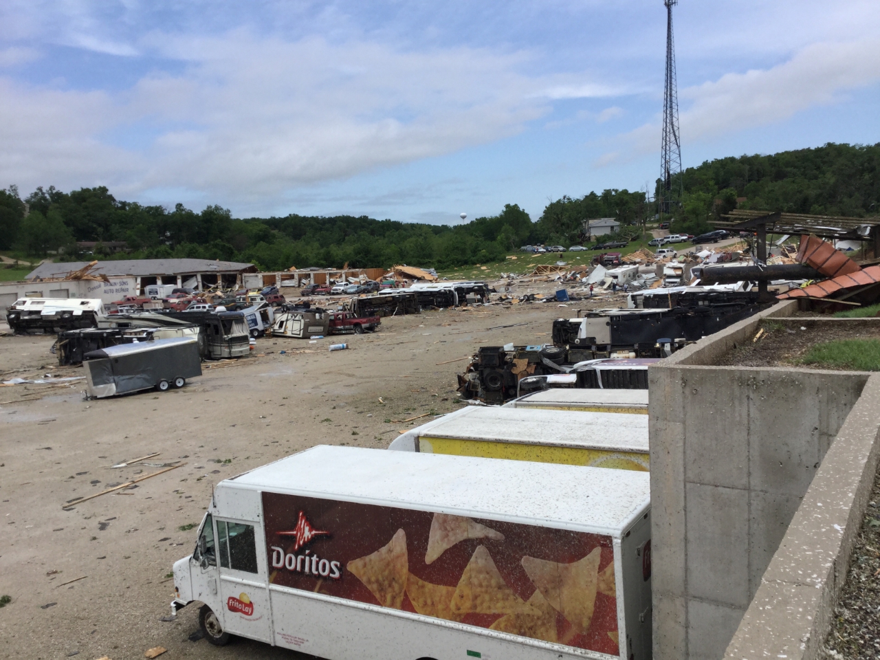
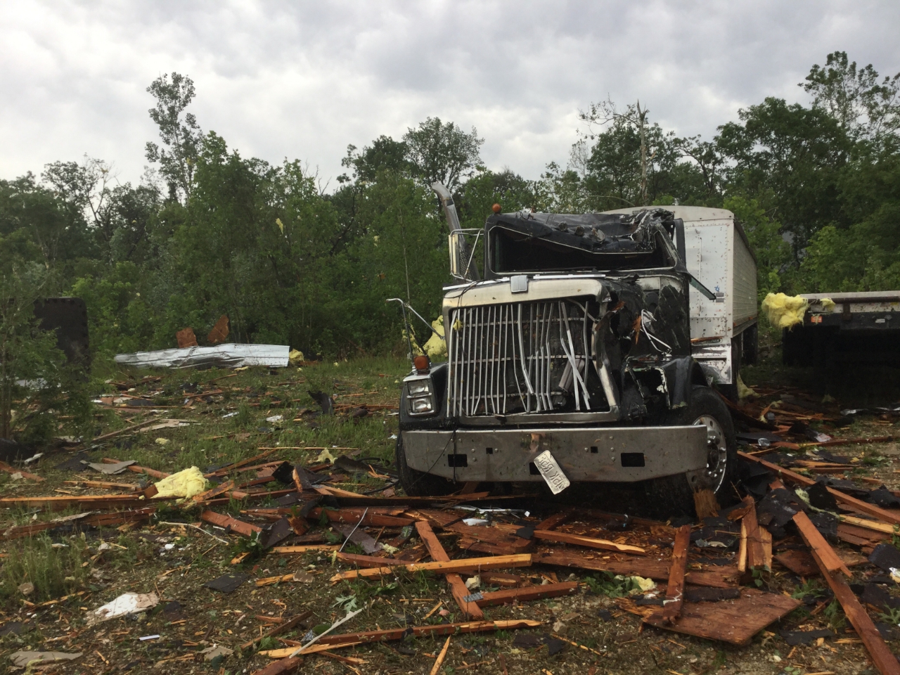
Warehouse walls collapse, trucks, RVs, and passenger vehicles moved and overturned by 125 mph winds. |
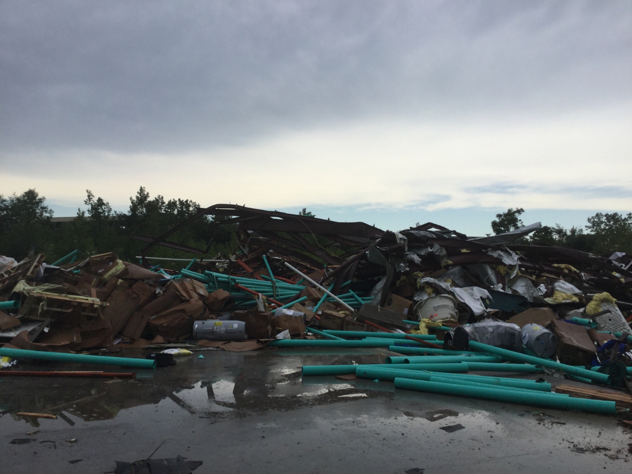
An automobile service building collapsed and cars were tossed into the debris. |
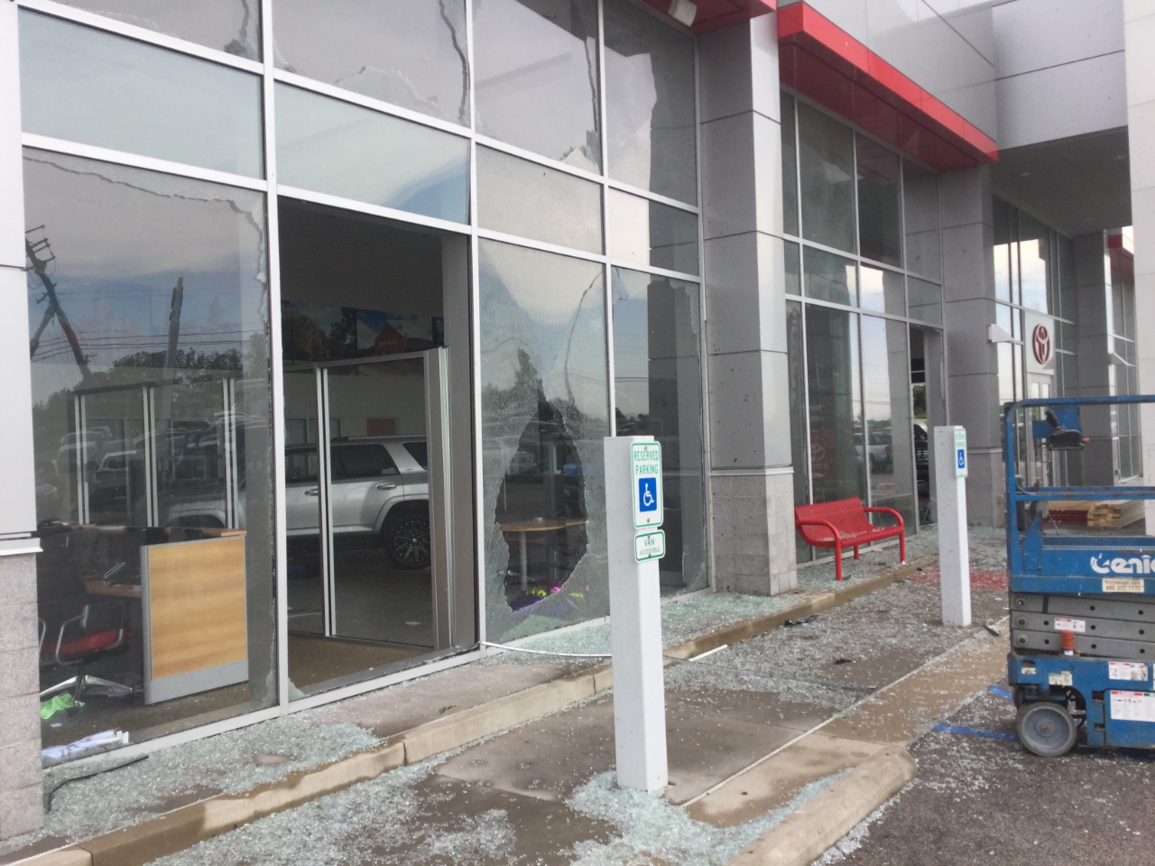
100 mph winds caused any loose object to become a projectile, breaking windows in cars and buildings. |
 |
 |
 |
 |
| At 130 mph even cars can become projectiles, turning orderly car dealerships into piles of damaged cars and trucks. |
A small professional building was utterly destroyed by 160 mph winds, the maximum speed this tornado produced. |
120 mph winds broke glass doors and windows, and ripped signs from the facade of this single story office building. |
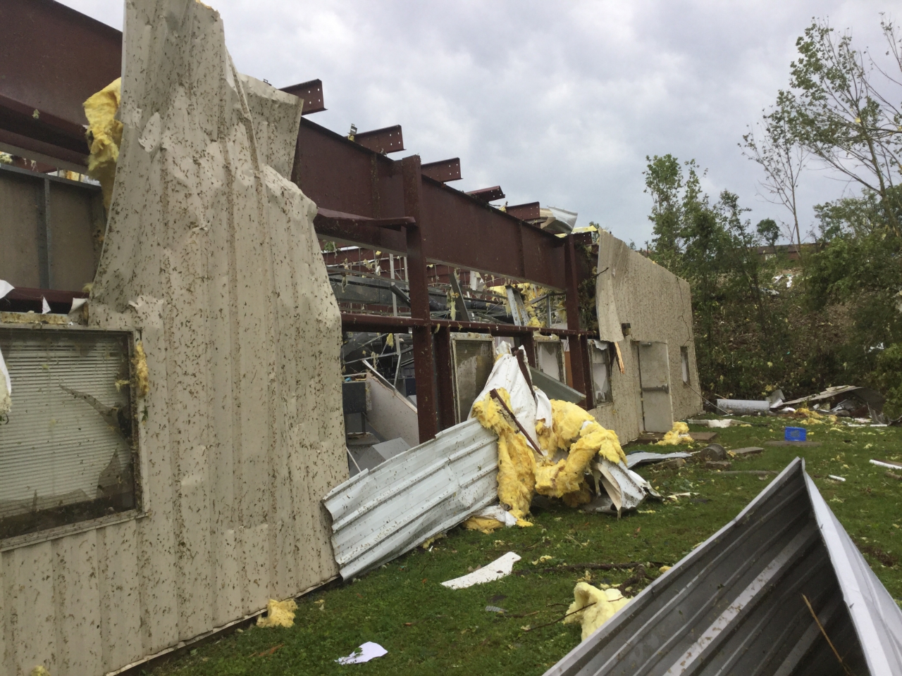
While the metal framing to this building stood up to the 130 mph winds, the exterior metal sheeting and some interior walls did not. |
 |
 |
 |
 |
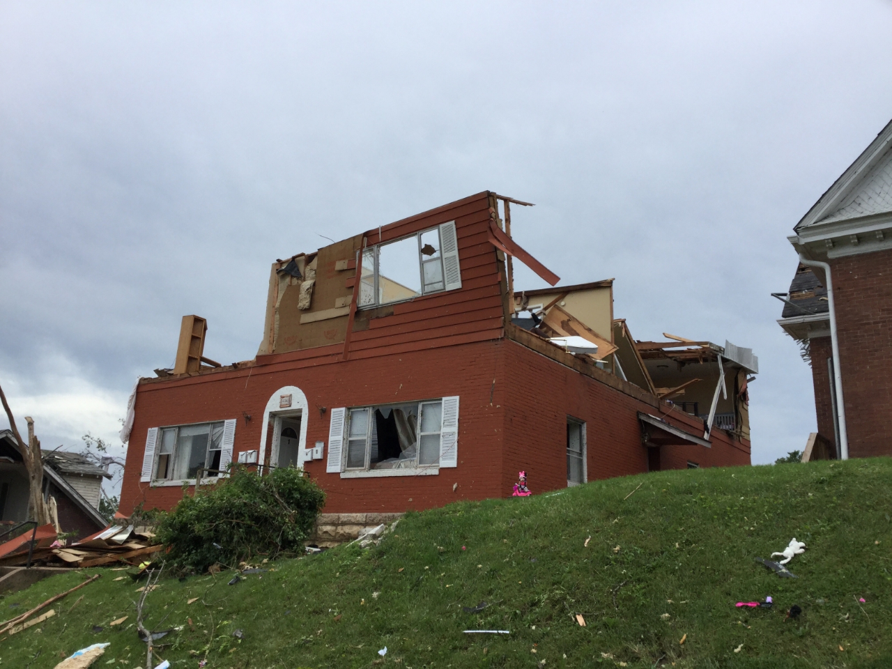
| The second floor of this house was completely destroyed by 130 mph winds. |
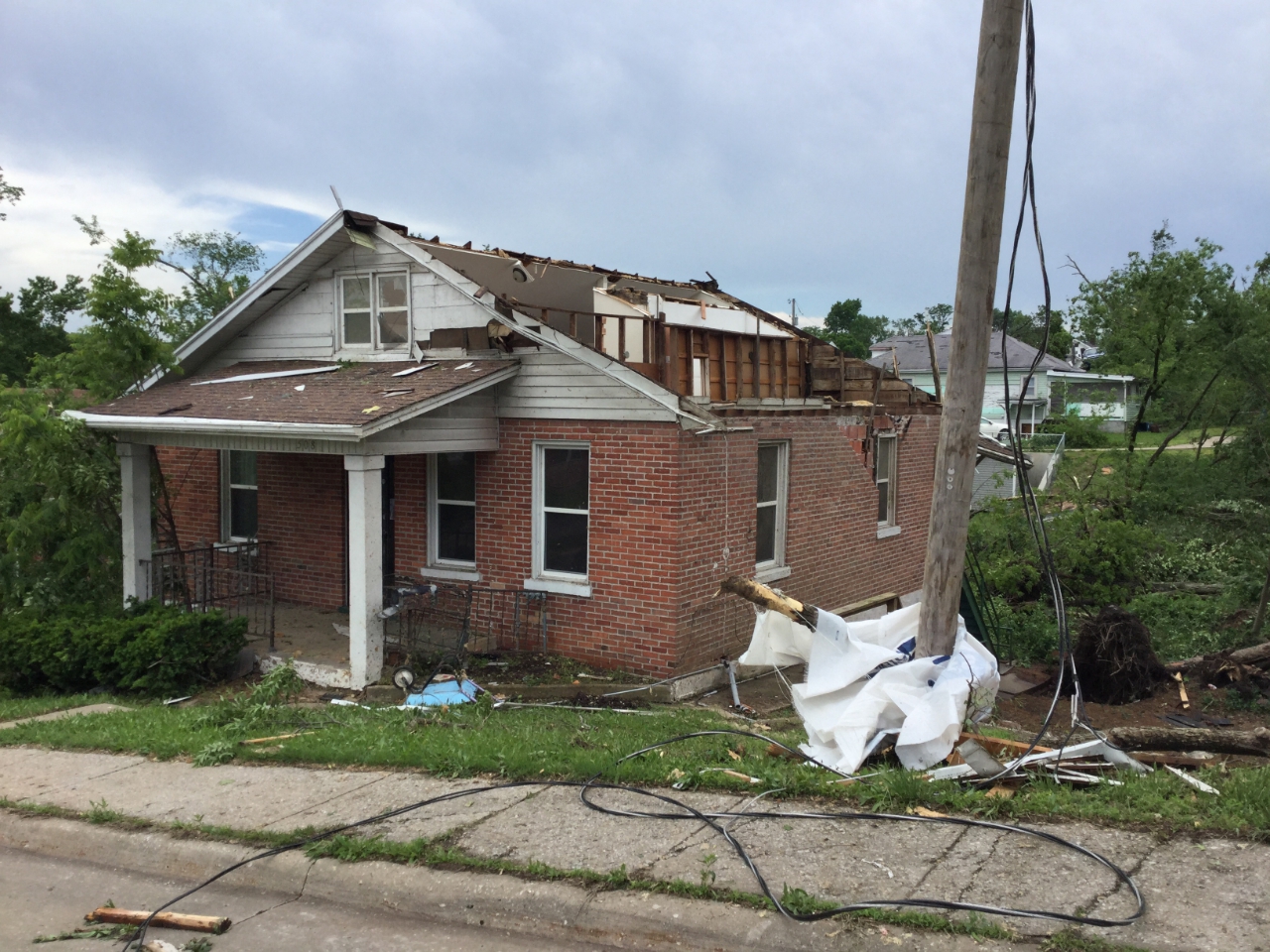
The roof of this home was ripped away when the tornado went through around 11:40 PM. |
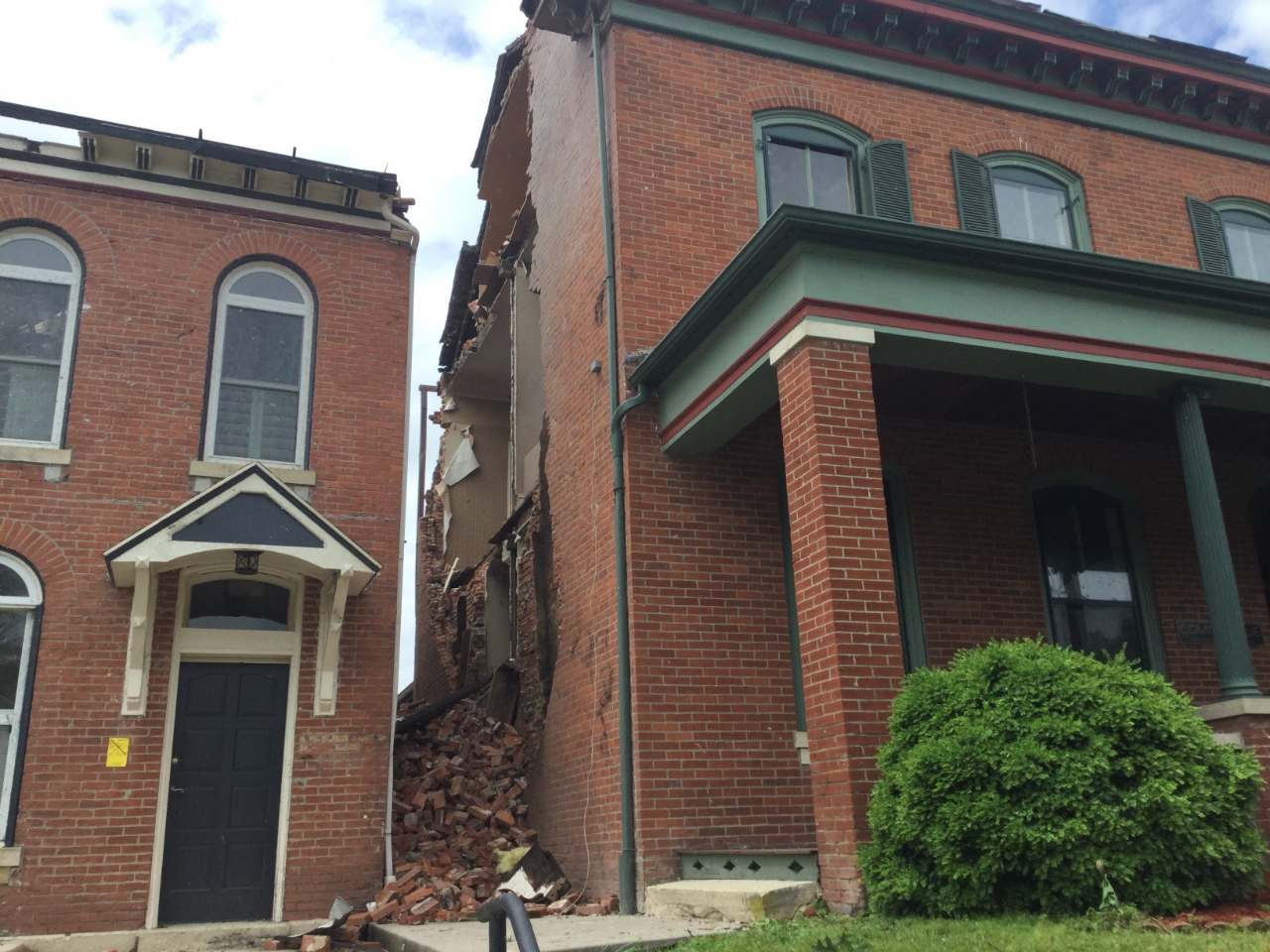
The brick house on the right lost part of its roof and most of one wall to 120 mph winds. |
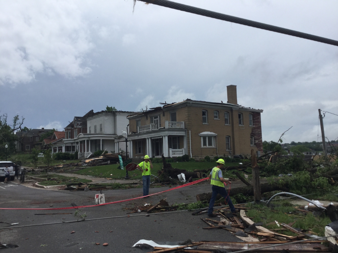
130 mph winds destroyed windows and removed roofs in this neighborhood in Jefferson City. |
|
Tornado - Yucatan, MO
Callaway County
| Date |
5/21/2019 |
| Time (Local) |
5:05 PM |
| EF Rating |
EF-1 |
| Est. Peak Winds |
100 mph |
| Path Length |
0.57 miles |
| Max Width |
250 yards |
| Injuries/Deaths |
0/0 |
|
Summary:
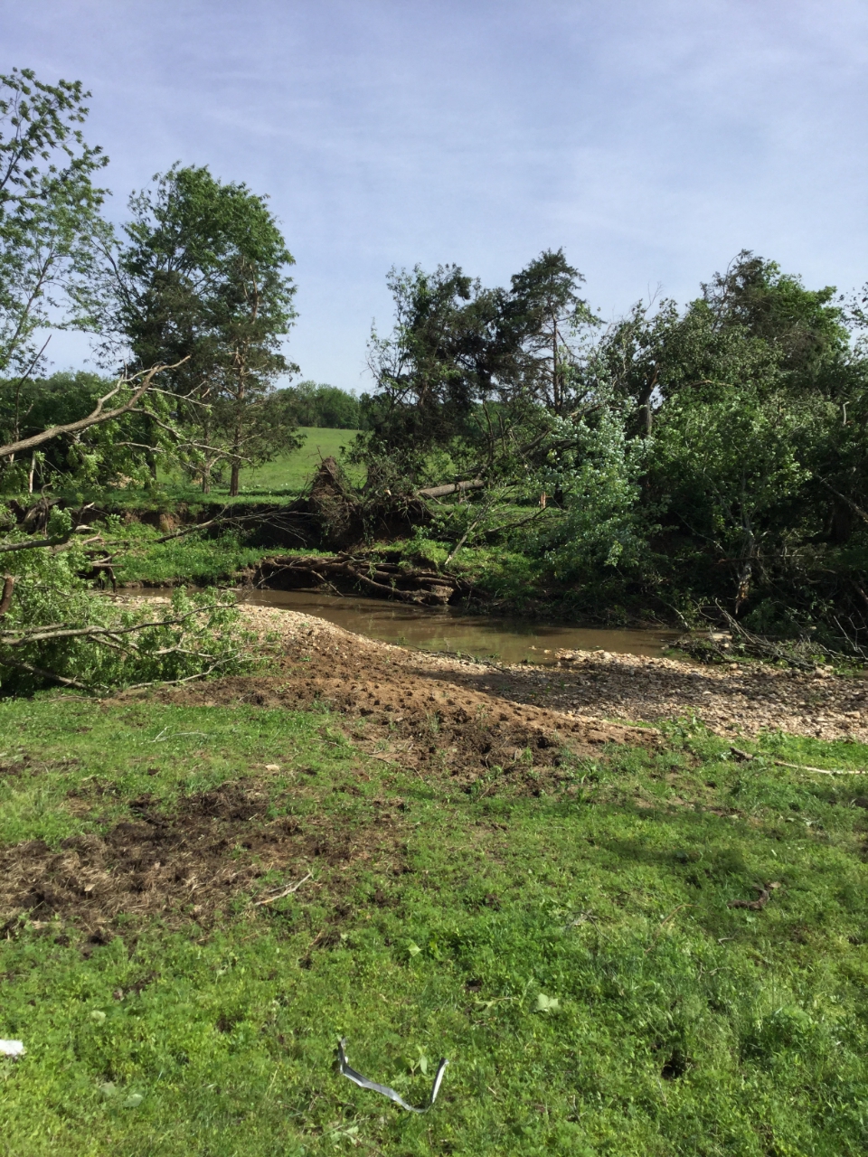
The weak tornado touched down northwest of the intersection of County Road 170 and County Road 171, destroying a small barn and causing tree damage. The tornado continued northeast widening to a width of 250 yards and causing more tree damage before lifting near Prairie Fork Creek.
|
Track Map
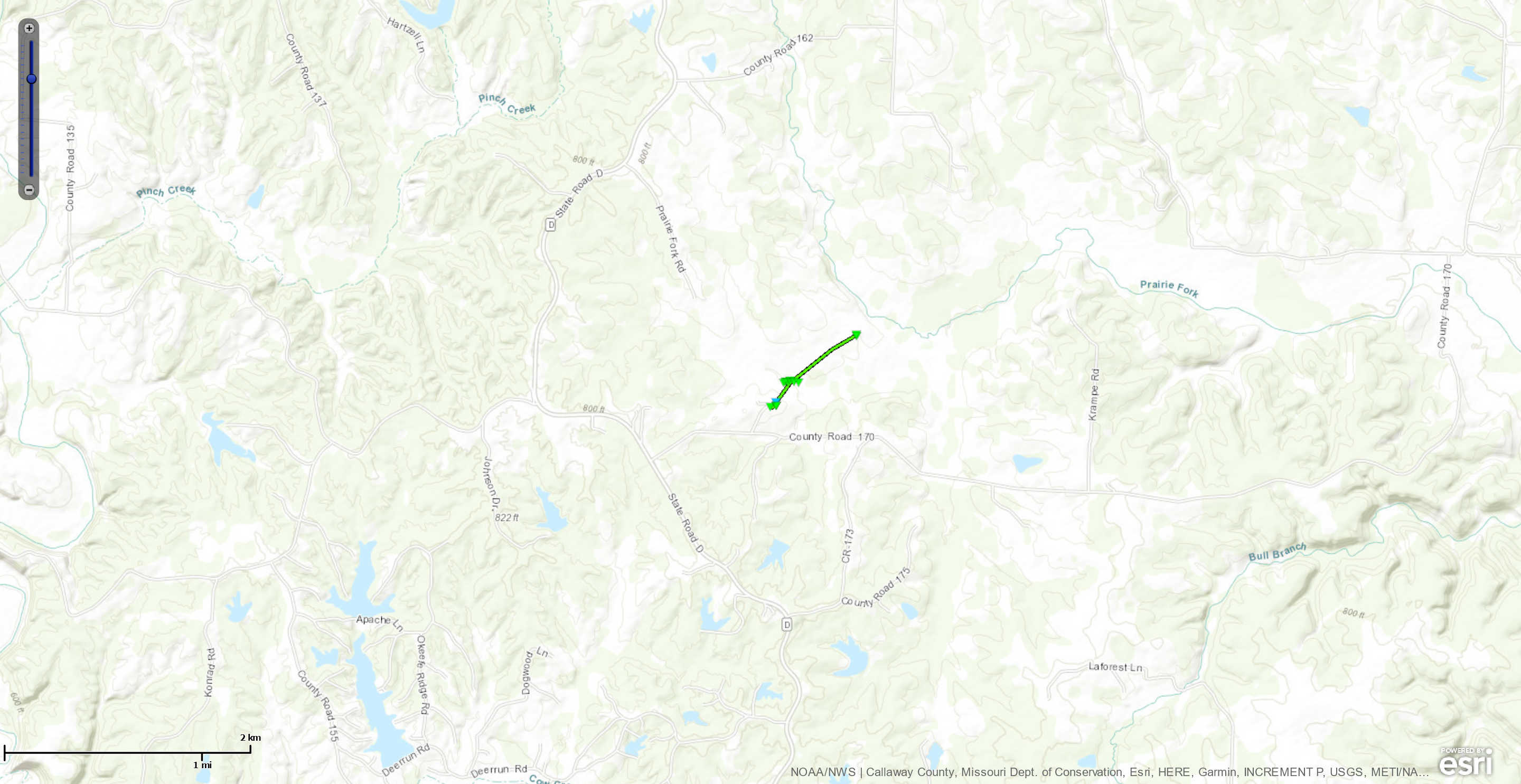 
Downloadable KMZ File
|
 |
 |
 |
 |
| Tree trunks near Yukutan, MO were snapped by 85 mph winds. |
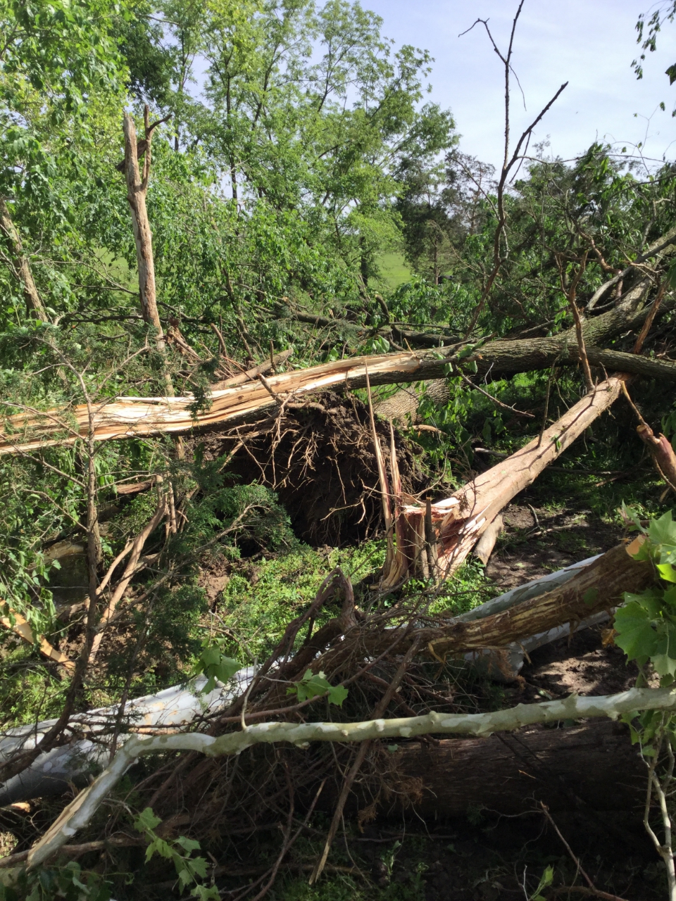
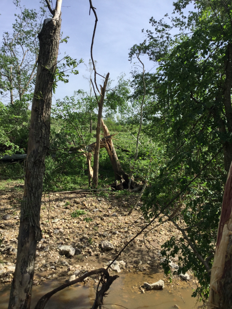
Hardwood trees were uprooted by 95 mph winds. |
100 mph snapped these hardwood tree trunks around 5:06 PM. |
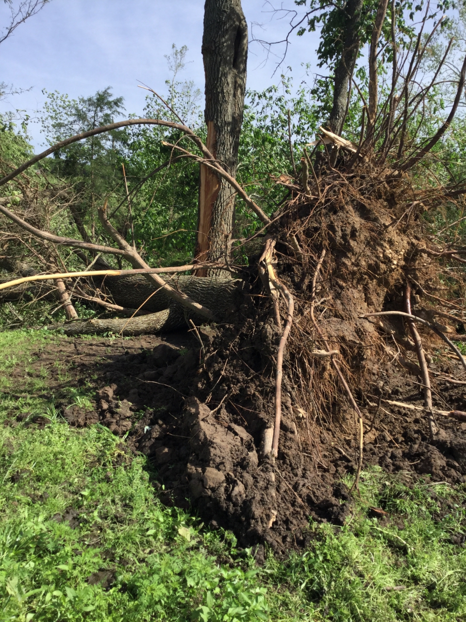
The tornado ripped up trees, sometimes by their roots. |
|
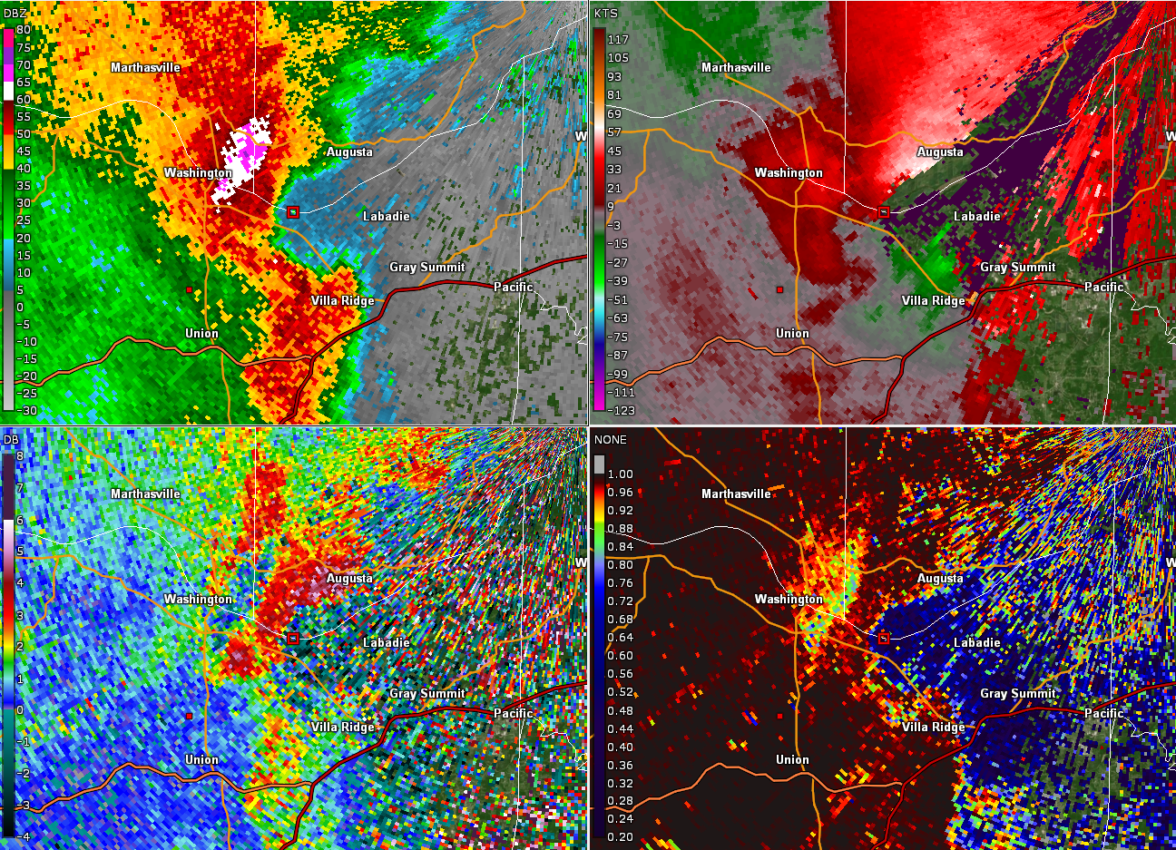
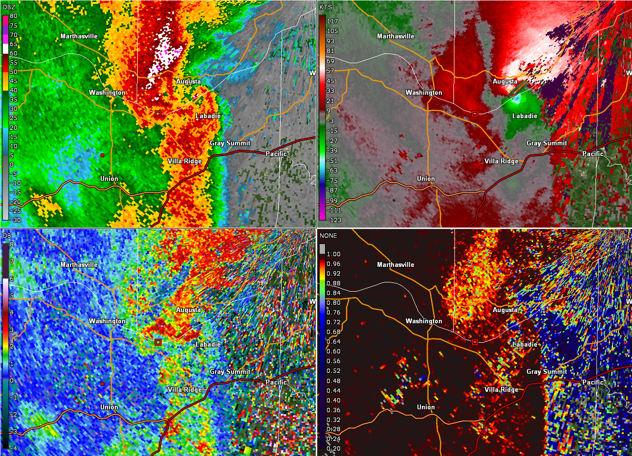
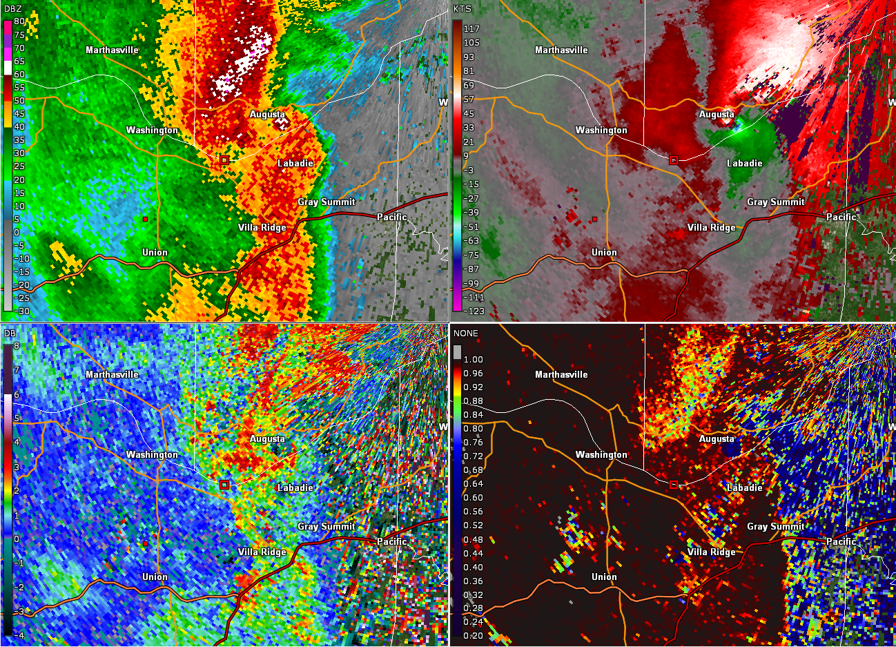
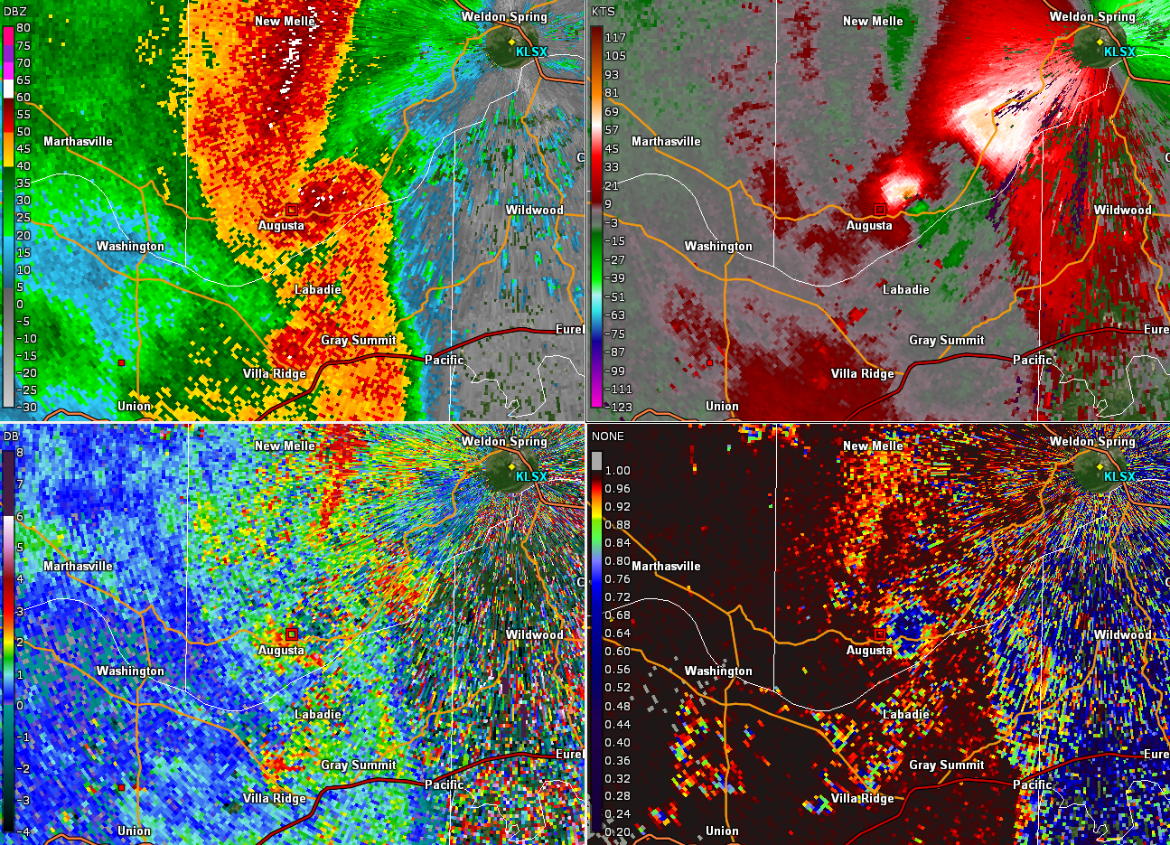
Tornado - Augusta, MO
Franklin and St. Charles County
| Date |
5/21/2019 |
| Time (Local) |
5:58 PM |
| EF Rating |
EF-1 |
| Est. Peak Winds |
100 mph |
| Path Length |
6 miles |
| Max Width |
250 yards |
| Injuries/Deaths |
0/0 |
|
Summary:
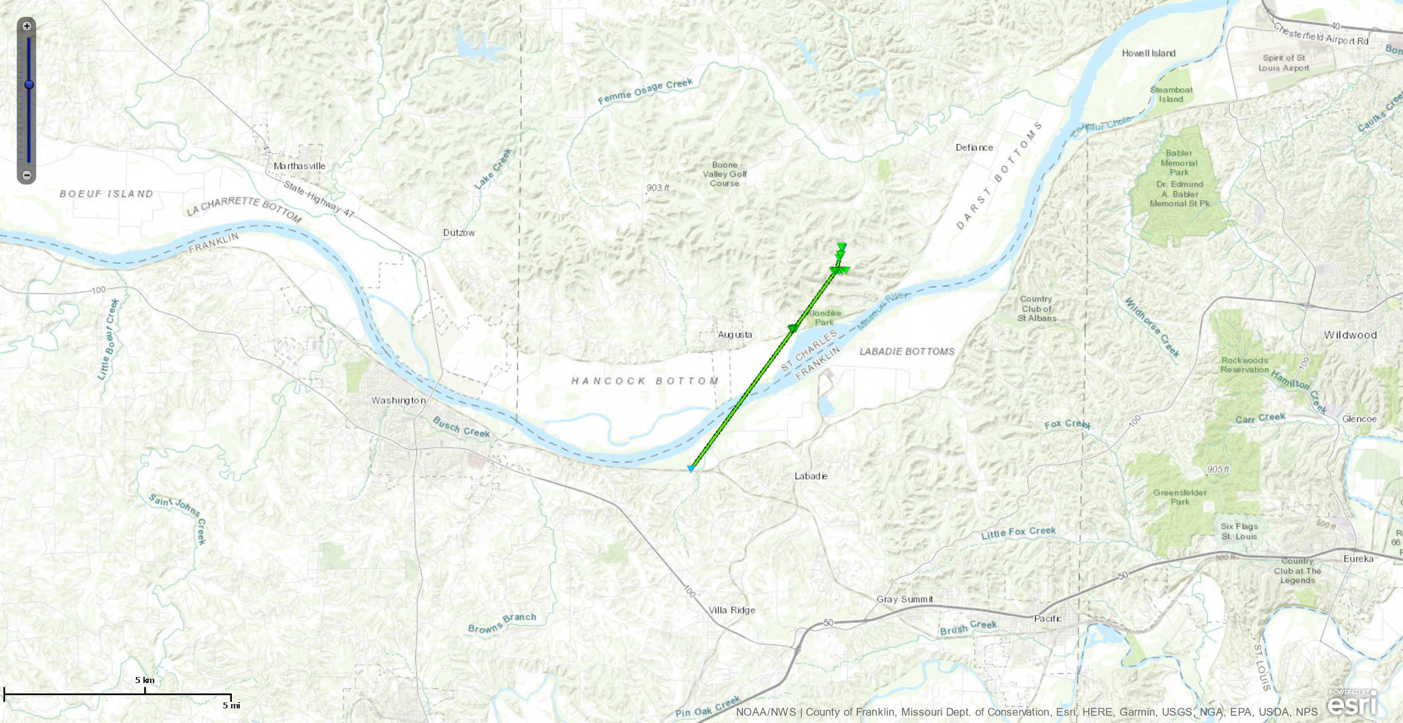
A tornado developed about 1 mile west of Labadie in Franklin County, causing some tree damage and then moved north-northeast across the Missouri River in St. Charles County. Extensive tree damage was noted on Sanders Road, Terry Road, and Coates Lane. Minor structural damage was noted on a few homes and a few roofs were blown off of barns and outbuildings.
|
Track Map
Downloadable KMZ File
|
 |
 |
 |
 |
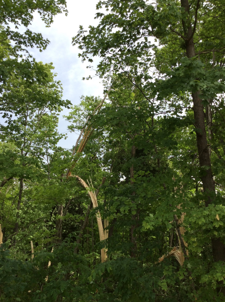
| Trees were snapped or uprooted along the tornado path through heavily wooded Augusta, MO. |
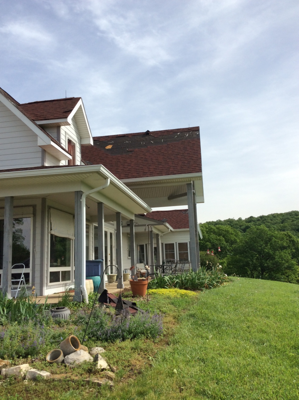
The tornado did minor damage to this home in Augusta, damaging the roof but leaving the structure intact. |
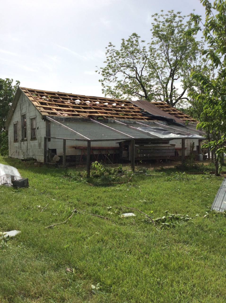
Farm buildings did not fair well, the tornado winds this barn roof. |
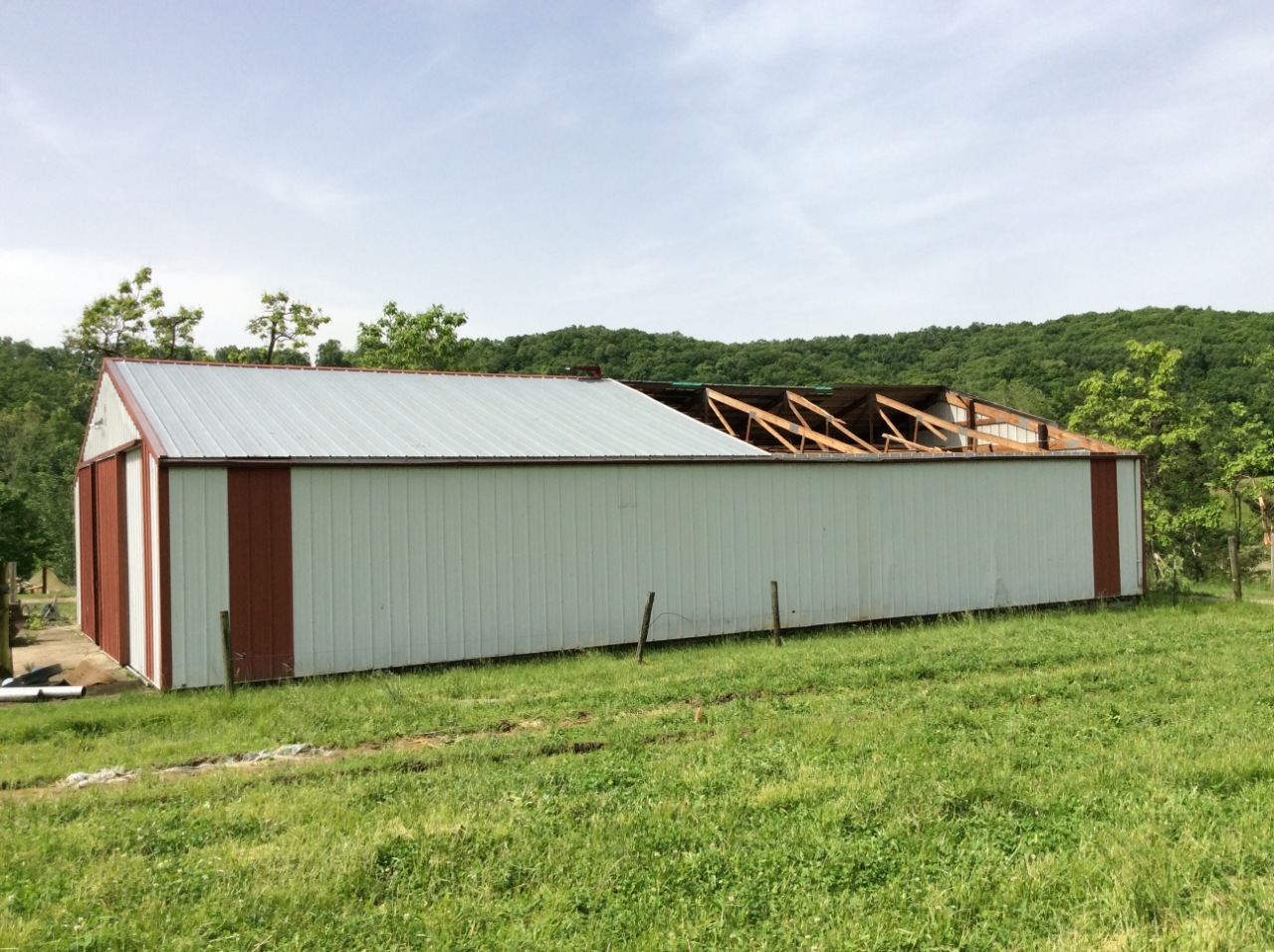
The winds also destroyed part of the roof on this farm building. |
|
Tornado - Waterloo, IL
Monroe County
| Date |
5/21/2019 |
| Time (Local) |
7:01 PM |
| EF Rating |
EF-0 |
| Est. Peak Winds |
85 mph |
| Path Length |
0.35 yards |
| Max Width |
50 yards |
| Injuries/Deaths |
0/0 |
|
Summary:
A weak tornado caused minor structural damage and tree damage in the northern section of Waterloo, IL. The tornado was estimated to only be on the ground for a minute and traveled less than a half mile.
|
Track Map
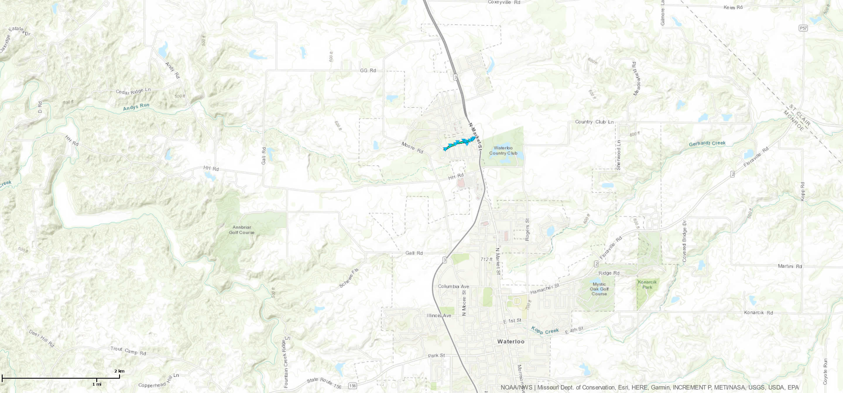
Downloadable KMZ File
|
 |
 |
 |
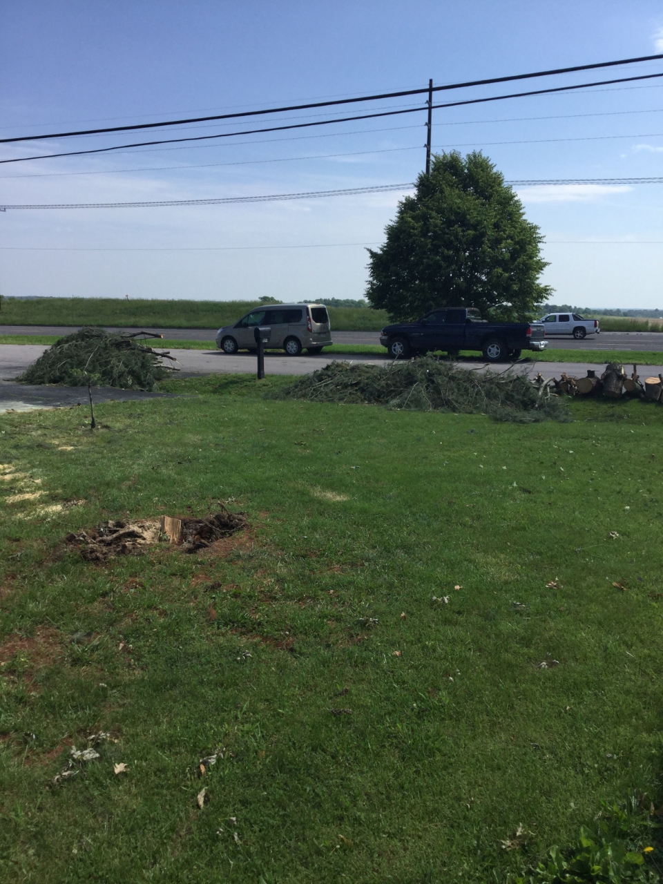 |
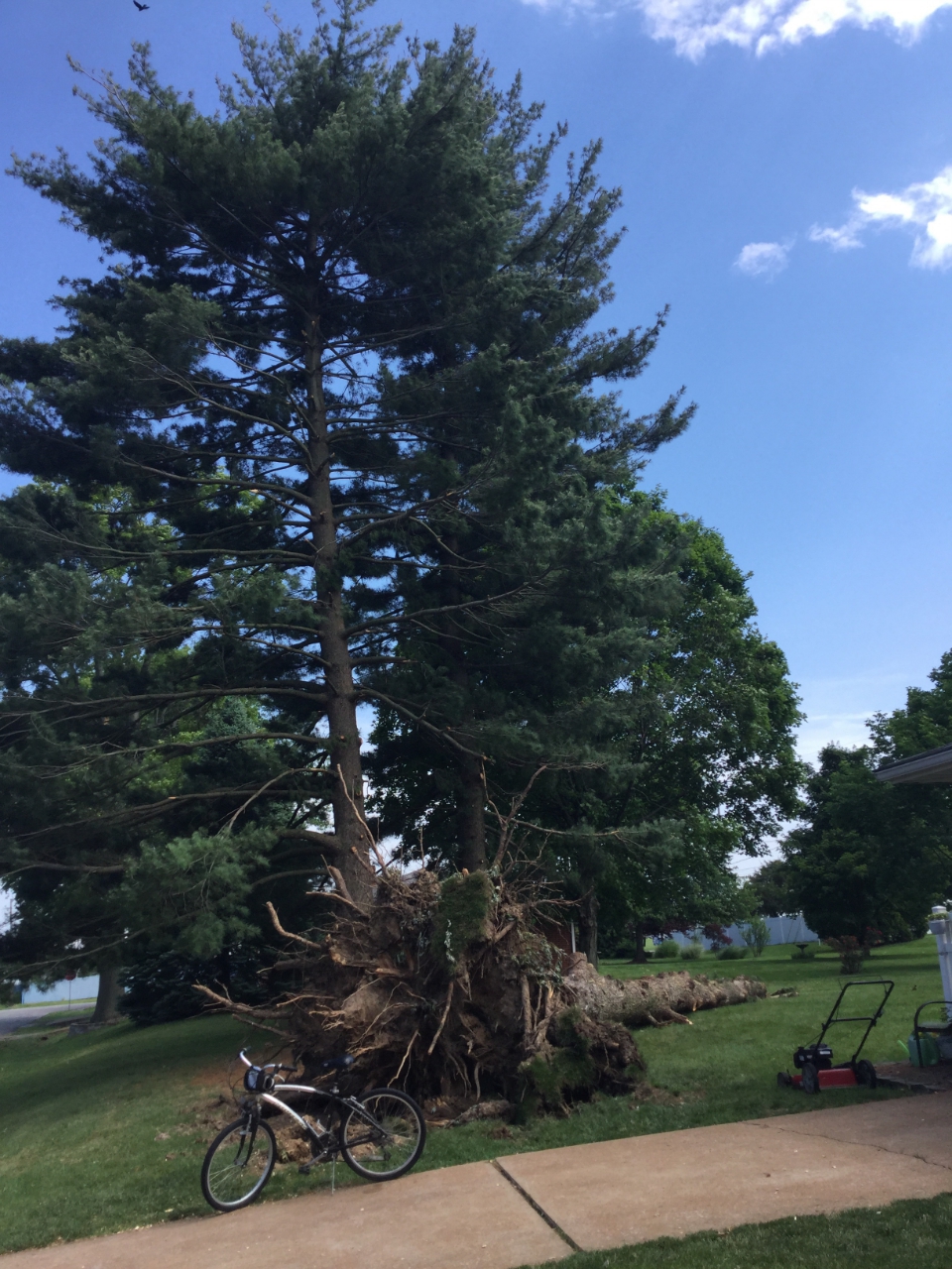
| This 80 foot pine was uprooted by 85 mph winds. |
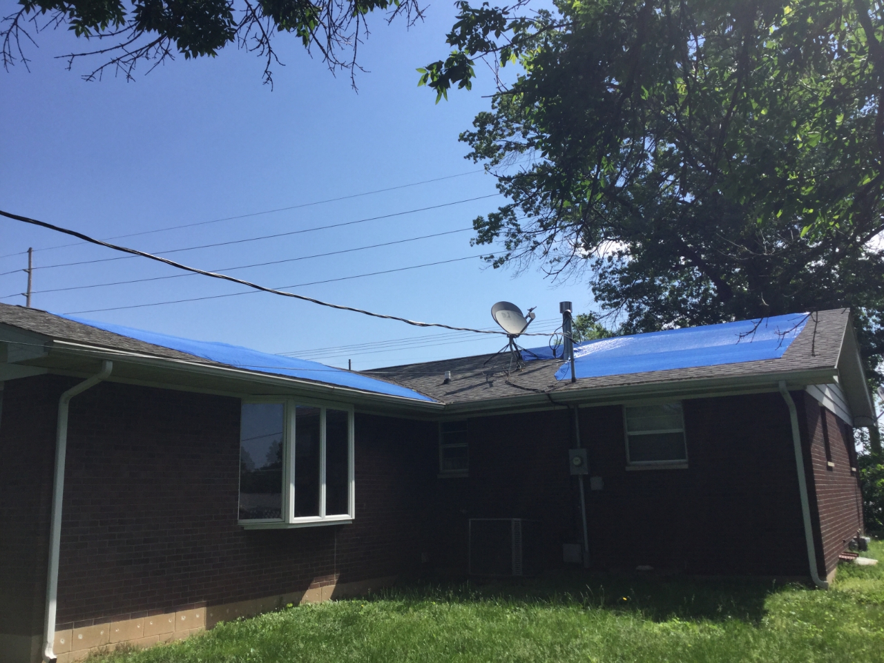
Minor roofing damage was done by the tornado as it moved over at 7:02 PM. |
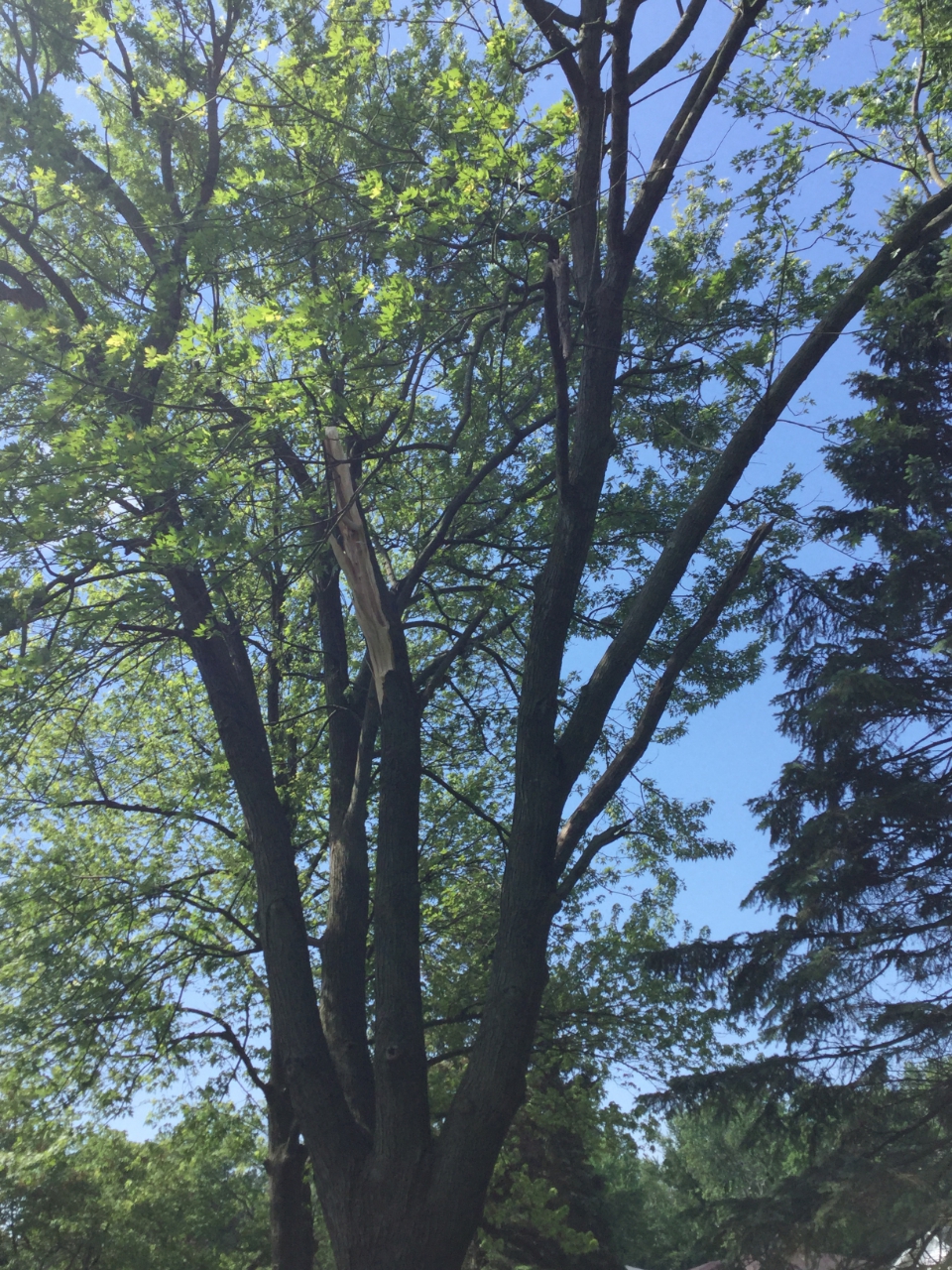
The tornado removed large branches from many trees in Waterloo. |
Tornado winds completed uprooted this tree. |
|
Tornado - Mexico, MO
Audrain County
| Date |
5/22/2019 |
| Time (Local) |
10:02 PM |
| EF Rating |
EF-0 |
| Est. Peak Winds |
85 mph |
| Path Length |
0.83 miles |
| Max Width |
150 yards |
| Injuries/Deaths |
0/0 |
|
Summary:
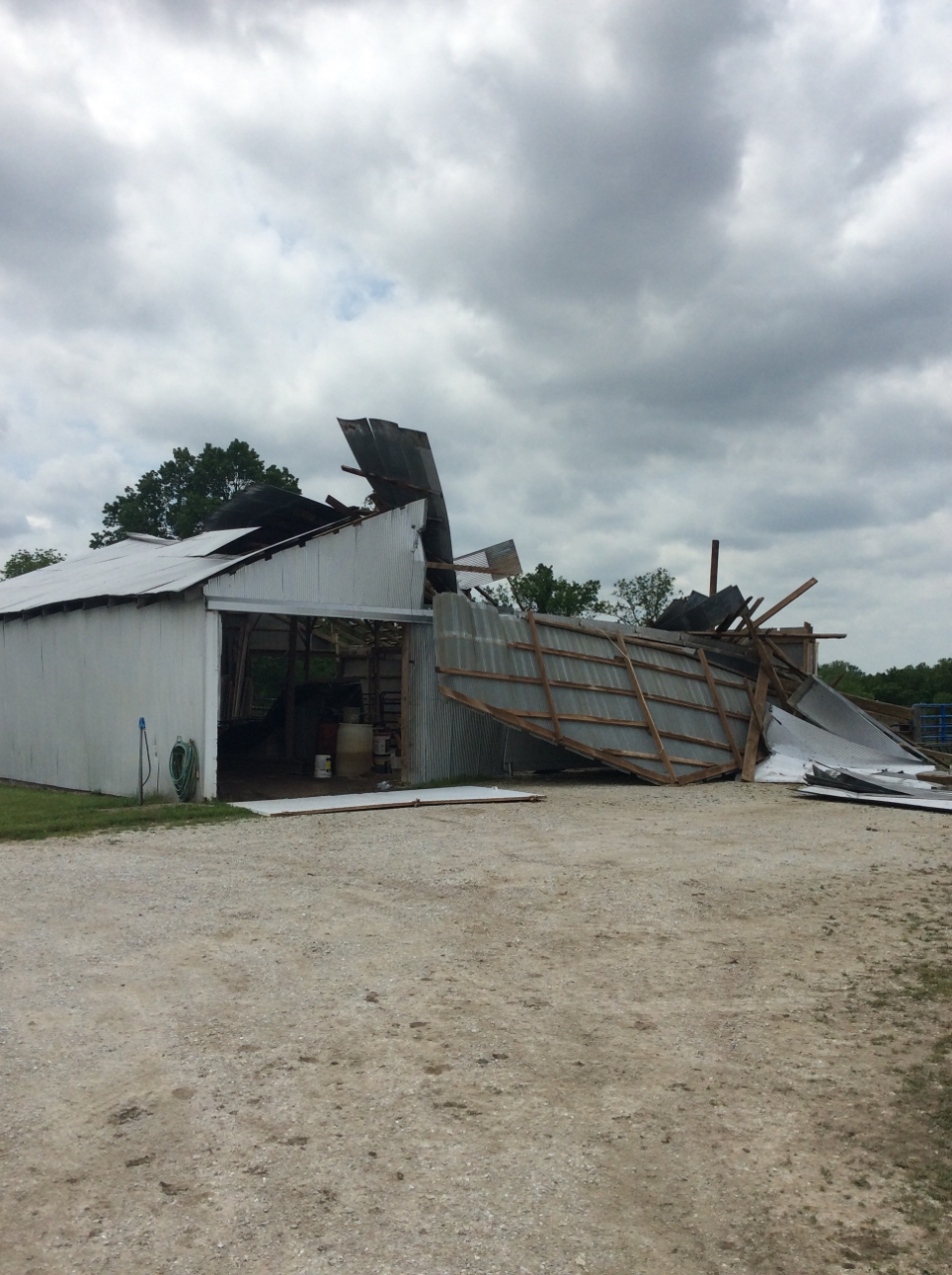
A weak tornado briefly spun up near the intersection of Highway J and Bean Creek in Audrain County, causing some tree damage. The tornado quickly moved to the NNW, where it caused extensive damage to a barn and damaged more trees.
|
Track Map
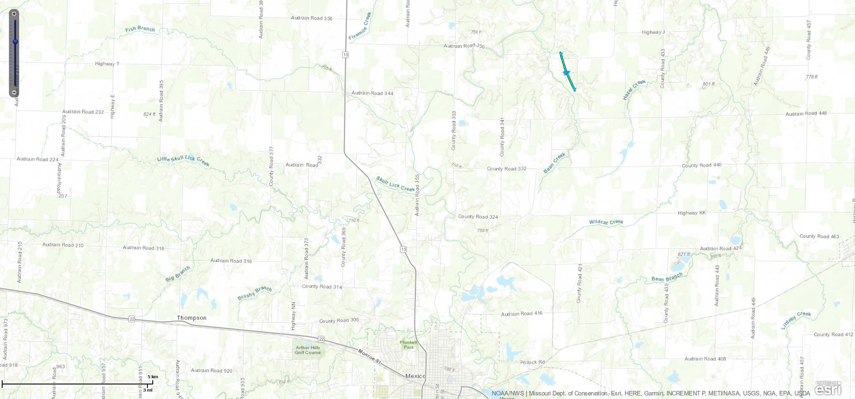
Downloadable KMZ File
|
 |
 |
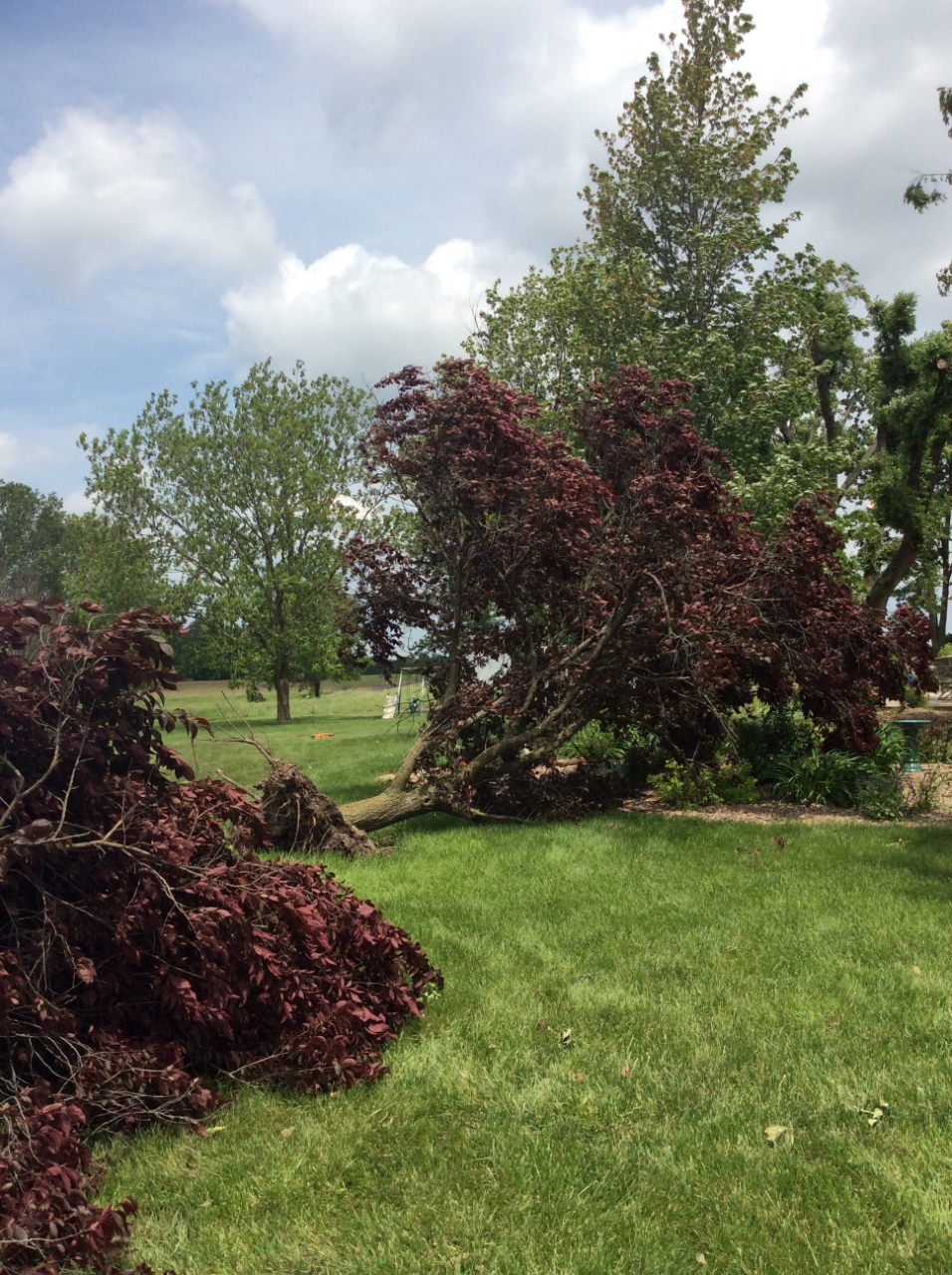 |
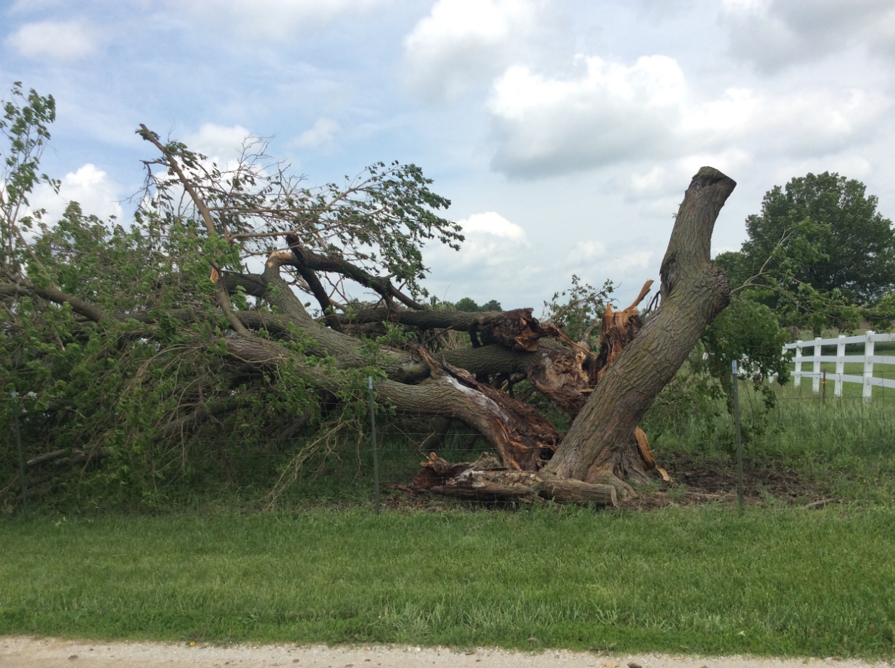
| The EF-0 tornado split this hardwood tree around 10:02 PM. |
This open ended farm building was severely damaged by the tornado that went through, destroying most of the roof and collapsing one of the walls. |
The 80 mph winds uprooted a couple of trees. |
|
The Enhanced Fujita (EF) Scale classifies tornadoes into the following categories:
EF0
Weak
65-85 mph |
EF1
Moderate
86-110 mph |
EF2
Significant
111-135 mph |
EF3
Severe
136-165 mph |
EF4
Extreme
166-200 mph |
EF5
Catastrophic
200+ mph |
 |
Wind:
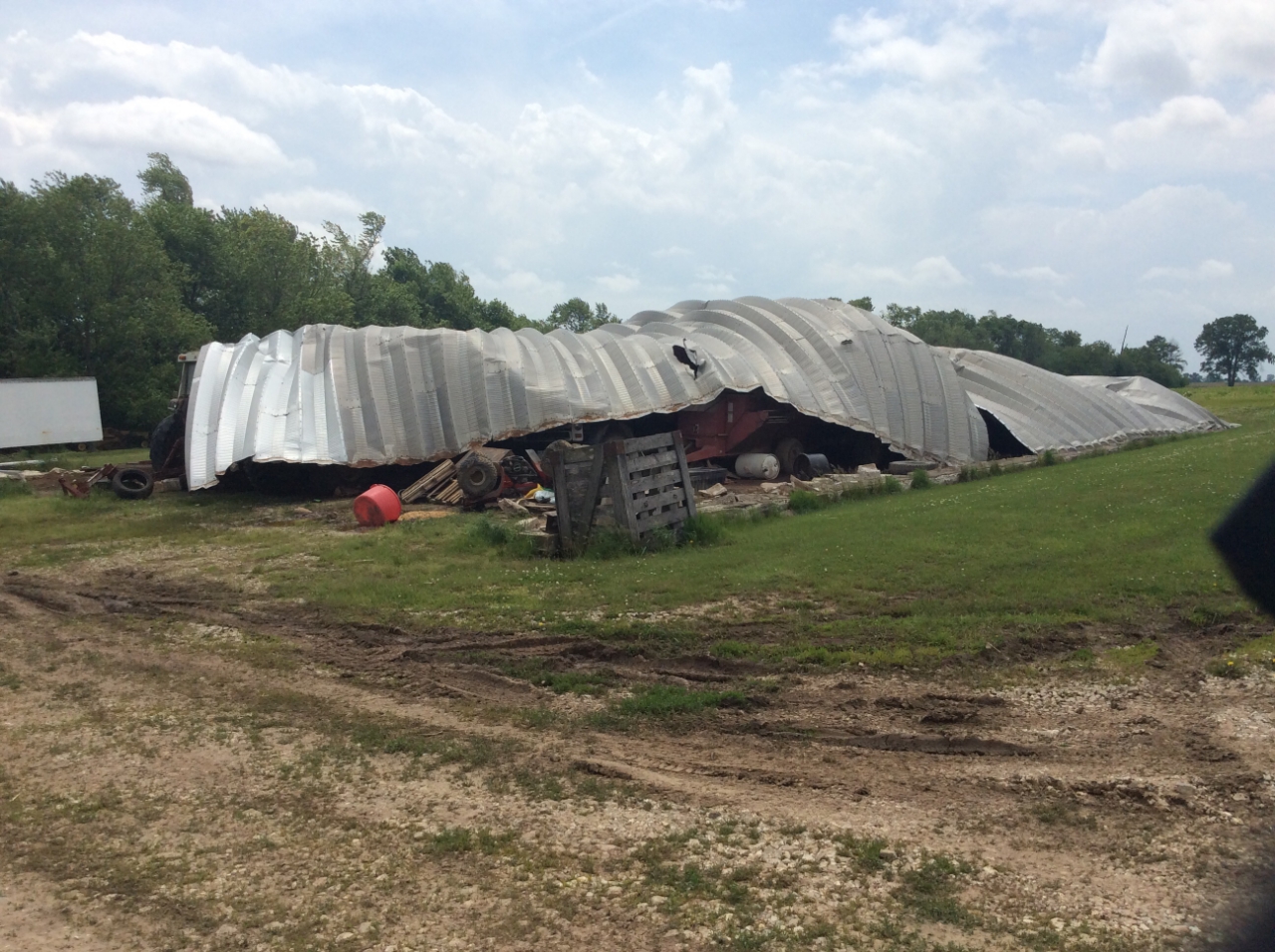
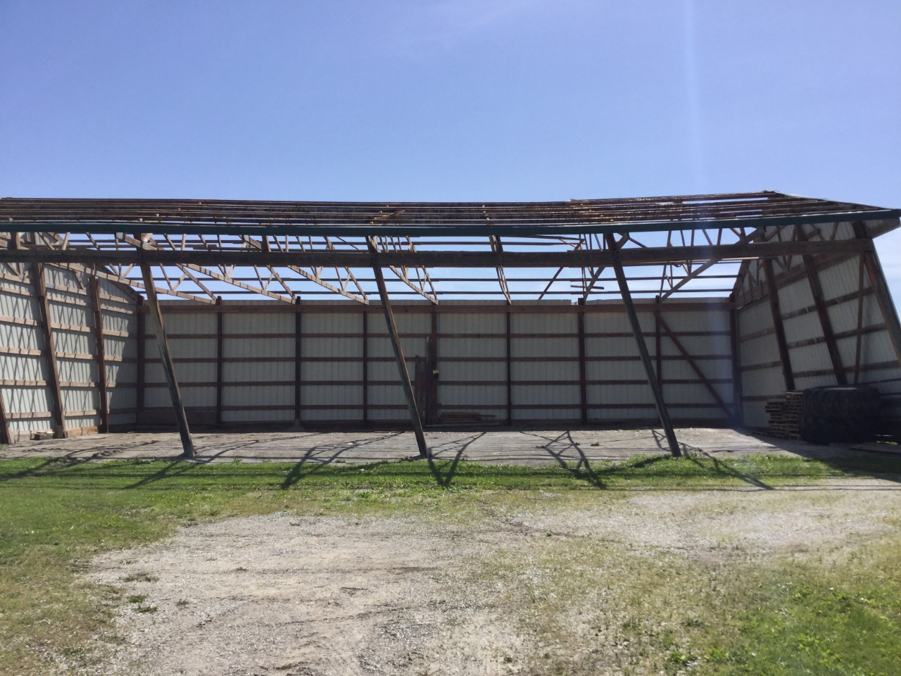
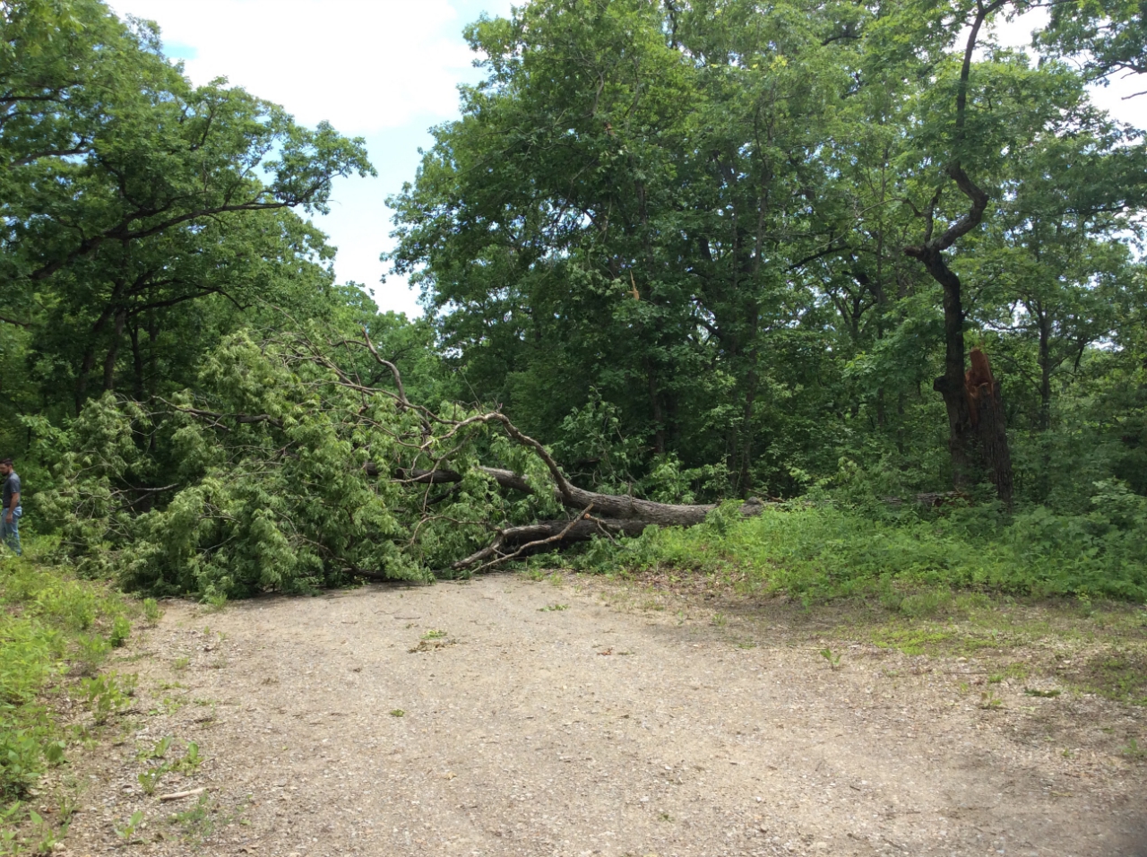
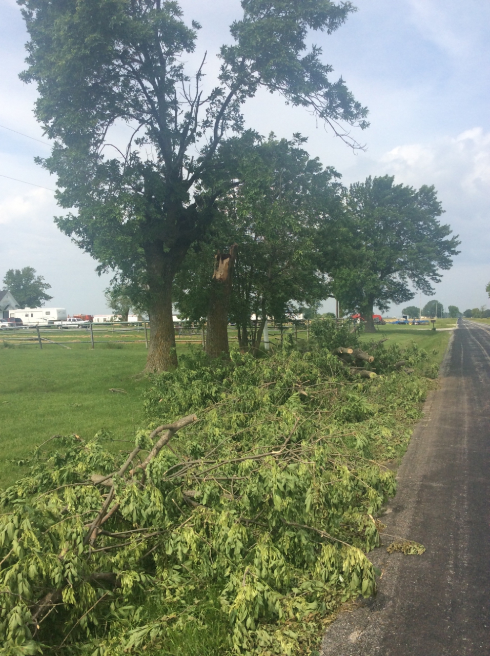
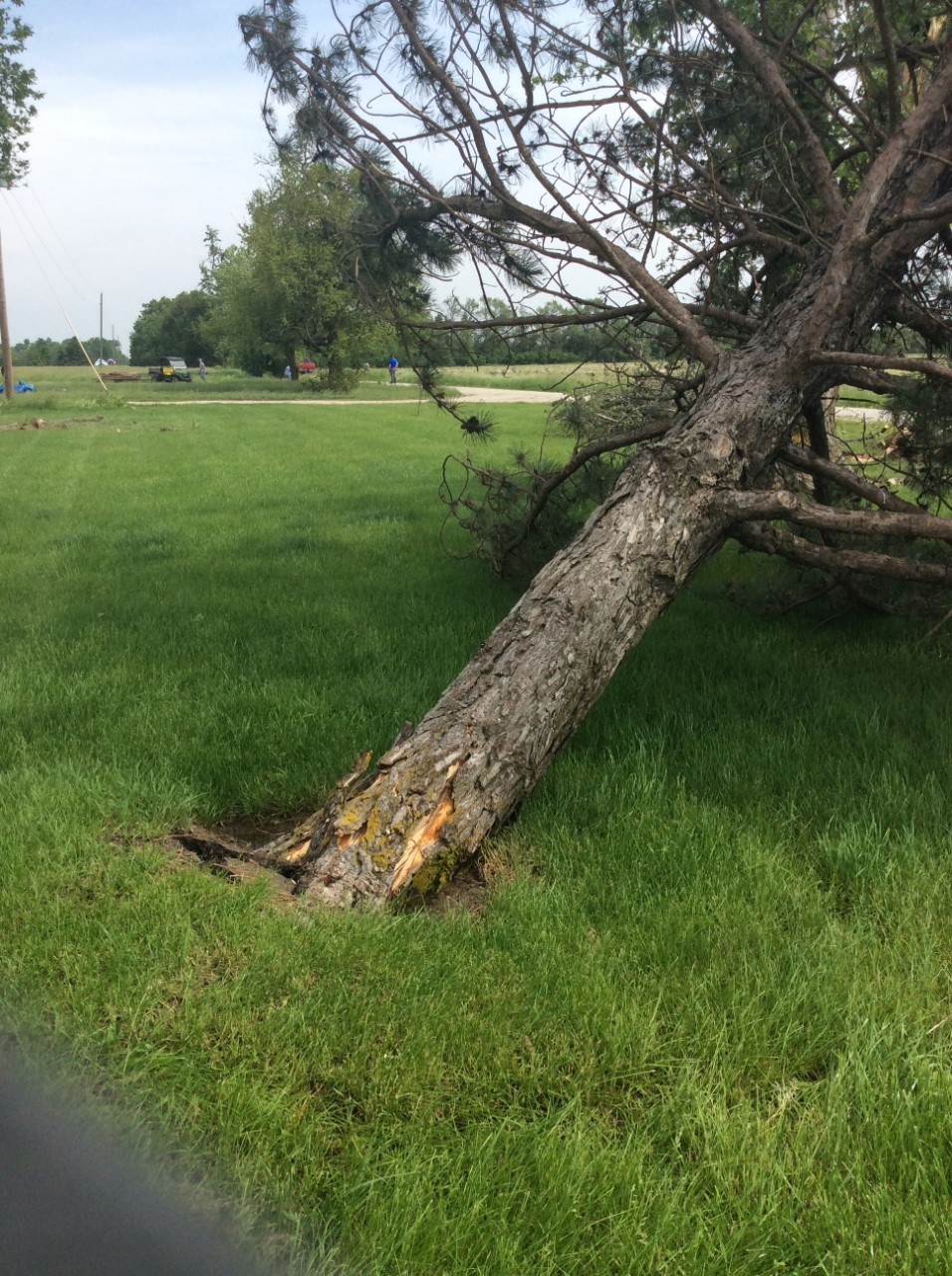
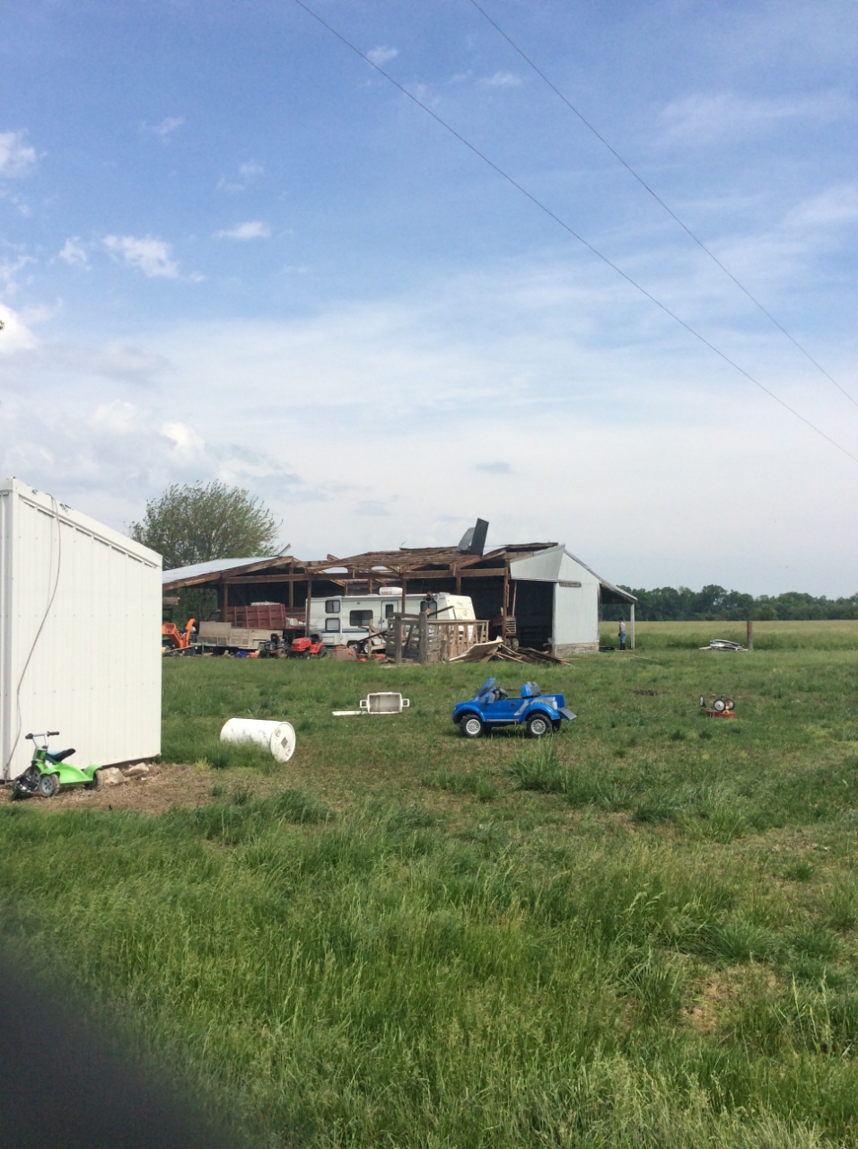
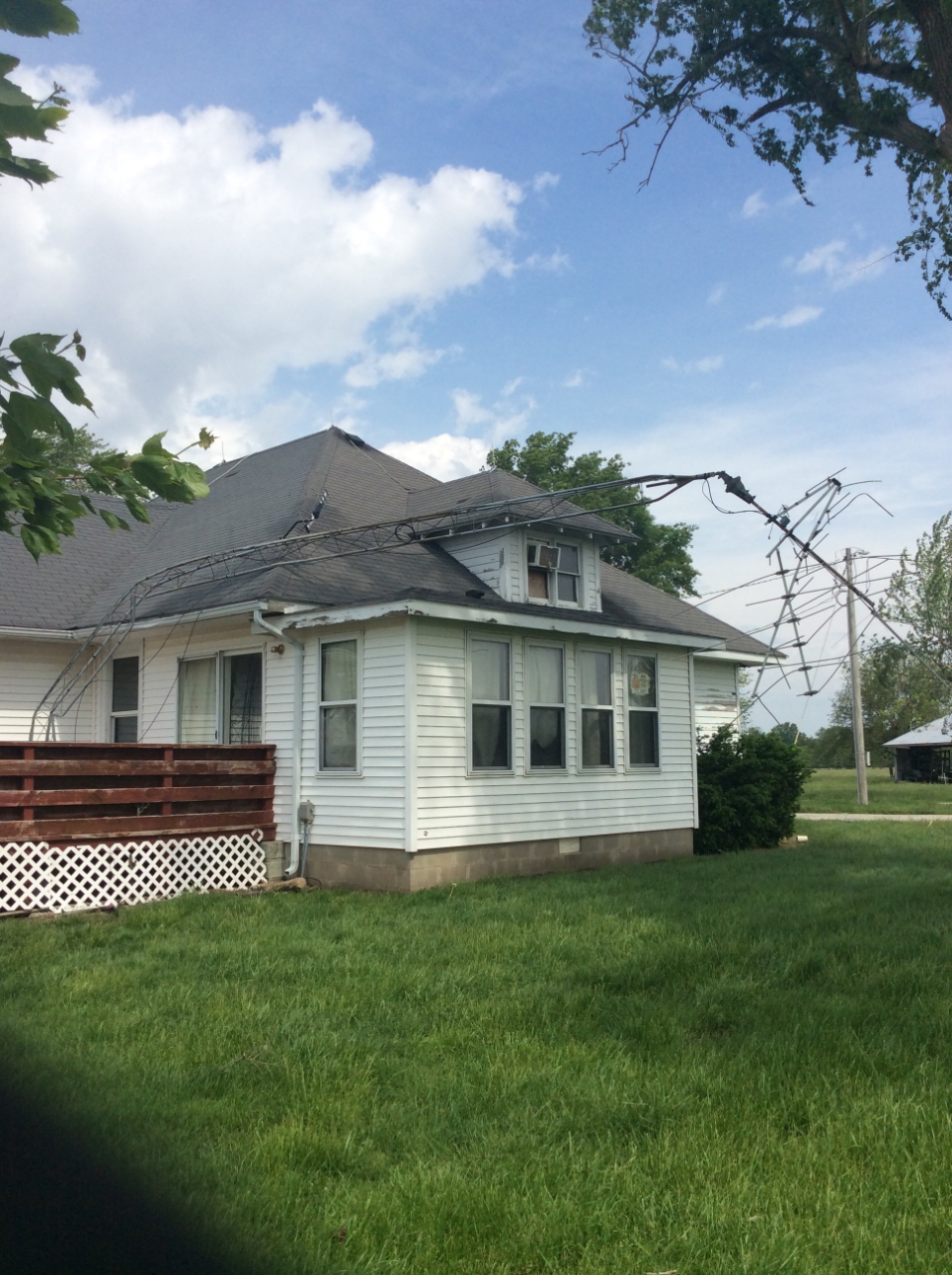
While surveying in Audrain County for the Mexico Tornado severe thunderstorm wind damage was observed. While much of the damage looks similar to the tornado damage seen above, it was classified as severe thunderstorm wind damage because of the pattern the debris made. When straight line winds from severe thunderstorms go through an area debris is often pushed into the ground or blown in a single direction. Tornado damage tends to be multi-directional and debris is lofted significant distances or pushed into the ground from different directions.
 |
 |
 |
 |
| This domed corrugated metal machine outbuilding collapsed completely. |
The open south side of the barn likely provided an easy way for north flowing wind to scoop the roof off. |
This single tree was uprooted and laying across the road. |
Tree limbs came down across Audrain County. |
 |
 |
 |
 |
| It's possible this tree snapped at the trunk in the severe thunderstorm wind gusts, and then fell over due to heavily saturated soils. |
Gusts removed some of the roof panels for this outbuilding. |
Wind gusts bent this small residential radio tower around the house.
|
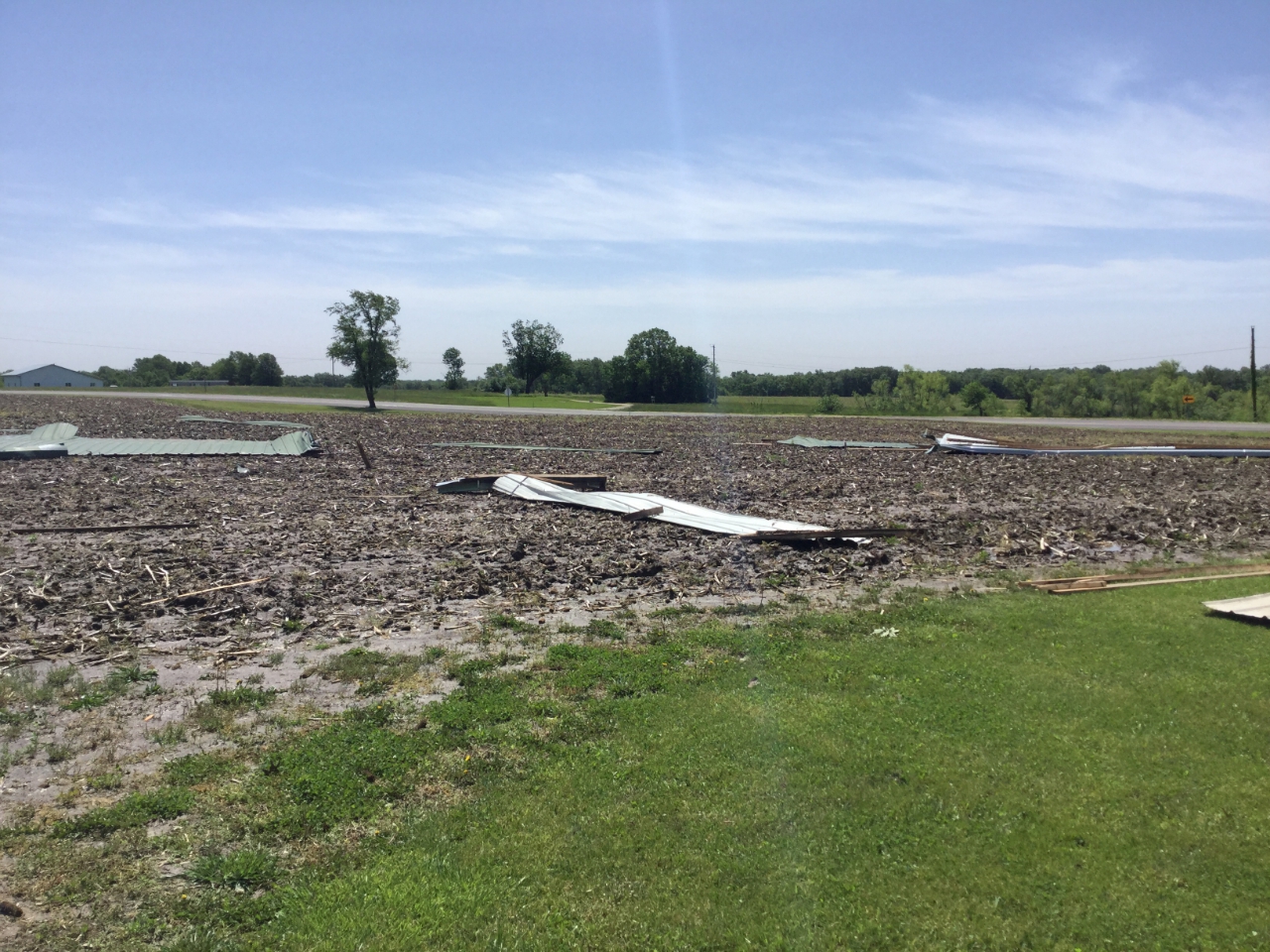
Roof panels from farm buildings were blown into fields.
|
 |
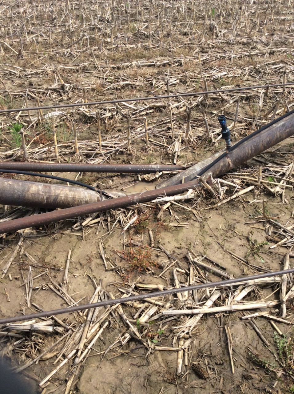 |
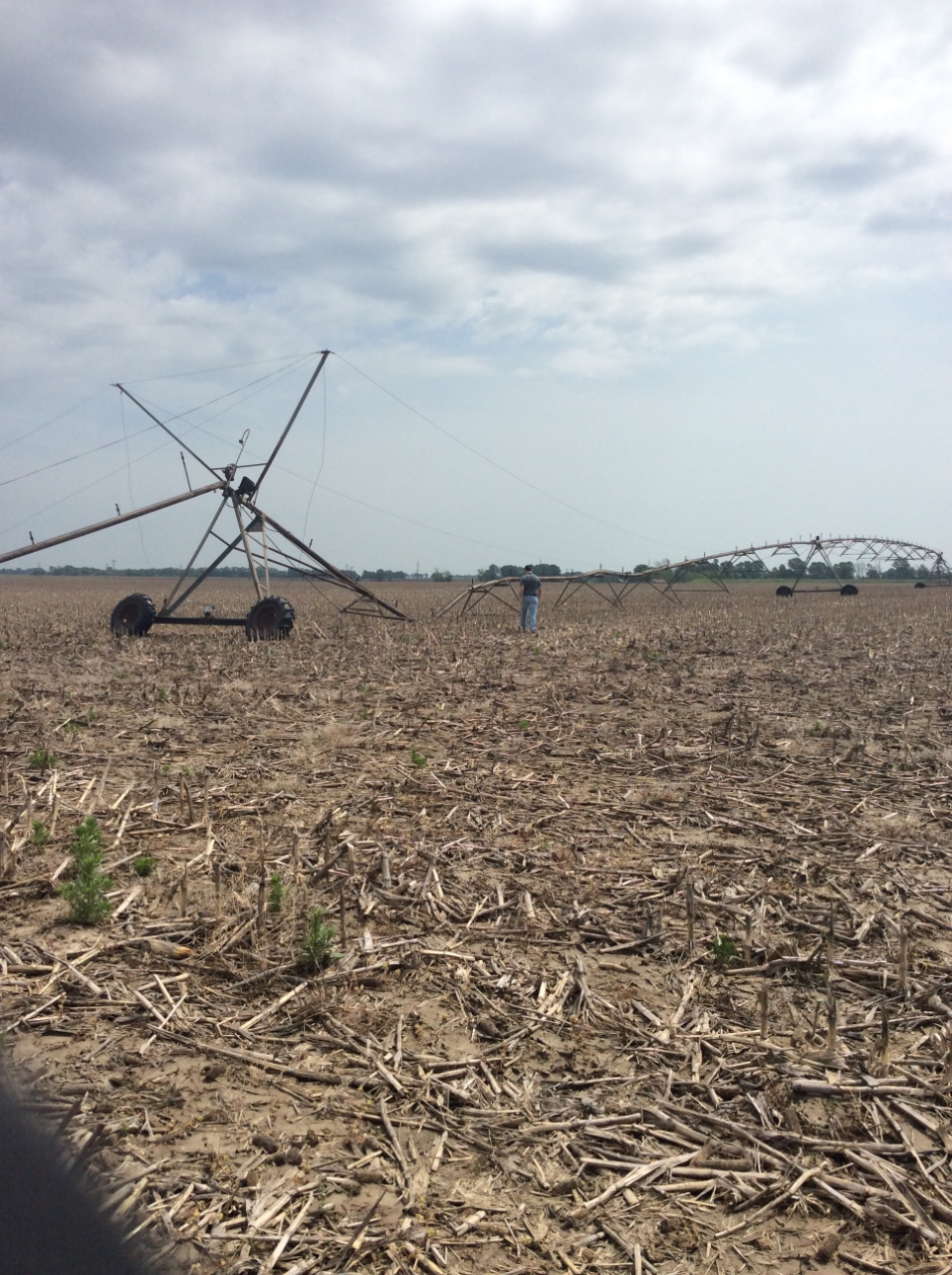
| Straight line winds drove this field irrigator into the field, while also turning the other end of the irrigator onto its side. |
Saturated soils likely helped to drive part of the irrigator straight into the ground |





 Weather Story
 Weather Map
 Local Radar
 Follow us on X
 Follow us on Facebook
 Follow us on YouTube
 LSX RSS Feed