Overview
|
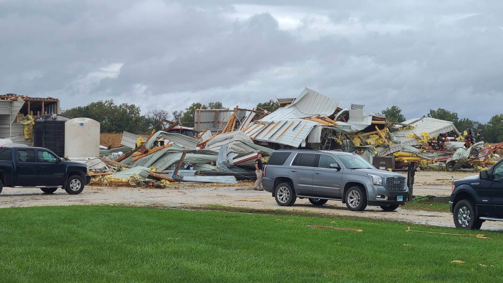
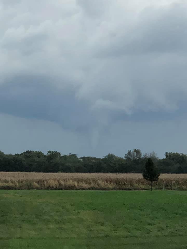
On Monday, October 11th 2021 (Columbus Day), the potential for severe weather existed across east-central/northeast Missouri and most of central and northern Illinois. Despite limited instability (energy for storms to develop), plentiful shear (changing wind speed or direction with height) from a potent mid-level storm system provided the potential for severe storms. Though most storms never became strong or severe, one supercell in particular became organized enough to produce a tornado. Around 2:35pm, a severe thunderstorm developed in west-central Illinois southwest of the small town of Wrights. Shortly thereafter, a tornado formed, which was photographed and videoed by residents and storm chasers. Damage to structures and vehicles was also reported via trained spotters, residents, and broadcast media. NWS St. Louis surveyed the storm damage and estimated the peak winds at 115 mph due to the extensive damage done to two well-built barns on the west side of the town of Wrights. The ground survey was supplemented with high resolution satellite data to determine the complete tornado track. |
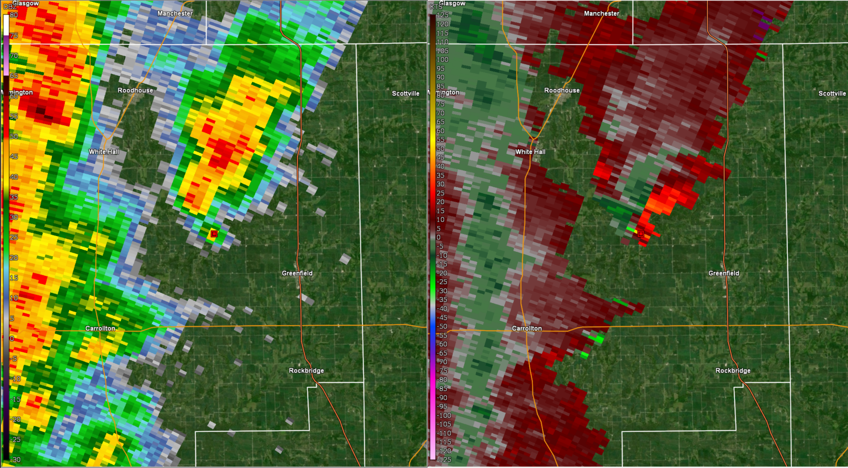
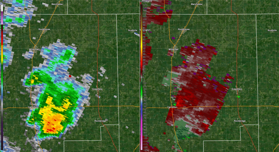 A radar loop of the supercell developing as it approaches Wrights, IL (red dot in the center of the loop). Left: Reflectivity (0.5deg), Right: Storm-Relative Velocity (0.5deg). |
 |
 |
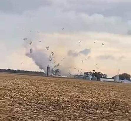 |
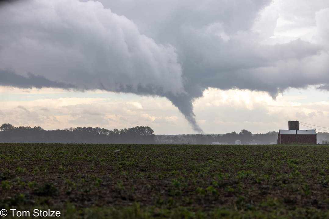
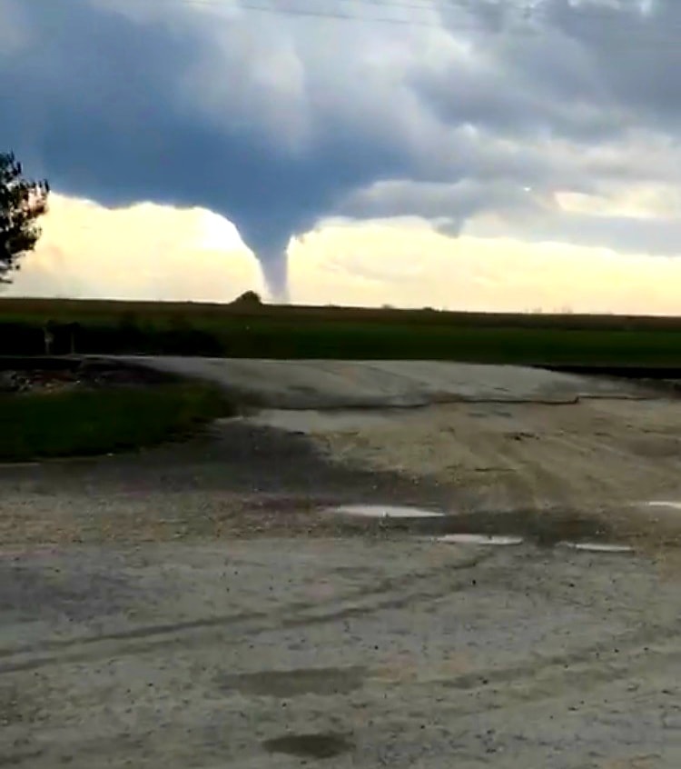
| Photo of the tornado as it began to touch down near Wrights, IL. Credit: Tom Stolze (via Facebook) | Photo of the tornado near Cloverleaf Feed Mill from Roodhouse, IL. Credit: Luke Nolan (via Facebook) | Photo of the tornado causing damage to a structure near Wrights, IL. Credit: Paul Davis (via Facebook) |
Tornadoes
|
Tornado - Wrights, IL
Track Map 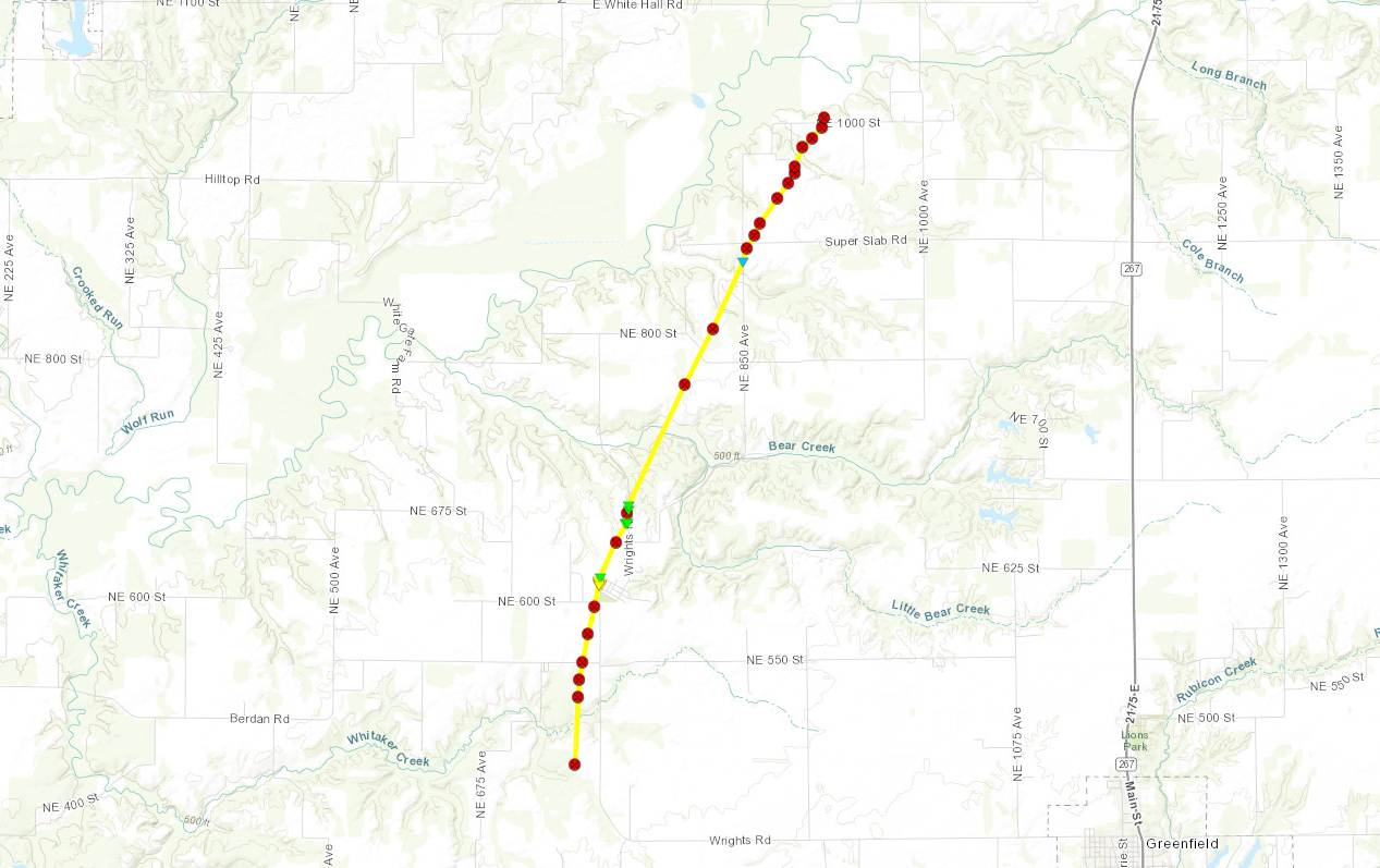 
Downloadable KMZ File |
||||||||||||||||
|
||||||||||||||||
The Enhanced Fujita (EF) Scale classifies tornadoes into the following categories:
| EF0 Weak 65-85 mph |
EF1 Moderate 86-110 mph |
EF2 Significant 111-135 mph |
EF3 Severe 136-165 mph |
EF4 Extreme 166-200 mph |
EF5 Catastrophic 200+ mph |
 |
|||||
 |
Media use of NWS Web News Stories is encouraged! Please acknowledge the NWS as the source of any news information accessed from this site. |
|


 Weather Story
 Weather Map
 Local Radar