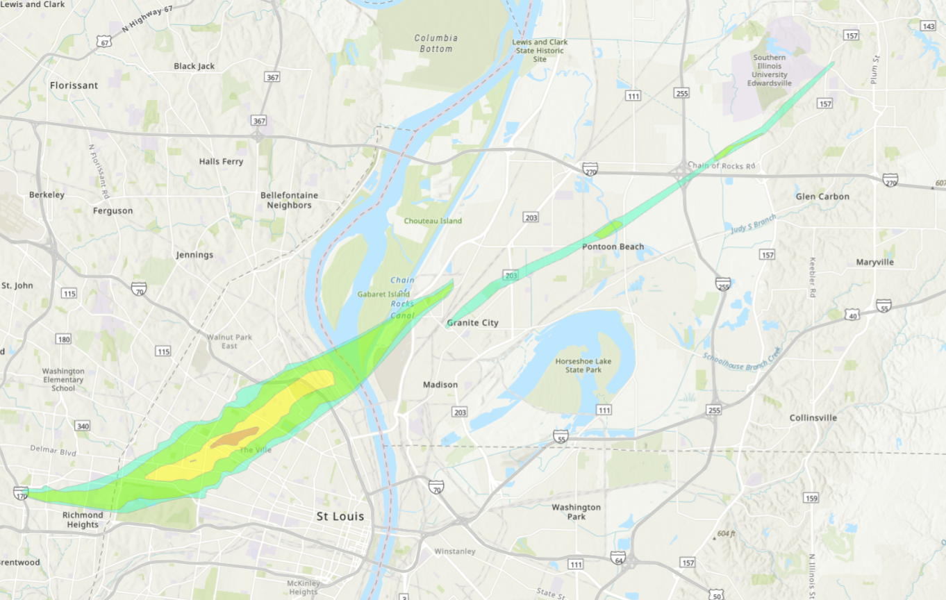
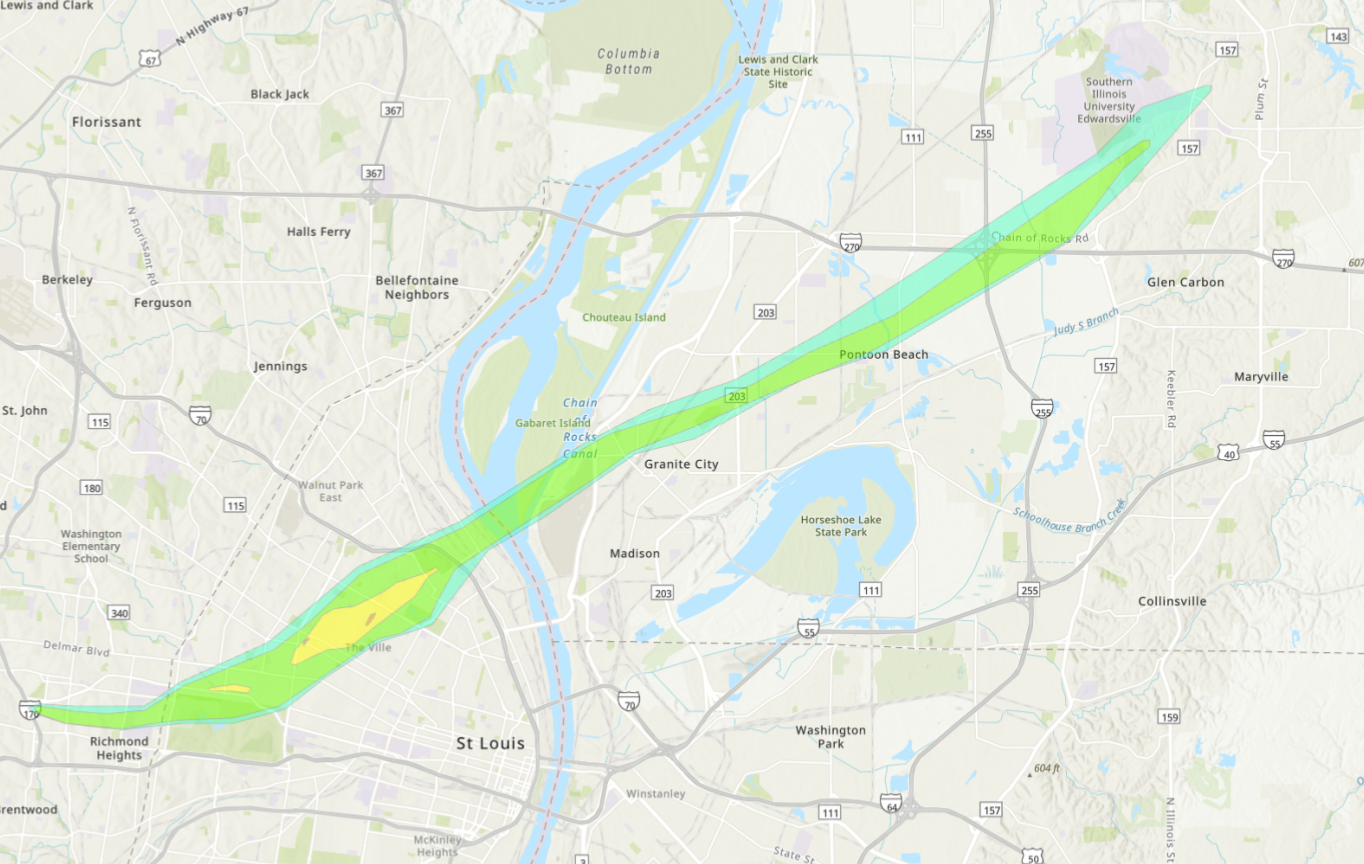
This slider shows the previous survey (left) compared to the updated survey (right).
Number of damage points: Over 10,000 damage points were added to the survey from various sources, with most stemming from the Missouri Structural Assessment and Visual Evaluation (SAVE) Coalition. This high-resolution and high-density dataset allowed for a much more comprehensive damage assessment. These points can be viewed in and downloaded from the NWS Damage Assessment Toolkit.
Number of tornadoes: It was found that two tornadoes occurred in the St. Louis metropolitan area. The EF-3 tornado that tracked through St. Louis County, St. Louis City, and far-western Madison County, IL dissipated outside of Granite City. A second tornado rated EF-1 with a maximum wind speed of 107mph was found to have tracked through western Madison County, dissipating just east of SIU Edwardsville.
Width of the St. Louis Tornado: The tornado width was increased to 3,168 yards (1.8 miles), which is the widest tornado in the region since 1950 when reliable records began. Including non-tornadic wind that occurred south and east of the tornado’s path, the swath of damage exceeds 2 miles. The second tornado had a path width of 525 yards (0.3 miles).
It is among the NWS’ highest priorities to provide a timely and accurate assessment following a tornado, however the availability of new ground survey data and high-resolution aerial imagery provides an opportunity to refine the official survey.
The updated damage assessment can be viewed, interacted with, and downloaded from the NWS Damage Assessment Toolkit.



 Weather Story
 Weather Map
 Local Radar
 Follow us on X
 Follow us on Facebook
 Follow us on YouTube
 LSX RSS Feed