St. Louis, MO
Weather Forecast Office
 |
| last updated: February 16, 2007 |
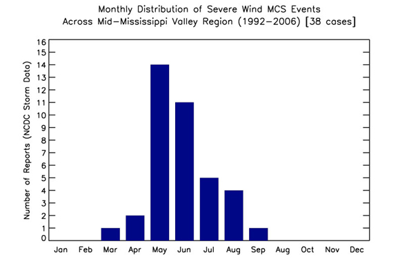 |
| Monthly MCS Distribution for the period 1992 - 2006 (Cases studied - 38 events / cases under study 7 MCS events). |
 |
|
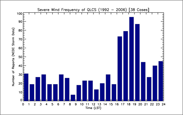
(Updated) MCS Severe Wind Frequency by time of day for 38 cases across the WFO St. Louis County Warning Area (CWA) for the period 1992 - 2006. Ordinate - number of reports. Abscissa - time of day (Local Standard Time). Damage Reports on this graph are from STORM DATA. Note the greatest number of reports occur between 4:00 PM and 8:00 PM Local Time.
|
 |
|
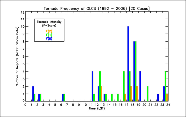
(Updated) Tornado Frequency by time of day for 20 QLCS days where non-supercell tornadoes occurred with the QLCS over the WFO St. Louis County Warning Area (CWA). Period covers 1992-2006. Note the greatest frequency of tornado touchdowns occurred between 1700 - 1900 UTC. F-scale of tornadic damage is shown in the following colors: F0 - blue; F1 - green; and F2 - orange.
|
| Back to the COMET - Damaging Wind Studies Page |
FORECAST
Forecaster's Discussion
Local area
Activity Planner
Aviation Weather
Fire Weather
Marine Weather
Severe Weather
Winter Weather
Hurricane Center
FAA Center Weather
US Dept of Commerce
National Oceanic and Atmospheric Administration
National Weather Service
St. Louis, MO
12 Missouri Research Park Drive
St. Charles, MO 63304-5685
636-441-8467
Comments? Questions? Please Contact Us.


 Weather Story
 Weather Map
 Local Radar