Missouri Winter Weather Awareness Day
November 15, 2017
Illinois Winter Weather Preparedness Week: Nov 12 - 18, 2017
The National Weather Service (NWS) along with the Missouri Department of Public Safety (DPS), Missouri State Emergency Management Agency (SEMA), the Department of Health and Senior Services (DHSS), the Missouri Highway Patrol (MHP), and the State Fire Marshal, has designated November 15, 2017 as Winter Weather Awareness Day. Winter storms and cold temperatures can be extremely dangerous. We urge people to use this day to review the hazards and safety rules of winter weather so they are prepared for the upcoming winter season.
While the winter of 2016-2017 was not too bad across the state, many people likely still remember January 2014, which was a reminder of what winter can do in Missouri. Everyone was talking about the "polar vortex"! January 6 - 7, 2014 brought some of the coldest temperatures we have seen in Missouri in many years. Lambert St. Louis International Airport fell to -8 on the 6th. That was the first time the temperature there had been below zero since 1999. How about these temperatures: Rosebud -26, Farmington -15, Hannibal -14, St. Charles -13, Fredericktown -12, Potosi -10, Jefferson City -9. Here are links to web pages with more information on this event.
https://www.crh.noaa.gov/lsx/?n=01_05_2014
https://www.weather.gov/sgf/events_2014jan5
As long as it is cold at the North Pole, cold air will flow into the Midwest of the United States. Winter will still arrive and we will have winter storms and extreme cold. However, we can save lives by being prepared. The NWS will transmit winter weather safety information on the NOAA Weather Wire Service and over NOAA Weather Radio during Winter Weather Awareness Day and during the week. The Missouri Department of Public Safety will send out information to local emergency managers and public safety directors across the state.
Illinois Emergency Management Agency Release
Missouri Department of Public Safety/SEMA Press Release
Fourteen one to two page fact sheets covering various winter weather safety topics have been produced for your use. They are in pdf format, so you will need the Adobe Reader to open view them. The reader is available free from Adobe.
Contact your local NWS office for interviews or additional information.
|
Office |
Telephone
|
Internet |
| St. Louis, MO | 636-441-8467 | weather.gov/stlouis |
| Kanasas City, MO | 816-540-6021 | weather.gov/kansascity |
| Springfield, MO | 417-869-4491 | weather.gov/springfield |
| Paducah, KY | 270-744-6440 | weather.gov/paducah |
| Memphis, TN | 901-544-0399 | weather.gov/memphis |
| Davenport, IA | 563-386-3976 | weather/gov/davemport |
|
City |
Temperature |
Date |
| Columbia |
-26 |
February 12, 1899 |
| Kansas City |
-23 |
December 22,23 1989 |
| Springfield |
-29 |
February 12, 1899 |
| St. Louis |
-22 |
January 5, 1894 |
Would you like to become a Rain and Snow Observer? Join CoCoRAHS
CoCoRAHS is a grassroots volunteer network of backyard weather observers of all ages and backgrounds working together to measure precipitation (rain, hail, and snow)
Extreme cold temperatures are a big danger during winter months in Missouri. Prolonged exposure to the cold can cause frostbite, hypothermia, or in extreme cases death. In fact, excessive cold is one of the leading weather-related causes of death across the country. Infants and the elderly are most susceptible to extreme cold. Freezing temperatures also cause damage to crops and property.
Cold Related Deaths in Missouri*
* Source: Missouri Department of Health and Senior Services (DHSS). For more information on cold weather safety, statistics, etc, visit the DHSS website. DHSS Hypothermia Web Site.
| Year | 97-98 | 98-99 | 99-00 | 00-01 | 01-02 | 02-03 | 03-04 | 04-05 | 05-06 | 06-07 | 07-08 | 08-09 | 09-10 | 10-11 | 11-12 | 12-13 | 13-14 | 14-15 | 15-16 | 16-17 |
|
Deaths |
8 | 5 | 12 | 19 | 14 | 28 | 25 | 20 | 22 | 36 | 27 | 27 | 27 | 27 | 12 | 22 | 33 | 36 | 29 | 20 |
Since the DHSS surveillance program began in Missouri during the winter of 1979-1980, there have been 631 deaths in which hypothermia was a factor.
Frostbite occurs when the skin becomes cold enough to actually freeze. A loss of feeling and a white or pale appearance in extremities, such as fingers, toes, ear lobes, or the nose are symptoms of frostbite.
Hypothermia (Low Body Temperature) can occur during long periods of exposure when the body temperature drops below 95 degrees F. A person will become disoriented, confused, and shiver uncontrollably, eventually leading to drowsiness and apparent exhaustion. In severe cases, death is possible.
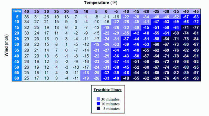
Wind Chill
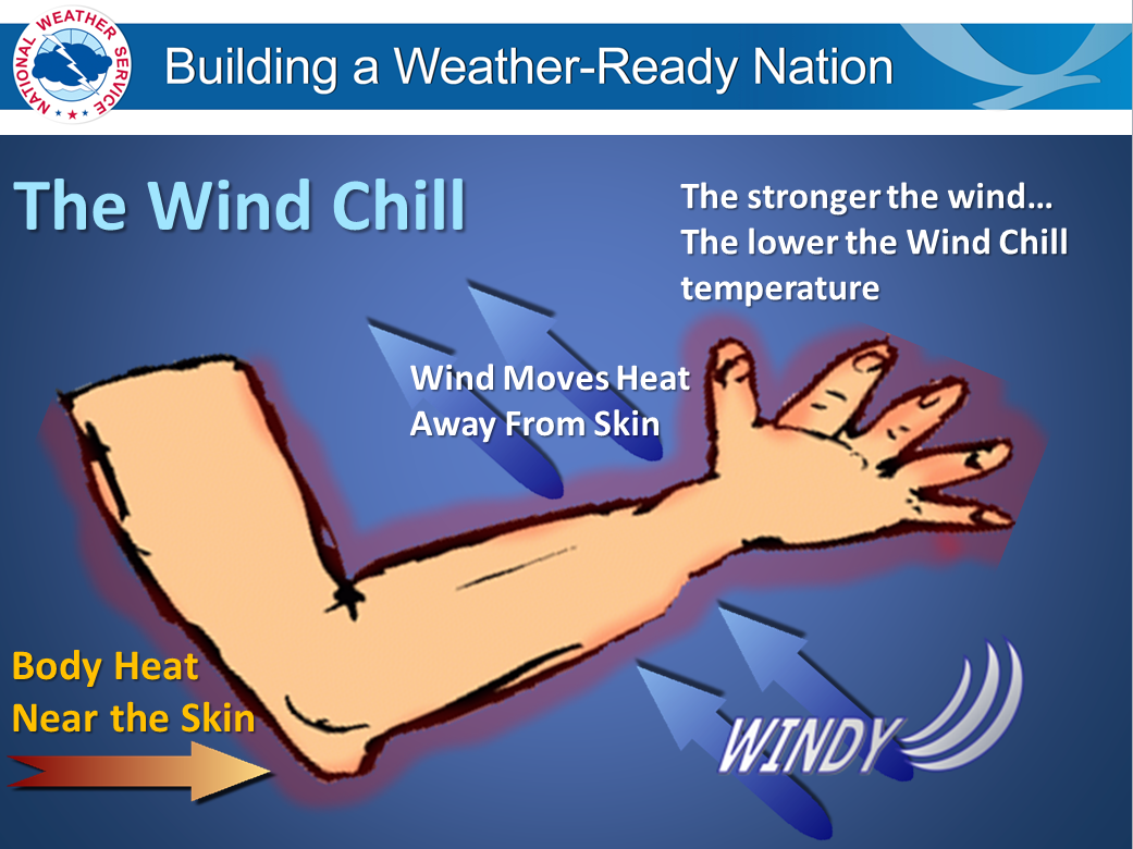
Wind Chill is the term used to describe the rate of heat loss on the human body resulting from the combined effect of low temperature and wind. As winds increase, heat is carried away from the body at a faster rate, driving down both the skin temperature and eventually internal body temperature. While exposure to low wind chills can be life threatening to both humans and animals alike, the only effect that wind chill has on inanimate objects, such as vehicles, is that is shortens the time it takes the object to cool to the actual air temperature (it cannot cool the object below that temperature). For example, water freezes at 32 degrees F, regardless of what the wind chill temperature is.
The current wind chill temperature index (WCT) formula was developed during 2000 -2001 and implemented for the winter of 2001-2002. A Joint Action Group for temperature Indices (JAG/TI) consisting of the NWS, Meteorologic Services of Canada (MSC), the academic research community (Indiana University-Purdue University in Indianapolis (IUPUI), University of Delaware, and University of Missouri), and the International Society of Biometeorology, developed the formula. The JAG/TI formula made use of the advances in science, technology, and computer modeling to provide a more accurate, understandable, and useful formula for calculating the dangers from winter winds and freezing temperatures. In addition, clinical trials were conducted and the results of those trials have been used to verify and improve the accuracy of the new formula.
Standardization of the WCT Index among the meteorological community is important, so that an accurate and consistent measure is provided and public safety is ensured. Some of the items incorporated into the WCT include:
incorporated modern heat transfer theory (heat loss from the body to its surroundings,
during cold and breezy/windy days)
lowered the calm wind threshold to 3 mph
used a consistent standard for skin tissue resistance; and
assumed the worst case scenario for solar radiation (clear night sky).
Did You Know?
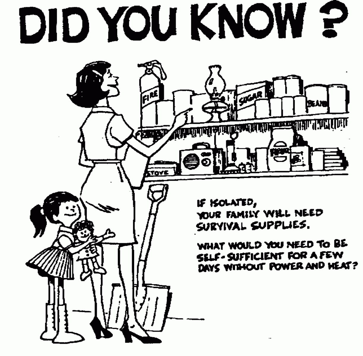
Severe winter weather can strand you in your own home. It is a good idea to keep some extra supplies around during the winter season. Items you may want to have include non-perishable food, medical supplies, batteries, and emergency heating supplies.
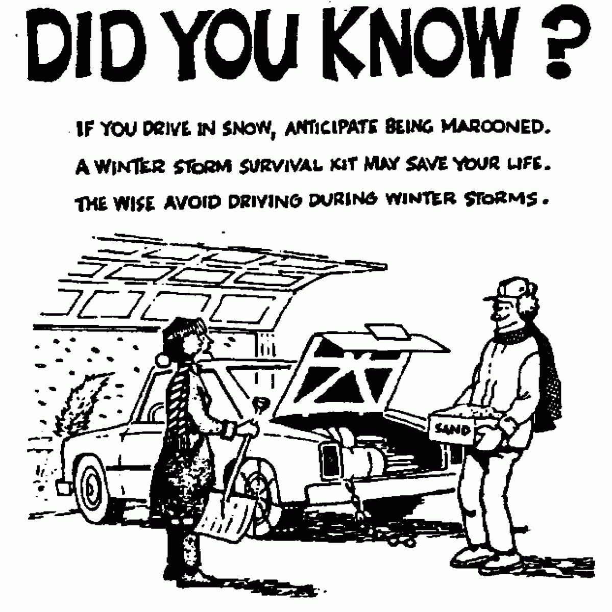
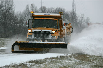
Travel in winter can be extremely dangerous. The best thing to do is cancel any travel if winter weather will occur. However if you must travel, make sure you plan ahead. Make sure other people know your travel plans and know how to contact you. Travel in convoy with other vehicles if possible. Keep a survival kit in you vehicle. This kit should include items which include non-perishable food such as can goods or candy bars, extra clothes and blankets, a battery powered radio, a shovel, and sand. If stranded, the best thing to do in to stay in the vehicle. Tie a bright colored cloth to the antenna so rescuers can find you. Run the engine occasionally for heat making sure to keep the exhaust pipe clear. Open windows occasionally for fresh air.
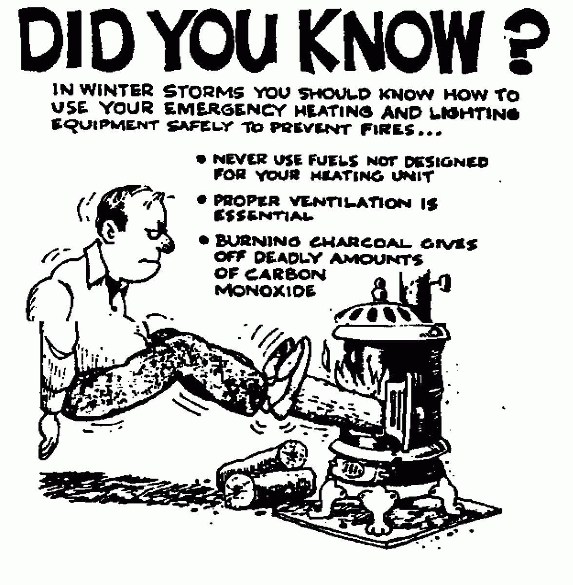
Portable Generators
Severe winter storms can cut off your supply of electricity and other winter fuels. It is important to have an alternative heat source available. However, be extremely careful in using fireplaces or wood stoves. Make sure they are properly ventilated to avoid the build up of carbon monoxide, an odorless, colorless, and deadly gas. Do not use charcoal indoors as it gives off large amounts of carbon monoxide. Have your furnace checked before the weather gets cold to make sure it is in good working order. Using alternative heat sources can also be a fire danger. Be very careful because if conditions are bad, the fire department may not be able to get to you. Make sure your smoke alarms are working and have fresh batteries. It is also a good idea to have carbon monoxide alarms in your home adjacent to sleeping areas.
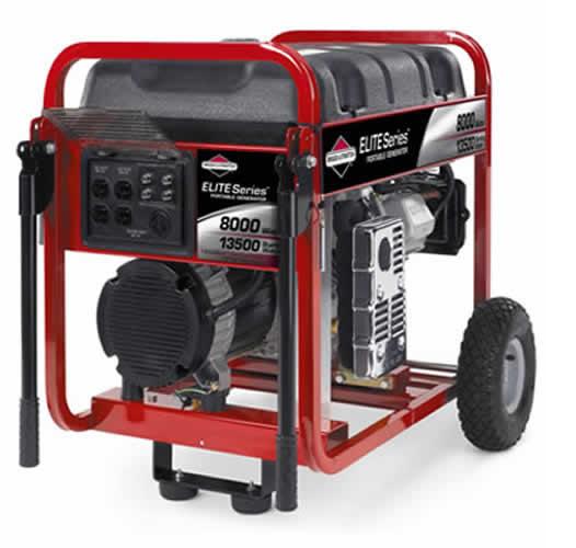
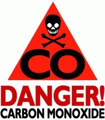
Portable electric generators like the one pictured above have become very popular. They can be an excellent piece of equipment to have should you lose electric power for an extended period of time. However they must be used safely and properly. A small generator can usually only run one major appliance at a time. It is also very important to place the generator OUTSIDE! The exhaust from the engine emits deadly carbon monoxide gas. Make sure you read the manual carefully and follow all the recommended safety precautions.
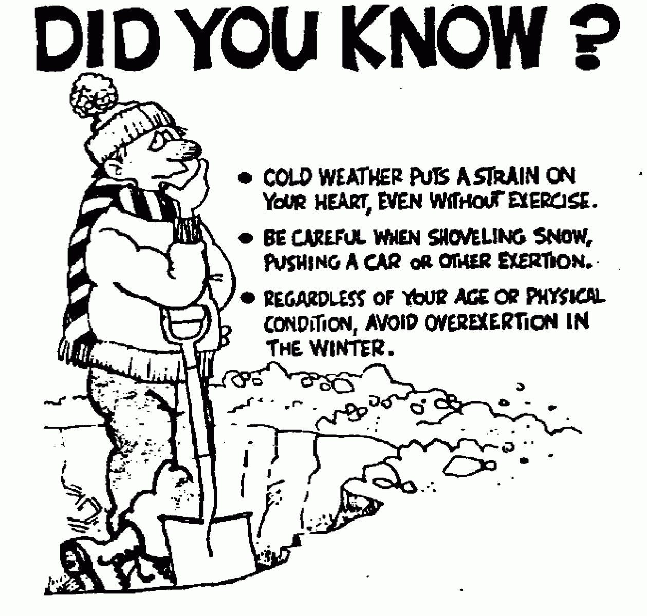
Working in cold weather puts a tremendous strain on the body, even for people in good shape. Take frequent breaks and don't overexert yourself. Make sure you dress properly for the conditions. Wear several layers of lightweight clothing. Air is trapped between the layers to help keep the body warm. Protect the extremities, such as the hands, feet and ears as they are the most susceptible to frostbite. Wear a hat as a large percentage of the body's heat is lost through the top of the head.
Winter Precipitation
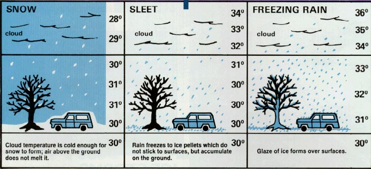
|
Snow |
Sleet |
Freezing Rain |
|
Cloud temperature is cold enough to form snow and the air above the ground does not melt it. Flurries: Light snow falling for short durations. No accumulation. |
Rain drops that freeze into ice pellets before reaching the ground. Sleet usually bounces when hitting a surface and does not stick to objects. However, it can accumulate like snow and cause a hazard to motorist. |
Rain that falls onto a surface with a temperature below freezing. This causes it to freeze to surfaces, such as trees, cars, and roads, forming a coating or glaze of ice. Even small accumulations of ice can cause a significant hazard. |
Around the Home
Automobiles
Click here for the latest travel and road information in Missouri
Click here for Illinois Road Conditions
Winter Safety for Schools
Children can be especially susceptible to the dangers associated with winter weather. Their youthful enthusiasm often takes over when common sense should prevail.
School administrators and principals need to be sensitive to the dangers winter weather can pose to children and be prepared. Winter weather procedures and practices need to be established before the onset of winter cold. The following items should be considered when formulating a winter weather safety plan:
Winter Weather Products and Criteria
Note: The criteria differs for other areas of Missouri that are covered by other NWS offices. Consult the office responsible for your area.
Outlook - The Hazardous Weather Outlook (HWOLSX, FLUS43 KLSX) will contain any and all information pertaining to potential winter storms that may occur in the latter days of the forecast.
Watch - A watch is used when the risk of hazardous winter weather has increased significantly, there is a strong possibility it will reach warning criteria, and falls in the 12 to 48 hour portion of the forecast.
Warning - The following warnings are issued when an event is occurring, is imminent, or has a high probability of occurrence. Warnings are issued for events that can be life threatening. The following warnings can be issued.
Blizzard Warning: Sustained wind or frequent gusts greater than or equal to 35 mph accompanied by falling and/ or blowing snow, frequently reducing visibility to less than 1/4 mile for three hours or more.
Ice Storm Warning: Ice accumulation of 1/4 inch or more.
Winter Storm Warning: Issued for snow events of 6 inches or more, sleet accumulations of 1/2 inch or more, or a combination of winter precipitation which will create life threatening conditions. For parts of Southern Missouri, the criteria for snow is 4 inches or more. Consult with your local NWS office.
Wind Chill Warning: Wind chill temperature of minus 25 degrees F or colder. :
Advisory - The following advisories will be issued when an event is occurring, is imminent, or has a high propbability of occurrence. These are issued for lesser events that while presenting an inconvenience, do not pose an immediate threat of death, injury, or significant property damage.
Winter Weather Advisory: Issued for lesser snowfall amounts. Depending on when the snow will fall and the temperatures an advisory could be issued for anywhere from 1 to 5 inches of snowfall. An advisory will be issued for light freezing rain accumulations of less than 1/4 inch, sleet accumulations of less than 1/2 inch, or an advisory can be issued when a combination of winter precipitation which will produce hazardous conditions. .
Wind Chill Advisory: Wind chill values of minus 15 to minus 24 degrees F.
Short Term Forecasts - These are issued at frequent intervals to provide information on current weather and expected conditions over the next 1 - 6 hours.


 Weather Story
 Weather Map
 Local Radar