|
|||||
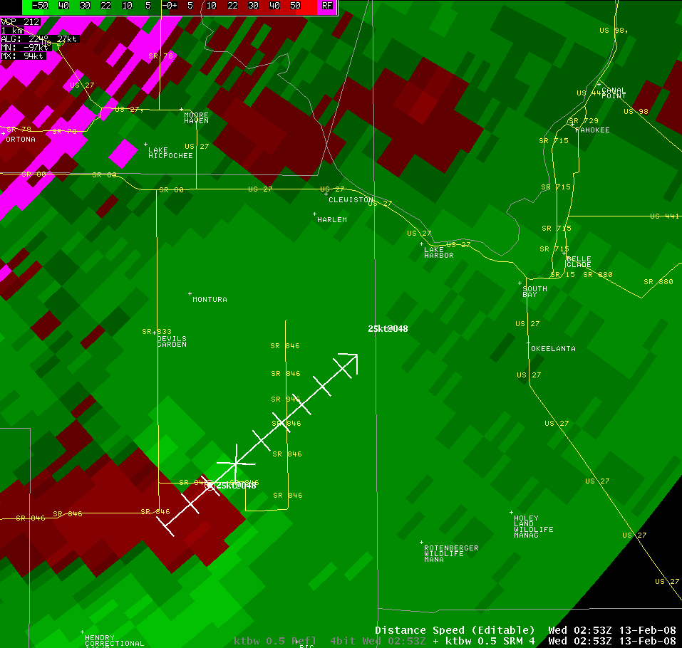
| Summary of WFO Miami Statements and Warnings: WFO Miami issued 13 total tornado warnings and 7 severe thunderstorm warnings during this event on 12 and 13 Feb 2008. The sequence of tornado warnings is presented here. Of the 13 tornado warnings, two were confirmed as shown in the previous page. The remainder of the tornadoes moved across sparsely populated areas from where reports were not received and therefore are considered unconfirmed. The first Tornado Warning was issued for Central Collier County at 902 PM for a supercell thunderstorm that had been tracked for several hours from the eastern Gulf of America. The storm moved onshore roughly 11 miles southwest of the Alligator Alley/State Route 29 intersection. As it did so it developed a tigh mesocyclone prompting the tornado warning. No damage reports were received from this storm. The second Tornado Warning of the evening was issued for Southwestern Palm Beach and Eastern Hendry Counties at 957 PM. This was for the same storm described above as it continued inland with tornadic signatures, but it remained mostly over Wildlife Management Areas, which are unpopulated, and no reports were received. The third Tornado Warning was issued for South Central Collier County and Northwestern Mainland Monroe County at 1006 PM. EF-0 tornado in the Everglades City area was reported ahead of this storm as mentioned in the previous page. This storm was tracked from north of Key West over the Gulf of America with very strong low-level circulation on radar imagery. The fourth Tornado Warning was issued for Northwestern Mainland Monroe County at 1038 PM for the storm that moved just south of Everglades City. This storm was over rural areas with the exception of Wilderness Waterway North as it moved Northeast, and no reports were received. The fifth Tornado Warning was issued for Northeastern Broward and Southeastern Palm Beach Counties at 1106 PM for a supercell that produced a tornado near the intersection of I-595 and US 441 as mentioned in the previous page. This storm moved just east of due north through the Riverland area producing a tornado with EF-0 damage along a roughly 3 mile path. The sixth Tornado Warning was issued for North Central Broward and South Central Palm Beach Counties at 1113 PM. This storm was also a supercell which exhibited strong low-level rotation on radar as well as a Bounded Weak Echo Region (BWER). This storm remained over rural areas and crossed U.S. 27 near the Broward/Palm Beach County line. No reports were received from this storm. The seventh Tornado Warning was issued for Southeastern Collier County at 1130 PM. This storm crossed Tamiami Trail between Monroe Station and Oasis Ranger Station as it moved Northeast, but no reports were received. This was the same storm that moved south of Everglades City earlier. The eighth Tornado Warning was issued for East Central Palm Beach County at 1153 PM for the same supercell storm that crossed U.S. 27 to the south earlier. This storm weakened as it approached the western Metro areas of Palm Beach County and no damage reports were received. The ninth Tornado Warning was issued for Southwestern Broward and East Central Collier Counties at 1159 PM. This was the same storm that earlier impacted the Everglades City and Monroe Station areas. The storm still indicated very strong low-level rotation as it approached Alligator Alley just east of the Miccosukee Service Plaza around 1225 AM, but no tornado or damage was reported. The tenth Tornado Warning was issued for Central Mainland Monroe County at 1209 AM…for a similar area that had been affected by the earlier storm as a new storm moved onshore with very strong low-level rotation. This is an unpopulated area and no damage reports were received. The eleventh Tornado Warning of the event was issued at 1246 AM for Southeastern Collier and North Central Mainland Monroe Counties for the storm mentioned just above in the tenth warning. It crossed Tamiami Trail (U.S. 41) several miles east of Monroe Station around 1 AM and otherwise remained over unpopulated areas. No tornado or damage reports were received. The same storm continued to move northeast and prompted the issuance of the twelfth Tornado Warning at 117 AM for Southwestern Broward and East Central Collier Counties. This storm crossed Alligator Alley near the West Broward Recreation Area around 145 AM, but otherwise remained over unpopulated areas, and no reports were received. The same storm continued northeast and prompted the thirteenth and last Tornado Warning to be issued at 141 AM for Western Broward County as it moved north of Alligator Alley. No damage reports were received from this unpopulated area. |
KAMX storm relative velocity and base reflectivity image from lowest two elevation slices associated with Tornado Warning # 1 (issued at 902 PM EST.
KAMX storm relative velocity and base reflectivity image from lowest two elevation slices associated with Tornado Warning # 2 issued at 957 PM EST.
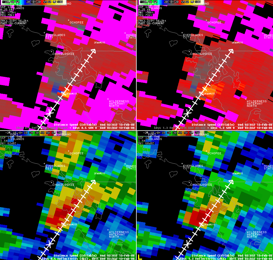
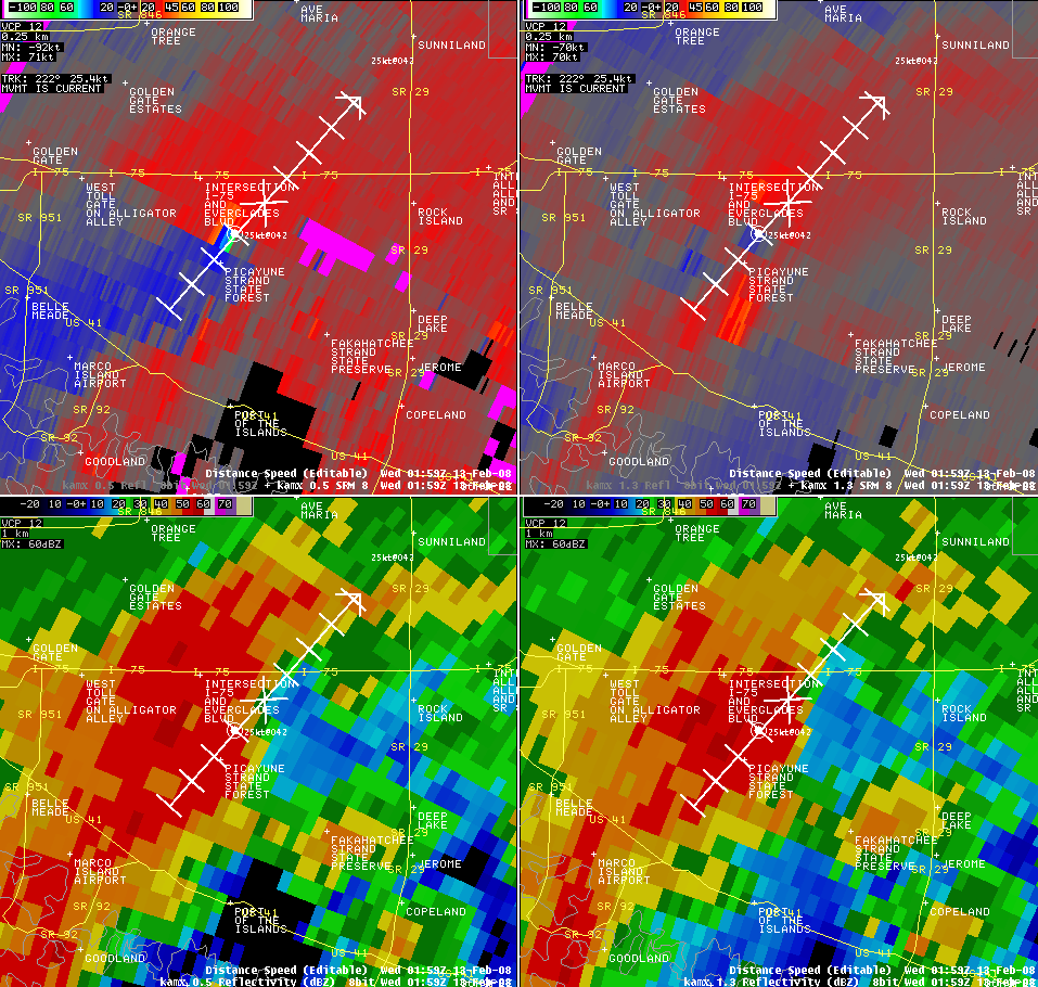
KAMX storm relative velocity and base reflectivity image from lowest two elevation slices associated with Tornado Warning # 3 issued at 1006 PM EST.
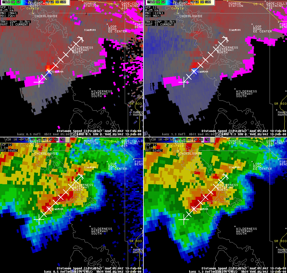
KAMX storm relative velocity and base reflectivity image from lowest two elevation slices associated with Tornado Warning # 4 issued at 1038 PM EST.
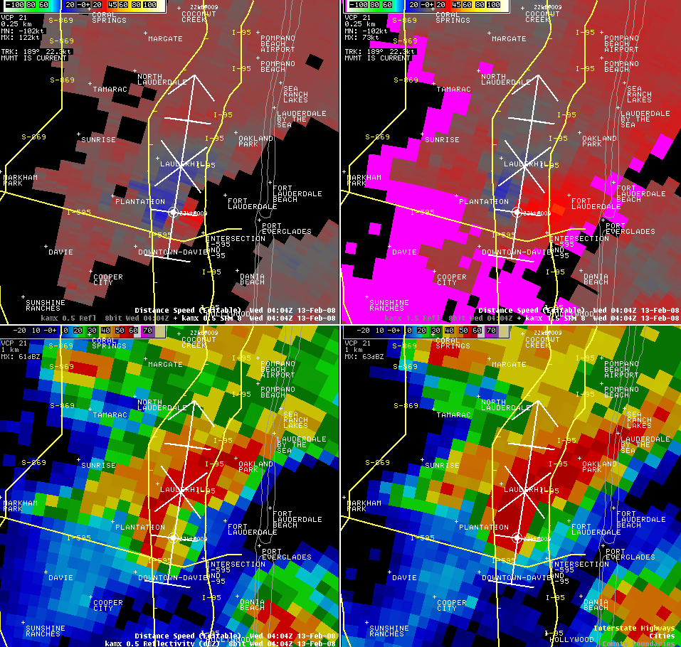
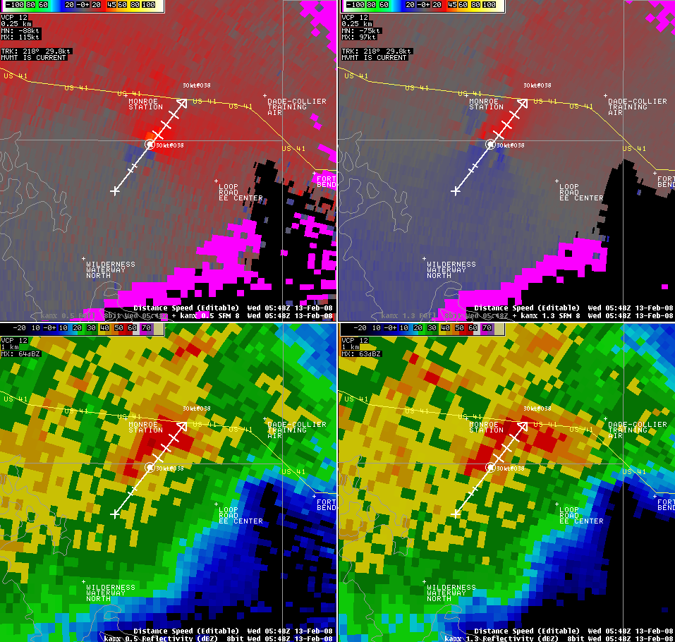
KAMX storm relative velocity and base reflectivity image from lowest two elevation slices associated with Tornado Warning # 5 issued at 1106 PM EST.
KAMX storm relative velocity from lowest three elevation slices and base reflectivity image (upper left) associated with Tornado Warning # 6 issued at 1113 PM EST.
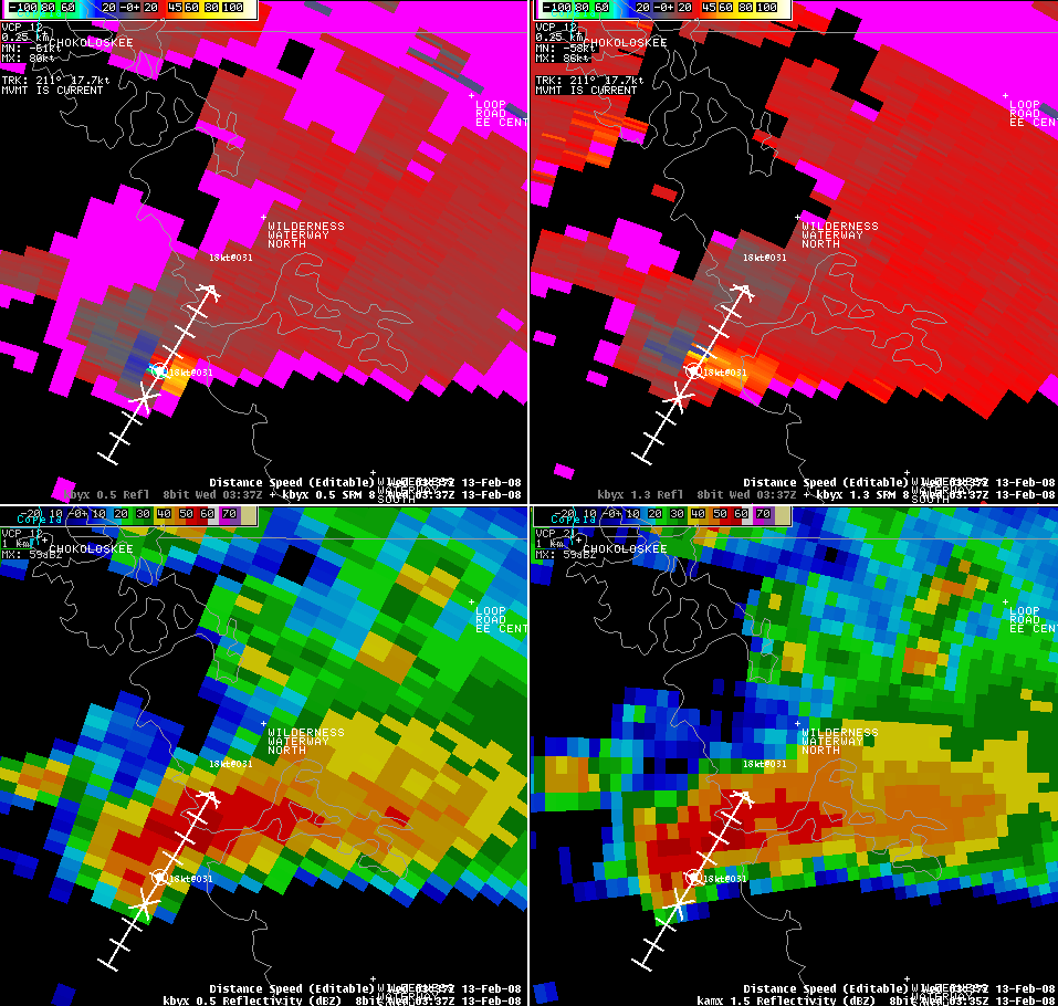
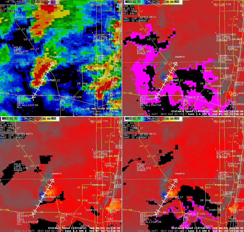
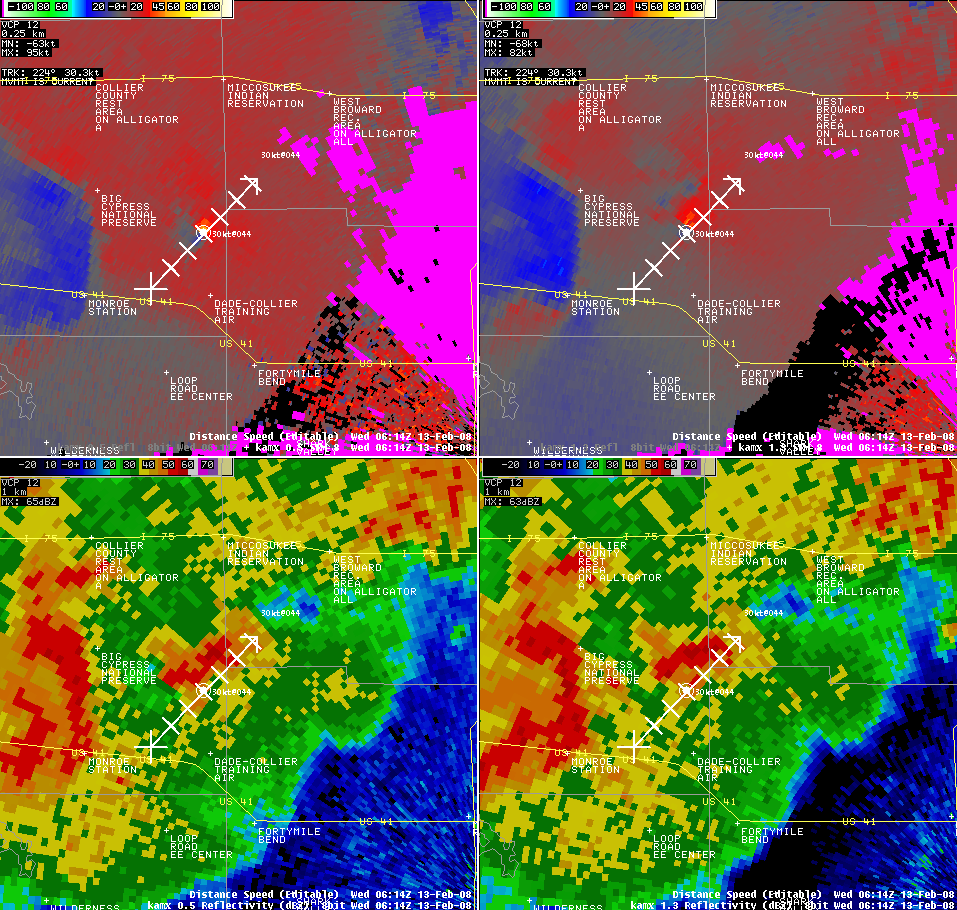
KAMX storm relative velocity and base reflectivity image from lowest two elevation slices associated with Tornado Warning # 7 issued at 1130 PM EST.
KAMX storm relative velocity and base reflectivity image from lowest two elevation slices associated with Tornado Warning # 8 issued at 1153 PM EST.

KAMX storm relative velocity and base reflectivity image from lowest two elevation slices associated with Tornado Warning # 9 issued at 1159 PM EST.
KAMX storm relative velocity and base reflectivity image from lowest two elevation slices associated with Tornado Warning # 10 issued at 1209 AM EST.
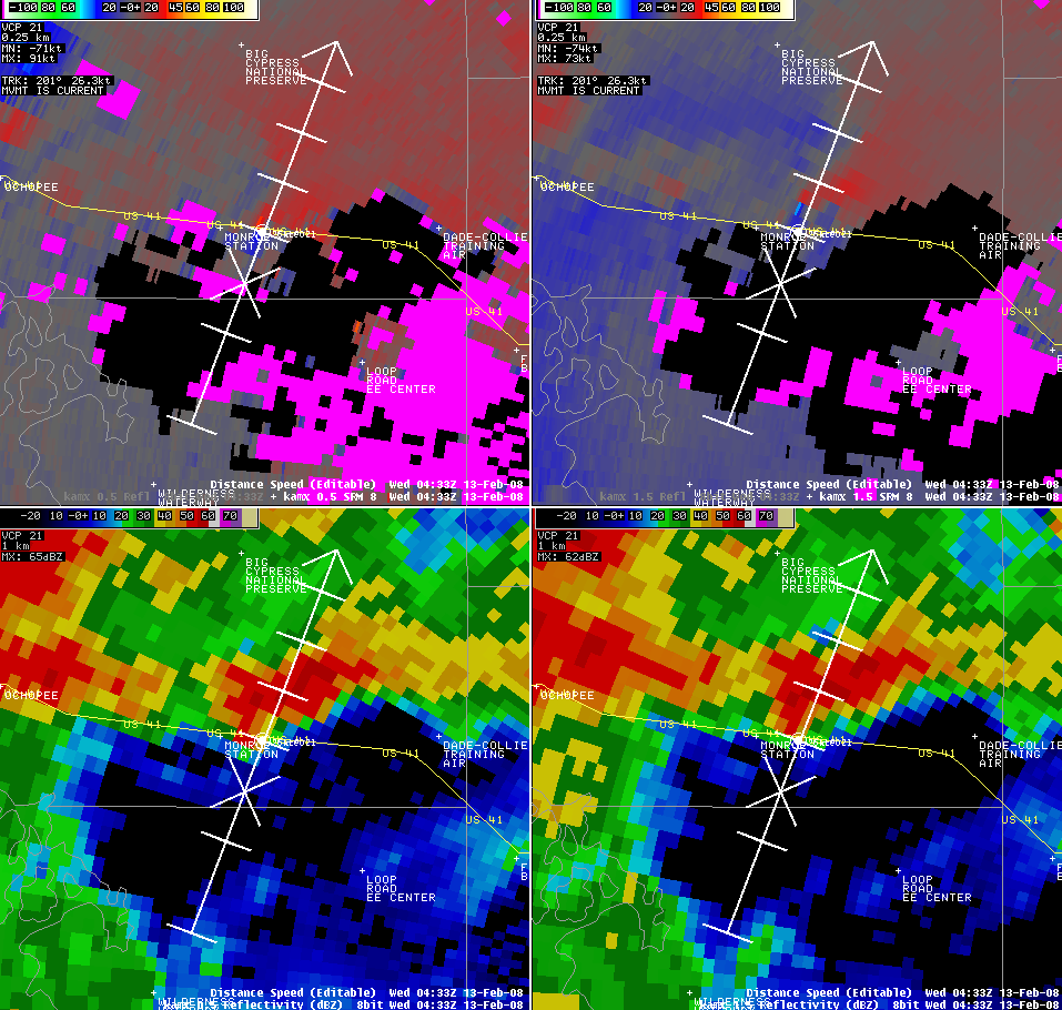
KAMX storm relative velocity and base reflectivity image from lowest two elevation slices associated with Tornado Warning # 11 issued at 1246 AM EST.
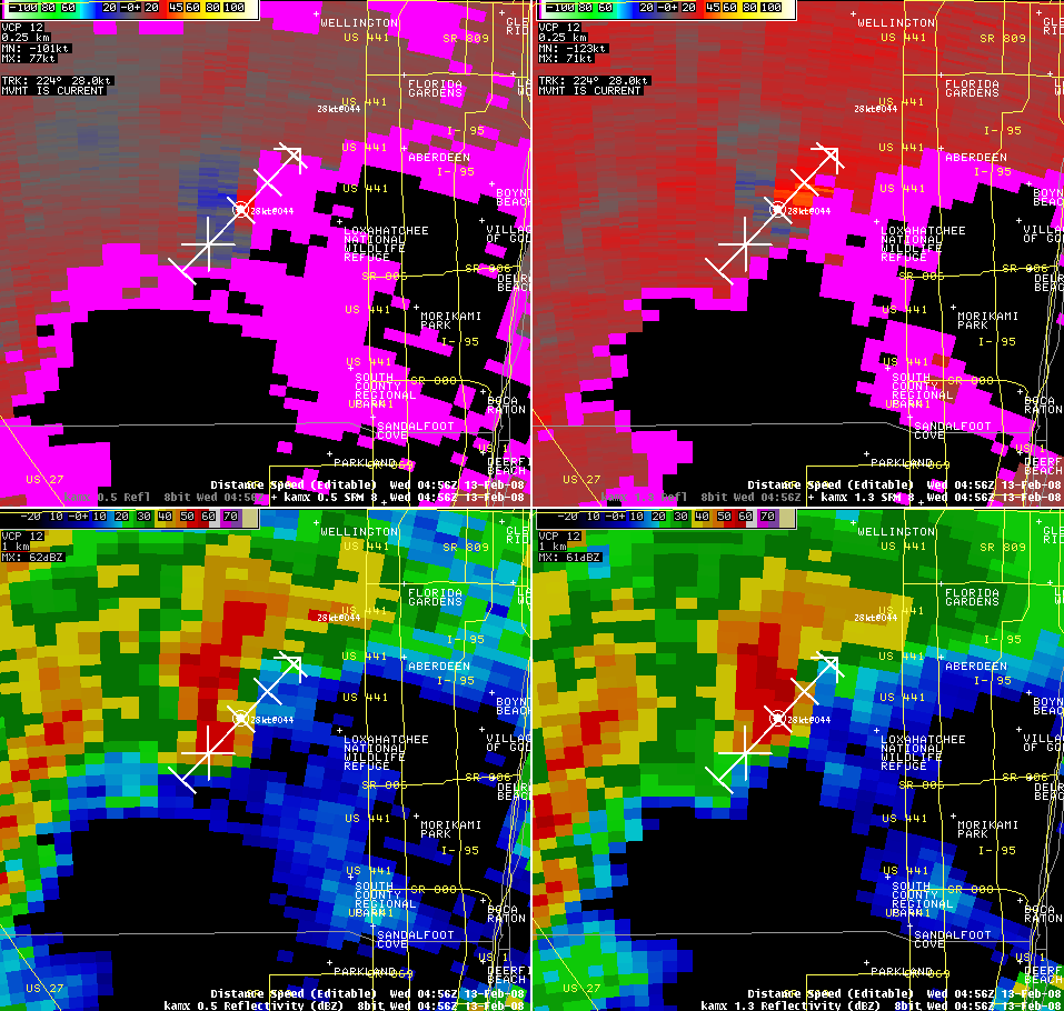
KAMX storm relative velocity and base reflectivity image from lowest two elevation slices associated with Tornado Warning # 12 issued at 117 AM EST.
|
||||