
Tropical Depression Two is expected to gradually strengthen and could bring tropical storm conditions to the Florida Panhandle beginning late Monday. Areas of flash flooding will be possible through Thursday along the eastern and central Gulf Coast. Severe thunderstorms will develop and move along a cold front crossing the Upper Midwest Monday, and through the Ohio Valley/Mid-Atlantic on Tuesday. Read More >
Key Points
Rivers
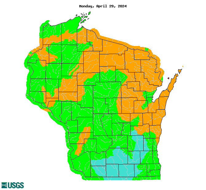
Monitor rivers levels here: Current River Levels and Short Term Forecast River Levels
Flood Outlook as of 3/11
The risk of spring flooding is average for southern Wisconsin including the following river basins: Baraboo, Wisconsin, Sugar, Pecatonica, Rock, lower Fox, upper Fox, Sheboygan, Milwaukee, and Root.
River flooding in Wisconsin typically occurs in March and April when there is a rapid snowmelt and/or heavy rain. But, it can happen any time of year when there is heavy rain.
Shoreline flooding and river flooding near river mouths near Lake Michigan, due to the High Lake Michigan Water Levels in expected to continue into the summer. Impacts mainly occur due to strong storms with high winds and waves. Lake level will largely depend on the amount of precipitation.
Seasonal Flood Probability Graphics
Seasonal Flood Probability Table
Current River Levels and Short Term Forecast River Levels
Flood Risk Factors
Current Conditions
Most of the snow pack has evaporated and melted. There was a very deep snowpack with a high water content and that moisture is still working its through the soils, subsoils, and making its way to the rivers. The Wisconsin River will be elevated into next week as a result of melting snow and rain from the northern and central portions of the basin.
Rivers and streams are rising from the melting snow. Streamflows are average to above average.
Soil moisture is average, but is slightly saturated from the recently melted snow. The slow melting of the snow is not overly saturating the soils.
Frost depth is shallow and has completely thawed in some areas. It ranges from 0 to 10 inches, and 1 to 5 inches has thawed at the surface. This will allow for some any future rainfall to absorb into the ground.
 |
||
| Snow Water Equivalent | Streamflow Compared to Normal | Soil Moisture Percentile |
Flood Risk Factors as of 2/26
SnowPack
The water contained in the snowpack is above average. Most of this snow will make its way into rivers when it melts, increasing the flood risk. Snow water equivalent values are 2 to 4 inches, with the highest amounts in far southern and far southeast Wisconsin. A few areas have over 4 inches. With ongoing melting and evaporation these values are going down, but they remain high. The water content is in the 60 to 90th percentile for this time of year.
There is less snow than normal in the upper Wisconsin River basin resulting in the average risk of spring flooding in the lower Wisconsin River.
StreamFlow
Streamflows have been much above average due to a very wet 2019 and they remained elevated going into this winter due to average precipitation in 2020. Levels went down somewhat over the past several weeks with all the recent precipitation in the form of snow. With the mild temperatures causing melting they have started to rise somewhat. Currently streamflows are close to normal across southern Wisconsin, except for the upper Fox basin, which is above normal, and the lower Wisconsin and Milwaukee River basins, which are below normal. Normal streamflows combined with the deep snowpack adds to the flood risk. Rivers will be able to hold some of the melted snow and any additional rain, but not as much than if they were lower.
Soil Moisture
Soil moisture is somewhat elevated, in the 70th to 80th percentile. There is some room in the soil to absorb moisture, but it could be better. Frost depth is 4-10 inches, which is shallow to moderate. A shallow frost will thaw sooner and allow the ground to soak up moisture, helping to limit flooding. But, there is a lot of water to absorb with the deep snow pack.
Looking Ahead
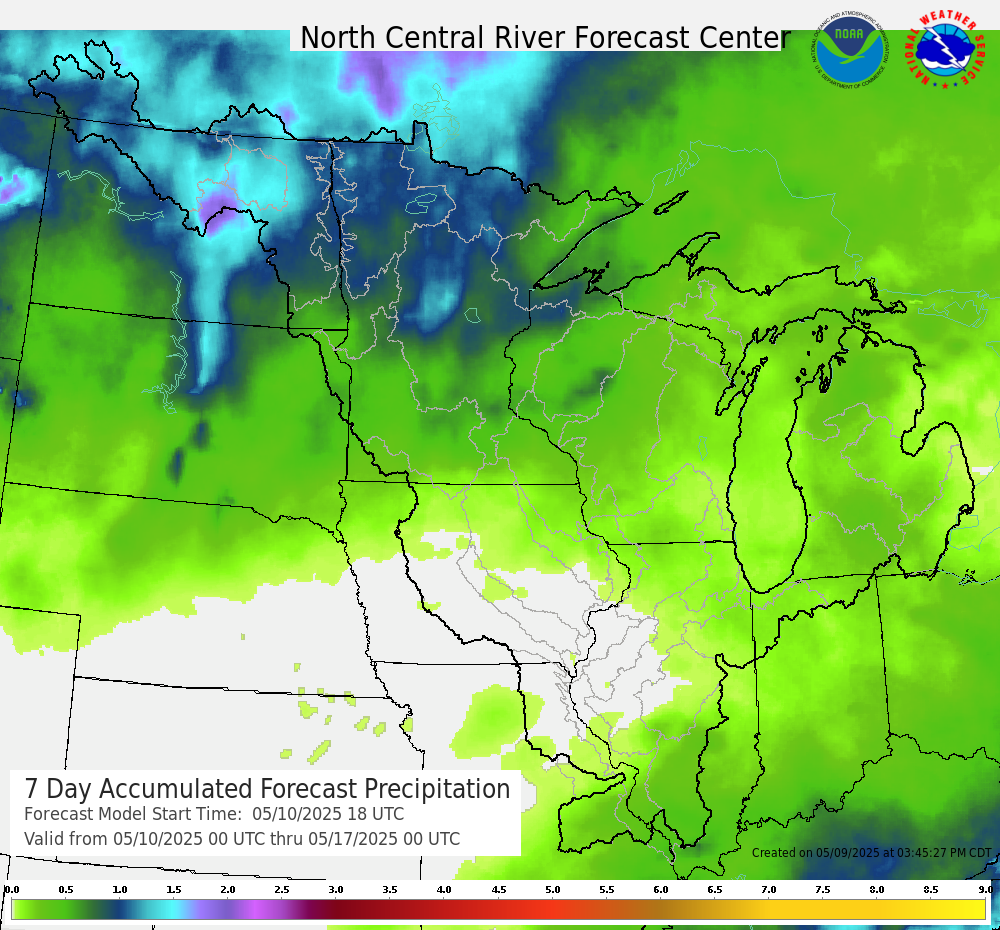
Precipitation from Wednesday and early next week could result in some minor flooding. Beyond that flooding will depend on whether there is moderate to heavy rain.
| 7 Day Precipitation Forecast |
 |
Extended outlooks from the Climate Prediction Center:
| 8 to 14 Day Temperature Outlook | 8 to 14 Day Precipitation Outlook |
 |
 |
| March Temperature Outlook | March Precipitation Outlook |
 |
 |
How To Prepare Safety
Preparedness/Early Actions:
How To Stay Safe During a Flood:
Additional Information
March 11, 2021 Webinar Recording and Slides
Feb. 26, 2021 Webinar Recording and Slides
Feb. 12, 2021 Webinar Recording
If you have any questions or comments about this spring flood outlook please contact:
Sarah Marquardt
Senior Service Hydrologist
National Weather Service Milwaukee
sarah.marquardt@noaa.gov
For a quicker response during non business hours please contact nws.milwaukee@noaa.gov.
 |
Media use of NWS Web News Stories is encouraged! Please acknowledge the NWS as the source of any news information accessed from this site. |
|

