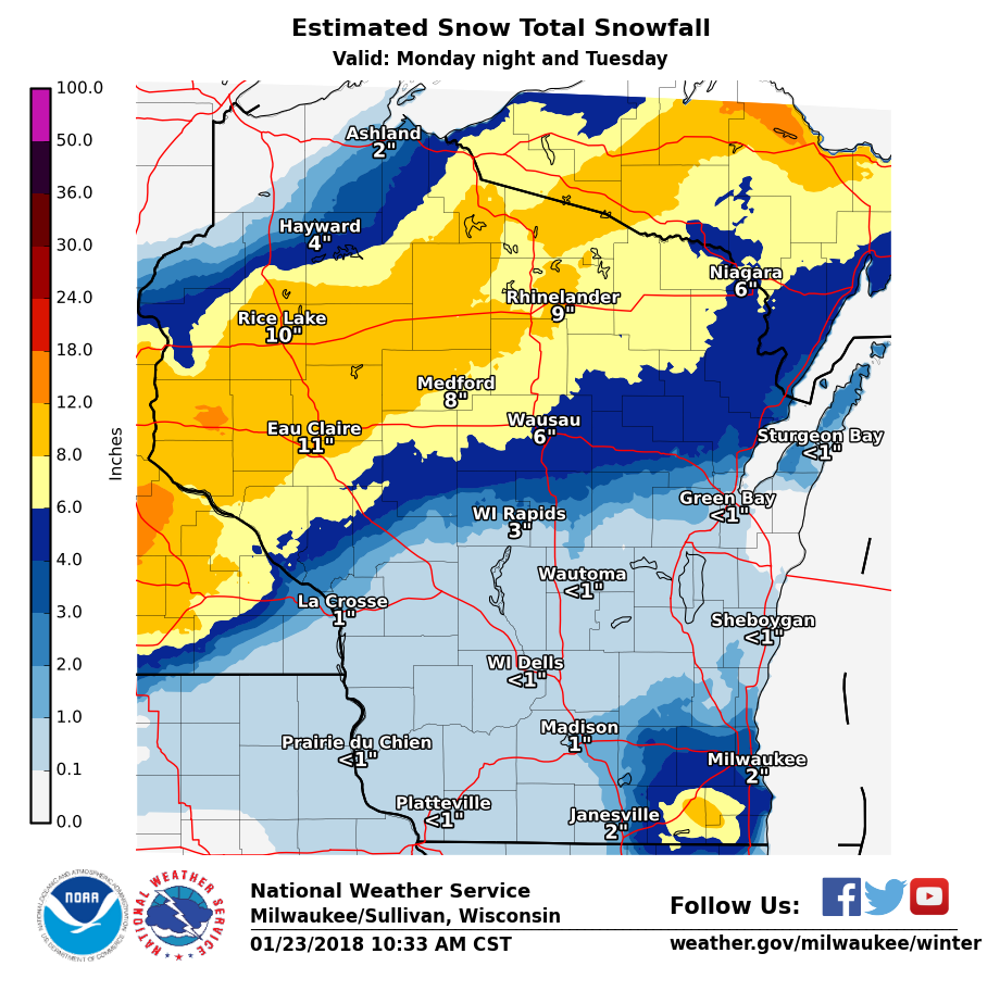
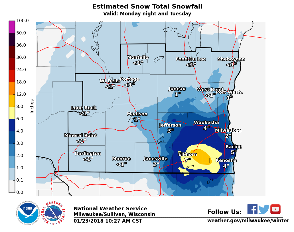
Overview
An evening of heavy rain and thunderstorms quickly transitioned to heavy snowfall in southern Wisconsin. Snowfall rates of an inch or higher per hour occurred in many locations, but lingered the longest in a localized area from Walworth to western Kenosha and Racine counties where 6-9" of snow fell. This quick transition from rain to snow caused many roads to become snow covered and slippery for the Tuesday morning commute.Snow
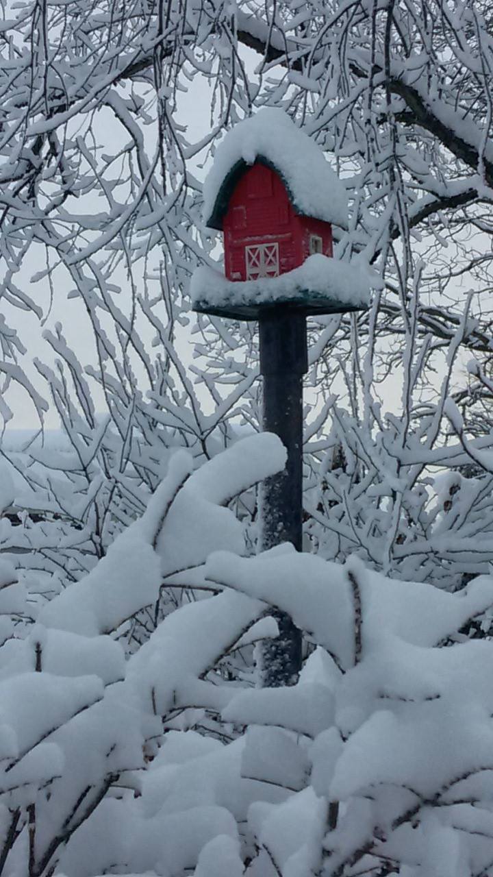
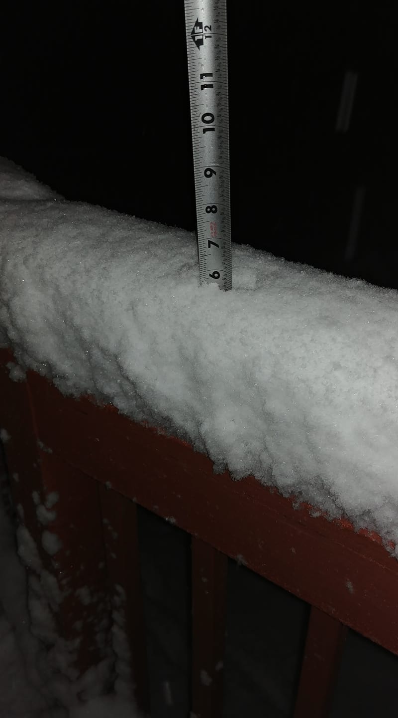
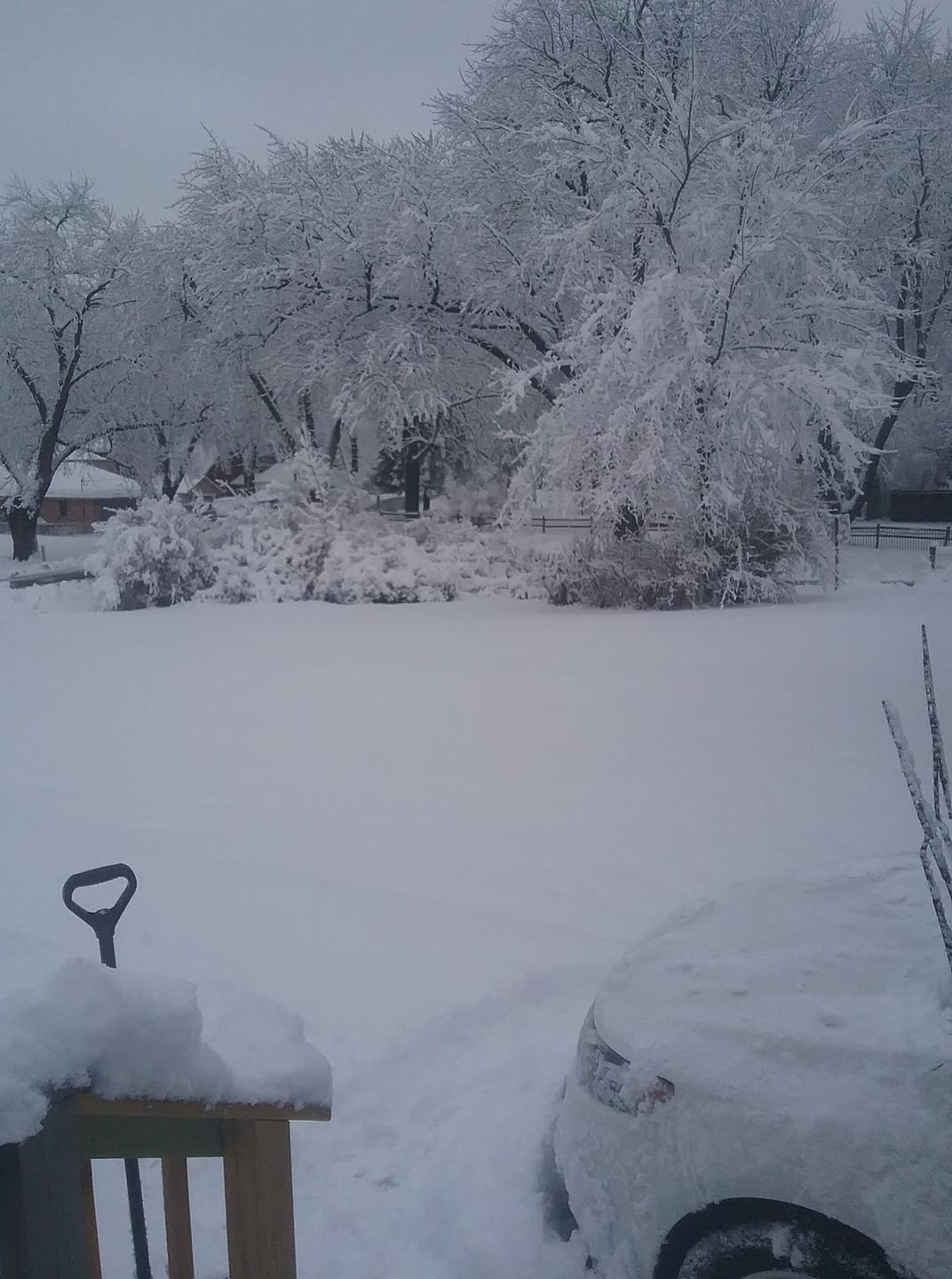
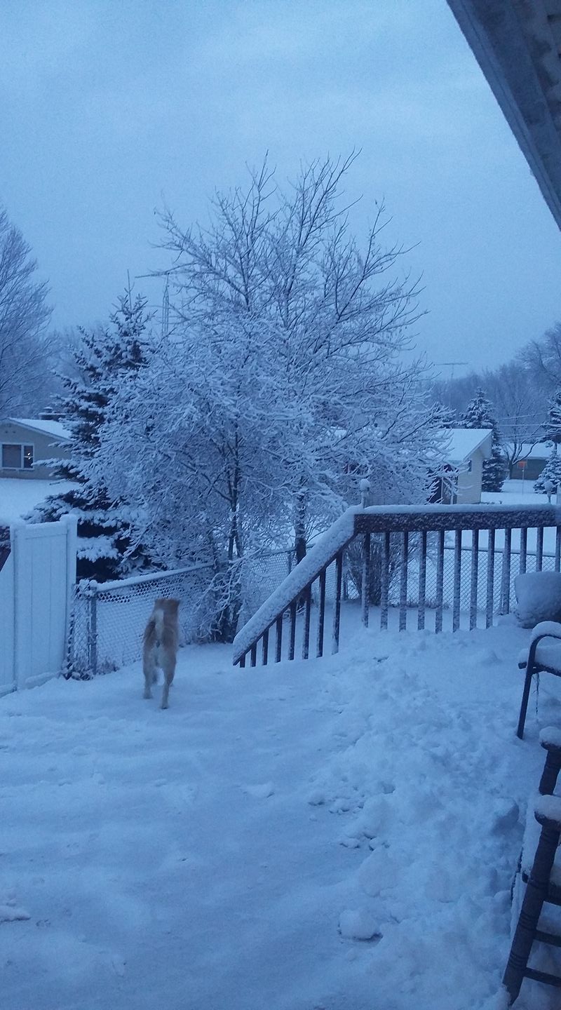
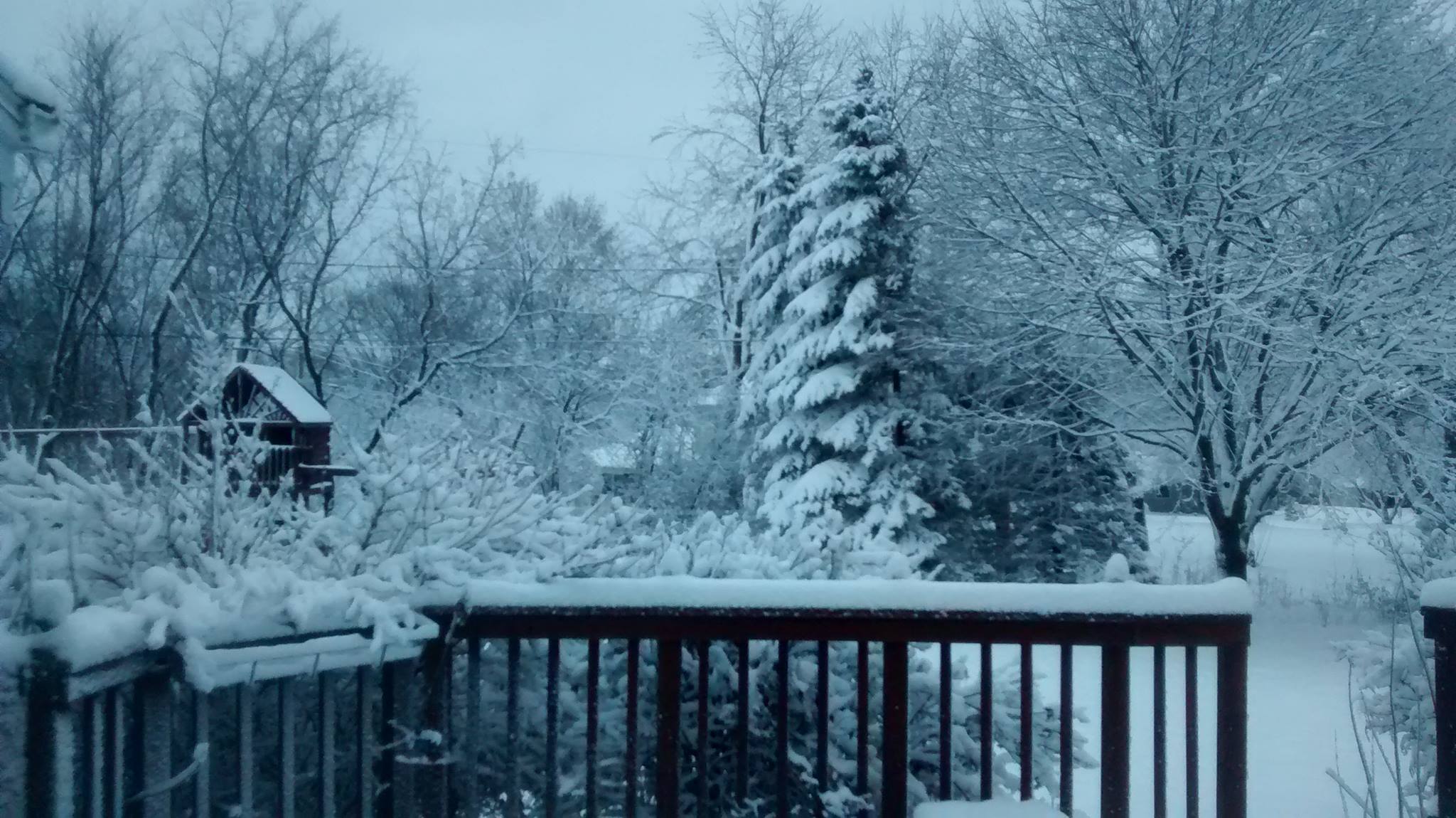
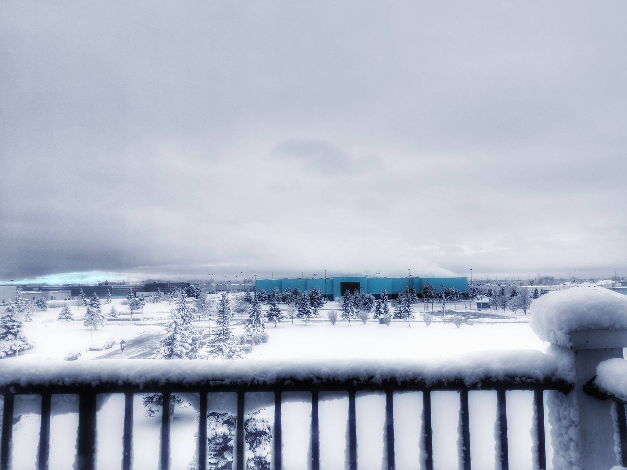
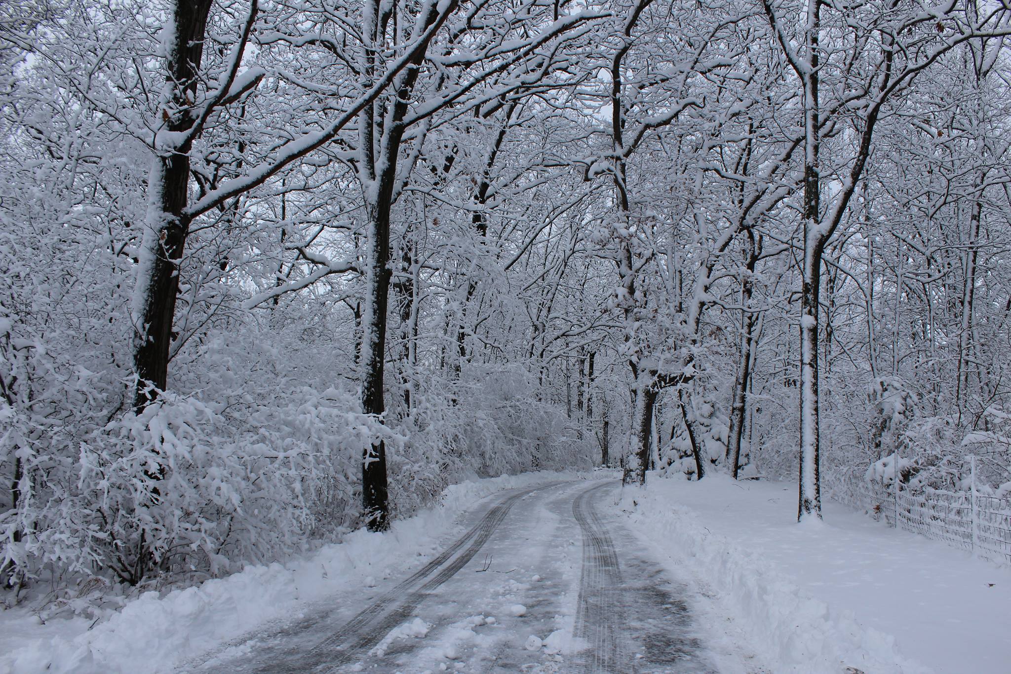
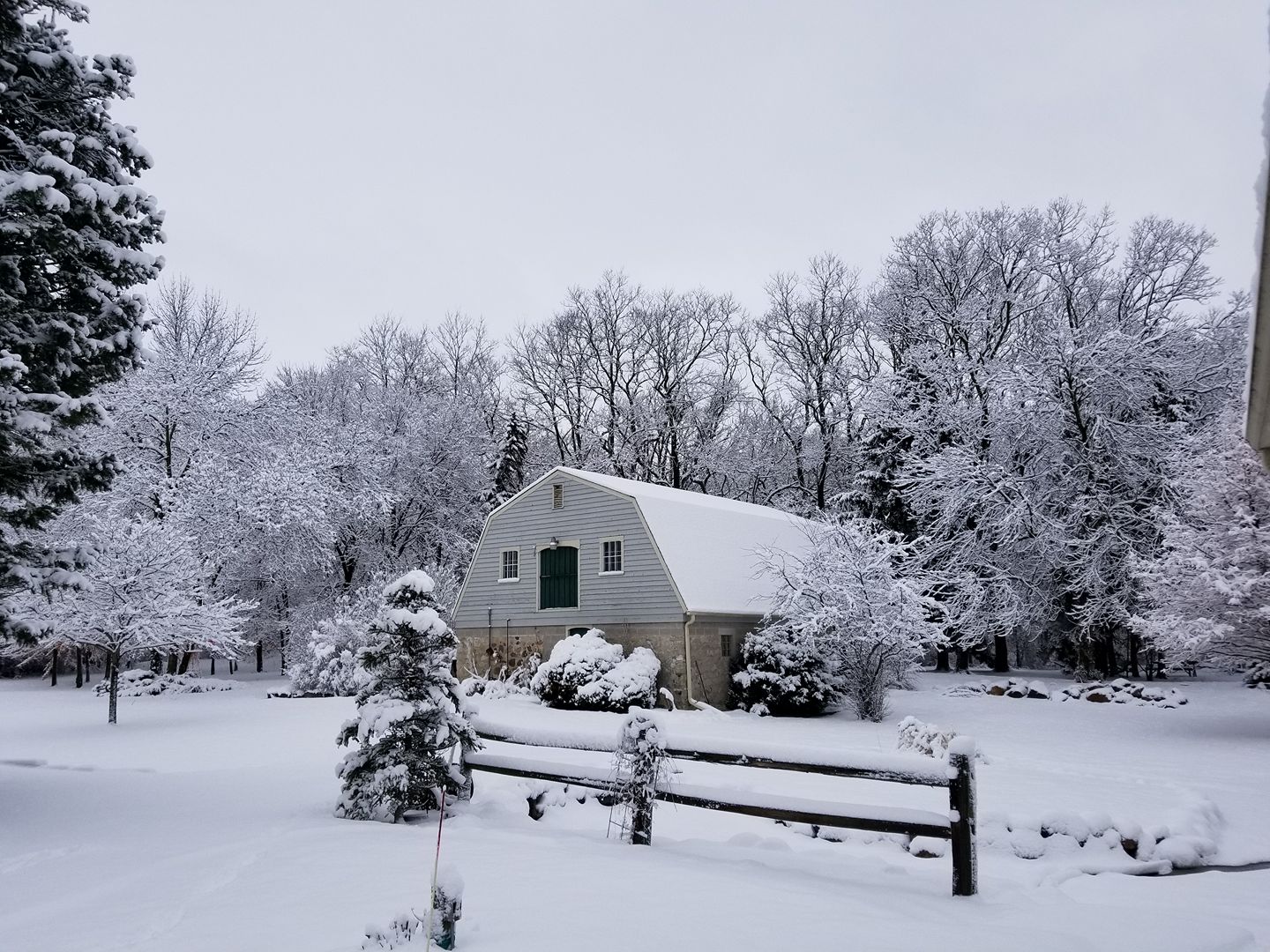
Photos:
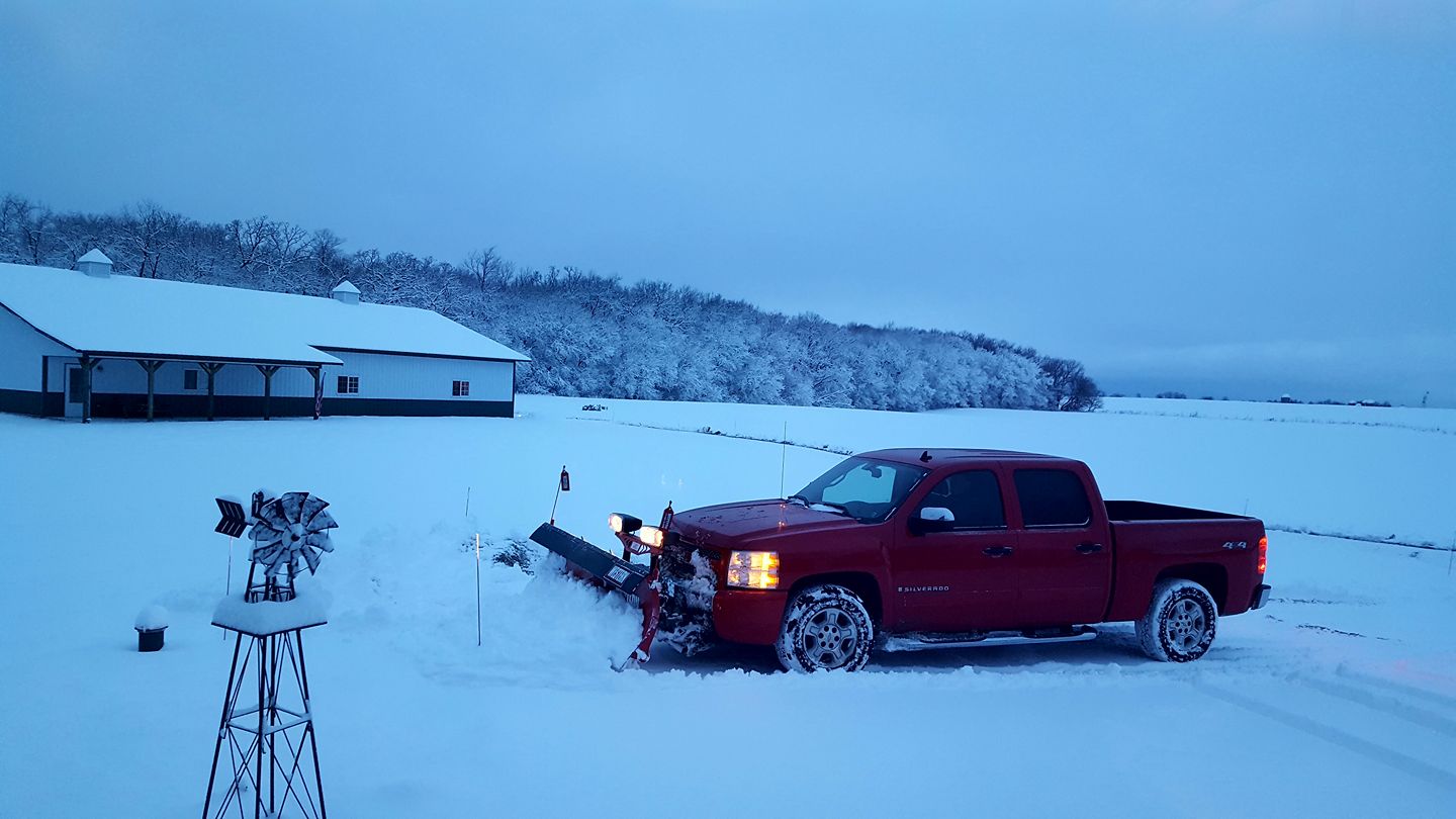
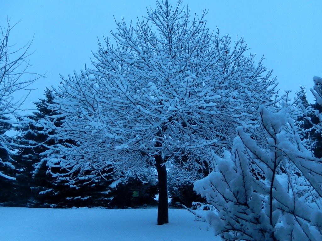
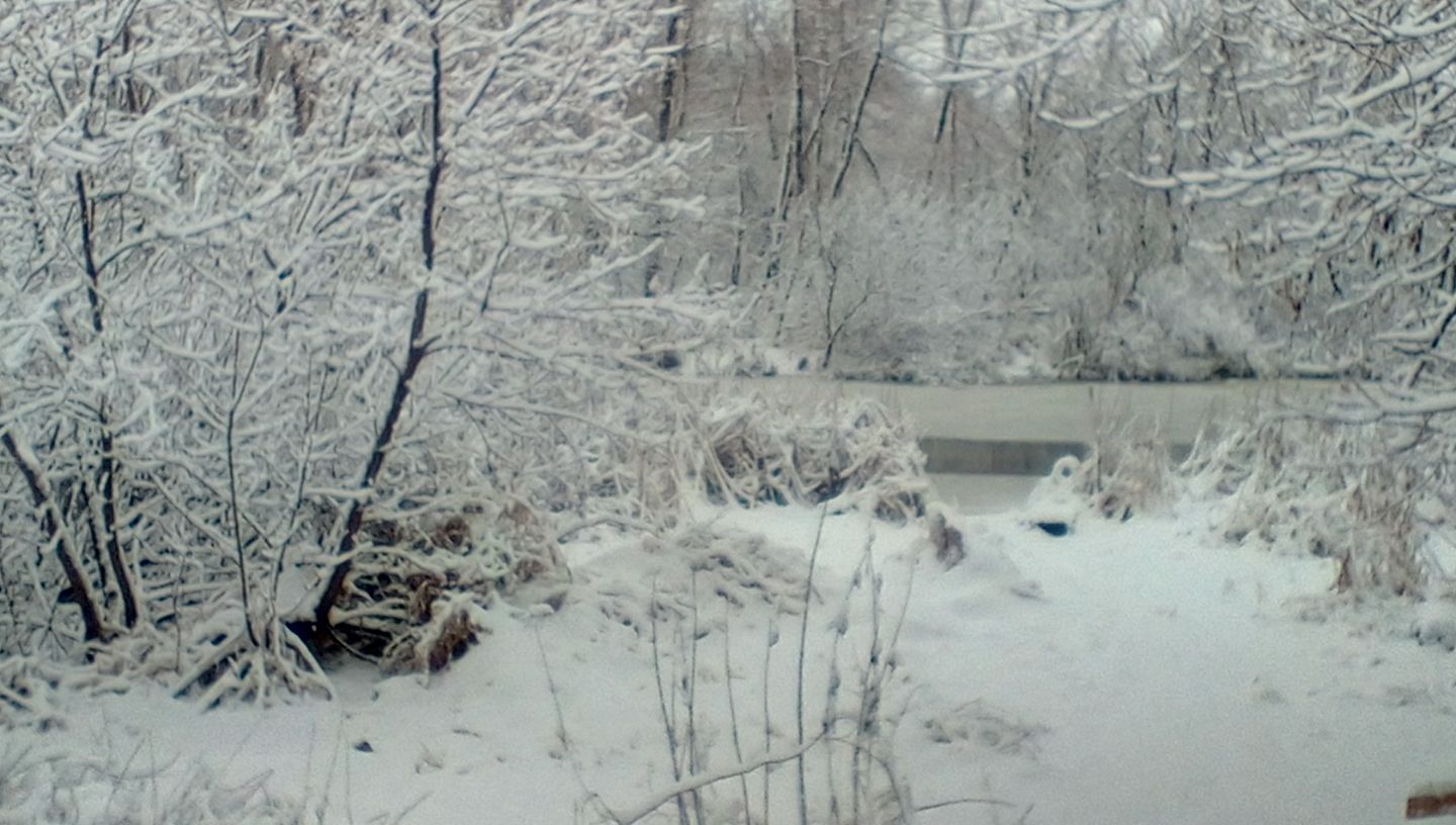
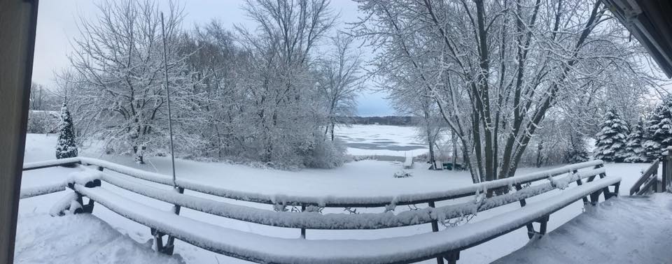
Pictures from across southern Wisconsin of the snow
 |
 |
 |
 |
| Yorkville (Sonia Harleigh) |
Twin Lakes (Christine Harris) |
Trevor (Eric Nowicki) |
Caledonia (Denice Erfourth) |
 |
 |
 |
 |
| Muskego (Mara Demien) |
Kenosha (Thomas Trae) |
Waterford (Sharon Schneider) |
Mt. Pleasant (Greg Mross) |
 |
 |
 |
 |
| Rome (Nancy Guckenberger) |
Lake Lorraine (James Richard Lang) |
Salem Lakes (Amanda Pflug) |
Sturtevant (Krystal Teer) |
Radar:
Loop of Thunderstorms in Evening to Heavy Snow Overnight
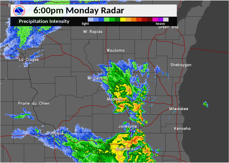 |
| Radar Loop: 6pm Monday until 6am Tuesday |
Storm Reports
 ...Preliminary Snowfall Reports - 1/23/2018 through 9 AM...
Location Amount Time/Date Lat/Lon
...Wisconsin...
...Columbia County...
1 S Columbus 0.6 in 1200 AM 01/23 43.32N/89.03W
Wisconsin Dells 0.3 in 0400 AM 01/23 43.63N/89.77W
Univ Farm 0.3 in 0800 AM 01/23 43.30N/89.35W
5 WSW Portage 0.2 in 0600 AM 01/23 43.51N/89.57W
...Dane County...
Stoughton 2.0 in 0700 AM 01/23 42.92N/89.22W
Oregon 1.5 in 0800 AM 01/23 42.92N/89.39W
Madison-Dane County Airport 1.4 in 0553 AM 01/23 43.14N/89.34W
3 WSW Shorewood Hills 1.2 in 0730 AM 01/23 43.04N/89.51W
1 SSW Shorewood Hills 1.2 in 0700 AM 01/23 43.06N/89.46W
1 W Shorewood Hills 1.1 in 0700 AM 01/23 43.08N/89.47W
1 SSW Middleton 1.0 in 0700 AM 01/23 43.08N/89.52W
2 S Middleton 1.0 in 0700 AM 01/23 43.07N/89.51W
Middleton 1.0 in 0700 AM 01/23 43.09N/89.51W
Madison South-UW Arboretum 1.0 in 0755 AM 01/23 43.04N/89.43W
3 NNE Verona 1.0 in 0521 AM 01/23 43.03N/89.50W
Madison 0.8 in 0700 AM 01/23 43.06N/89.48W
Waunakee 5 W 0.4 in 0700 AM 01/23 43.20N/89.55W
Mt Horeb 0.4 in 0700 AM 01/23 42.98N/89.74W
...Dodge County...
Village Of Hustisford 2.5 in 1200 AM 01/23 43.34N/88.60W
Beaver Dam 1.0 in 0700 AM 01/23 43.45N/88.85W
Horicon-WWTP 0.8 in 0700 AM 01/23 43.45N/88.63W
Theresa 0.3 in 0700 AM 01/23 43.51N/88.46W
...Green County...
Brodhead 0.5 in 0700 AM 01/23 42.62N/89.39W
2 SE Monticello 0.2 in 0730 AM 01/23 42.72N/89.56W
...Green Lake County...
3 ESE Princeton 0.2 in 0700 AM 01/23 43.82N/89.08W
Markesan 0.2 in 0700 AM 01/23 43.70N/89.00W
...Jefferson County...
1 SW Palmyra 5.7 in 0700 AM 01/23 42.86N/88.61W
2 SSW Palmyra 5.7 in 0630 AM 01/23 42.86N/88.61W
1 N Palmyra 5.2 in 0700 AM 01/23 42.90N/88.59W
Johnson Creek 4.0 in 0634 AM 01/23 43.08N/88.77W
3 W Lac La Belle 3.8 in 0630 AM 01/23 43.14N/88.59W
1 NW Whitewater 3.5 in 0700 AM 01/23 42.85N/88.75W
Johnson Creek 3.5 in 0730 AM 01/23 43.08N/88.77W
Watertown 3.0 in 0205 AM 01/23 43.19N/88.72W
3 NW Johnson Creek 2.8 in 0700 AM 01/23 43.12N/88.81W
Watertown 2.0 in 0700 AM 01/23 43.17N/88.74W
Johnson Creek 2.0 in 0345 AM 01/23 43.08N/88.77W
Lake Mills 1.8 in 0600 AM 01/23 43.07N/88.91W
Waterloo 0.6 in 0745 AM 01/23 43.19N/88.98W
...Kenosha County...
1 SW Paddock Lake 9.0 in 0700 AM 01/23 42.56N/88.11W
Silver Lake 7.2 in 0600 AM 01/23 42.55N/88.17W
4 WNW Silver Lake 7.0 in 0645 AM 01/23 42.58N/88.23W
Twin Lakes 6.0 in 0555 AM 01/23 42.52N/88.26W
1 NNE Twin Lakes 5.5 in 0615 AM 01/23 42.53N/88.25W
Pleasant Prairie 4.0 in 0600 AM 01/23 42.56N/87.94W
3 NNW Kenosha 4.0 in 0700 AM 01/23 42.62N/87.83W
2 WSW Kenosha 1.5 in 0700 AM 01/23 42.56N/87.86W
...Lafayette County...
4 NNW South Wayne 0.2 in 0730 AM 01/23 42.63N/89.90W
Benton 0.1 in 0730 AM 01/23 42.57N/90.39W
...Milwaukee County...
Franklin 4.3 in 0600 AM 01/23 42.90N/88.02W
1 NW Franklin 4.3 in 0600 AM 01/23 42.89N/88.02W
2 ENE West Allis 4.3 in 0610 AM 01/23 43.02N/88.00W
Greendale 4.0 in 0510 AM 01/23 42.94N/88.00W
Franklin 2 NW 3.8 in 0700 AM 01/23 42.92N/88.06W
1 ENE Greendale 3.1 in 0700 AM 01/23 42.94N/87.98W
1 E Wauwatosa 3.0 in 0700 AM 01/23 43.06N/88.00W
Cudahy 3.0 in 0700 AM 01/23 42.96N/87.86W
Milwaukee-Timmerman Arpt 3.0 in 0726 AM 01/23 43.11N/88.03W
3 WSW Glendale 2.6 in 0600 AM 01/23 43.11N/87.99W
South Milwaukee-WWTP 2.5 in 0700 AM 01/23 42.90N/87.85W
Milwaukee-Gen Mitchell Arpt 2.3 in 0552 AM 01/23 42.95N/87.90W
Brown Deer 2.1 in 0630 AM 01/23 43.18N/87.98W
Mt. Mary College 2.0 in 0700 AM 01/23 43.07N/88.03W
...Ozaukee County...
Newburg 1.8 in 0700 AM 01/23 43.43N/88.04W
Port Washington-CoCoRaHS 1.6 in 0700 AM 01/23 43.39N/87.88W
Grafton 1.3 in 0730 AM 01/23 43.32N/87.95W
Saukville-WWTP 1.0 in 0600 AM 01/23 43.37N/87.94W
Grafton-WWTP 1.0 in 0805 AM 01/23 43.31N/87.96W
...Racine County...
Browns Lake 8.5 in 0630 AM 01/23 42.69N/88.22W
Bohners Lake 8.5 in 0548 AM 01/23 42.62N/88.28W
3 NNW Burlington 8.0 in 0645 AM 01/23 42.71N/88.31W
Waterford 8.0 in 0615 AM 01/23 42.76N/88.22W
Burlington 8.0 in 0520 AM 01/23 42.68N/88.28W
1 S Rochester 7.8 in 0615 AM 01/23 42.73N/88.22W
Burlington 7.7 in 0615 AM 01/23 42.67N/88.28W
Rochester-WWTP 7.0 in 0600 AM 01/23 42.73N/88.23W
1 E Burlington 6.7 in 0537 AM 01/23 42.68N/88.26W
Union Grove 6.5 in 0700 AM 01/23 42.70N/88.03W
Sturtevant 6.0 in 0610 AM 01/23 42.70N/87.90W
1 S Burlington 6.0 in 0518 AM 01/23 42.66N/88.28W
North Bay 5.0 in 0700 AM 01/23 42.77N/87.79W
Waterford 5.0 in 0550 AM 01/23 42.76N/88.22W
1 NW Elmwood Park 3.3 in 0700 AM 01/23 42.71N/87.85W
...Rock County...
Afton-Rock River 3.0 in 0700 AM 01/23 42.62N/89.07W
3 W Janesville 1.0 in 0700 AM 01/23 42.68N/89.08W
Janesville 1.0 in 1225 AM 01/23 42.69N/89.02W
Beloit 0.8 in 0808 AM 01/23 42.52N/89.01W
Beloit 0.3 in 0536 AM 01/23 42.50N/89.03W
Argyle 0.2 in 0829 AM 01/23 42.70N/89.02W
...Sheboygan County...
Hingham 1.0 in 0800 AM 01/23 43.64N/87.91W
2 NNW Sheboygan 0.8 in 0600 AM 01/23 43.78N/87.72W
Random Lake-CoCoRaHS 0.6 in 0700 AM 01/23 43.55N/87.95W
4 WSW Howards Grove 0.5 in 0630 AM 01/23 43.81N/87.91W
3 NNE Kohler 0.3 in 0615 AM 01/23 43.78N/87.77W
Sheboygan 1sw 0.3 in 0630 AM 01/23 43.74N/87.73W
Howards Grove 0.1 in 0800 AM 01/23 43.84N/87.82W
...Walworth County...
2 NNW Pell Lake 7.5 in 0709 AM 01/23 42.57N/88.38W
1 NW Elkhorn 7.3 in 0400 AM 01/23 42.68N/88.55W
Elkhorn 5.6 in 0645 AM 01/23 42.67N/88.54W
Pell Lake 5.5 in 0615 AM 01/23 42.54N/88.37W
Lake Geneva 5.2 in 0700 AM 01/23 42.59N/88.42W
Pell Lake 5.0 in 0700 AM 01/23 42.53N/88.33W
6 SSE Whitewater 5.0 in 0645 AM 01/23 42.76N/88.69W
Elkhorn 4.5 in 0556 AM 01/23 42.67N/88.54W
2 SW Delavan Lake 4.0 in 0700 AM 01/23 42.58N/88.65W
2 WNW Potter Lake 3.8 in 0600 AM 01/23 42.84N/88.39W
7 NNW Elkhorn 3.8 in 0545 AM 01/23 42.76N/88.60W
1 NNE Darien 2.3 in 0700 AM 01/23 42.62N/88.70W
Delevan 2.3 in 0725 AM 01/23 42.63N/88.66W
...Washington County...
2 W Hartford 2.0 in 0630 AM 01/23 43.32N/88.40W
Germantown 1.9 in 0700 AM 01/23 43.22N/88.12W
Jackson-CoCoRaHS 1.0 in 0600 AM 01/23 43.32N/88.17W
Jackson-COOP 1.0 in 0600 AM 01/23 43.32N/88.17W
4 NE Jackson 0.8 in 0800 AM 01/23 43.37N/88.10W
1 NW West Bend 0.6 in 0531 AM 01/23 43.44N/88.20W
3 ESE Jackson 0.6 in 0500 AM 01/23 43.29N/88.11W
Slinger 0.5 in 0700 AM 01/23 43.33N/88.30W
Allenton 0.5 in 0745 AM 01/23 43.42N/88.35W
1 ESE Hartford 0.3 in 0625 AM 01/23 43.31N/88.36W
1 W Kewaskum 0.2 in 0700 AM 01/23 43.53N/88.27W
...Waukesha County...
3 SE Dousman 6.5 in 0700 AM 01/23 42.97N/88.44W
2 SE Eagle 5.3 in 0700 AM 01/23 42.85N/88.44W
Oconomowoc 5.0 in 0700 AM 01/23 43.10N/88.50W
1 E Mukwonago 4.8 in 0700 AM 01/23 42.87N/88.30W
Big Bend 4.7 in 0700 AM 01/23 42.88N/88.21W
Muskego 4.2 in 0630 AM 01/23 42.89N/88.14W
2 SW Oconomowoc 4.1 in 0700 AM 01/23 43.09N/88.52W
2 NNE Oconomowoc 3.8 in 0730 AM 01/23 43.13N/88.49W
Mukwonago 3.7 in 0700 AM 01/23 42.87N/88.33W
1 W Oconomowoc 3.5 in 0700 AM 01/23 43.11N/88.52W
3 N Mukwonago 3.5 in 0546 AM 01/23 42.92N/88.32W
Oconomowoc 3.3 in 0700 AM 01/23 43.11N/88.50W
1 WNW New Berlin 3.2 in 0700 AM 01/23 42.98N/88.16W
Oconomowoc South 3.1 in 0654 AM 01/23 43.11N/88.50W
1 E Merton 2.6 in 0800 AM 01/23 43.14N/88.29W
Waukesha 2.1 SSW 2.5 in 0700 AM 01/23 42.98N/88.25W
Merton 1.5n 2.1 in 0623 AM 01/23 43.17N/88.30W
1 NE Merton 1.8 in 0700 AM 01/23 43.15N/88.30W
Merton 1.8 in 0630 AM 01/23 43.14N/88.31W
1 NW Waukesha 1.7 in 0700 AM 01/23 43.03N/88.26W
Observations are collected from a variety of sources with varying
equipment and exposures. We thank all volunteer weather observers
for their dedication. Not all data listed are considered official.
...Preliminary Snowfall Reports - 1/23/2018 through 9 AM...

Location                     Amount    Time/Date       Lat/Lon

...Wisconsin...

...Columbia County...
1 S Columbus                 0.6 in    1200 AM 01/23   43.32N/89.03W
Wisconsin Dells              0.3 in    0400 AM 01/23   43.63N/89.77W
Univ Farm                    0.3 in    0800 AM 01/23   43.30N/89.35W
5 WSW Portage                0.2 in    0600 AM 01/23   43.51N/89.57W

...Dane County...
Stoughton                    2.0 in    0700 AM 01/23   42.92N/89.22W
Oregon                       1.5 in    0800 AM 01/23   42.92N/89.39W
Madison-Dane County Airport  1.4 in    0553 AM 01/23   43.14N/89.34W
3 WSW Shorewood Hills        1.2 in    0730 AM 01/23   43.04N/89.51W
1 SSW Shorewood Hills        1.2 in    0700 AM 01/23   43.06N/89.46W
1 W Shorewood Hills          1.1 in    0700 AM 01/23   43.08N/89.47W
1 SSW Middleton              1.0 in    0700 AM 01/23   43.08N/89.52W
2 S Middleton                1.0 in    0700 AM 01/23   43.07N/89.51W
Middleton                    1.0 in    0700 AM 01/23   43.09N/89.51W
Madison South-UW Arboretum   1.0 in    0755 AM 01/23   43.04N/89.43W
3 NNE Verona                 1.0 in    0521 AM 01/23   43.03N/89.50W
Madison                      0.8 in    0700 AM 01/23   43.06N/89.48W
Waunakee 5 W                 0.4 in    0700 AM 01/23   43.20N/89.55W
Mt Horeb                     0.4 in    0700 AM 01/23   42.98N/89.74W

...Dodge County...
Village Of Hustisford        2.5 in    1200 AM 01/23   43.34N/88.60W
Beaver Dam                   1.0 in    0700 AM 01/23   43.45N/88.85W
Horicon-WWTP                 0.8 in    0700 AM 01/23   43.45N/88.63W
Theresa                      0.3 in    0700 AM 01/23   43.51N/88.46W

...Green County...
Brodhead                     0.5 in    0700 AM 01/23   42.62N/89.39W
2 SE Monticello              0.2 in    0730 AM 01/23   42.72N/89.56W

...Green Lake County...
3 ESE Princeton              0.2 in    0700 AM 01/23   43.82N/89.08W
Markesan                     0.2 in    0700 AM 01/23   43.70N/89.00W

...Jefferson County...
1 SW Palmyra                 5.7 in    0700 AM 01/23   42.86N/88.61W
2 SSW Palmyra                5.7 in    0630 AM 01/23   42.86N/88.61W
1 N Palmyra                  5.2 in    0700 AM 01/23   42.90N/88.59W
Johnson Creek                4.0 in    0634 AM 01/23   43.08N/88.77W
3 W Lac La Belle             3.8 in    0630 AM 01/23   43.14N/88.59W
1 NW Whitewater              3.5 in    0700 AM 01/23   42.85N/88.75W
Johnson Creek                3.5 in    0730 AM 01/23   43.08N/88.77W
Watertown                    3.0 in    0205 AM 01/23   43.19N/88.72W
3 NW Johnson Creek           2.8 in    0700 AM 01/23   43.12N/88.81W
Watertown                    2.0 in    0700 AM 01/23   43.17N/88.74W
Johnson Creek                2.0 in    0345 AM 01/23   43.08N/88.77W
Lake Mills                   1.8 in    0600 AM 01/23   43.07N/88.91W
Waterloo                     0.6 in    0745 AM 01/23   43.19N/88.98W

...Kenosha County...
1 SW Paddock Lake            9.0 in    0700 AM 01/23   42.56N/88.11W
Silver Lake                  7.2 in    0600 AM 01/23   42.55N/88.17W
4 WNW Silver Lake            7.0 in    0645 AM 01/23   42.58N/88.23W
Twin Lakes                   6.0 in    0555 AM 01/23   42.52N/88.26W
1 NNE Twin Lakes             5.5 in    0615 AM 01/23   42.53N/88.25W
Pleasant Prairie             4.0 in    0600 AM 01/23   42.56N/87.94W
3 NNW Kenosha                4.0 in    0700 AM 01/23   42.62N/87.83W
2 WSW Kenosha                1.5 in    0700 AM 01/23   42.56N/87.86W

...Lafayette County...
4 NNW South Wayne            0.2 in    0730 AM 01/23   42.63N/89.90W
Benton                       0.1 in    0730 AM 01/23   42.57N/90.39W

...Milwaukee County...
Franklin                     4.3 in    0600 AM 01/23   42.90N/88.02W
1 NW Franklin                4.3 in    0600 AM 01/23   42.89N/88.02W
2 ENE West Allis             4.3 in    0610 AM 01/23   43.02N/88.00W
Greendale                    4.0 in    0510 AM 01/23   42.94N/88.00W
Franklin 2 NW                3.8 in    0700 AM 01/23   42.92N/88.06W
1 ENE Greendale              3.1 in    0700 AM 01/23   42.94N/87.98W
1 E Wauwatosa                3.0 in    0700 AM 01/23   43.06N/88.00W
Cudahy                       3.0 in    0700 AM 01/23   42.96N/87.86W
Milwaukee-Timmerman Arpt     3.0 in    0726 AM 01/23   43.11N/88.03W
3 WSW Glendale               2.6 in    0600 AM 01/23   43.11N/87.99W
South Milwaukee-WWTP         2.5 in    0700 AM 01/23   42.90N/87.85W
Milwaukee-Gen Mitchell Arpt  2.3 in    0552 AM 01/23   42.95N/87.90W
Brown Deer                   2.1 in    0630 AM 01/23   43.18N/87.98W
Mt. Mary College             2.0 in    0700 AM 01/23   43.07N/88.03W

...Ozaukee County...
Newburg                      1.8 in    0700 AM 01/23   43.43N/88.04W
Port Washington-CoCoRaHS     1.6 in    0700 AM 01/23   43.39N/87.88W
Grafton                      1.3 in    0730 AM 01/23   43.32N/87.95W
Saukville-WWTP               1.0 in    0600 AM 01/23   43.37N/87.94W
Grafton-WWTP                 1.0 in    0805 AM 01/23   43.31N/87.96W

...Racine County...
Browns Lake                  8.5 in    0630 AM 01/23   42.69N/88.22W
Bohners Lake                 8.5 in    0548 AM 01/23   42.62N/88.28W
3 NNW Burlington             8.0 in    0645 AM 01/23   42.71N/88.31W
Waterford                    8.0 in    0615 AM 01/23   42.76N/88.22W
Burlington                   8.0 in    0520 AM 01/23   42.68N/88.28W
1 S Rochester                7.8 in    0615 AM 01/23   42.73N/88.22W
Burlington                   7.7 in    0615 AM 01/23   42.67N/88.28W
Rochester-WWTP               7.0 in    0600 AM 01/23   42.73N/88.23W
1 E Burlington               6.7 in    0537 AM 01/23   42.68N/88.26W
Union Grove                  6.5 in    0700 AM 01/23   42.70N/88.03W
Sturtevant                   6.0 in    0610 AM 01/23   42.70N/87.90W
1 S Burlington               6.0 in    0518 AM 01/23   42.66N/88.28W
North Bay                    5.0 in    0700 AM 01/23   42.77N/87.79W
Waterford                    5.0 in    0550 AM 01/23   42.76N/88.22W
1 NW Elmwood Park            3.3 in    0700 AM 01/23   42.71N/87.85W

...Rock County...
Afton-Rock River             3.0 in    0700 AM 01/23   42.62N/89.07W
3 W Janesville               1.0 in    0700 AM 01/23   42.68N/89.08W
Janesville                   1.0 in    1225 AM 01/23   42.69N/89.02W
Beloit                       0.8 in    0808 AM 01/23   42.52N/89.01W
Beloit                       0.3 in    0536 AM 01/23   42.50N/89.03W
Argyle                       0.2 in    0829 AM 01/23   42.70N/89.02W

...Sheboygan County...
Hingham                      1.0 in    0800 AM 01/23   43.64N/87.91W
2 NNW Sheboygan              0.8 in    0600 AM 01/23   43.78N/87.72W
Random Lake-CoCoRaHS         0.6 in    0700 AM 01/23   43.55N/87.95W
4 WSW Howards Grove          0.5 in    0630 AM 01/23   43.81N/87.91W
3 NNE Kohler                 0.3 in    0615 AM 01/23   43.78N/87.77W
Sheboygan 1sw                0.3 in    0630 AM 01/23   43.74N/87.73W
Howards Grove                0.1 in    0800 AM 01/23   43.84N/87.82W

...Walworth County...
2 NNW Pell Lake              7.5 in    0709 AM 01/23   42.57N/88.38W
1 NW Elkhorn                 7.3 in    0400 AM 01/23   42.68N/88.55W
Elkhorn                      5.6 in    0645 AM 01/23   42.67N/88.54W
Pell Lake                    5.5 in    0615 AM 01/23   42.54N/88.37W
Lake Geneva                  5.2 in    0700 AM 01/23   42.59N/88.42W
Pell Lake                    5.0 in    0700 AM 01/23   42.53N/88.33W
6 SSE Whitewater             5.0 in    0645 AM 01/23   42.76N/88.69W
Elkhorn                      4.5 in    0556 AM 01/23   42.67N/88.54W
2 SW Delavan Lake            4.0 in    0700 AM 01/23   42.58N/88.65W
2 WNW Potter Lake            3.8 in    0600 AM 01/23   42.84N/88.39W
7 NNW Elkhorn                3.8 in    0545 AM 01/23   42.76N/88.60W
1 NNE Darien                 2.3 in    0700 AM 01/23   42.62N/88.70W
Delevan                      2.3 in    0725 AM 01/23   42.63N/88.66W

...Washington County...
2 W Hartford                 2.0 in    0630 AM 01/23   43.32N/88.40W
Germantown                   1.9 in    0700 AM 01/23   43.22N/88.12W
Jackson-CoCoRaHS             1.0 in    0600 AM 01/23   43.32N/88.17W
Jackson-COOP                 1.0 in    0600 AM 01/23   43.32N/88.17W
4 NE Jackson                 0.8 in    0800 AM 01/23   43.37N/88.10W
1 NW West Bend               0.6 in    0531 AM 01/23   43.44N/88.20W
3 ESE Jackson                0.6 in    0500 AM 01/23   43.29N/88.11W
Slinger                      0.5 in    0700 AM 01/23   43.33N/88.30W
Allenton                     0.5 in    0745 AM 01/23   43.42N/88.35W
1 ESE Hartford               0.3 in    0625 AM 01/23   43.31N/88.36W
1 W Kewaskum                 0.2 in    0700 AM 01/23   43.53N/88.27W

...Waukesha County...
3 SE Dousman                 6.5 in    0700 AM 01/23   42.97N/88.44W
2 SE Eagle                   5.3 in    0700 AM 01/23   42.85N/88.44W
Oconomowoc                   5.0 in    0700 AM 01/23   43.10N/88.50W
1 E Mukwonago                4.8 in    0700 AM 01/23   42.87N/88.30W
Big Bend                     4.7 in    0700 AM 01/23   42.88N/88.21W
Muskego                      4.2 in    0630 AM 01/23   42.89N/88.14W
2 SW Oconomowoc              4.1 in    0700 AM 01/23   43.09N/88.52W
2 NNE Oconomowoc             3.8 in    0730 AM 01/23   43.13N/88.49W
Mukwonago                    3.7 in    0700 AM 01/23   42.87N/88.33W
1 W Oconomowoc               3.5 in    0700 AM 01/23   43.11N/88.52W
3 N Mukwonago                3.5 in    0546 AM 01/23   42.92N/88.32W
Oconomowoc                   3.3 in    0700 AM 01/23   43.11N/88.50W
1 WNW New Berlin             3.2 in    0700 AM 01/23   42.98N/88.16W
Oconomowoc South             3.1 in    0654 AM 01/23   43.11N/88.50W
1 E Merton                   2.6 in    0800 AM 01/23   43.14N/88.29W
Waukesha 2.1 SSW             2.5 in    0700 AM 01/23   42.98N/88.25W
Merton 1.5n                  2.1 in    0623 AM 01/23   43.17N/88.30W
1 NE Merton                  1.8 in    0700 AM 01/23   43.15N/88.30W
Merton                       1.8 in    0630 AM 01/23   43.14N/88.31W
1 NW Waukesha                1.7 in    0700 AM 01/23   43.03N/88.26W

Observations are collected from a variety of sources with varying
equipment and exposures. We thank all volunteer weather observers
for their dedication. Not all data listed are considered official.
 |
Media use of NWS Web News Stories is encouraged! Please acknowledge the NWS as the source of any news information accessed from this site. |
|


