Milwaukee/Sullivan, WI
Weather Forecast Office
Weather Observation At NWS Milwaukee/Sullivan:
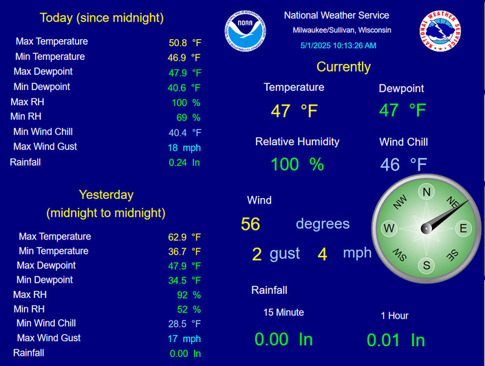
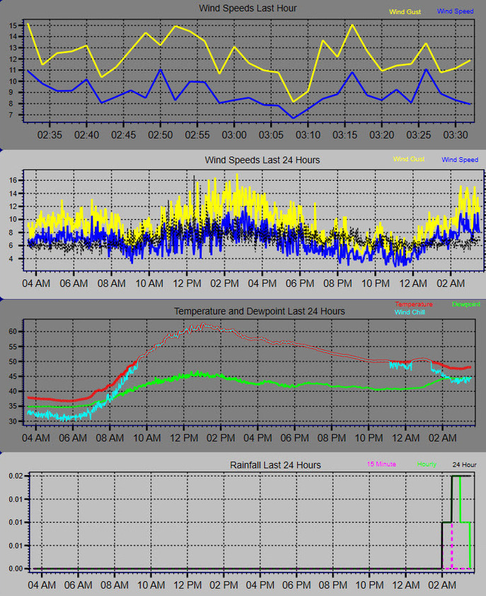
This observation is sent to our web servers every 10 minutes. Refresh your browser to ensure the latest observation is displayed (we are unable to set this page up to autorefresh.)
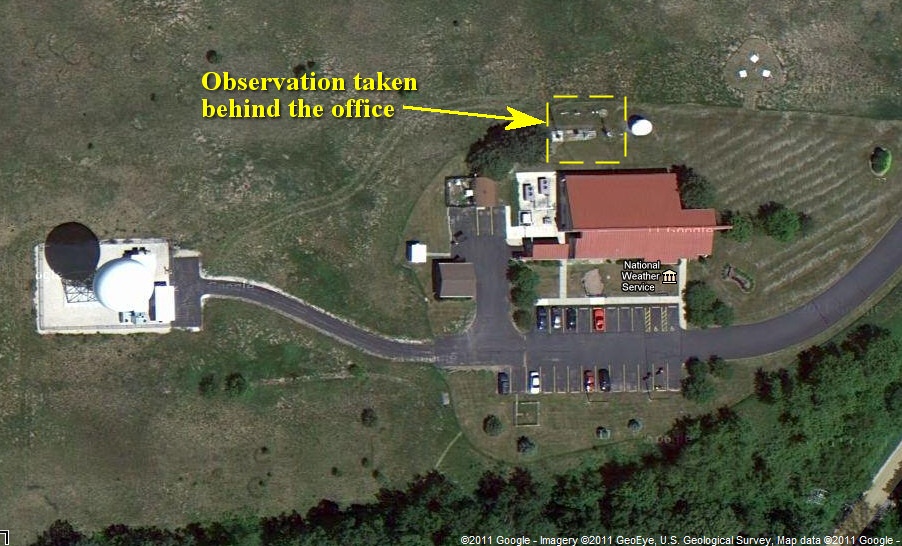
Our office is located in far eastern Jefferson County, 3 miles southeast of the village of Sullivan, and the observation is taken outside the office with standard instrumentation (click the image below for a larger version). Temperature and humidity are measured 2 meters above a grassy surface (using Campbell Scientific sensors), and wind at the top of a 10-meter tower (using a sensor by R.M. Young.) Rainfall is measured by a "tipping-bucket" gauge (Texas Electronics) that does not need to be emptied periodically. The 15-minute and 1-hour rainfall totals are running totals up to the time of the observation.
We use LoggerNet, by Campbell Scientific, to capture all of the data. This data is displayed on a monitor in the office. We then use a program called Snagit to do a screen capture of the observation display. This captured image is then RSYNC'd to our web servers in Kansas City, MO.
|
Overhead view of NWS MKX |
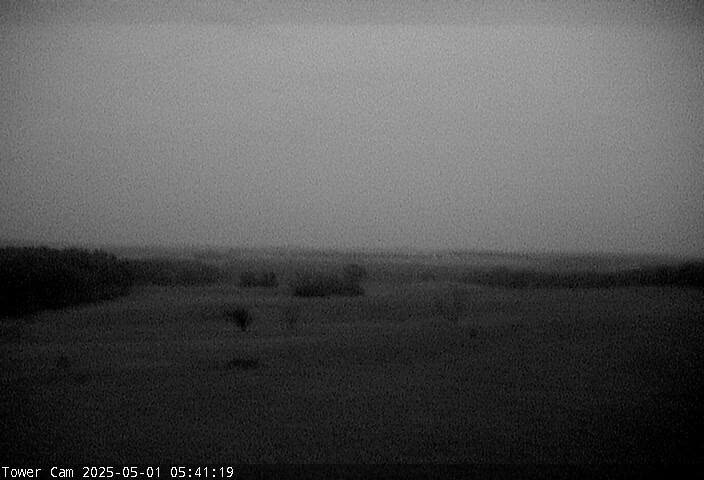
Live tower camera view |
Hazards
National Briefing
Hazardous Weather Outlook
Skywarn
View Local Storm Reports
Submit A Storm Report
Winter Weather
Summer Weather
Beach Hazards
Local Forecasts
Marine
Aviation
Fire
Local Text Products
Local Precip Forecast
Hourly Forecast Graphics
Forecast Discussion
Climate
Lightning Plot Archive
Daily Climate Graphics
Local Climate Products
Normals/Records MKE/MSN
CoCoRaHS
Historic Events For Srn WI
US Dept of Commerce
National Oceanic and Atmospheric Administration
National Weather Service
Milwaukee/Sullivan, WI
N3533 Hardscrabble Road
Dousman, WI 53118
262-965-2074
Comments? Questions? Please Contact Us.