|
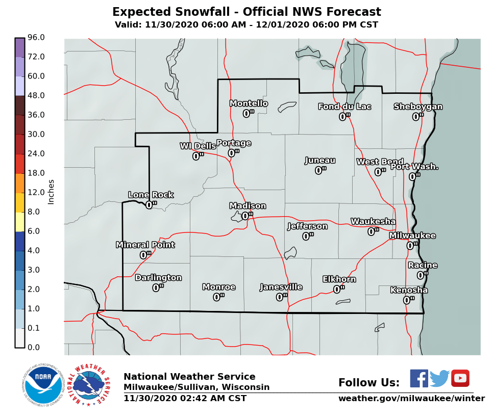
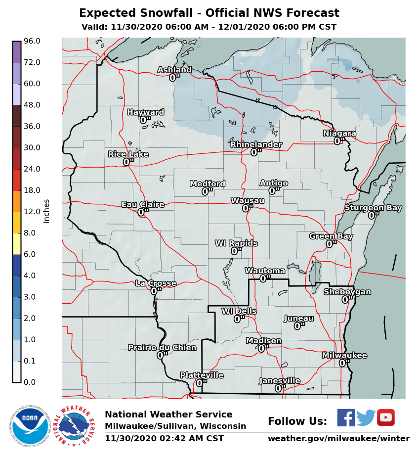
More Wintry Precipitation This Evening Areas along and northwest of a line roughly from Madison to Fond du Lac should see mainly light snow. Freezing drizzle is likely southeast of this line. It will linger through the evening. Ice accumulations anywhere from a light glaze to a tenth of an inch are possible. The mixed precipitation will likely result in slick conditions on roads and sidewalks.
Below are radar animations of the current precipitation from across the region. Our local radar animation is on the right side of this page.
A Winter Weather Advisory is in effect for parts of the region. See graphic to the right. The advisory will end at midnight. Latest Wisconsin Road Conditions
Observed Jan 10-11 Snow and Wind
Observed Wind Gusts From Tuesday Afternoon/Evening

0415 PM     NON-TSTM WND GST MONROE AIRPORT          42.62N 89.59W
01/10/2017  M54.00 MPH       GREEN              WI   AWOS

0429 PM     NON-TSTM WND GST KENOSHA AIRPORT         42.60N 87.93W
01/10/2017  M54.00 MPH       KENOSHA            WI   ASOS

0431 PM     NON-TSTM WND GST RACINE BATTEN AIRPORT   42.76N 87.81W
01/10/2017  M47.00 MPH       RACINE             WI   ASOS

0440 PM     NON-TSTM WND GST MINERAL POINT AIRPORT   42.89N 90.23W
01/10/2017  M49.00 MPH       IOWA               WI   AWOS

0454 PM     NON-TSTM WND GST LONE ROCK AIRPORT       43.21N 90.19W
01/10/2017  M44.00 MPH       SAUK               WI   ASOS

0504 PM     NON-TSTM WND GST MILWAUKEE INTERNATIONAL 42.94N 87.90W
01/10/2017  M47.00 MPH       MILWAUKEE          WI   ASOS

0535 PM     NON-TSTM WND GST WEST BEND AIRPORT       43.42N 88.13W
01/10/2017  M48.00 MPH       WASHINGTON         WI   AWOS

0626 PM     NON-TSTM WND GST FOND DU LAC             43.78N 88.45W
01/10/2017  E44.00 MPH       FOND DU LAC        WI   ASOS

0646 PM     NON-TSTM WND GST SHEBOYGAN AIRPORT       43.77N 87.85W
01/10/2017  M58.00 MPH       SHEBOYGAN          WI   ASOS
SPM/MG/Wood/BSH/SM (updated 1/11/17 @ 5 PM)
|
Submit Report Latest Winter Statement Latest Storm Reports
Weather Story 
Radar
|