
Tropical Storm Isaias is forecast to track toward the central Gulf Coast while strengthening into a hurricane on Thursday. There is an increasing risk of damaging hurricane-force winds and life-threatening storm surge impacts along portions of the northern Gulf Coast Friday into Saturday. Isaias will bring heavy rainfall to the central Gulf Coast and much of the Southeast Friday into the weekend. Read More >
|
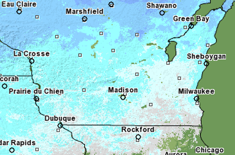
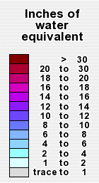
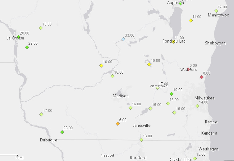
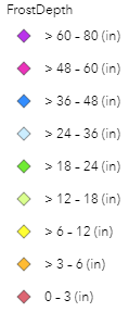
Mild temperatures and light of rain caused the snowpack across southern Wisconsin to melt rapidly in mid March. Rivers were below their banks to start the month but were in the 25-75th percentile (according to the USGS). There was 2 to 8 inches of snow (up to 2 inches water equivalent), highest in the northwest before temperatures warmed. Highs reached the 50s and lower 60s March 15 and all the snow melted. The ground will still frozen with frost depths of 12-18 inches causing the rain and snowmelt to run off into ditches, streams, and rivers. Many rivers reached moderate and a few reach major flood stage. There were 7 new record high river levels set: Spring Creek at Lodi, Milwaukee river near Cedarbug, Sheboygan River at Sheboygan, Pecatonica River at Martintown, Sugar River at Albany, Fox river in Pardeeville, Milwaukee river in Waubeka. Ice jams occurred on the Milwaukee River near Saukville and Waubeka. Numerous roads were closed across southern Wisconsin due to ice jams, river flooding, and low lying areas with flooding.
Snow Water Equivalent March 7, 2019:
Frost Depth ~March 6, 2019:
Additional Information:
|
|
NWS Milwaukee/Sullivan



 Follow us on X
 Follow us on Facebook
 Follow us on YouTube
 MKX RSS Feed