
Late March Alabama Tornadoes
March 22nd, 2022
Summary of all Local Storm Reports (LSRs) on March 22nd, as well as all the LSRs across the region for this event.
Storm survey teams preliminarily concluded that there was 1 EF-2 tornado and 2 EF-1 tornadoes that occurred in our forecast area - 2 tornadoes (1 EF-2 and 1 EF-1) in Choctaw County, AL and 1 EF-1 tornado in Baldwin County, AL.
The data provided on this page are considered preliminary as we continue to analyze all available data. We will add more information to this page and social media as it becomes available. We thank you in advance for your patience.
----- IMPORTANT 2023 UPDATE -----
Significant updates were made to several tornado tracks and wind swaths impacting the NWS Mobile/Pensacola area in the 2018 to 2023 timeframe thanks to the introduction of high-resolution Sentinel, Worldview, and Planet satellite imagery. One or multiple tornado tracks/wind swaths listed on this event webpage were updated in 2023.
An updated graphic and details surrounding these significant updates can be found further down on this webpage in the section for that specific tornado track or wind swath. More information on this Local Tornado Reanalysis Project and a list of all updates can be found on our webpage at weather.gov/mob/TornadoReanalysis or the National Damage Viewer.
Here is a list of the significant updates:
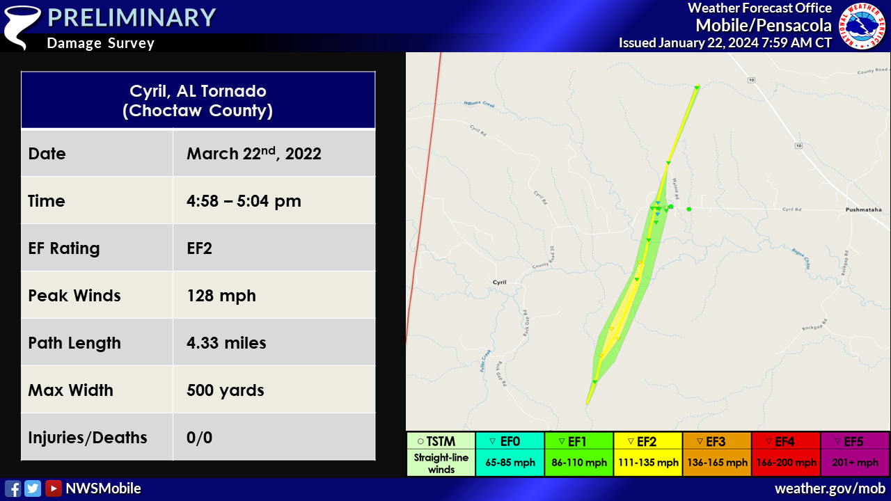
1. March 22, 2022 - Updated Tornado - Choctaw County, AL: The length of the tornado that moved between the Cyril and Pushmataha communities in northwest Choctaw County, AL was extended further to the northeast based on Worldview satellite imagery. Numerous snapped and uprooted trees were also noted in satellite imagery in the first half of the track, thus the intensity increased to 128 mph (remaining an EF2 tornado). The new path length is 4.33 miles and the width was increased to 306 yards.
2. March 22, 2022 - Updated Tornado - Choctaw County, AL: The length of the tornado in southeastern Choctaw County, AL (northeast of the Toxey community) was extended based on Sentinel satellite imagery. The new path length is 3.05 miles.

Cyril Tornado (Choctaw County, AL)
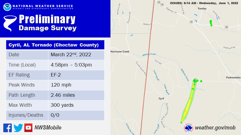
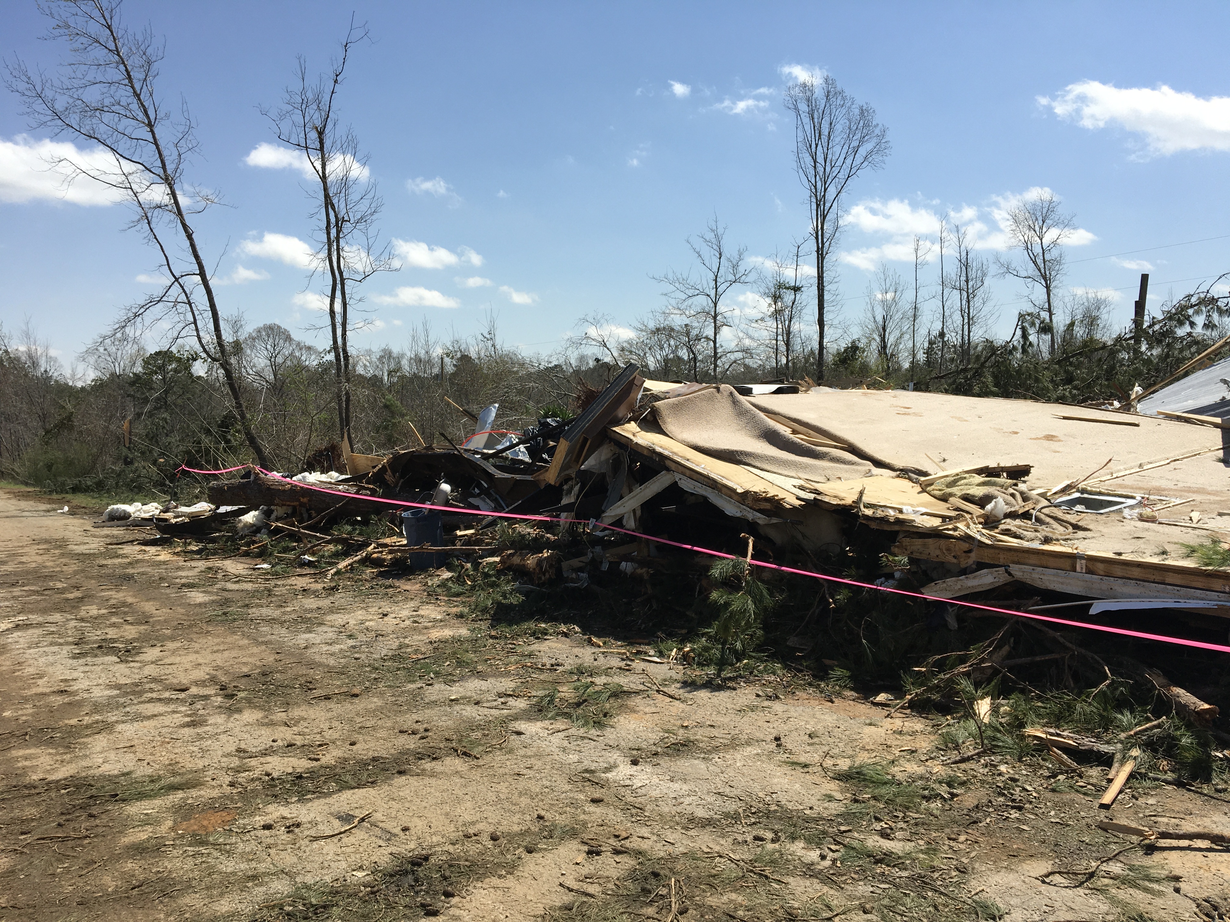
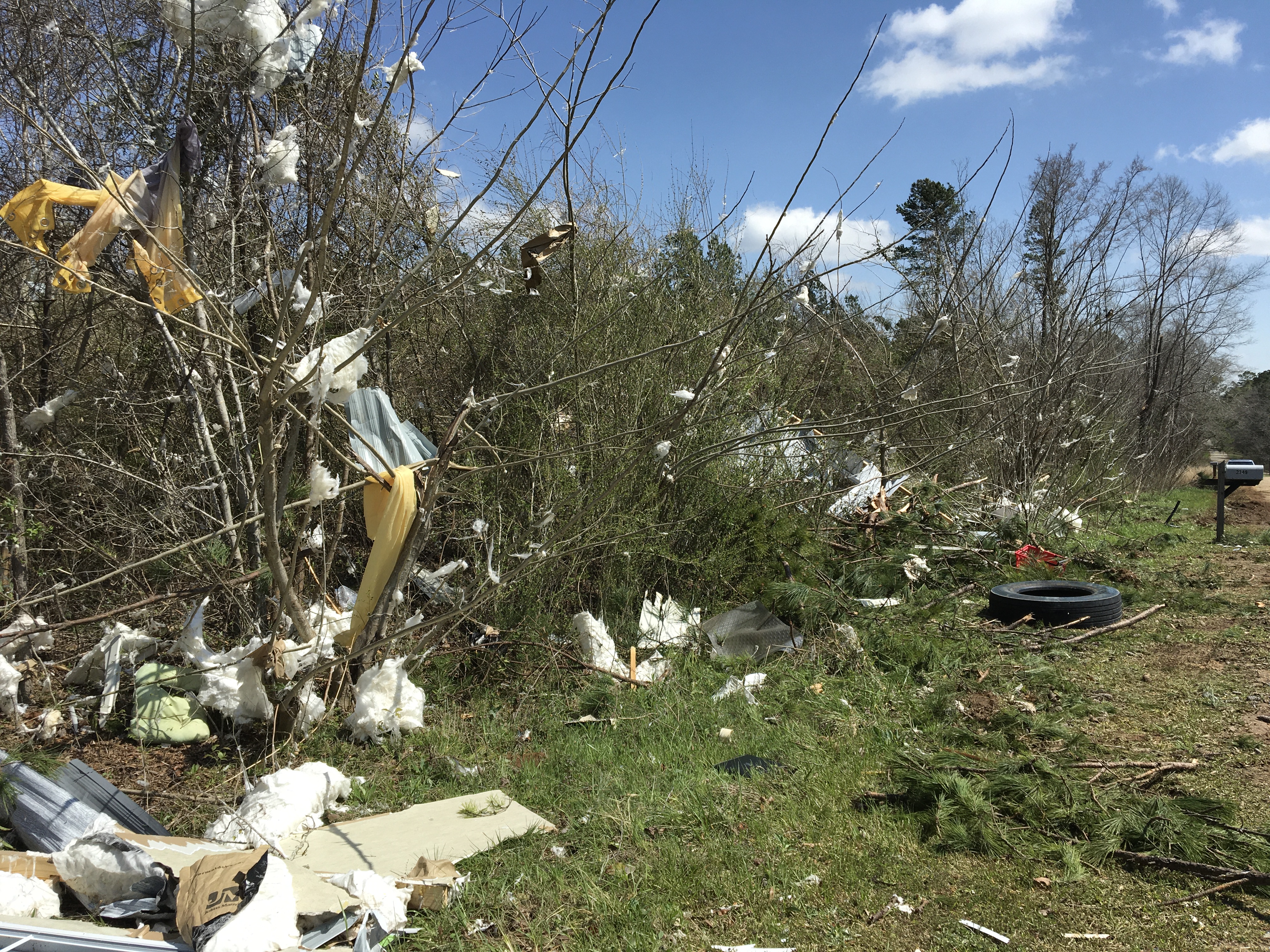
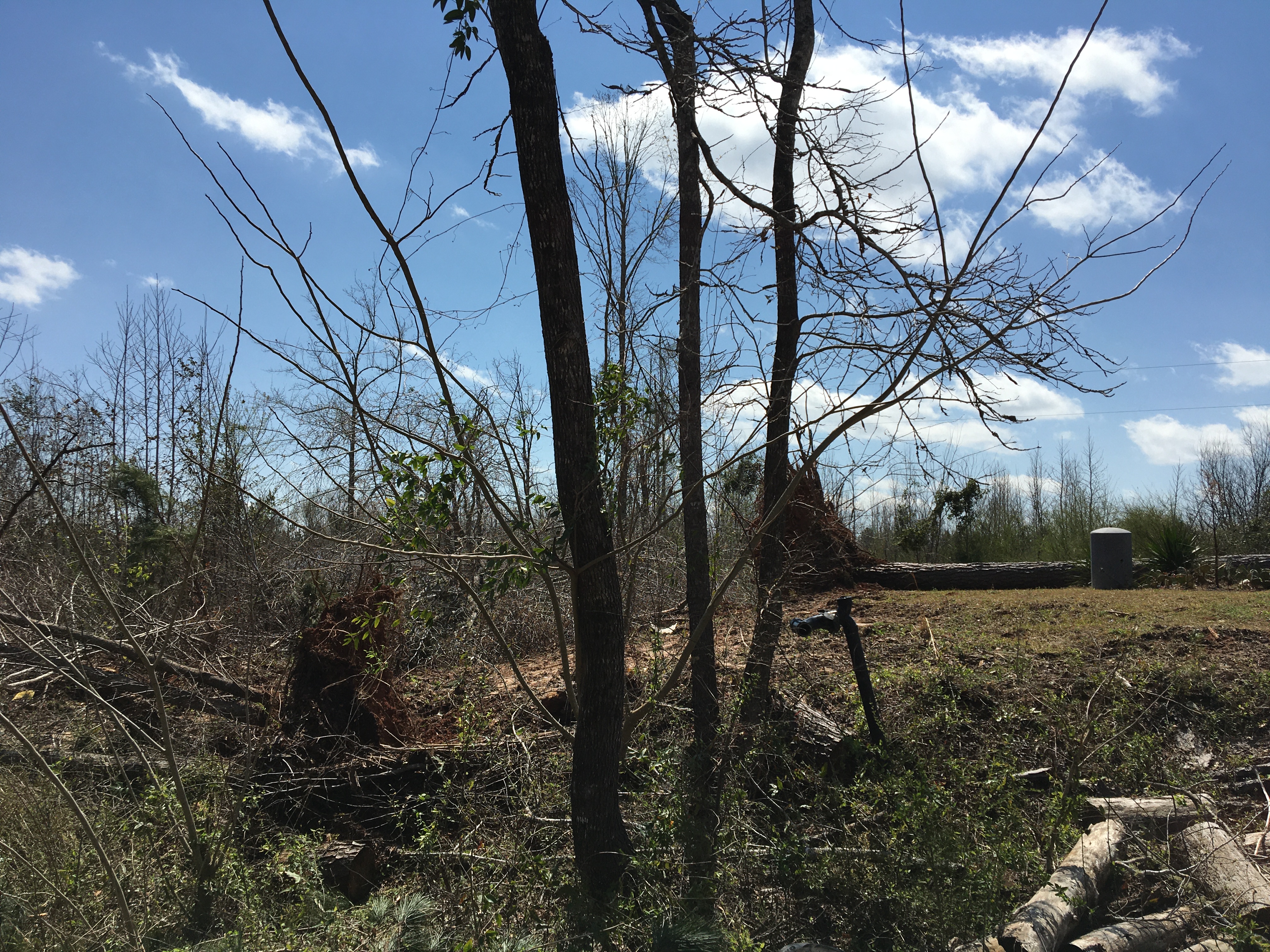
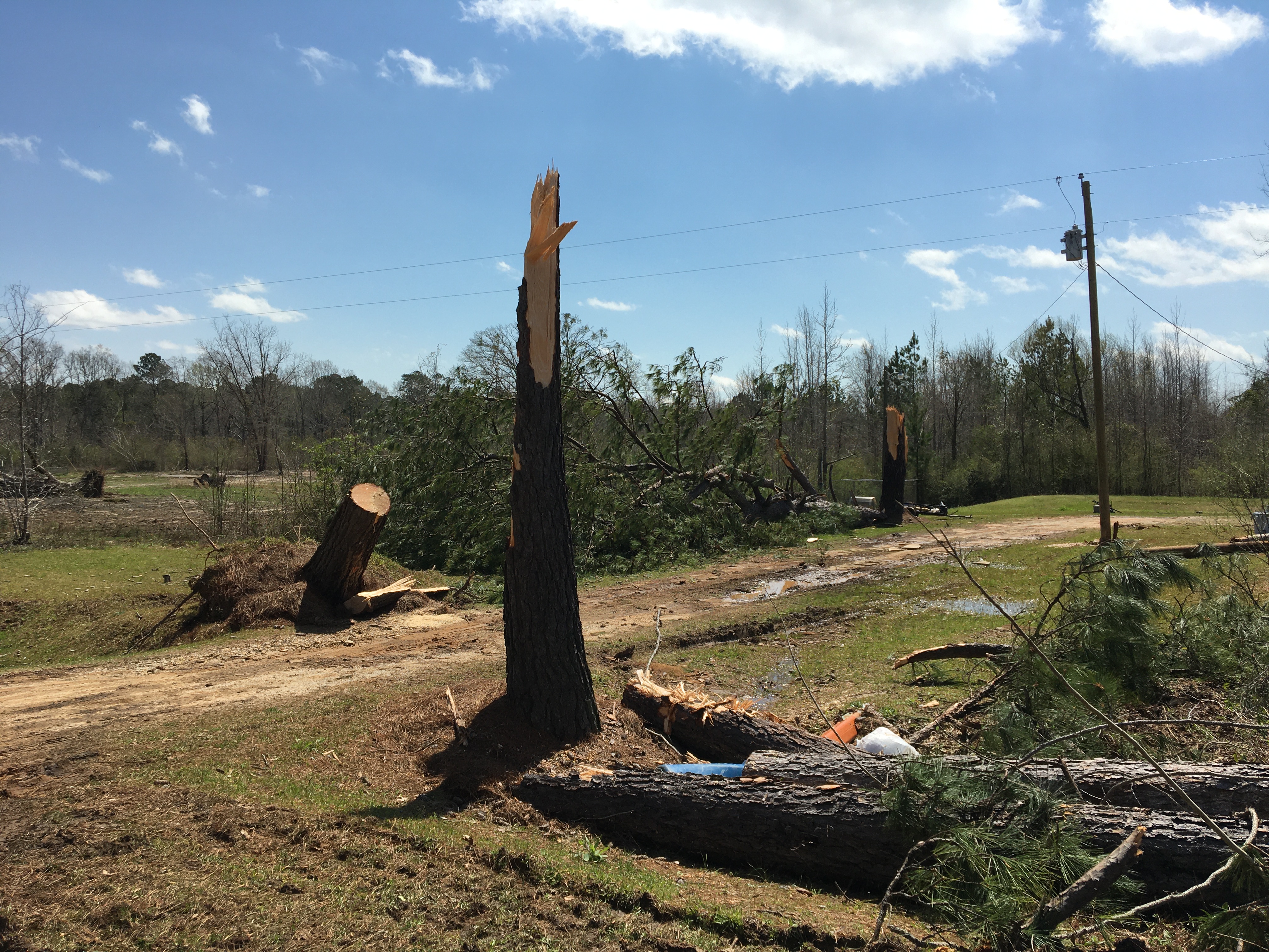
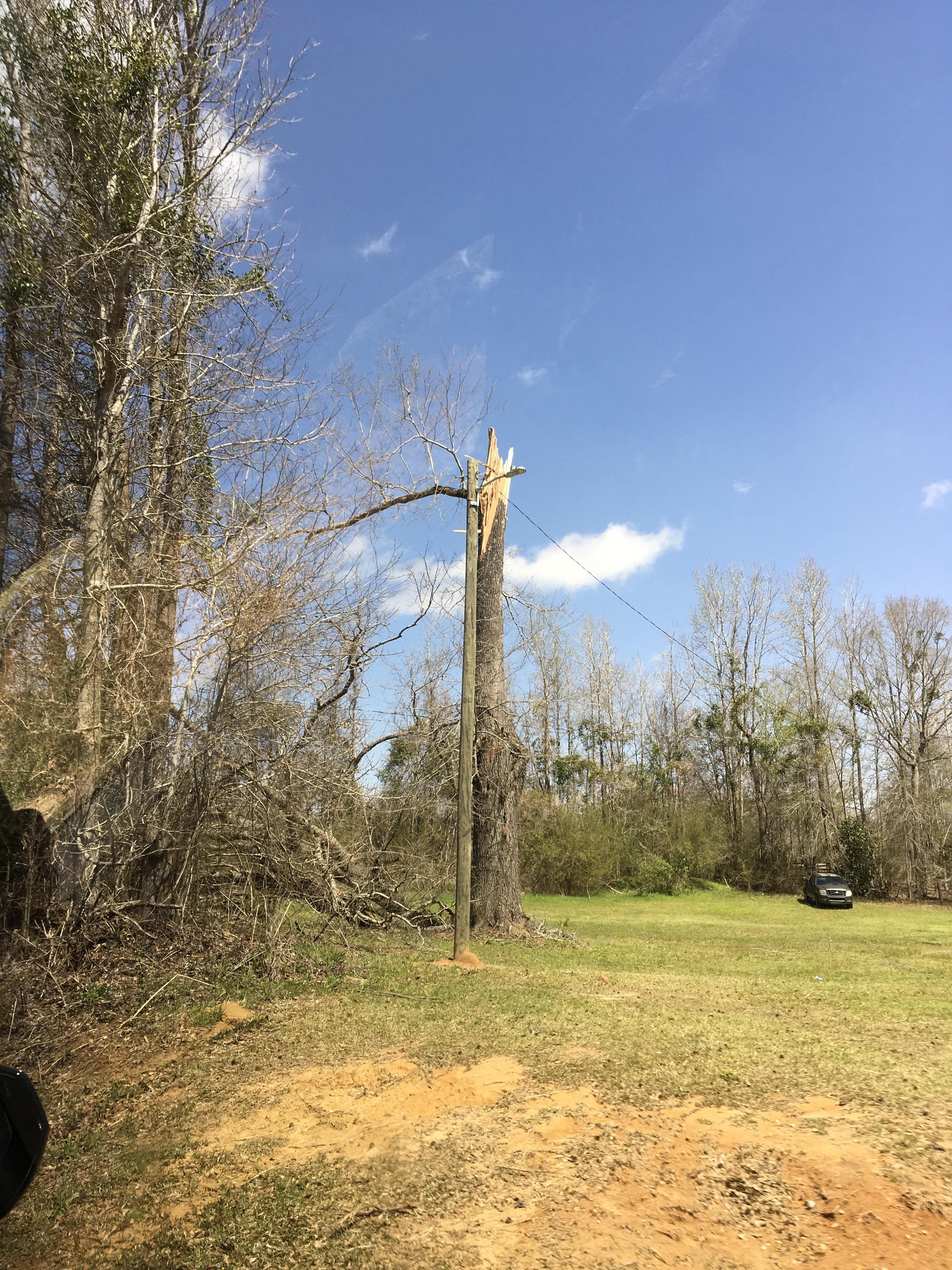
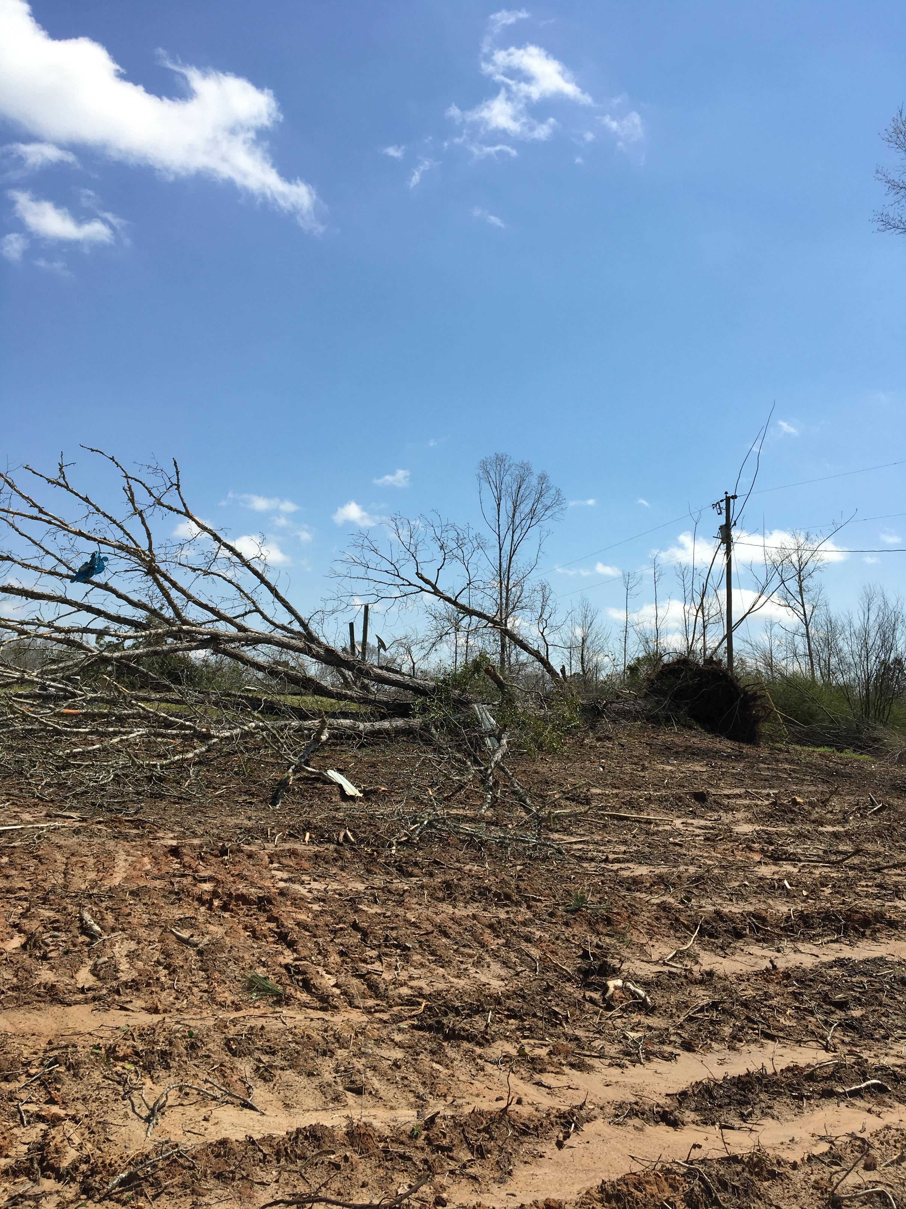
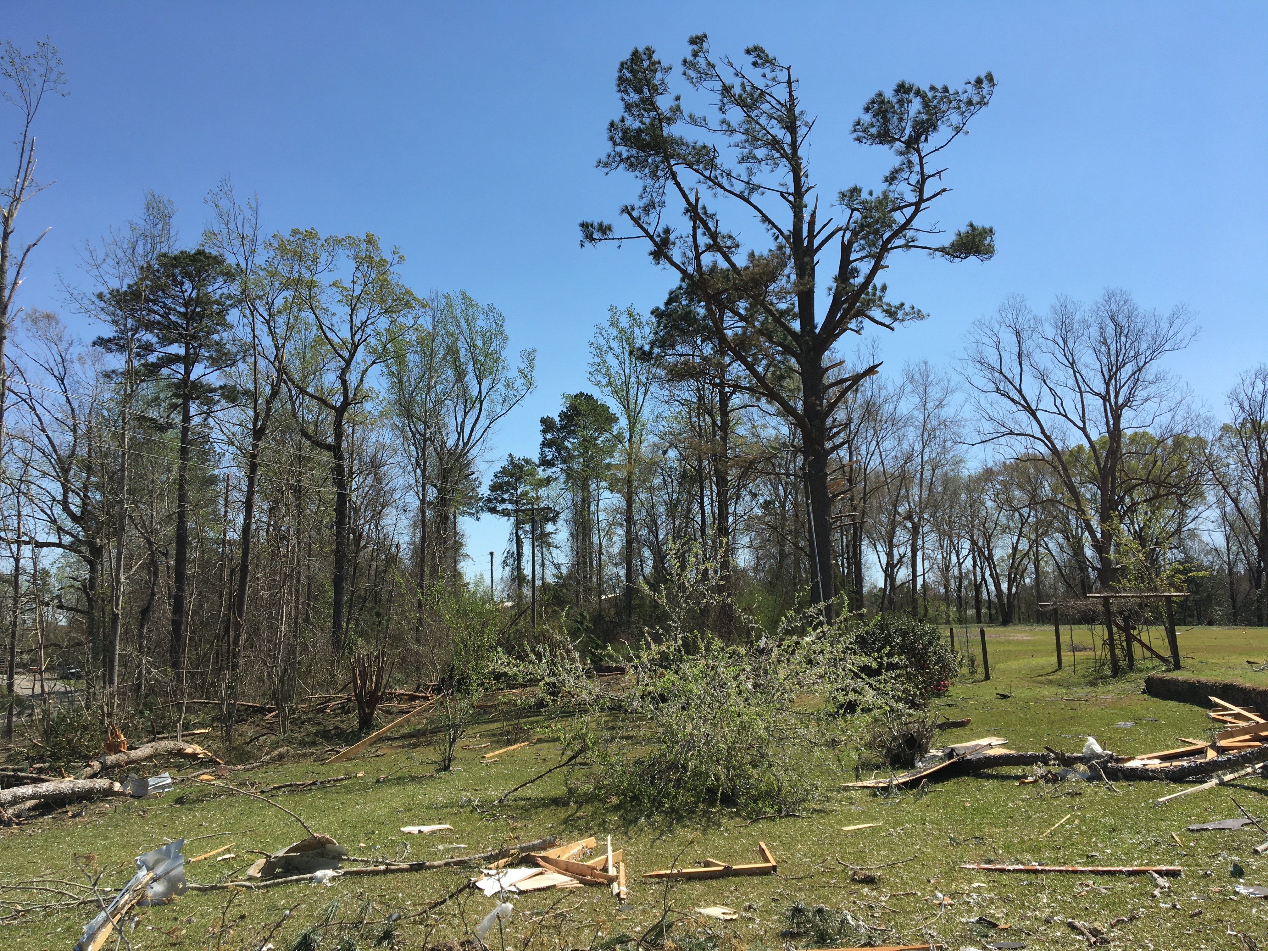
Public Information Statement
National Weather Service Mobile AL
243 PM CDT Thu May 12 2022

...NWS Damage Survey for 03/22/2022 Tornado Event...

.Update...After reviewing Sentinel satellite imagery for the March
22nd, 2022 tornado event, the Cyril, AL tornado has been upgraded
to an EF2 with winds of 120mph. This is corroborated with
previous upgrades we have done this season based on similar
evidence of extensive swaths of tree damage via Sentinel satellite
imagery.

..Cyril, AL Tornado...

Rating:                 EF2
Estimated Peak Wind:    120 mph
Path Length /statute/:  2.4582 miles
Path Width /maximum/:   300.0 yards
Fatalities:             0
Injuries:               0

Start Date:             03/22/2022
Start Time:             04:58 PM CDT
Start Location:         2 SE Cyril / Choctaw County / AL
Start Lat/Lon:          32.1601 / -88.4028

End Date:               03/22/2022
End Time:               05:03 PM CDT
End Location:           2 W Pushmataha / Choctaw County / AL
End Lat/Lon:            32.1939 / -88.3901

Survey Summary:
An EF-2 tornado began southwest of the community of Cyril, Alabama
in a forested area. The tornadoes strongest point was in this area
where a swath of extensive tree damage was noted based on Sentinel
satellite imagery. Based on this data in corroboration with other
upgrades done this season, we have raised the peak intensity of
the tornado to EF-2 with wind speeds of 120mph. The tornado began
to weaken some as it approached the community of Cyril, Alabama,
where a manufactured home was lifted and rolled into Cyril Rd just
west of Alabama SR-10. Debris from the home was scattered in the
treeline across the street. The manufactured home located next
door to the damaged home was intact with a couple of nearby large
trees snapped half way up the trunk. A nearby power pole was
uprooted as well. Numerous trees in the Cyril Rd area were
uprooted and snapped. There was minor roof damage to another
nearby home. The Cyril Rd area was the only area along the initial
tornado path that was able to be surveyed due to lack of road
access further southwest and the rest of the damage survey was
determined based on Sentinel satellite imagery. Sentinel satellite
data confirmed that the path of this tornado extended another 2+
miles to the southwest of the damage along Cyril Rd. A continuous
track with a swath of tree damage was noted in the satellite data.
Approximately 3 miles to the north-northeast of the damage along
Cyril Rd was an area of straight-line wind damage along CR 32 and
Gamma Rd. The survey team could not discern any notable
convergent pattern in the tree damage along Gamma Rd, nor did the
satellite imagery confirm a continuous track into this area. There
was also minor damage to two manufactured homes along Gamma Rd.


&&

EF Scale: The Enhanced Fujita Scale classifies tornadoes into the
following categories:

EF0...Weak......65 to 85 mph
EF1...Weak......86 to 110 mph
EF2...Strong....111 to 135 mph
EF3...Strong....136 to 165 mph
EF4...Violent...166 to 200 mph
EF5...Violent...>200 mph

NOTE:
The information in this statement is preliminary and subject to
change pending final review of the event and publication in NWS
Storm Data.
The photos below were taken during the tornado survey in the Cyril community and show the extent of the damage along the path of the tornado.
Toxey/Pleasant Hill Tornado (Choctaw County, AL)
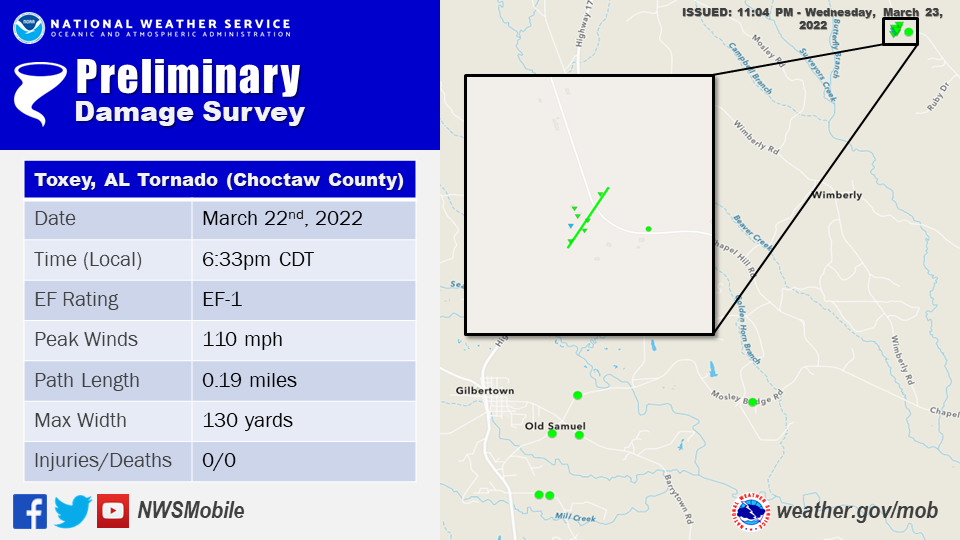 Public Information Statement
National Weather Service Mobile AL
1048 PM CDT Wed Mar 23 2022
...NWS Damage Survey for 03/22/2022 Tornado Event...
Public Information Statement
National Weather Service Mobile AL
1048 PM CDT Wed Mar 23 2022

...NWS Damage Survey for 03/22/2022 Tornado Event...
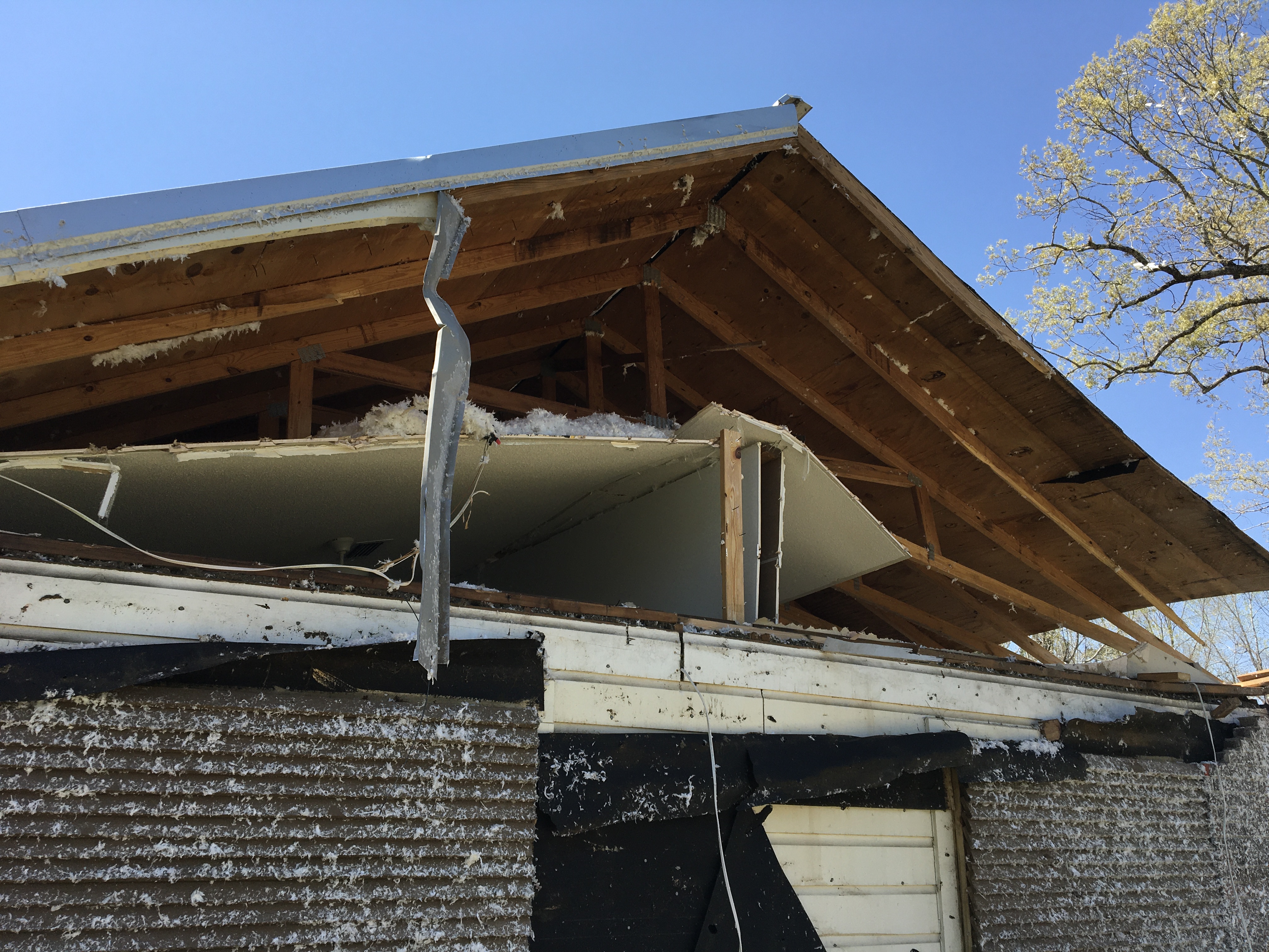
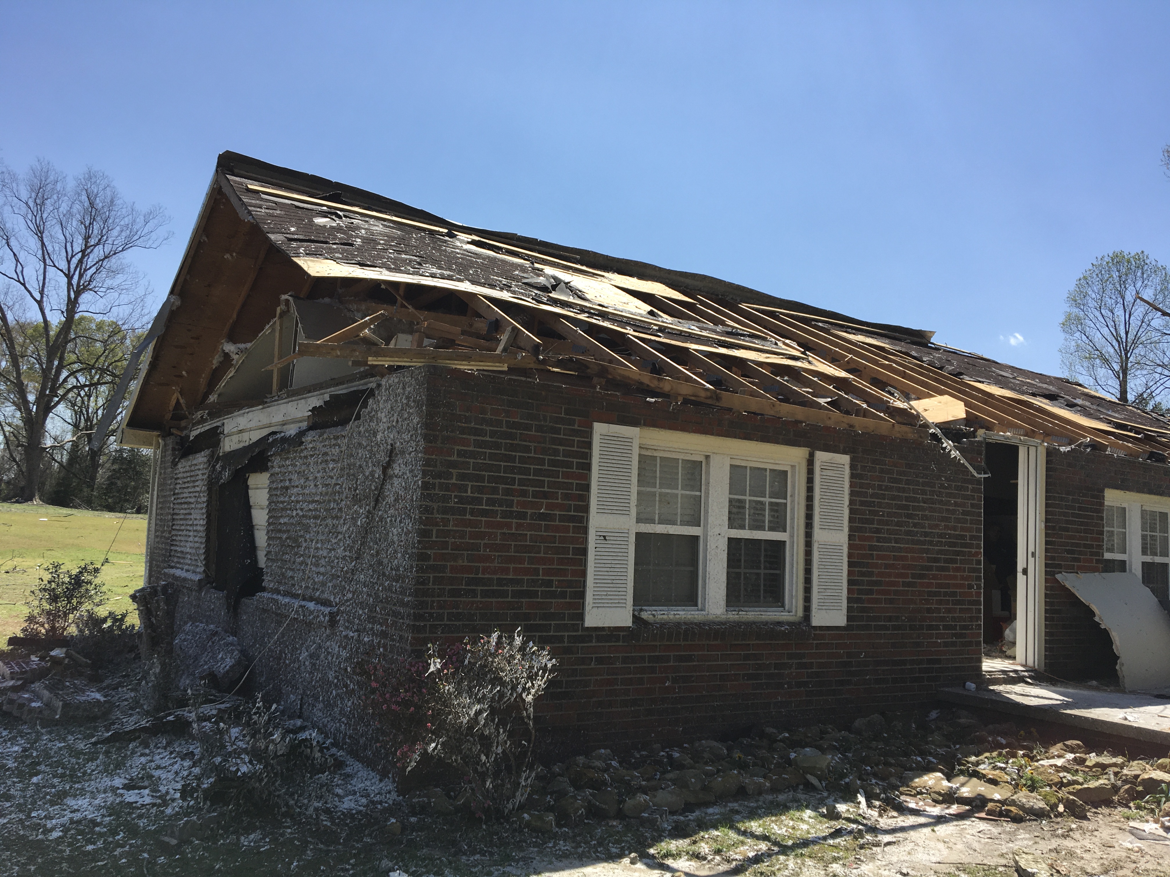
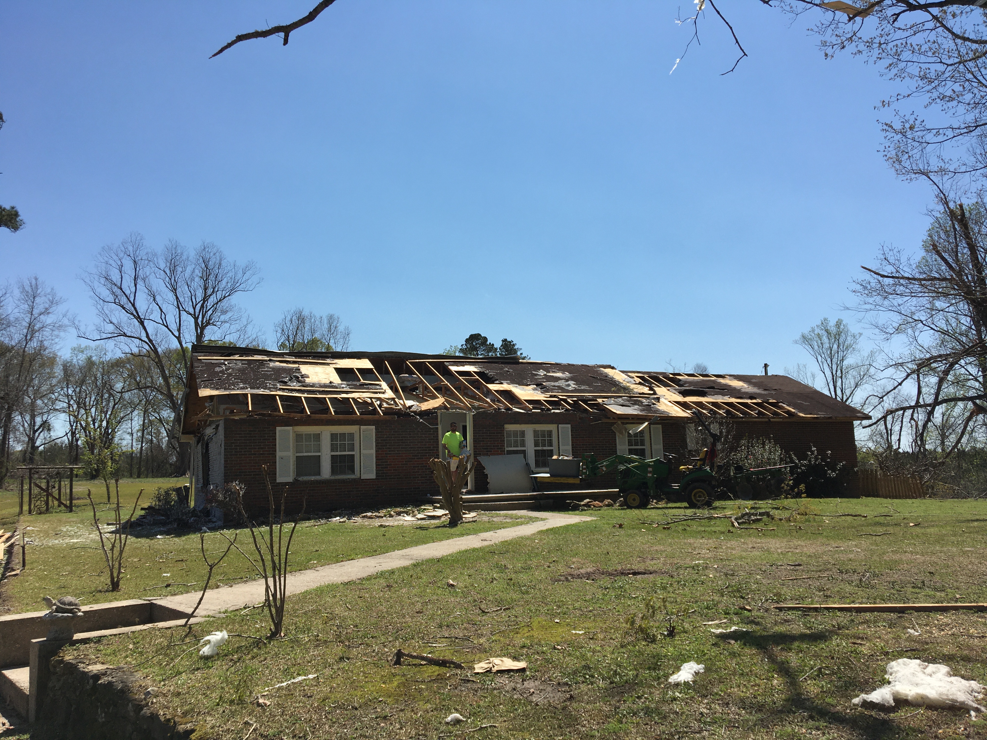
..Toxey, AL Tornado...

Rating:                 EF1
Estimated Peak Wind:    110 mph
Path Length /statute/:  0.1872 miles
Path Width /maximum/:   130.0 yards
Fatalities:             0
Injuries:               0

Start Date:             03/22/2022
Start Time:             06:33 PM CDT
Start Location:         2 NW Lou / Choctaw County / AL
Start Lat/Lon:          31.9457 / -88.2364

End Date:               03/22/2022
End Time:               06:33 PM CDT
End Location:           2 NW Lou / Choctaw County / AL
End Lat/Lon:            31.948 / -88.2347

Survey Summary:
The storm produced likely straight line wind damage east of
Alabama SR 17 in Gilbertown. Sporadic tree damage was noted along
Clarke Road, Barrytown Road, and Mosley Bridge Road. The storm
continued to progress to the northeast for six miles and
eventually produced a high-end EF-1 tornado near Pleasant Hill
Road. Numerous trees were uprooted and snapped in the area. The
roof of a manufactured home was damaged partially due to wind and
snapped trees. The manufactured home was shifted off its
foundation and the nearby carport and shed were heavily damaged.
The tornado went on to lift the metal roof off the back end of a
nearby home. This resulted in substantial loss of its roofing. In
addition, the force of the wind moving through the home pushed the
front walls outward and blew out the front windows and part of
the roof frame. The debris from the home was lofted into the tops
of the trees across the road, with metal wrapped around trees.
While this was determined to be a short-lived tornado, its path
could have extended farther northeast; however, the survey team
could not assess any further damage due to the lack of road
access.

&&

EF Scale: The Enhanced Fujita Scale classifies tornadoes into the
following categories:

EF0...Weak......65 to 85 mph
EF1...Weak......86 to 110 mph
EF2...Strong....111 to 135 mph
EF3...Strong....136 to 165 mph
EF4...Violent...166 to 200 mph
EF5...Violent...>200 mph

NOTE:
The information in this statement is preliminary and subject to
change pending final review of the events and publication in NWS
Storm Data.
The photos below were taken during the tornado survey in the Toxey community and show the extent of the damage along the path of the tornado.
Summerdale Tornado (Baldwin County, AL)
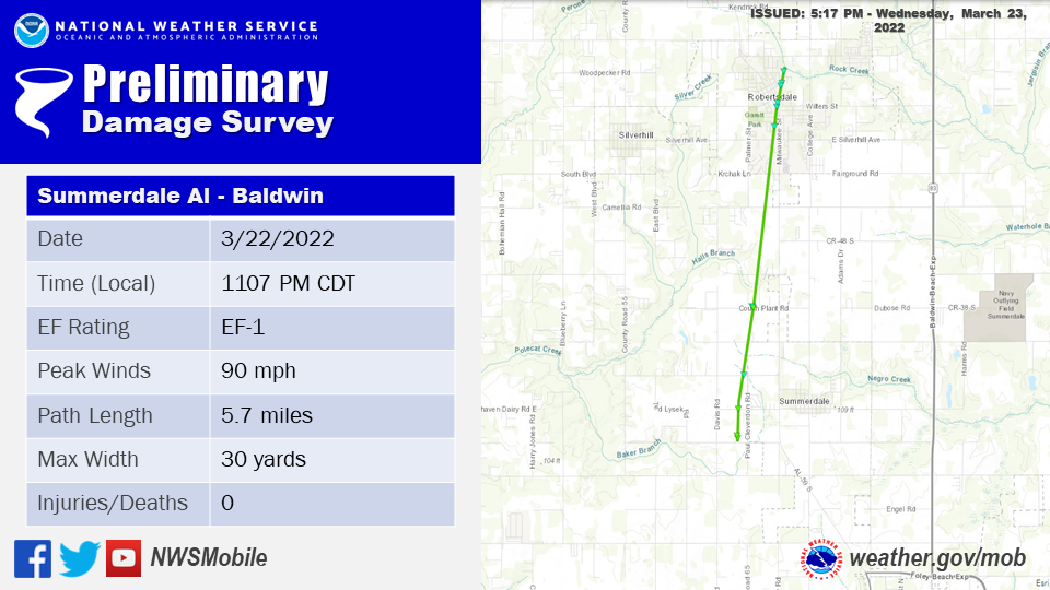
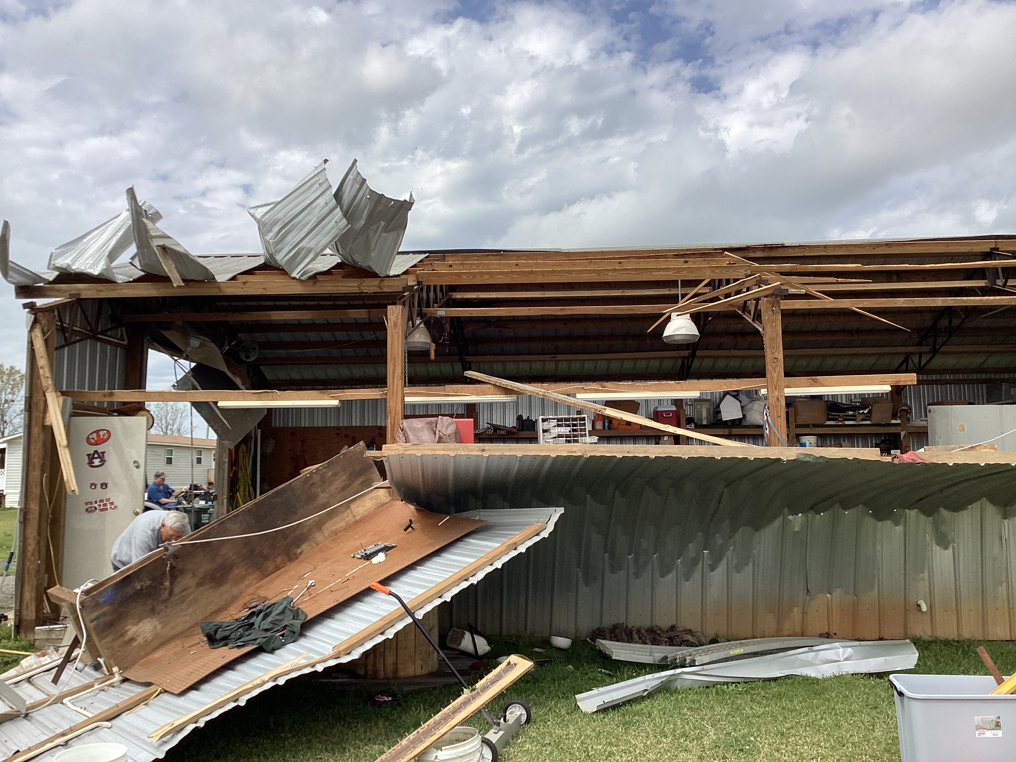
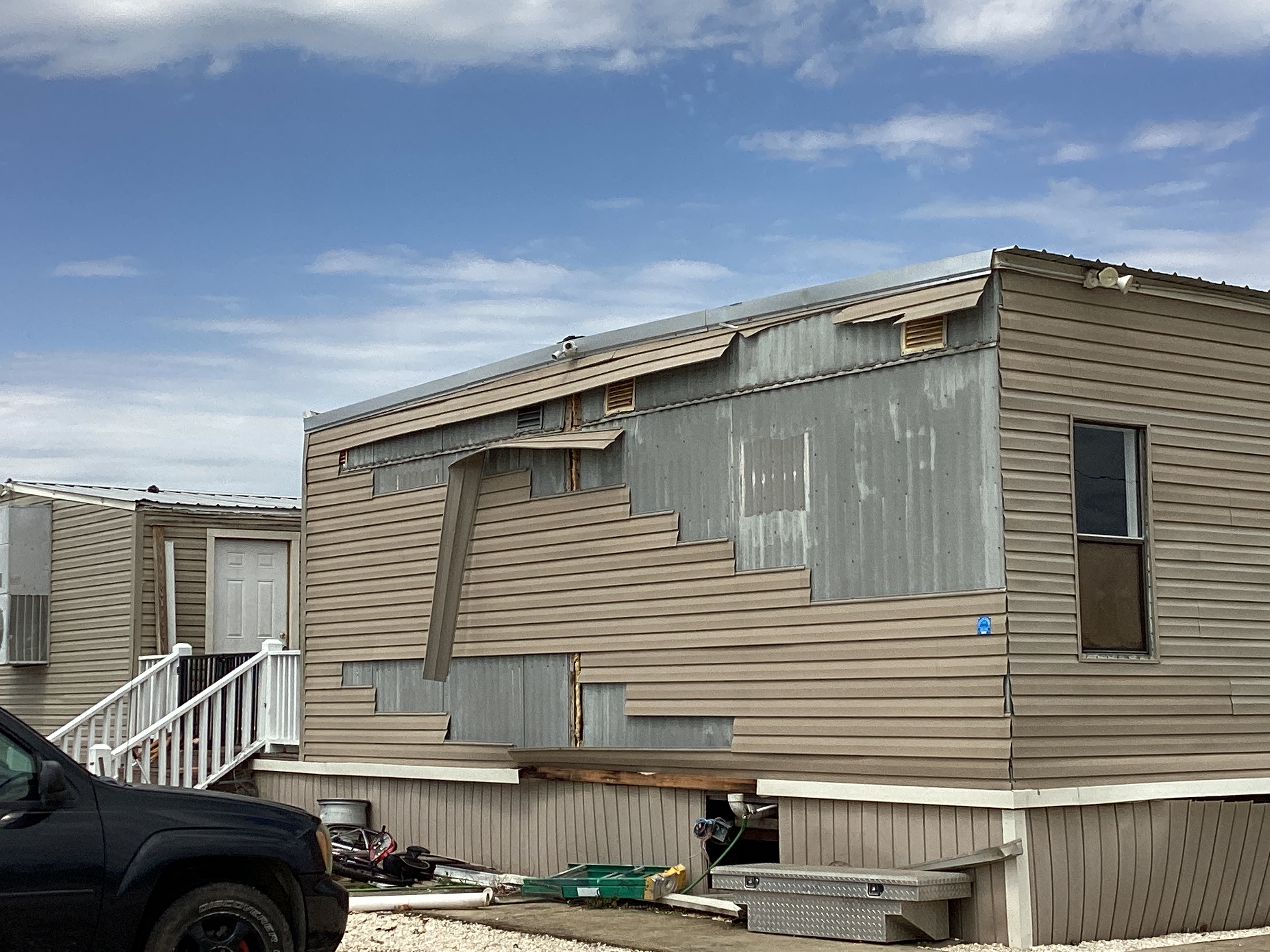
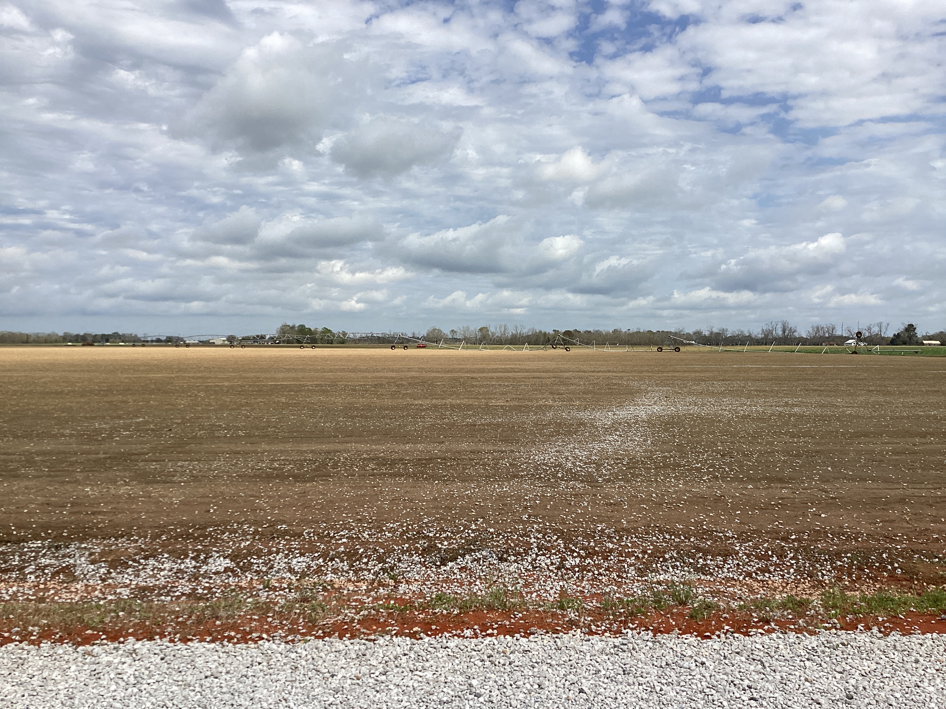
Public Information Statement
National Weather Service Mobile AL
511 PM CDT Wed Mar 23 2022

...NWS Damage Survey for 03/22/22 Baldwin County AL Tornado...

..Summerdale to Robertsdale AL Tornado...

Rating:                 EF1
Estimated Peak Wind:    90 mph
Path Length /statute/:  5.7 miles
Path Width /maximum/:   30.0 yards
Fatalities: 0
Injuries: 0

Start Date:             03/22/2022
Start Time:             11:07 PM CDT
Start Location:         1 WSW Summerdale / Baldwin County / AL
Start Lat/Lon:          30.4798 / -87.7198

End Date:               03/22/2022
End Time:               11:16 PM CDT
End Location:           1 NNE Robertsdale / Baldwin County / AL
End Lat/Lon:            30.5613 / -87.7067

Survey Summary:
A compact EF1 tornado touched down at approximately 11:07 PM CDT
3/22/22 on CR-34 S affecting a residence in Summerdale where a
storage building experienced damage to its walls and roofing
material removed. The tornado quickly moved north impacting a
wooded area just past the residence where multiple hardwood trees
were snapped/uprooted supporting its peak intensity around 90 mph.
This tornado then crossed Wynn Road before overturning/mangling a
couple irrigation systems. The tornado began to weaken after this
and damage became sporadic as it tracked north-northeast with
pockets of EF0 damage being done to residential structures and
trees until it reached Robertsdale. Once in Robertsdale the
tornado continued to produce EF0 damage peeling back roofing
material of small retail buildings by 11:14 PM CDT. The tornado
began to narrow considerably as it tracked into northeastern
Robertsdale knocking down large tree limbs and overturning a shed.
The tornado lifted in northeastern Robertsdale off of Baldwin
Street at 11:16 PM CDT.


&&

EF Scale: The Enhanced Fujita Scale classifies tornadoes into the
following categories:

EF0...Weak......65 to 85 mph
EF1...Weak......86 to 110 mph
EF2...Strong....111 to 135 mph
EF3...Strong....136 to 165 mph
EF4...Violent...166 to 200 mph
EF5...Violent...>200 mph

NOTE:
The information in this statement is preliminary and subject to
change pending final review of the event and publication in NWS
Storm Data.
The photos below were taken during the tornado survey in the Summerdale community and show the extent of the damage along the path of the tornado.

Additional Information
SPC Storm Report Archive
RAMMB-CIRA Satellite Library for the late March Severe Outbreak
NWS Local Write-Ups and Webpages:NWS New Orleans
NWS Birmingham
Acknowledgements: Page created by Christina Leach (Forecaster) and Morgan Barry (Forecaster). Page updated by Caitlin Baldwin (Forecaster).
LAST UPDATED: March 2024

