
Late November Tornado Event
November 29th and 30th, 2022
Summary of all Local Storm Reports (LSRs) on November 29th and 30th, as well as all the LSRs across the region for this event.
The storm survey team preliminarily concluded that there was one EF-3 tornado that occurred in our forecast area that began in Greene County, MS and lifted in Washington County, AL.
The data provided on this page are considered preliminary as we continue to analyze all available data. We will add more information to this page and social media as it becomes available. We thank you in advance for your patience.
----- IMPORTANT 2023 UPDATE -----
Significant updates were made to several tornado tracks and wind swaths impacting the NWS Mobile/Pensacola area in the 2018 to 2023 timeframe thanks to the introduction of high-resolution Sentinel, Worldview, and Planet satellite imagery. One or multiple tornado tracks/wind swaths listed on this event webpage were updated in 2023.
An updated graphic and details surrounding these significant updates can be found further down on this webpage in the section for that specific tornado track or wind swath. More information on this Local Tornado Reanalysis Project and a list of all updates can be found on our webpage at weather.gov/mob/TornadoReanalysis or the National Damage Viewer.
Here is a list of the significant updates:
1. November 30, 2022 - Updated Tornado - Greene County, MS and Washington County, AL: The overall track of the tornado that began in Greene County, MS and ended in Washington County, AL received cosmetic updates based on Planet satellite imagery. A deviation in the tornado motion was noted near the middle of the track (just west of Fruitdale) with several EF1 and EF2 points added based on Worldview satellite imagery. The maximum width was updated to approximately 700 yards, but the EF3 intensity remains the same.
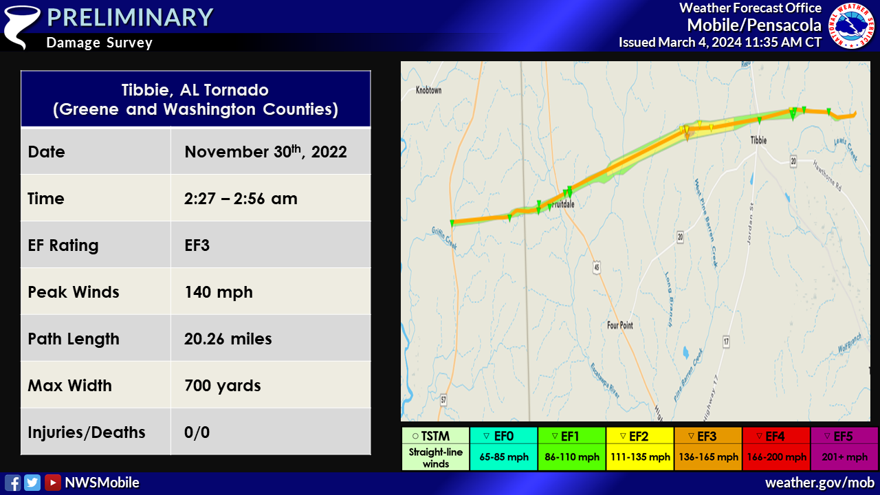
Tibbie Tornado (Greene County, MS and Washington County, AL)
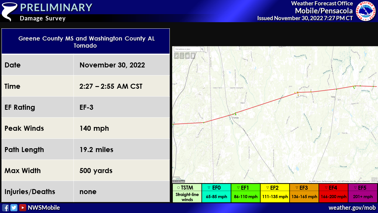
Public Information Statement
National Weather Service Mobile AL
659 PM CST Wed Nov 30 2022

...NWS Damage Survey for 11/30/22 Tornado Event...

..Greene County MS to Washington County AL Tornado...

Rating:                 EF3
Estimated Peak Wind:    140 mph
Path Length /statute/:  19.15 miles
Path Width /maximum/:   500 yards
Fatalities:             0
Injuries:               0

Start Date:             11/30/2022
Start Time:             02:27 AM CST
Start Location:         3 SSE Knobtown / Greene County / MS
Start Lat/Lon:          31.3351 / -88.5049

End Date:               11/30/2022
End Time:               02:55 AM CST
End Location:           3 N Seaboard / Washington County / AL
End Lat/Lon:            31.3714 / -88.1853

Survey Summary:

The tornado began near Highway 57 in Greene County where several
softwood tree trunks were snapped. It continued on an east
northeast track producing damage along Nursery Road. The track
continued into Washington County Alabama. The tornado crossed
Highway 45 and hit Fruitdale High School where windows were
damaged along with roof damage to the school and nearby houses.
Widespread tree and power line damage was also observed in the
Fruitdale area. The damage in Fruitdale is estimated to have been
in the high EF-1 range with winds 105-110 mph. The tornado
continued northeast and strengthened as it approached Baxter
McIllwain Road. This is where the tornado reached peak intensity.
Based on the ground survey, a nearly 500 yard swath of major tree
damage was observed with countless hardwood and softwood trees
destroyed. The EF-3 peak intensity (140 mph) is based on this
swath of major tree damage. The tornado continued to track
eastward through Tibbie with more significant to major tree
damage (EF-2 intensity), along with roof damage observed along
Leo and Boyd Willie Parnell Road. The tornado weakened as it moved
east across Howardtown Road and dissipated east of Clarke Place
Road.

In the coming days, available high resolution satellite imagery
will be analyzed and adjustments to the track are possible.

&&

EF Scale: The Enhanced Fujita Scale classifies tornadoes into the
following categories:

EF0...Weak......65 to 85 mph
EF1...Weak......86 to 110 mph
EF2...Strong....111 to 135 mph
EF3...Strong....136 to 165 mph
EF4...Violent...166 to 200 mph
EF5...Violent...>200 mph

NOTE:
The information in this statement is preliminary and subject to
change pending final review of the event and publication in
NWS Storm Data.
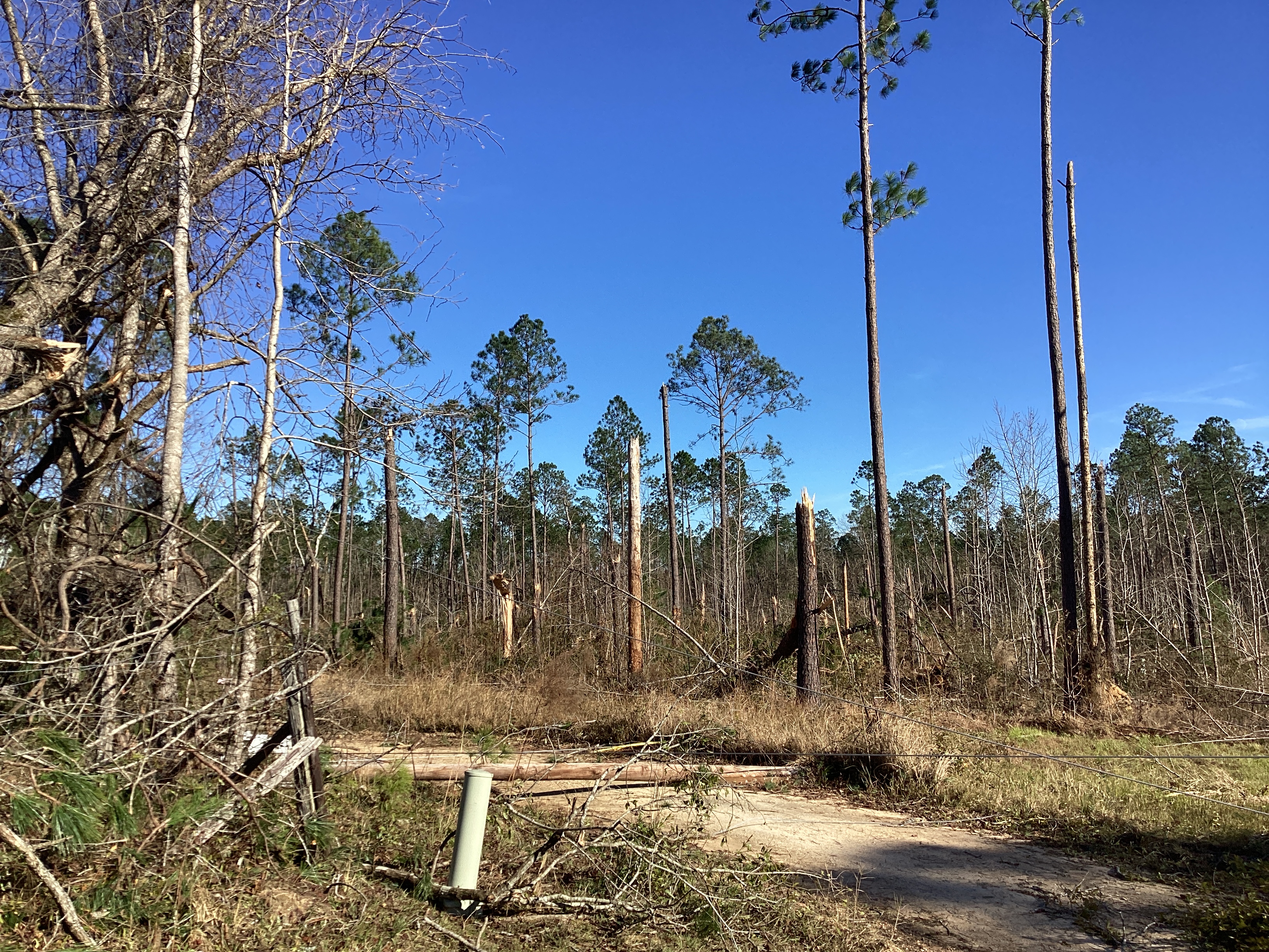
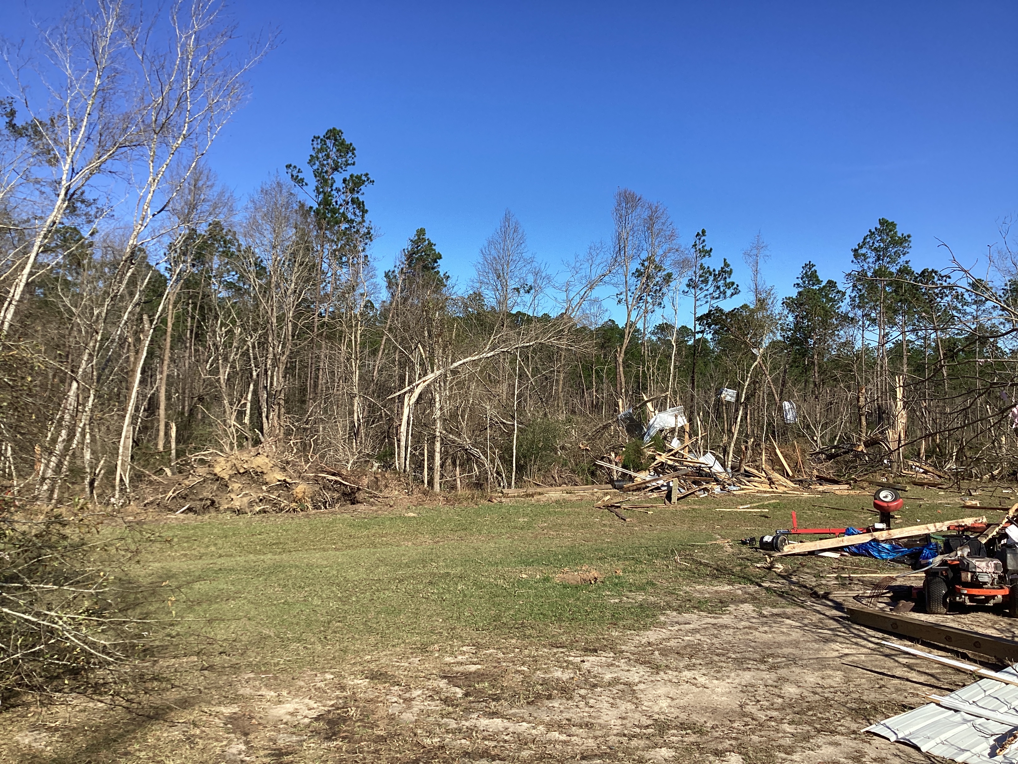
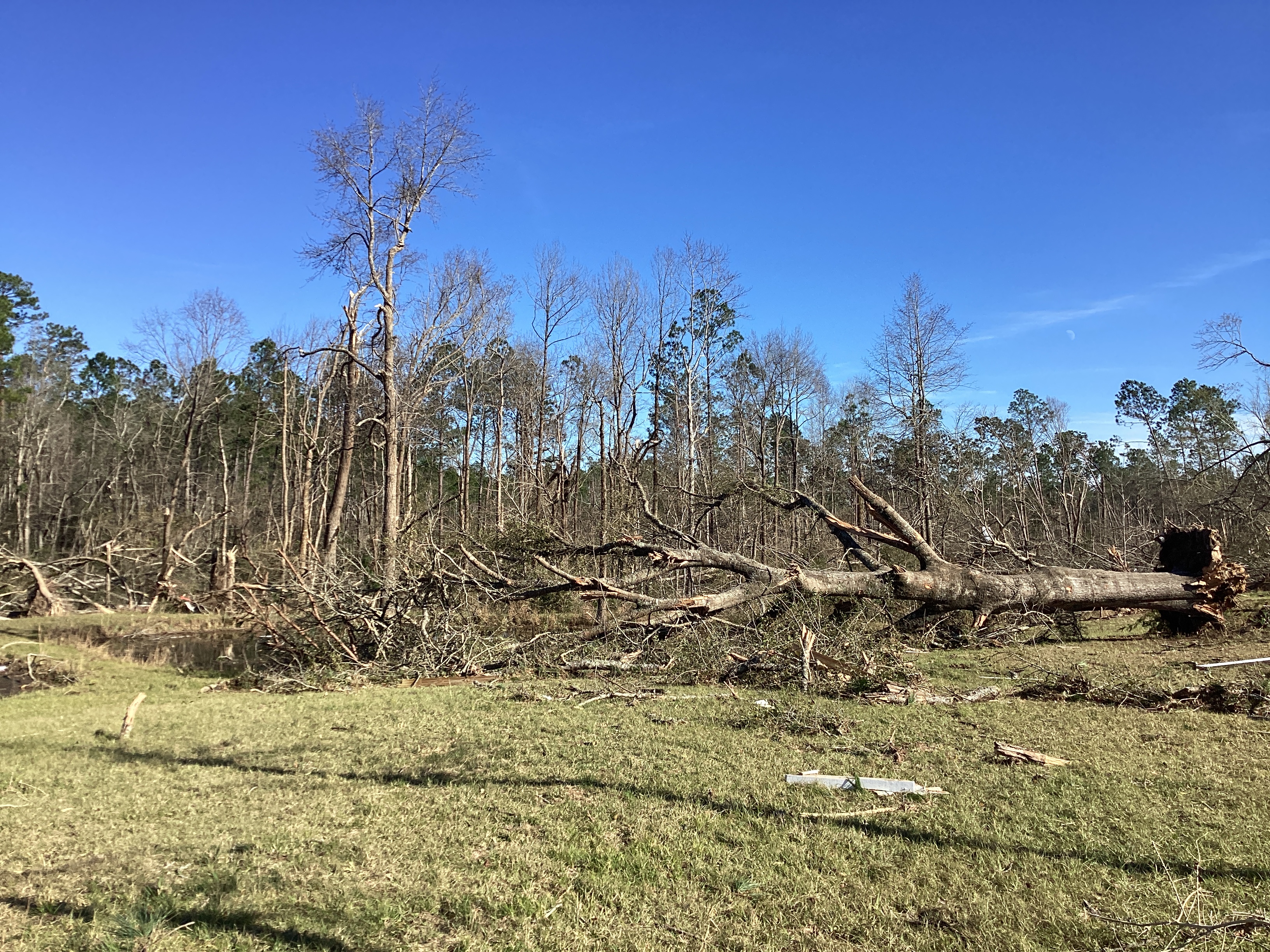
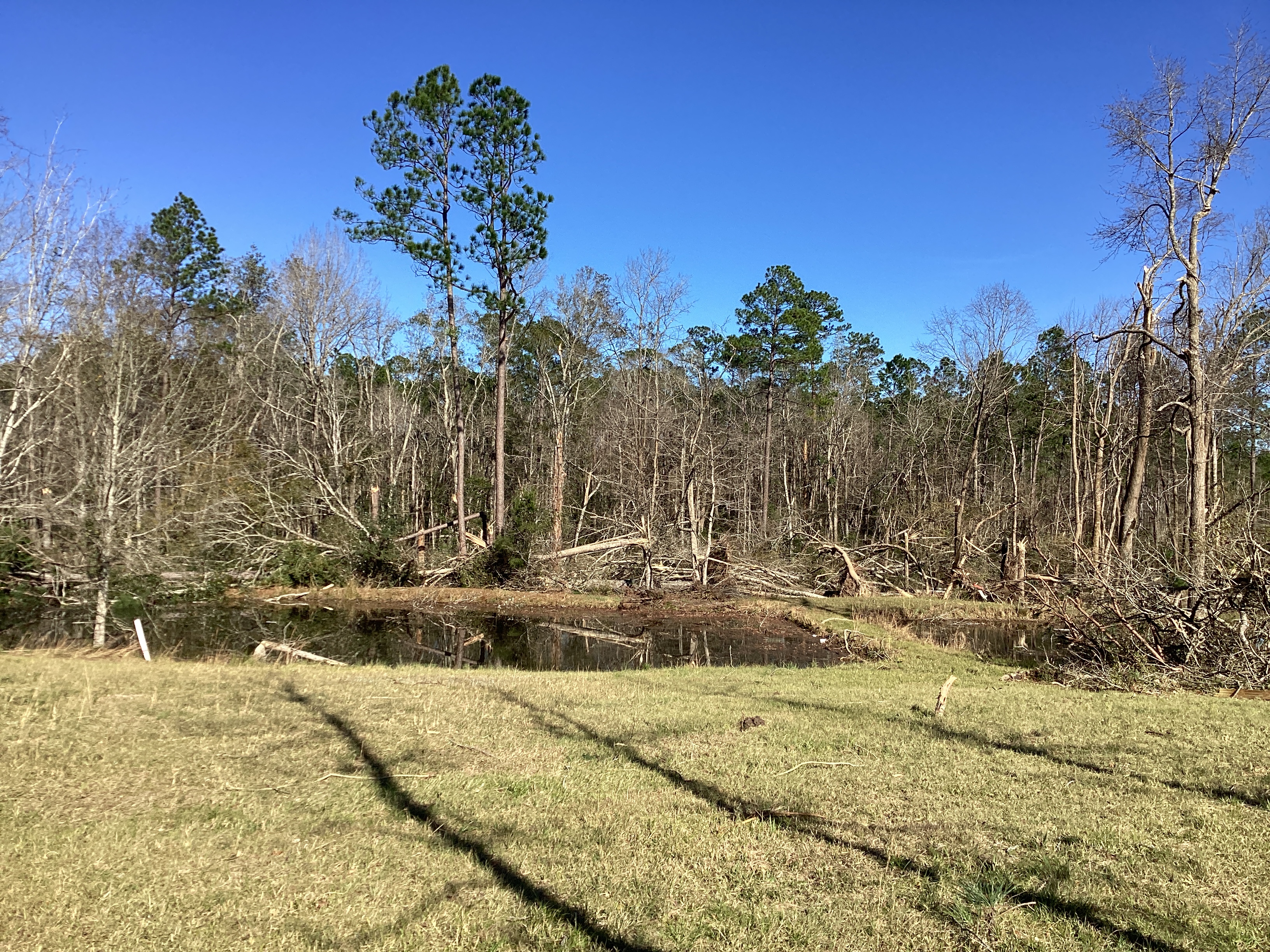
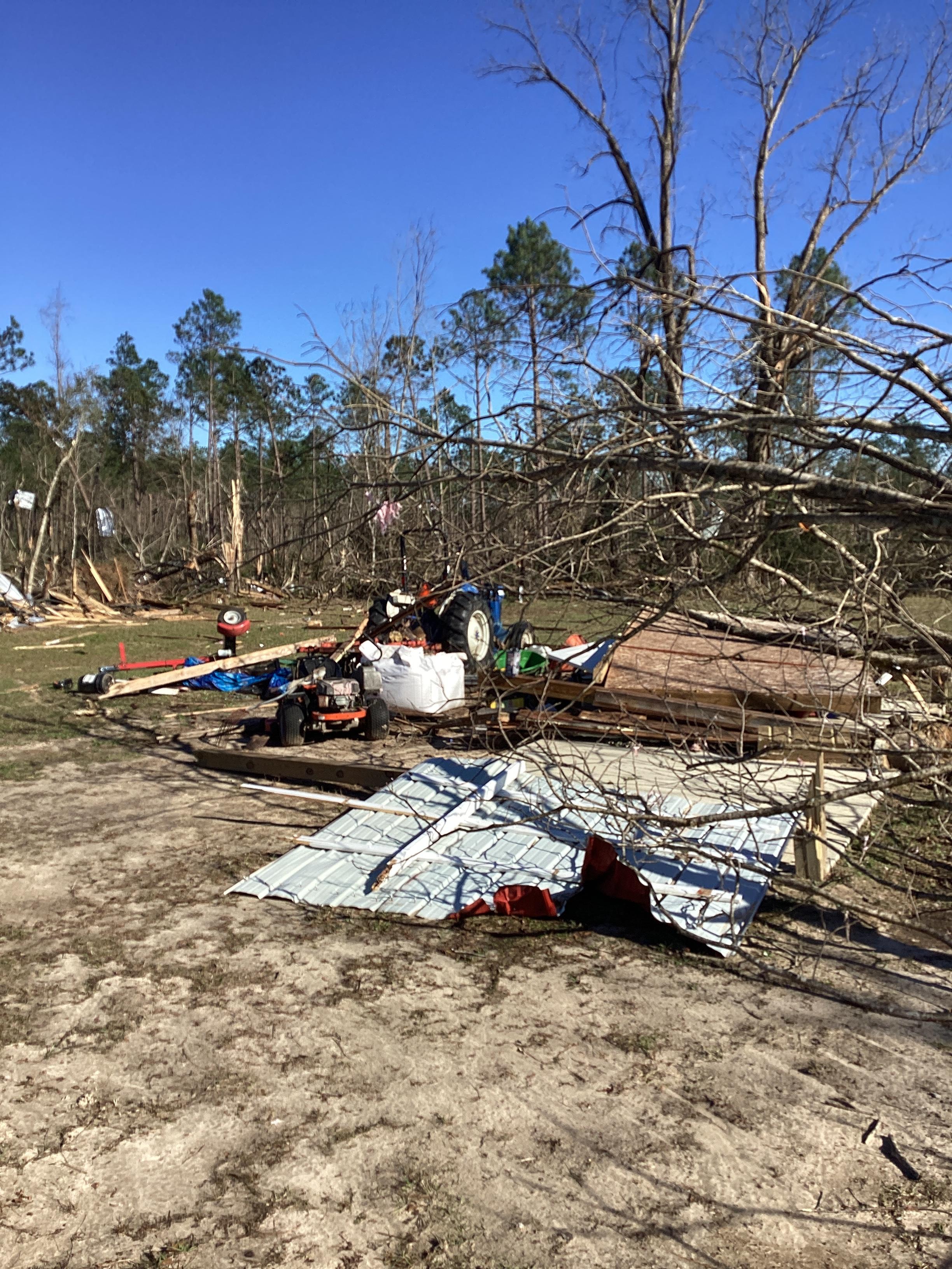
The photos below were taken during the tornado survey in between the Fruitdale and Tibbie communities (Washington County in Alabama) and show the extent of the significant tree damage along the path of the tornado.


Additional Information
SPC Storm Report Archive (29th and 30th)
NWS Local Write-Ups and Webpages:
NWS Jackson, MS
NWS New Orleans
NWS Birmingham
NWS Tallahassee
Acknowledgements: Page created and updated by Morgan Barry (Lead Forecaster). Updated by Michael Mugrage (Forecaster)
LAST UPDATED: March 2024

