An area of low pressure is expected to form over the northeast Gulf this weekend. Some slow development of this system is possible as it slowly moves northeastward.
For more information, visit our social media pages at Facebook and X pages or listen to a NOAA Weather Radio. Stay weather aware!
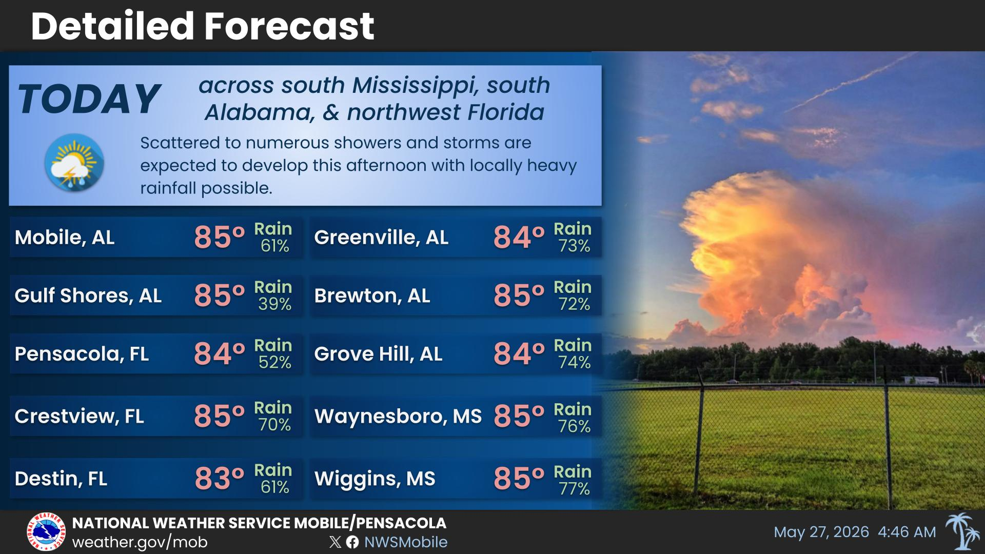
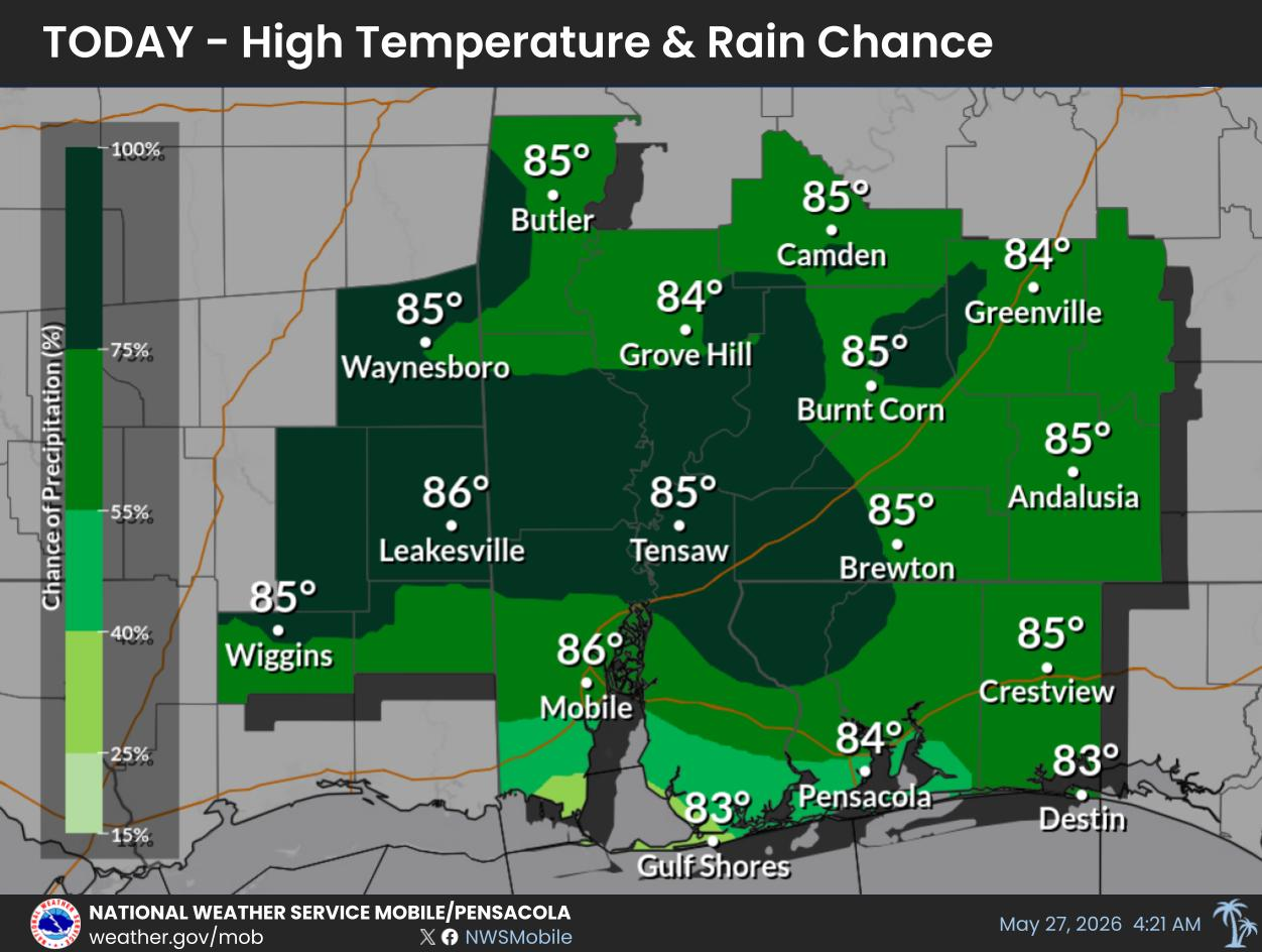
Much drier weather conditions prevail through the rest of this week with generally isolated storm coverage any given day. Better chances for showers and storms return this weekend. High temperatures in the upper 80's and lower 90's today warm to the lower to middle 90's by late week into the weekend.
For more information, visit our social media pages at Facebook and X pages or listen to a NOAA Weather Radio. Stay weather aware!
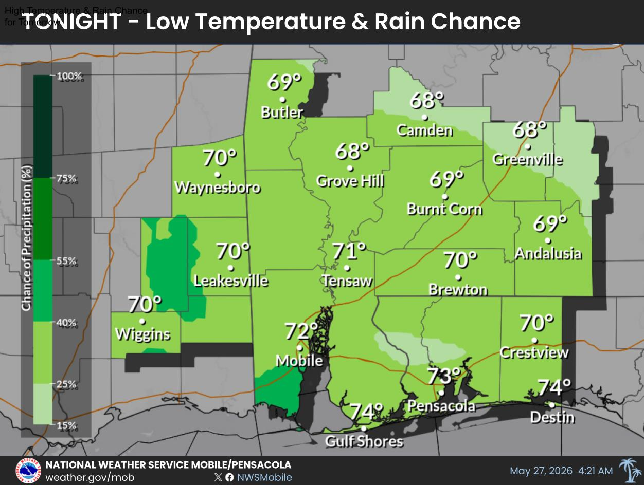
Low Temperatures & Rain Chances for Tonight.
For more information, visit our social media pages at Facebook and X pages or listen to a NOAA Weather Radio. Stay weather aware!
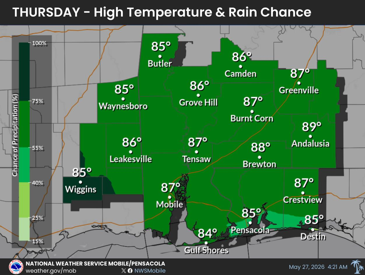
High Temperatures & Rain Chances for Thursday.
For more information, visit our social media pages at Facebook and X pages or listen to a NOAA Weather Radio. Stay weather aware!
Low Temperatures & Rain Chances for Thursday Night.
For more information, visit our social media pages at Facebook and X pages or listen to a NOAA Weather Radio. Stay weather aware!


 Local Radar
 Weather Map
 Satellite Imagery
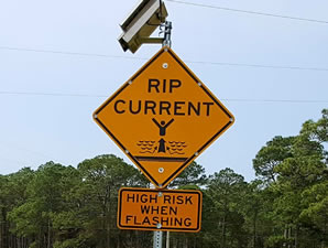 Beach and Surf
 Tropical Weather
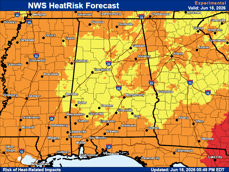 Heat Risk
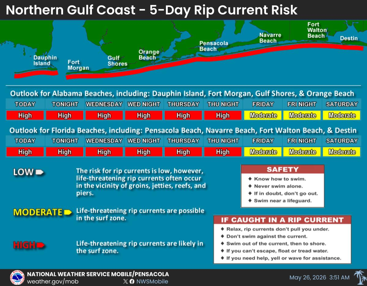
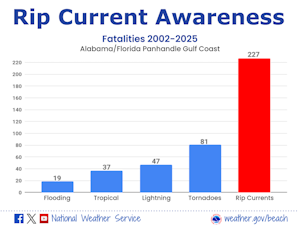 Rip Current Awareness
 Local Forecast Maps