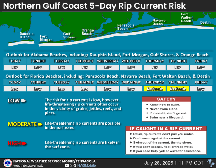
An area of low pressure currently over the northern Gulf will continue to push west through late week. If it can make it offshore, conditions are generally favorable for additional development, and a tropical depression could form later this week. There is a 40% chance of development over the next 2 days and a 40% chance of development over the next 7 days. Regardless of development, heavy rain could lead to flooding concerns today through Friday and there is a HIGH risk of rip currents for Thursday and Friday. Continue to monitor updates from NWS Mobile/Pensacola, the National Hurricane Center, and other reliable sources. For more information, visit our social media pages at Facebook and X pages or listen to a NOAA Weather Radio. Stay weather aware!
Periods of showers and thunderstorms, some heavy at times are expected through Friday night. Some localities may see several thunderstorms passing in a short amount of time, causing localized flooding.


 Local Radar
 Weather Map
 Satellite Imagery
 Tropical Weather
 Local Forecast Maps
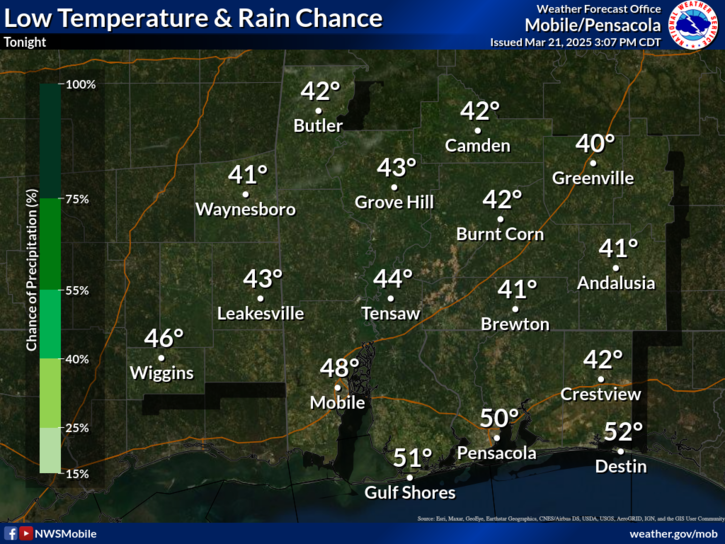
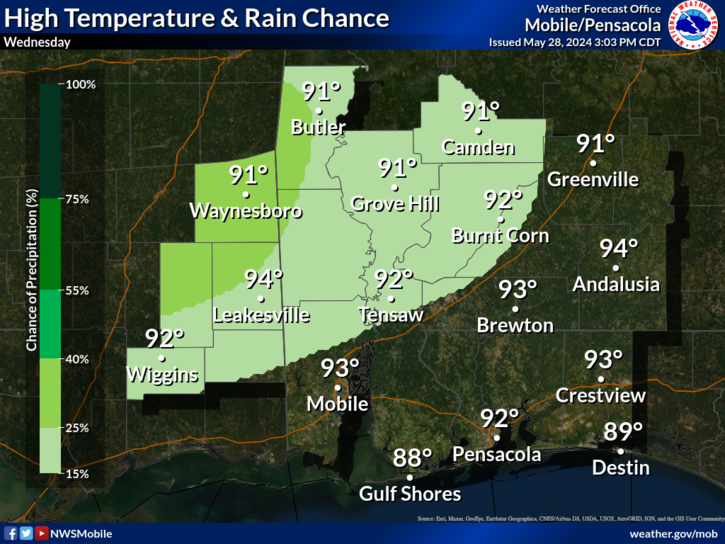