Tropical Storm Arthur has formed near the Texas coast. The remnants of Arthur will bring significant impacts to the local area beginning early tomorrow morning, including widespread flash flooding.
For more information, visit our social media pages at
Facebook and
X pages or listen to a NOAA Weather Radio. Stay weather aware!


 Local Radar
 Weather Map
 Satellite Imagery
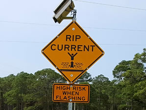 Beach and Surf
 Tropical Weather
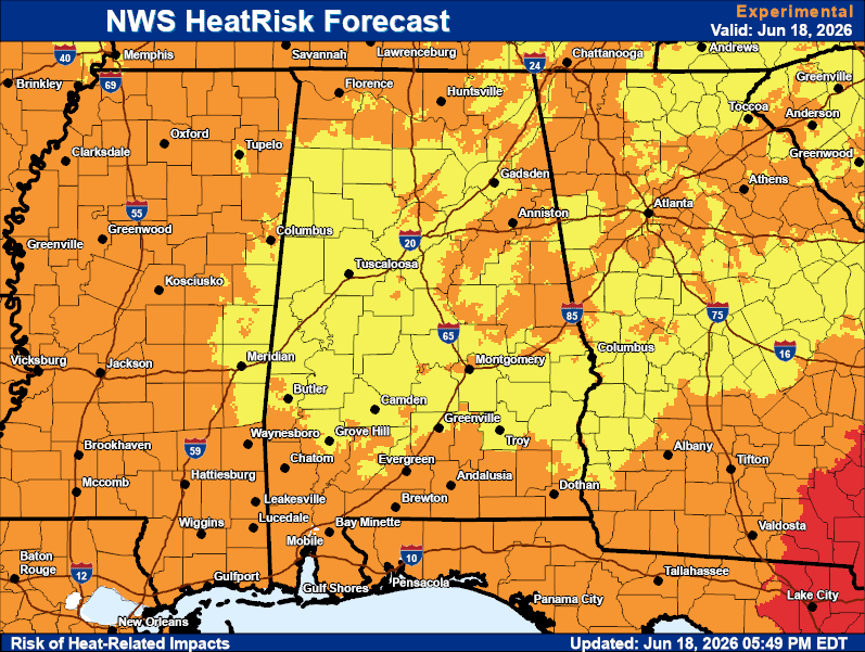 Heat Risk
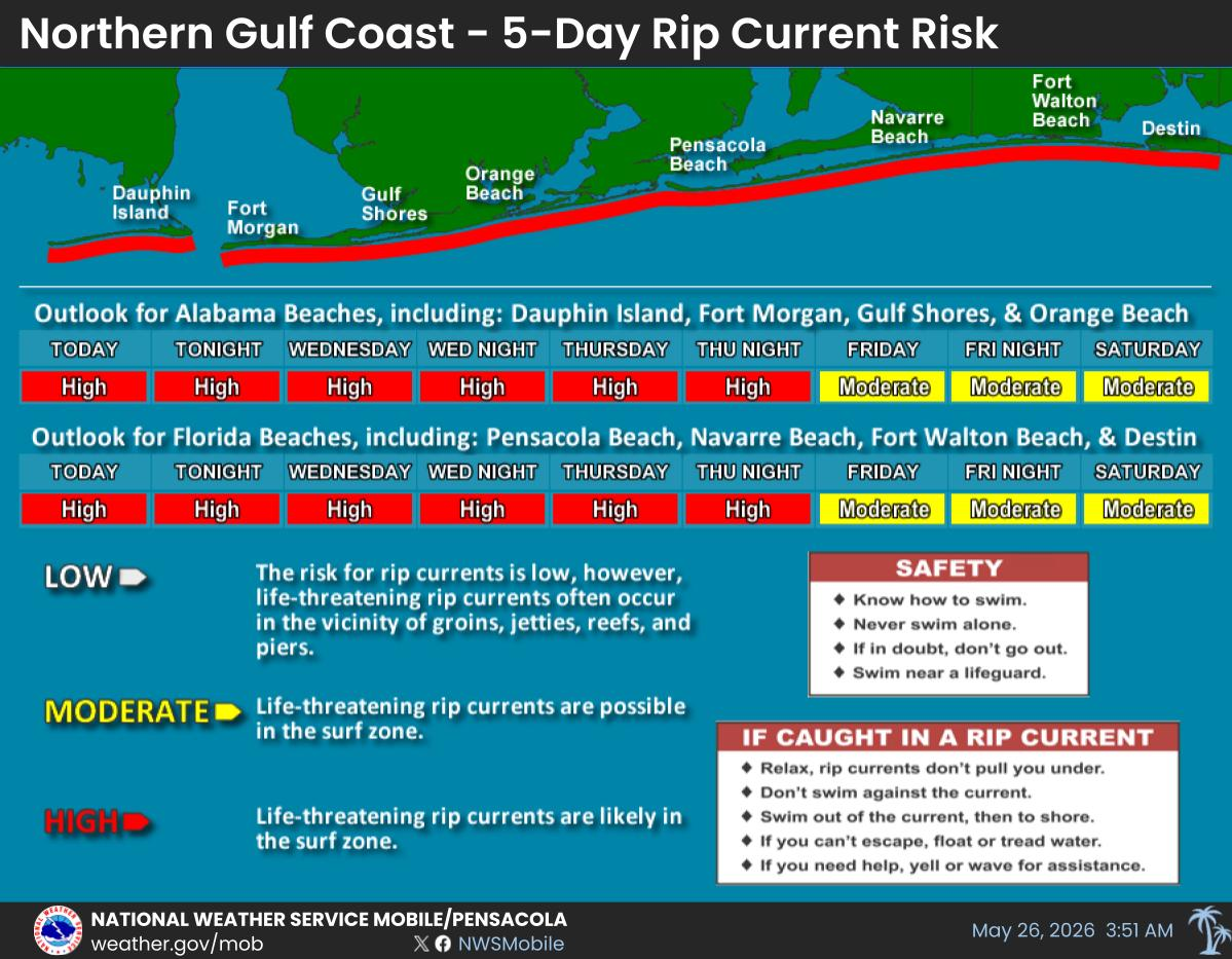
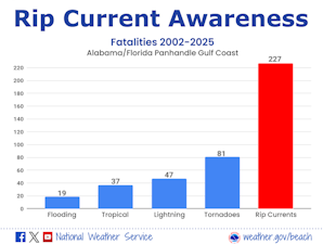 Rip Current Awareness
 Local Forecast Maps
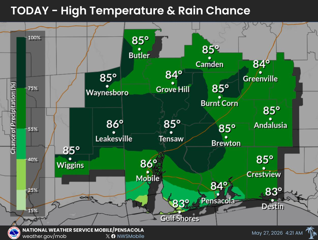
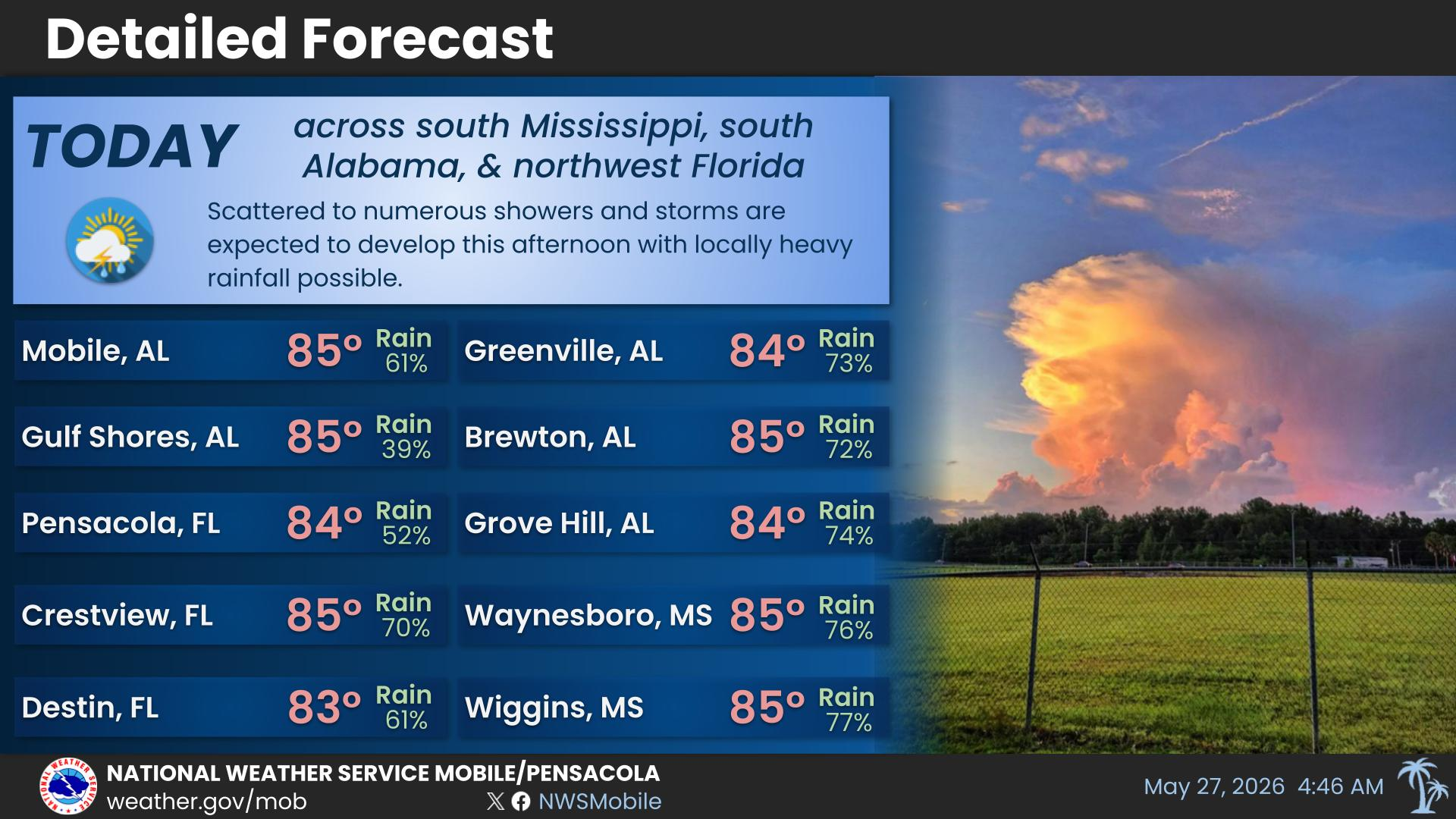
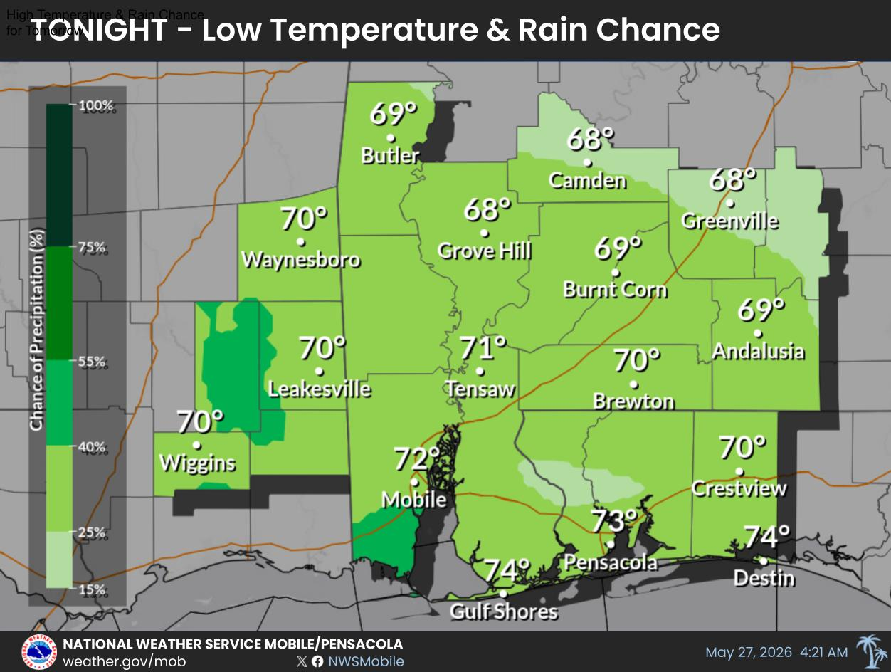
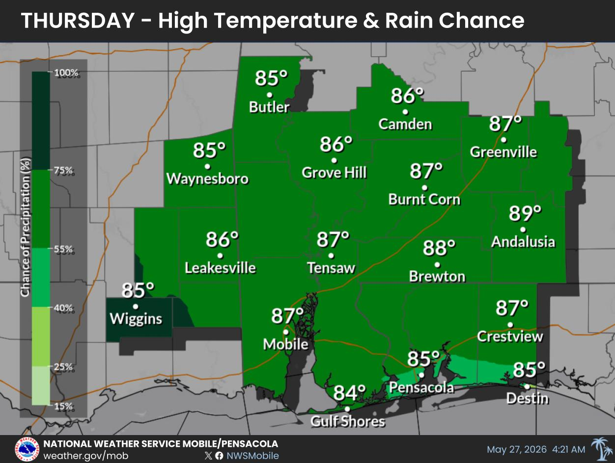