|
Severe Weather Heavy Rain & Flooding Drought Extreme Heat Winter: Snow Ice Cold |
||
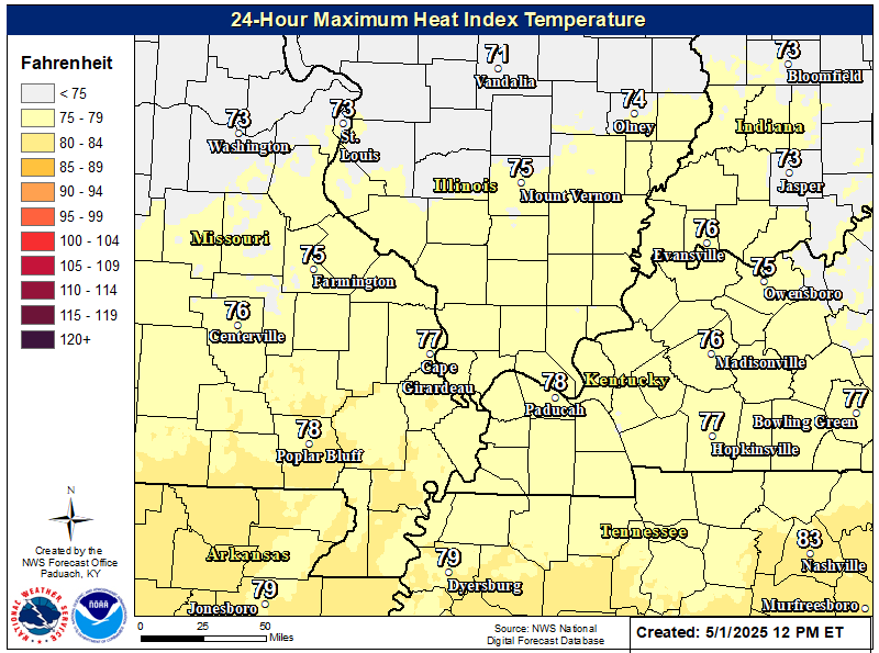
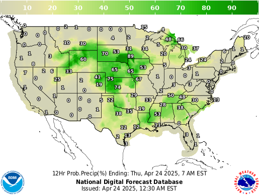
| Satellite | Maximum Heat Index Forecast | Graphical Forecast |
 |
 |
 |
| Current Weather | Forecast Maps | |
 |
 |
|
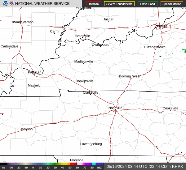
| Paducah Radar | Evansville Radar | Fort Campbell Radar |
 |
 |
 |
| Weather Story | Current Hazards | Graphical Nowcast |
 |
 |
| Weather Information: Watches, Warnings, Forecast Products, etc. | |
|
General Forecast Products |
Other Local Products |
|
Miscellaneous Products |
Latest Weather Observations |
| Climate Prediction Center (CPC) Graphics | |||
| Information & Forecasts from the Climate Prediction Center (CPC) | |||
| Drought Information | |||
|
|
|
|
|
| Temperature Outlooks | |||
|
|
|
|
|
| Precipitation Outlooks | |||
|
|
|
|
|
| Safety and Preparedness | |
|
|
|
| Criteria for Extreme Heat Products Issued by WFO Paducah | |
|
|
|
|
| Heat Index Chart | |
 |
|
|
Heat Index 90°-105° |
Sunstroke, heat cramps, and heat exhaustion possible with prolonged physical activity |
|
Heat Index 105°-130° |
Sunstroke, heat cramps, or heat exhaustion likely, and heatstroke possible with prolonged exposure and/or physical activity |
|
Heat Index 130° and higher |
Heatstroke and/or sunstroke highly likely with continued exposure |
| IMPORTANT: Since heat index values were devised for shady, light wind conditions, exposure to full sunshine can increase heat index values by up to 15°F. The combination of strong winds with very hot, dry air can also be extremely dangerous. | |


