|
Severe Weather Heavy Rain & Flooding Drought Extreme Heat Winter: Snow Ice Cold |
||
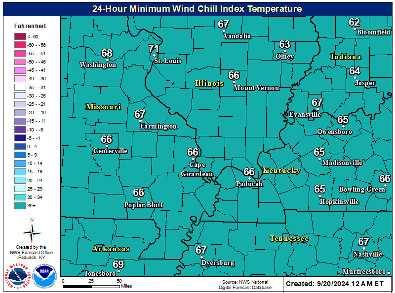
| Satellite | Minimum Wind Chill Forecast | Graphical Forecast |
 |
 |
 |
| Current Weather | Forecast Maps | |
 |
 |
|
| Paducah Radar | Evansville Radar | Fort Campbell Radar |
 |
 |
 |
| Weather Story | Current Hazards | Graphical Nowcast |
 |
 |
| Weather Information: Watches, Warnings, Storm Reports, Forecast Products, etc. | |
|
General Forecast Products |
Other Local Products |
|
Road Condition Pages |
Latest Weather Observations |
| Weather Prediction Center (WPC) Forecasts | ||
| WPC Composite Charts | ||
|
Day 1
|
Day 2
|
Day 3
|
| WPC Freezing Rain Probability Forecasts | ||
|
Day 1
|
Day 2
|
Day 3
|
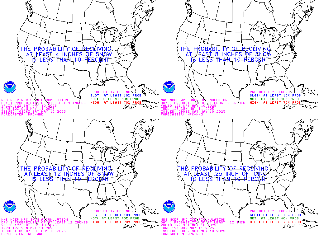
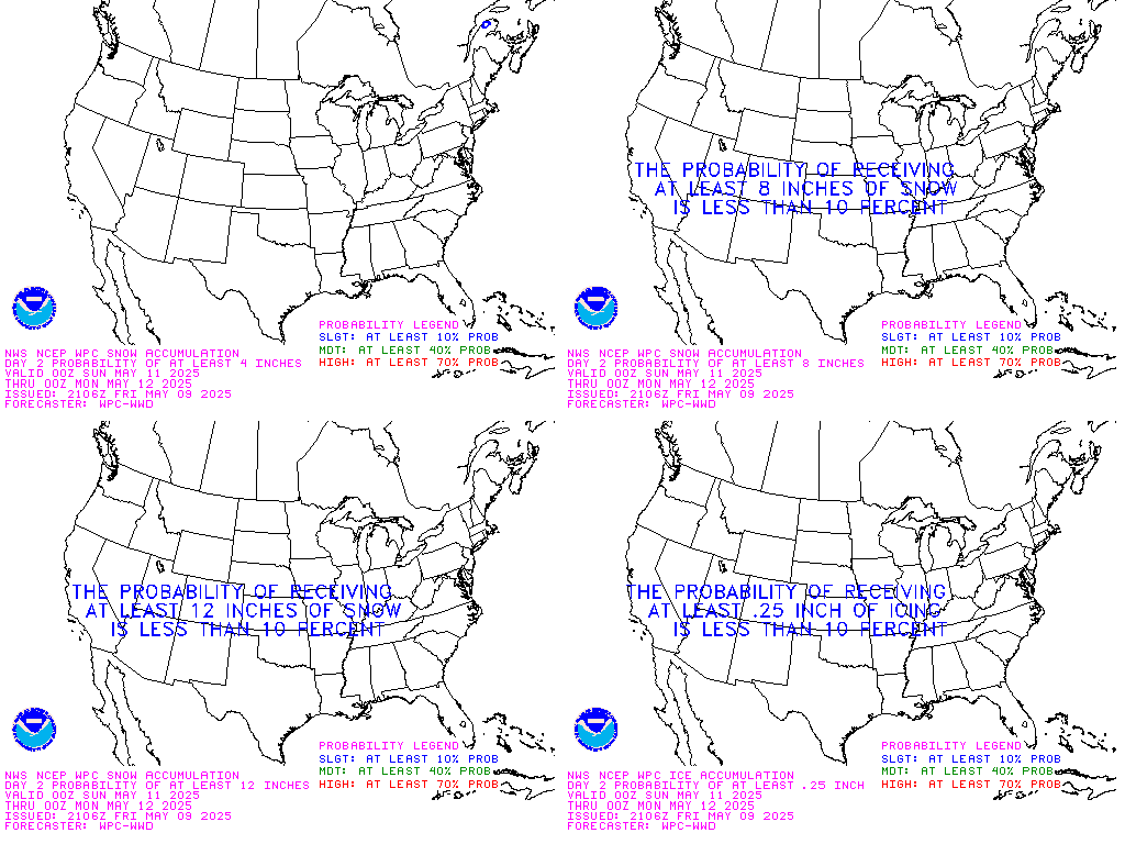
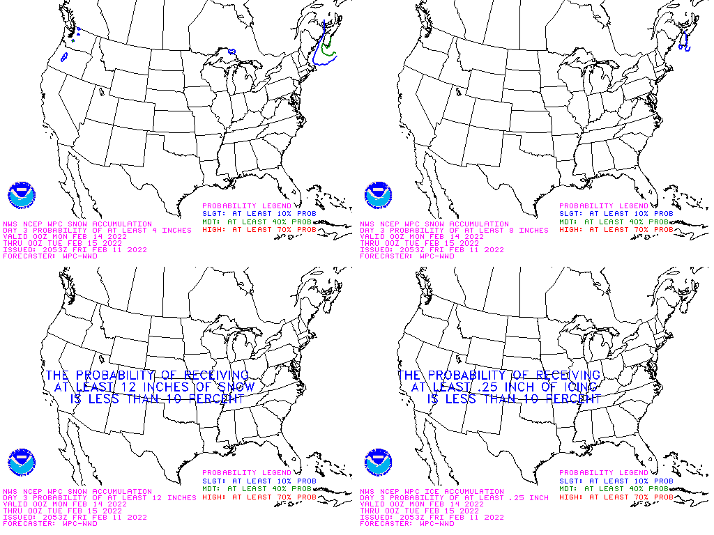
| WPC Snowfall Probability Forecasts | ||
| 4+ inches | 8+ inches | 12+ inches |
|
Day 1
|
Day 1
|
Day 1
|
|
Day 2
|
Day 2
|
Day 2
|
|
Day 3
|
Day 3
|
Day 3
|
| Safety and Preparedness |
| Criteria for Winter Weather Products Issued by WFO Paducah |
|
|
|
|
|
|
|
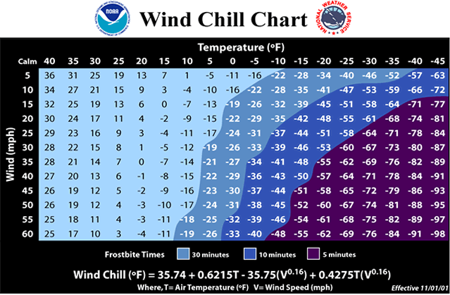
| Wind Chill Chart |
|
|