Storm Report for July 17, 2022
Impacts: Severe thunderstorms with damaging winds
|
|
|
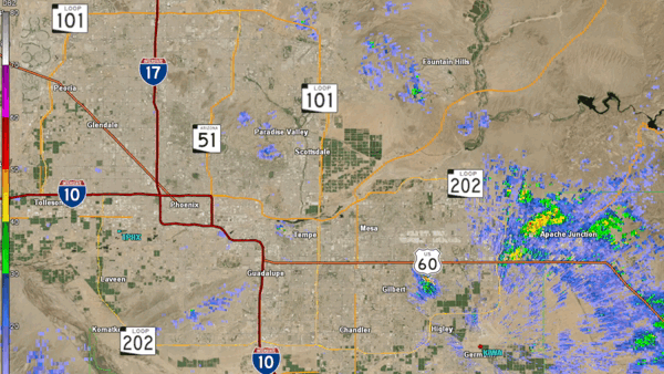
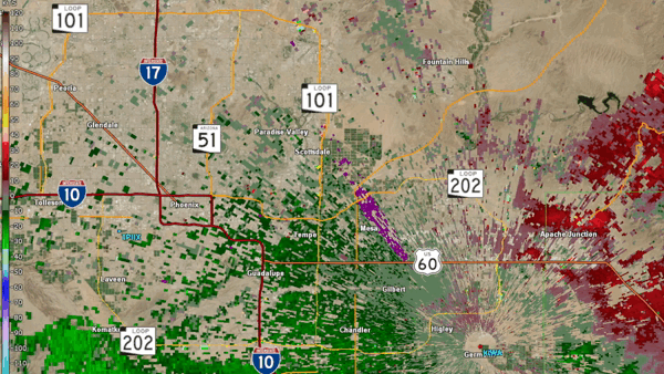
Fig. 1-2. Reflectivity loop (left) and Velocity loop (right) between 7:58 PM and 9:10 PM MST on July 17, 2022 from the KIWA (Phoenix, AZ) radar showing the cluster of severe thunderstorms moving through Mesa and the Salt River Pima-Maricopa Indian Community
A cluster of organized severe thunderstorms developed and affected Mesa and the Salt River Pima-Maricopa Indian Community during the evening hours of July 17, 2022 (Fig. 1-2). This cluster of storms produced widespread severe wind gusts in excess of 60 mph and widespread wind damage.
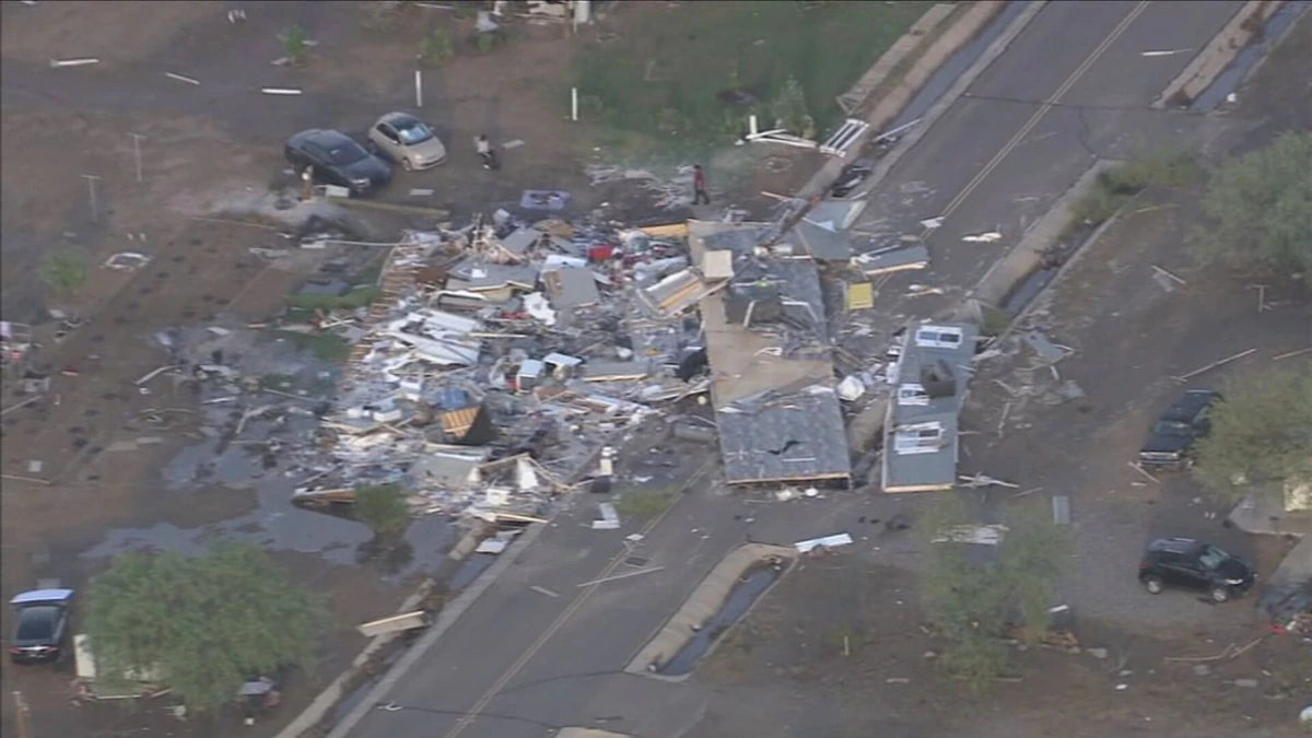
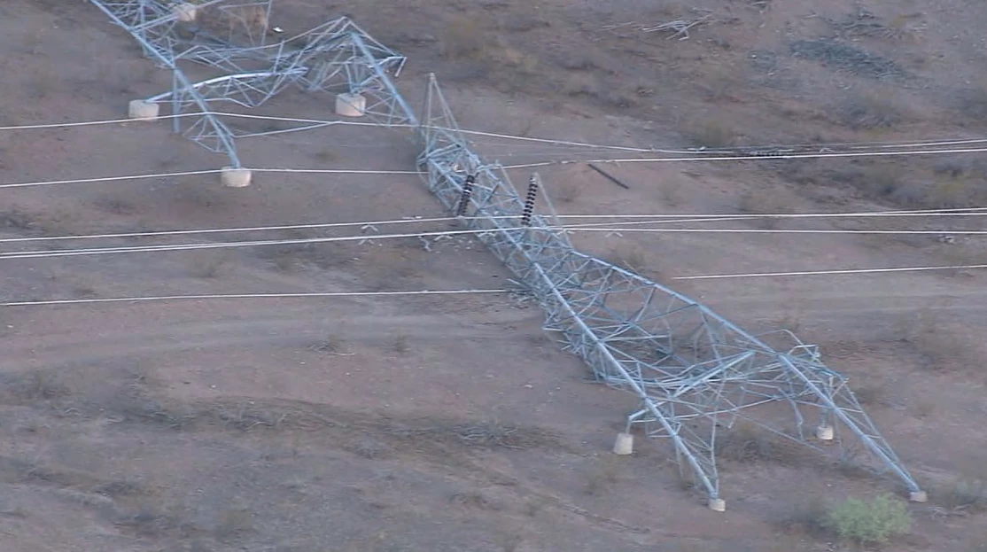
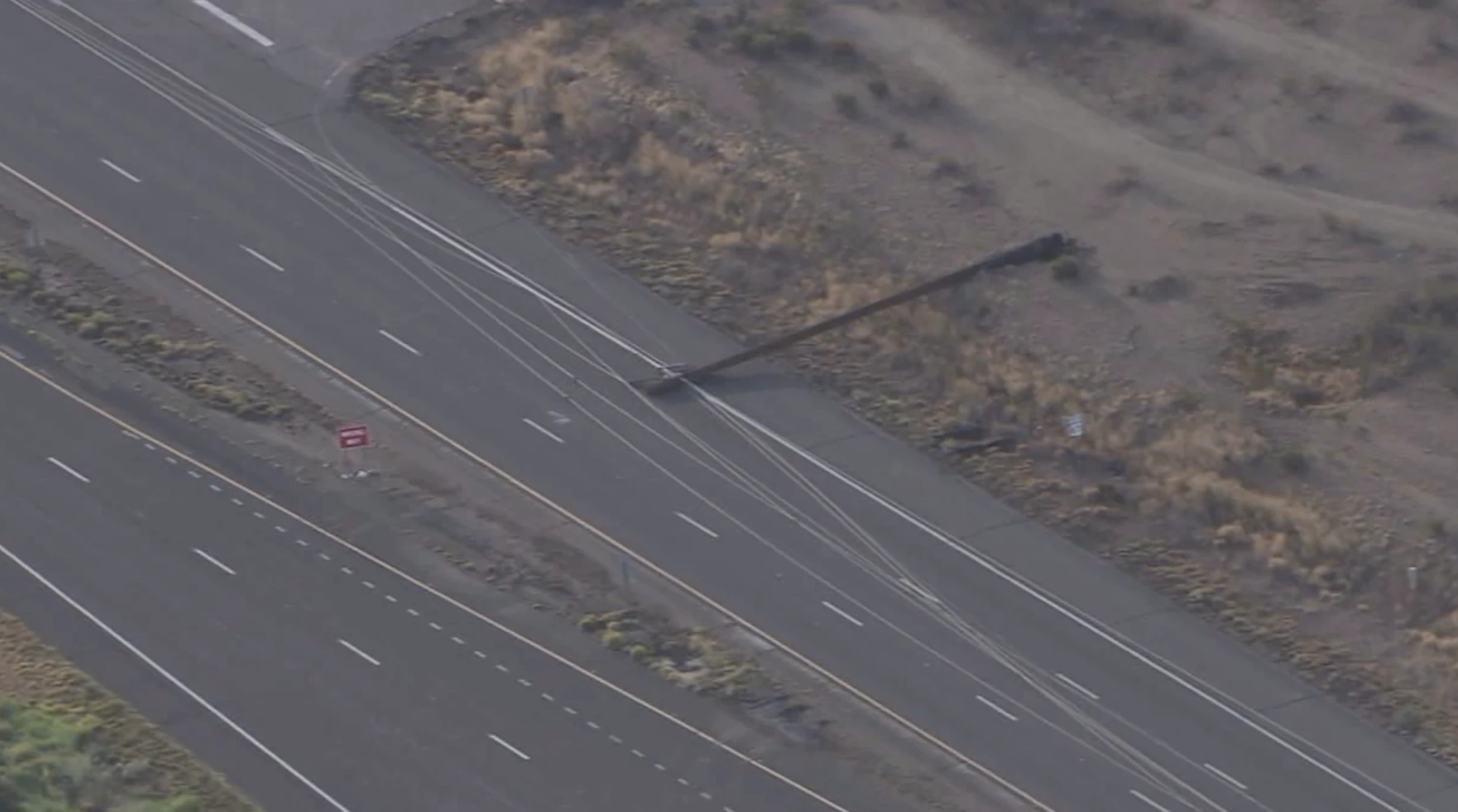
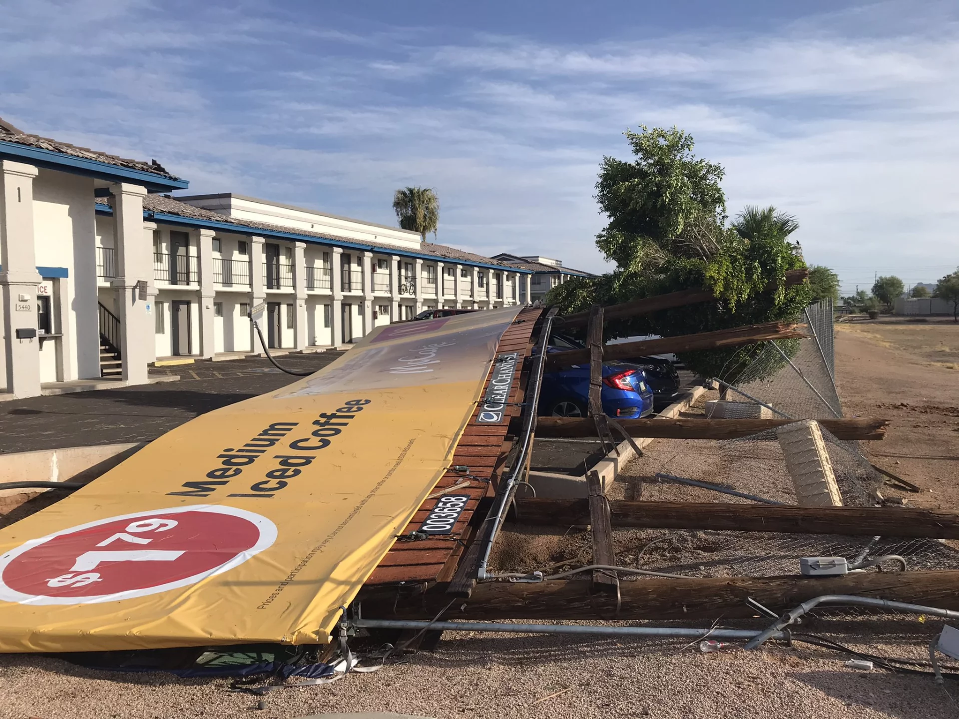
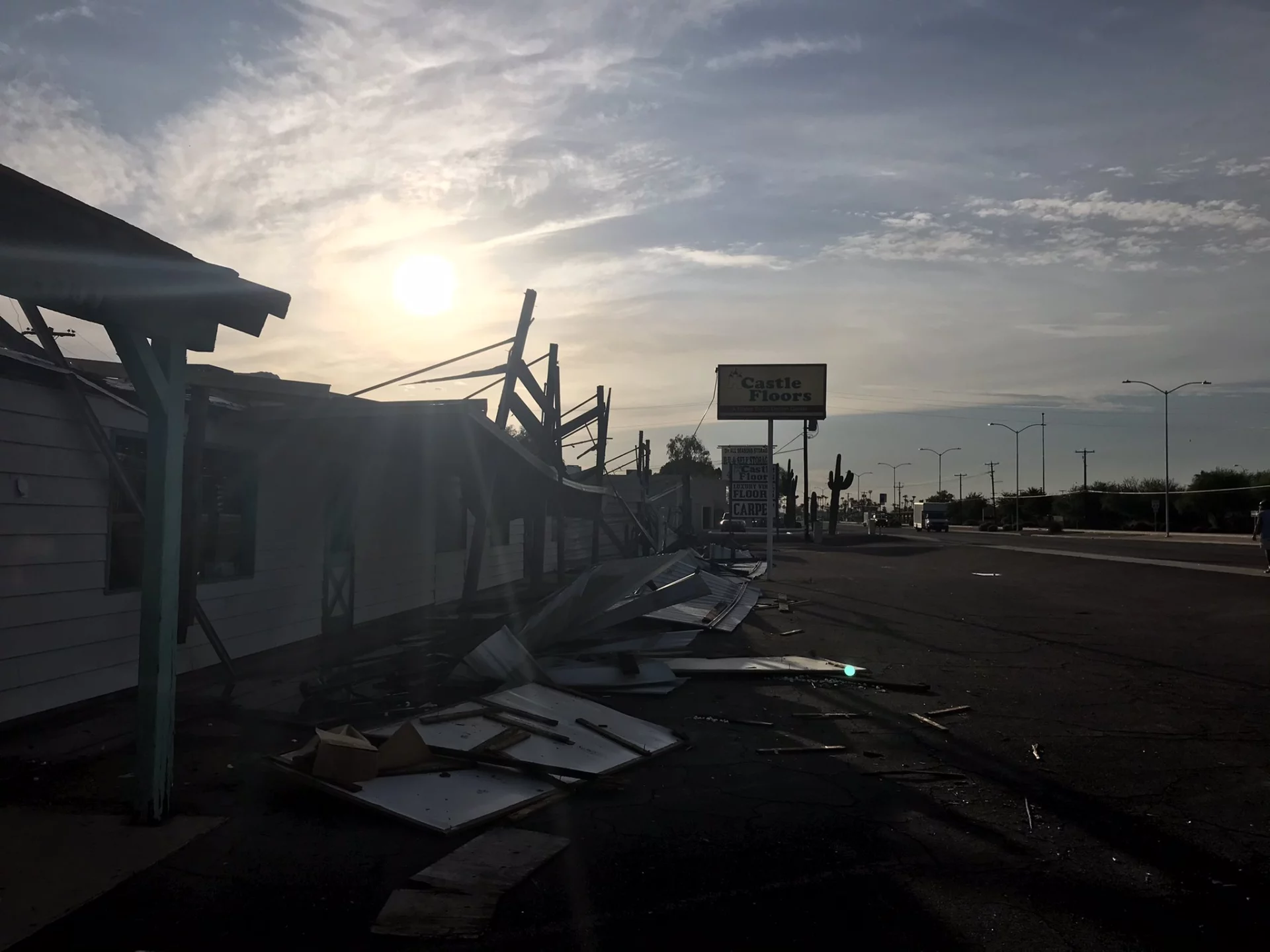
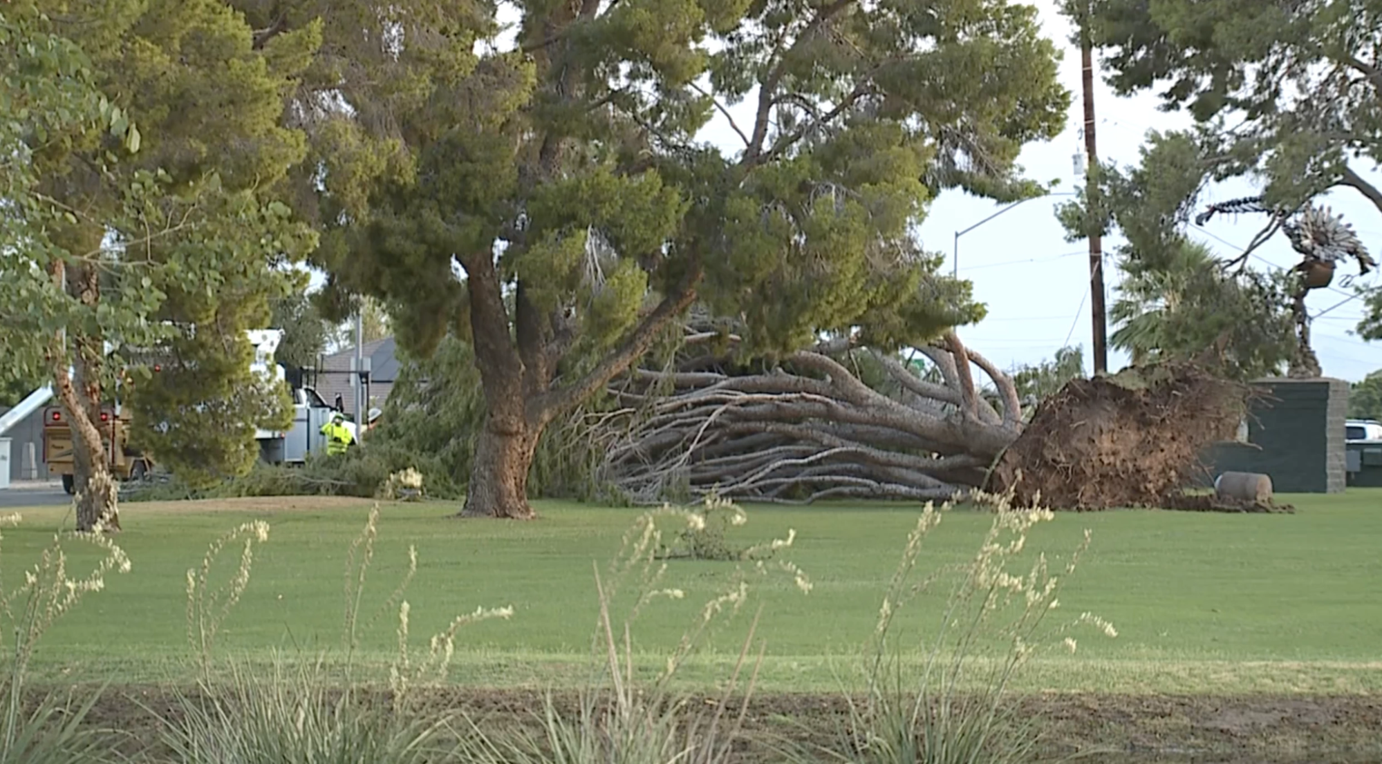
The most severe damage occurred in the Salt River Pima-Maricopa Indian Community, just northeast of Mesa. One mobile home and one modular home were completely destroyed, resulting in an injury to a woman that required her to be transported to the hospital in critical condition (Fig. 3). Numerous power poles as well as several large transmission towers were blown down (Fig. 4-5). Other less severe damage included shingles and facades blown off from homes and businesses, tree damage, and damage to road signs (Fig. 6-8). Based on the magnitude of the damage to the power grid especially, it was estimated that winds were between 80 to 100 mph. Emergency management had estimated the damage cost to be approximately 5 million dollars.
|
|
|
|
|
|
|
|
Fig. 3-8. Images of the wind damage. Image location and sources (clockwise from top-left): Modular home destroyed near the area of E. Roma Avenue and Gilbert Road in the Salt River Pima-Maricopa Indian Community (AZ Family); Transmission towers toppled over near SR-87 in the Salt River Pima-Maricopa Indian Community (ABC15); Power pole toppled over SR-87 near Gilbert Road in the Salt River Pima-Maricopa Indian Community (ABC15); Large uprooted tree near Hohokam Stadium in Mesa (ABC15); Roof and facade damage to the Castle Floors Flooring Store in E Main Street in Mesa (ABC15); Billboard sign toppled over two cars parked in a motel located in the intersection of E Main Street and S. Higley Road in Mesa (ABC15)
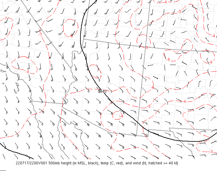
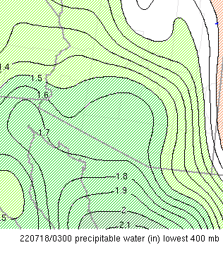
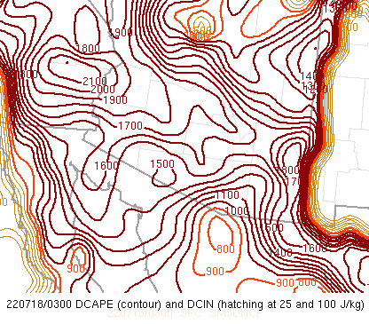
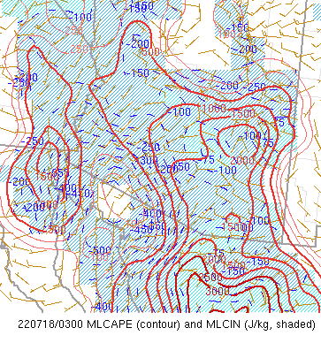
Setup: In what was a typical monsoon pattern setup, with the subtropical high pressure situated across the four corners region, southeast flow was prevalent across Arizona (Fig. 9). This resulted in above normal moisture values for mid-July standards with precipitable water values, a measure of the amount of moisture in the atmosphere, between 1.5-1.7” (above the 90th percentile) across most of central and southern Arizona (Fig. 10). Instability was more than sufficient with mixed-layer convective available potential energy (MLCAPE) ranging between 1000-2000 J/KG (Fig. 11). In addition, the downdraft convective available potential energy values (DCAPE), a measurement used to assess the potential strength of rain cooled downdraft air, was high, in excess of 1500 J/KG (Fig. 12). Thus, any thunderstorm that developed within this environment had the potential to produce strong to severe wind gusts.
|
|
|
|
|
|
Fig. 9-12. Objective analysis fields at 8 PM MST on July 17, 2022 of (clockwise from top-left): 500 MB heights, temp, and winds; Precipitable Water Values; Mixed Layer Convective Available Potential Energy (MLCAPE) and Mixed Layer Convective Inhibition (MLCIN); Downdraft Convective Available Potential Energy (DCAPE) and Downdraft Convective Inhibition (DCIN)
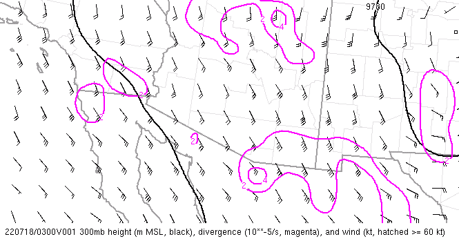
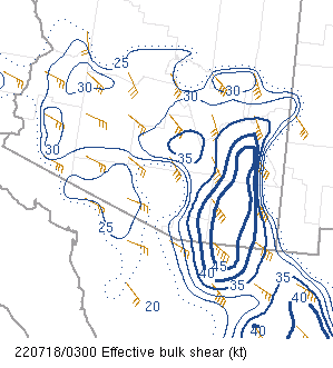
However, what made the thunderstorm activity this day stronger and more organized and persistent than usual were two factors. First factor was the diffluent flow aloft in place across Arizona, which helped with the vertical ascent and the overcoming of the capping inversion (an inhibitor to rising motion)(Fig. 12). The second factor was the unusually strong vertical shear in place across the entire depth of the atmosphere with values around 30-35 kts (Fig. 13).
|
|
|
Fig. 12-13. Objective analysis fields at 8 PM MST on July 17, 2022 of: 300 mb heights, divergence, and winds (left); effective bulk shear (right)
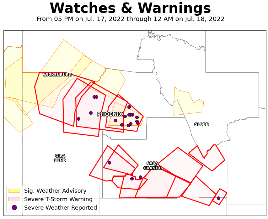
Fig. 14. Spatial extent of Severe Thunderstorm Warnings/Significant Weather Advisories issued by the NWS office in Phoenix and Tucson. Locations where severe weather was reported to the NWS noted with purple dots.