Take-Away: A brief landspout tornado formed in Glendale, AZ on Tuesday 23 October 2018. The time on the ground was approximately 10 minutes (415 PM to 425 PM) with a path length approximated at 3 miles and an EF0 rating (winds 65 mph). No damage was reported or found.
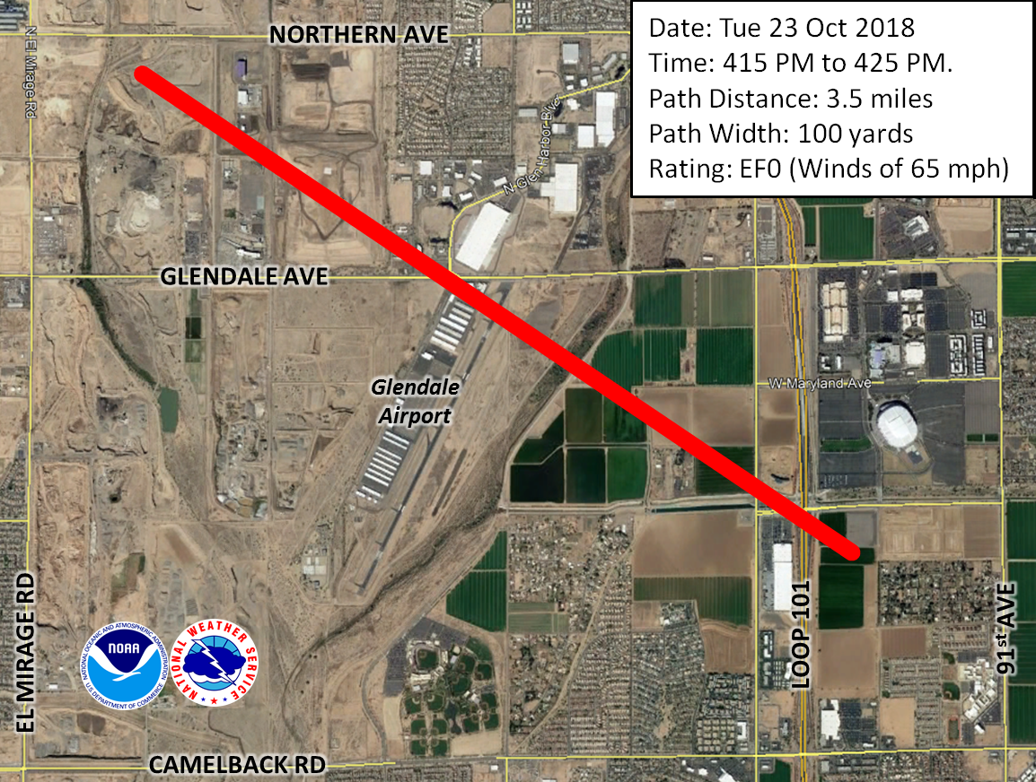
Path of landspout tornado.
Several thunderstorms developed across the Phoenix, AZ metropolitan area during the afternoon of Tuesday 23 October 2018. Some of the storms became severe, developing hail as large as 1.25” in diameter. As is usually the case, strong outflow winds developed due to the storms. Radar data easily depicted the westward movement of the leading edge of these winds as they progressed from Phoenix into the West Valley communities.
Due to variations in the forward speed of this leading edge, kinks can develop in the outflow which can induce low-level circulations/eddies. In some instances, these circulations may tighten and cause brief “gustnadoes” to form. The American Meteorological Society
defines a gustnado as “a short-lived, shallow, generally weak, vertically oriented vortex found along a gust front.” It further describes their visual appearance as a “rotating dust or debris cloud”. Notably, they are not associated with the rotation of a parent thunderstorm.
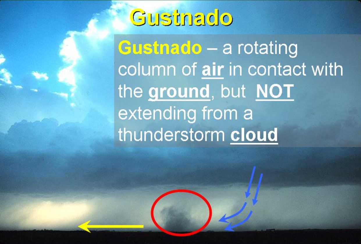
Example of a gustnado. Source: NOAA/NWS Norman, OK
Not surprising, several images of gustnadoes appeared on social media as the gust front pushed across Phoenix that Tuesday afternoon from 3 PM through 5 PM. However, a series of events started at 330 PM which allowed a brief tornado to form in Glendale, AZ. As the outflow boundary crossed the Mid-Town area of Phoenix, it caused a thunderstorm to begin developing overhead. This was first noted by the NWS Phoenix (KIWA) radar located at Phoenix/Mesa Gateway Airport at 330 PM as very weak returns around 20,000 feet above the ground, indicating raindrops in a developing updraft. As the storm continued to develop and shift west, the rapidly ascending air in the updraft located over the outflow boundary (area of converging air at the ground) caused vertical stretching of the air. As a result, a more pronounced kink formed in the outflow boundary at about 4 PM and stretched the existing enhanced vorticity (or local spinning motion) and induced a deeper circulation to develop. The storm continued to intensify, and at 420 PM a
Severe Thunderstorm Warning was issued. The storm would go on to produce 1” hail and 1-2” of rain.
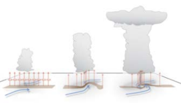
Depiction of how landspout tornadoes form. Source: NOAA/NWS WDTD
As the decision was made to issue the Severe Thunderstorm Warning, the circulation along the outflow boundary tightened enough to cause a
landspout tornado. These types of tornadoes form from “the bottom up”, meaning the spin is initially due to features near the ground, which are then amplified by the upward motion in a developing thunderstorm. They can be very similar to gustnadoes, with the only difference being the interaction between the ground and a developing storm above. This was the case in Glendale that day. While there were many gustnadoes forming along the progressing outflow boundary, based on radar data and images/video from social media, it is clear only one was tied to a developing storm and thus classified as a landspout tornado.
Based on several tweets (
link,
link,
link,
link),
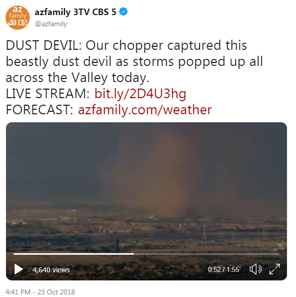
news chopper footage (shot at I-10 and the agua Fria River, looking north), photos sent to the NWS, eye-witness information from personnel at the Glendale Airport, and corroborating radar data, an EF0 tornado is classified. A survey by NWS personnel found no damage in the area, and none was reported at this time.
Time: 415 PM to 425 PM.
Path: From 33.519° N, -112.265° W to 33.547° N, -112.318° W
Path Distance: 3.5 miles
Path Width: 100 yards
Rating: EF0 (Winds of 65 mph)
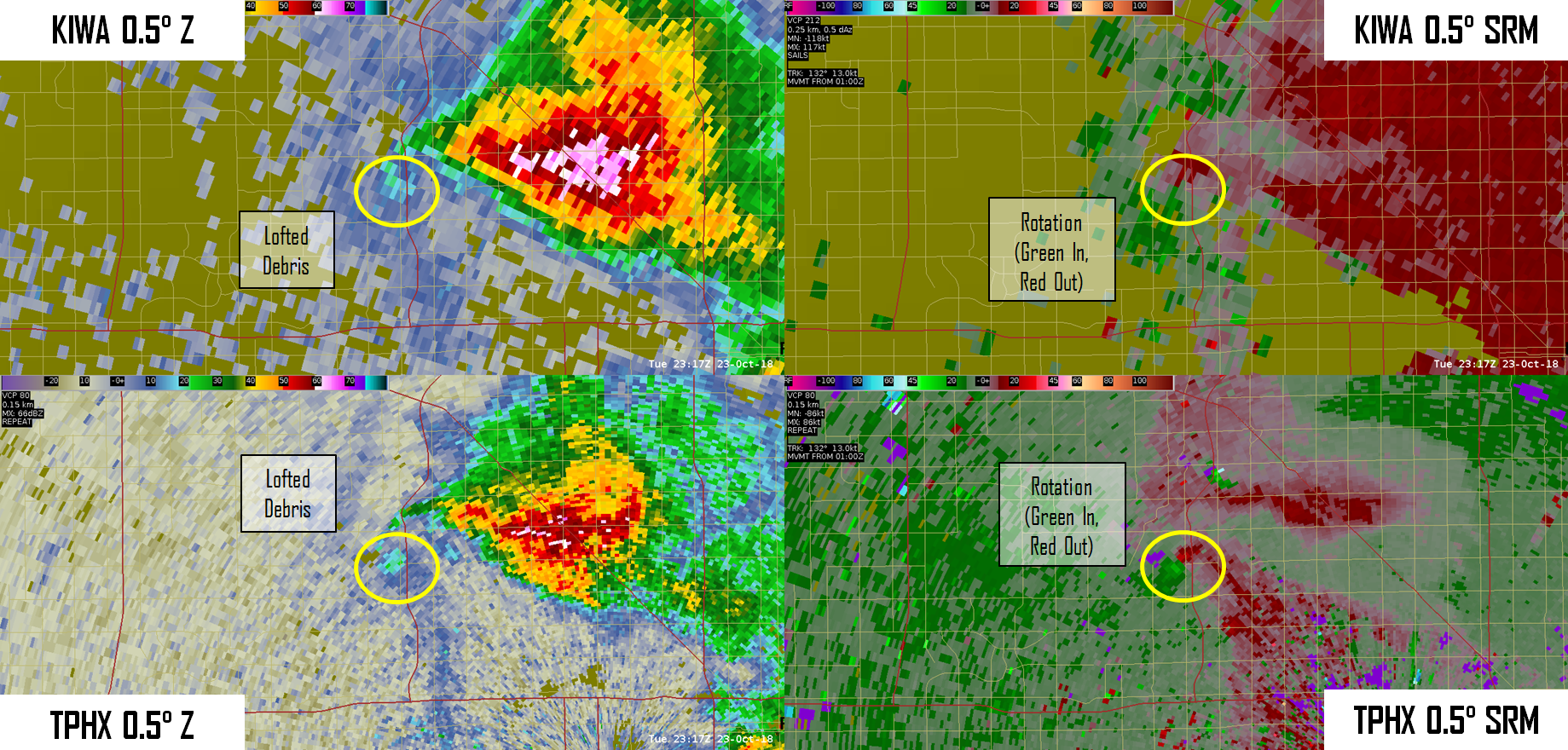
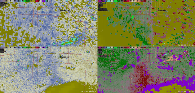
View of landspout tornado at 417 PM from KIWA (top) and TPHX (bottom) radars.
Click here for a radar loop of the event.