Storm Report for 30 July 2018
By NWS Phoenix -- last updated at 9 AM on 2 August 2018
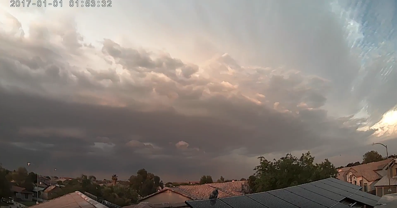
Image of thunderstorms developing north of Phoenix (source: Chris Mahar, YouTube).
A clear, warm, and muggy Monday afternoon gave way to thunderstorm development over the mountains of central and eastern Arizona during the later afternoon and evening hours. Fueled by moderate instability, a deep boundary layer conducive to strong winds, and just enough enhancement from winds in the upper parts of the atmosphere, the storms exploded just north and east of Phoenix. Click here to view upper level maps for 12Z Monday 30 July 2018 from the NWS Storm Prediction Center.
Strong to severe winds developed at the ground, causing a very large area of outflow winds to spread across Maricopa and Pinal counties. While the thunderstorms eventually decayed as they invaded the lower elevation areas, winds remained exceptionally strong through portions of the North and West Valley of the Phoenix area, causing widespread damage. Additional storms in Pinal County likewise caused areas of damaging winds. As is typically of nearly all storm-related damage in the lower deserts during the summer, this damage was caused by downburst winds.
Peak observed winds were 74 mph at the Phoenix/Deer Valley airport and Goodyear airport, though widespread values of 40-60 mph were common. NWS storm spotters and local media reported many trees down, primarily concentrated from north Phoenix to Goodyear. In some instances, the trees were blown over onto cars and homes. Additional damage was reported in Florence where a mobile home was destroyed. Due to the intensity and coverage of the winds, widespread dust did develop. Visibility across much of Phoenix was reported at under one mile, with those reports dropping closer to zero west and south of the city in more open, desert areas. Average rainfall amounts across Phoenix were about 1/4", with 68% of the metropolitan area receiving some rain. More intense rain did occur across northern Maricopa County and in the far East Valley near Apache Junction. Minor flooding was noted in these areas.
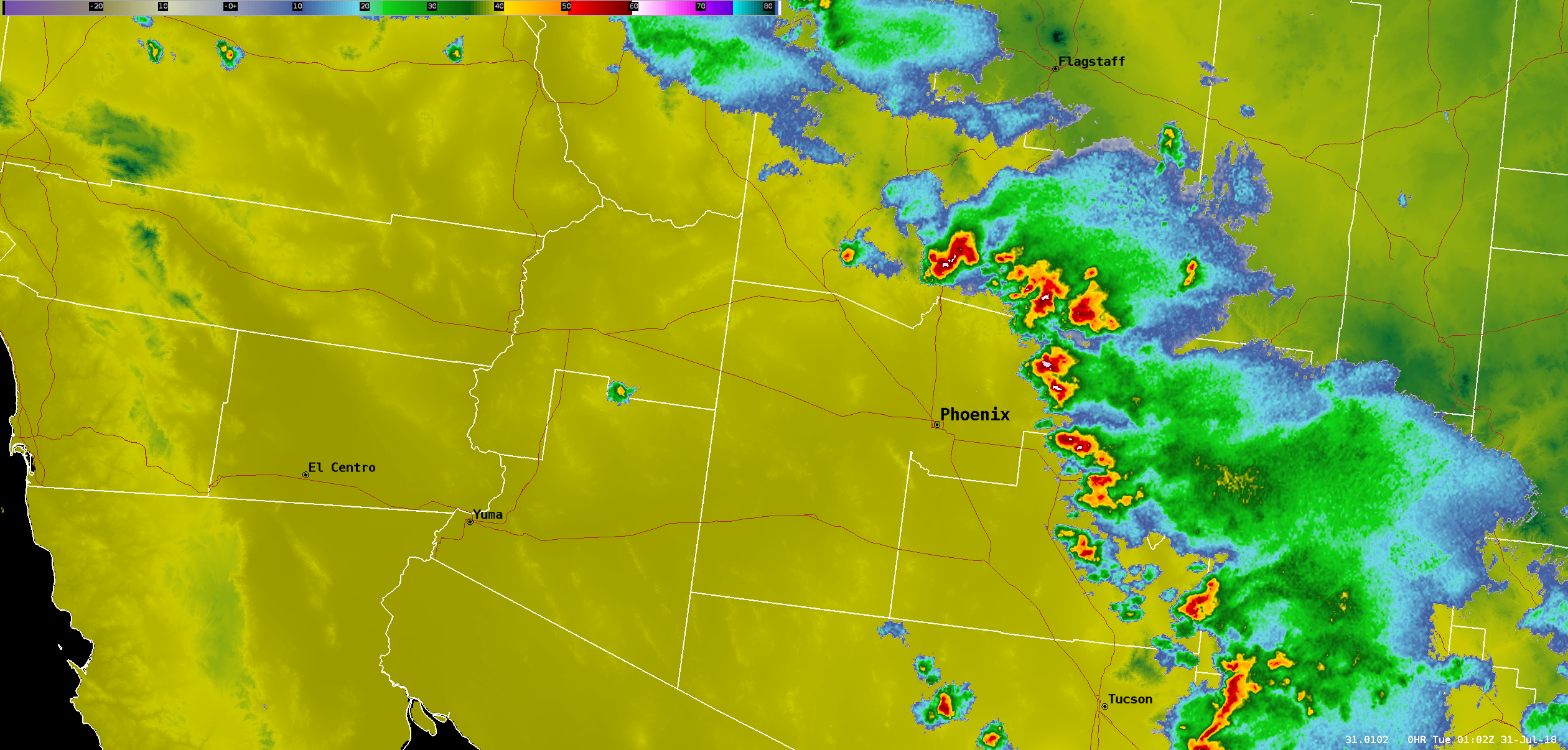
Radar at 6 PM Monday 30 July 2018. Click image for full event loop.
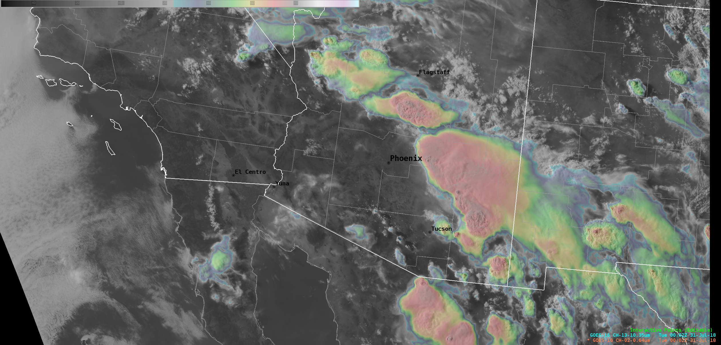
GOES-16 satellite at 5 PM Monday 30 July 2018. Click image for full event loop.
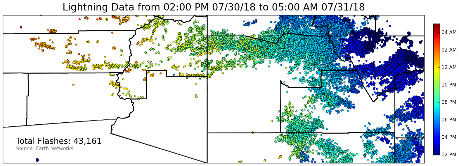
Lightning Data. Hover over image to toggle between cloud-to-ground strikes and cloud-to-cloud flashes. Source: Earth Networks.
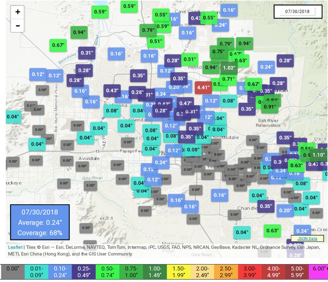
Phoenix Rainfall Index for 30 July 2018 (link). Note value of 4.41" is erroneous.

