Storm Report for October 4 - 5, 2021
Last updated at 700 PM MST on October 14, 2021
Impacts: Supercells with large hail, strong winds, and heavy rain
|
|
|
|
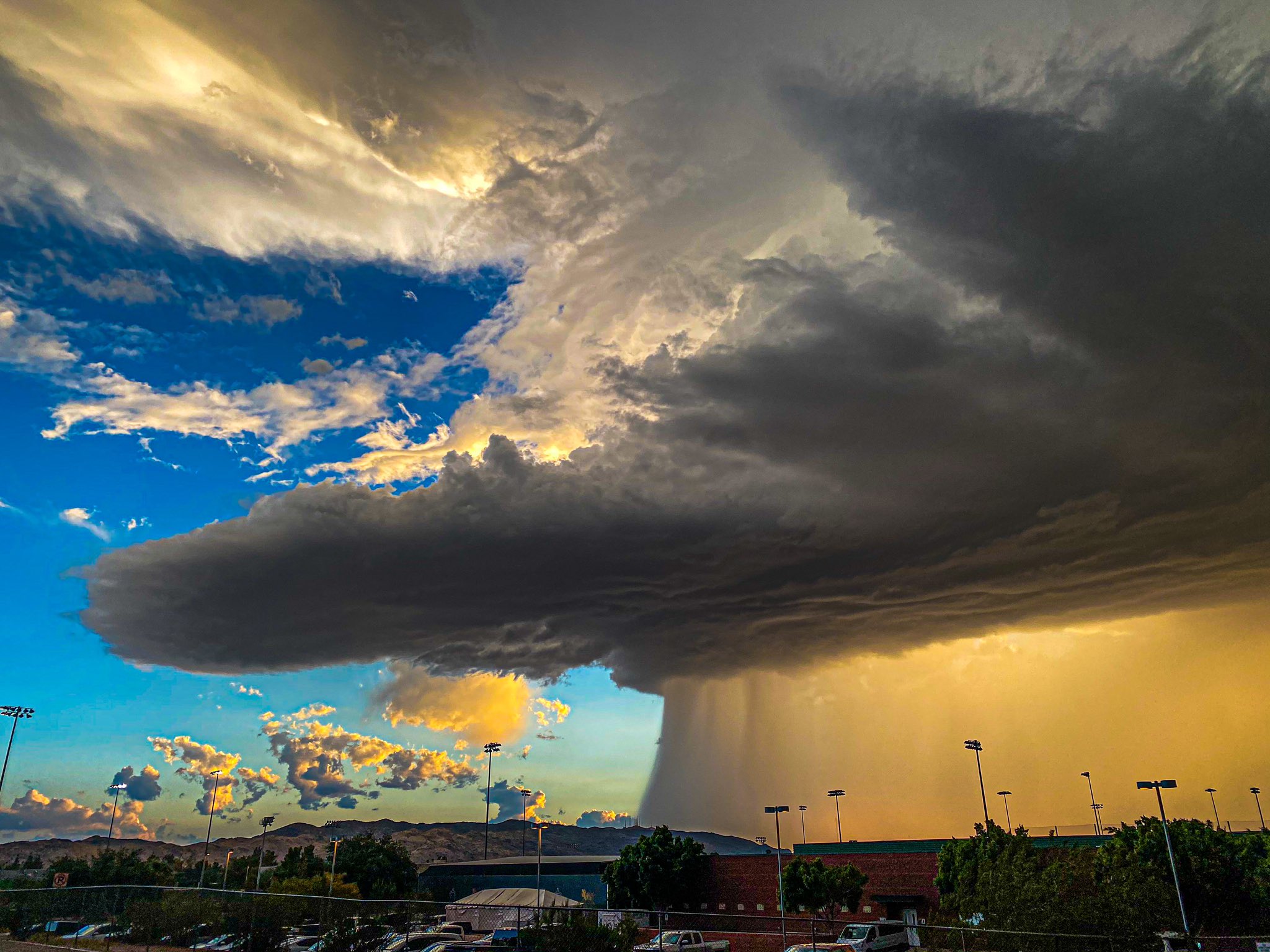
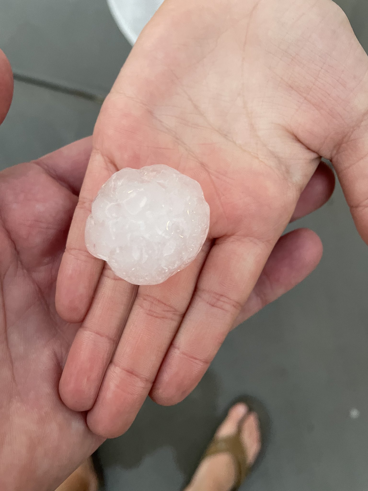
Fig. 1-2. Images of the supercell that moved through Phoenix and estimated ping-pong ball sized hail that fell between Phoenix Sky Harbor Airport and South Mountain. Credit: Spike Davis (left) & William Pitts (right). |
|
A strong low pressure system led to the development of scattered showers and thunderstorms across Arizona and southern California beginning on Monday October 4th and lasting through the evening of Tuesday October 5th. Initially showers and thunderstorms were relatively weak, but increased in intensity through the day Tuesday as the upper level low gradually progressed through the region. The most notable and attention-grabbing impact from thunderstorms on Tuesday was hail. With cold air aloft and unstable conditions, most thunderstorms produced at least small hail and the strongest thunderstorms produced large hail up to 1.5 to 2 inches in diameter (ping-pong ball to lime sized). In addition to the hail, some thunderstorms produced damaging winds and heavy rainfall with localized flash flooding.
Fig. 3. Mosaic radar imagery from 12 PM on Oct. 4, 2021 to 1 AM on Oct. 6, 2021.
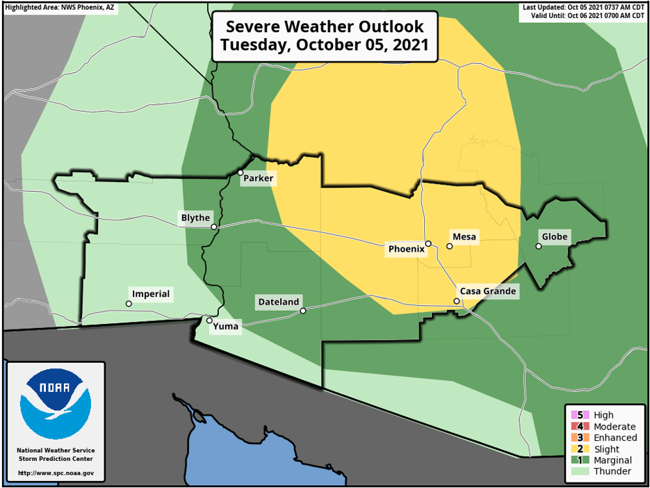
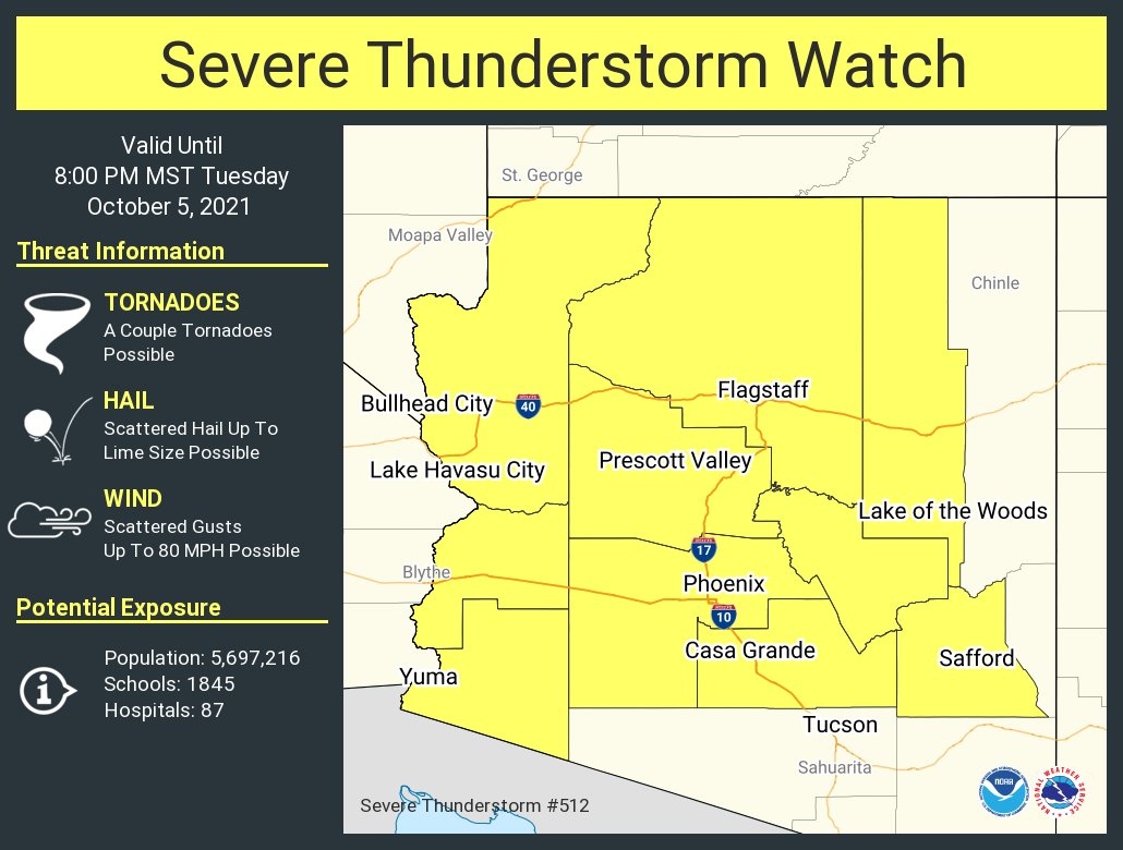
At 5:40 AM MST on October 5, the Storm Prediction Center (SPC) upgraded their Day 1 Convective Outlook to include a Slight Risk for severe thunderstorms in Central Arizona. At 11:45 AM MST the SPC in coordination with NWS offices in Phoenix, Tucson, Flagstaff, and Las Vegas issued a Severe Thunderstorm Watch for most of Arizona. The primary threats were wind and hail with a low probability threat of a few tornadoes.
|
|
|
|
Fig. 4-5. SPC Day 1 Convective Outlook (left) and Severe Thunderstorm Watch (right). |
|
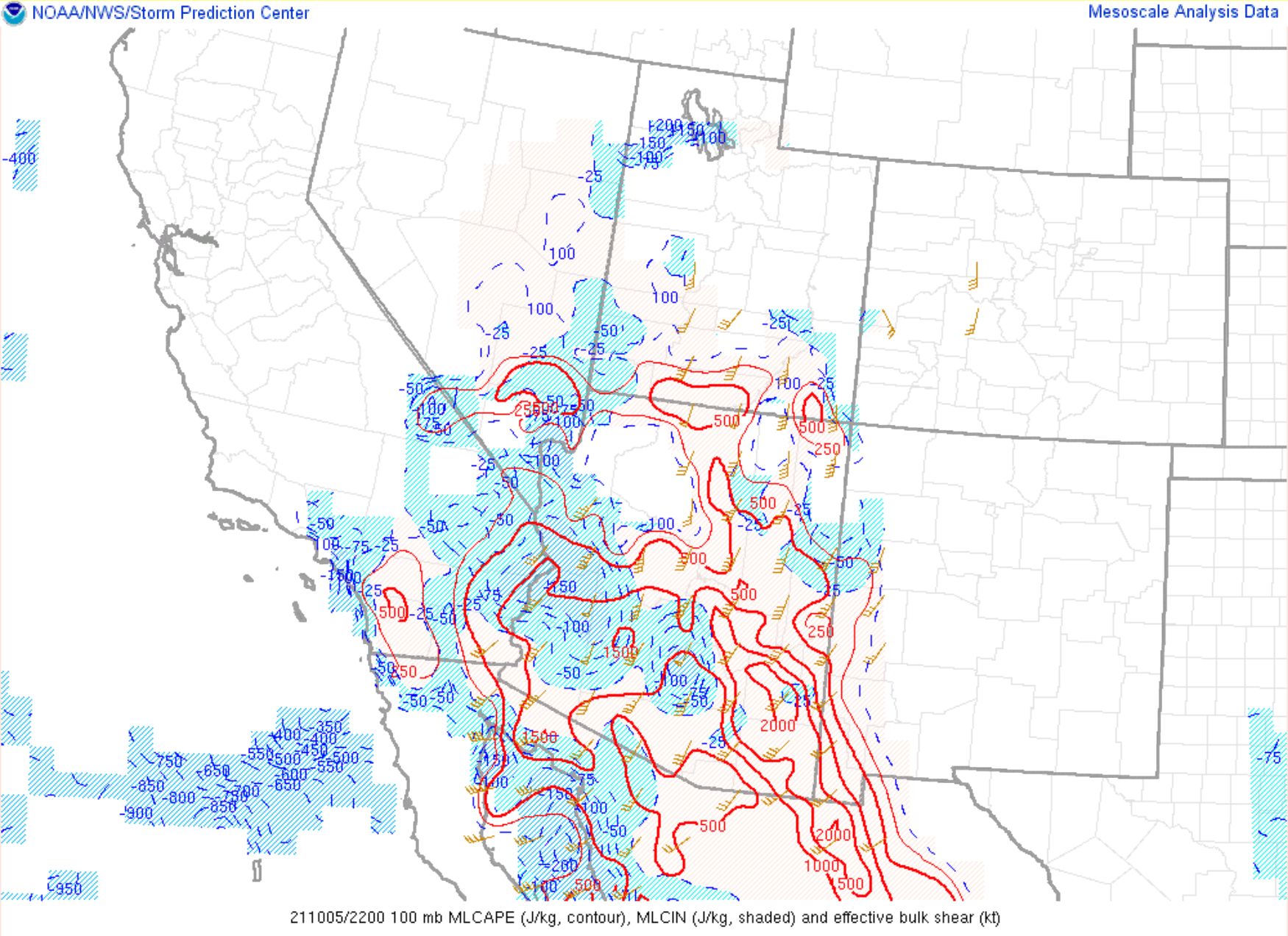
Strong atmospheric dynamics played a large role in the intensity of storms and storm mode on Tuesday. Ample sunshine over the lower deserts of Arizona helped boost surface heating and instability, especially during the afternoon. Mixed layer convective available potential energy (MLCAPE - a measure of buoyancy of air near the ground) was moderate around 1000-1500 J/kg in the afternoon and low- and mid-level lapse rates (change in temperature with height) were conditionally unstable around 7-8 °C/km. This supported strong thunderstorm updrafts.
|
|
|
|
|
|
|
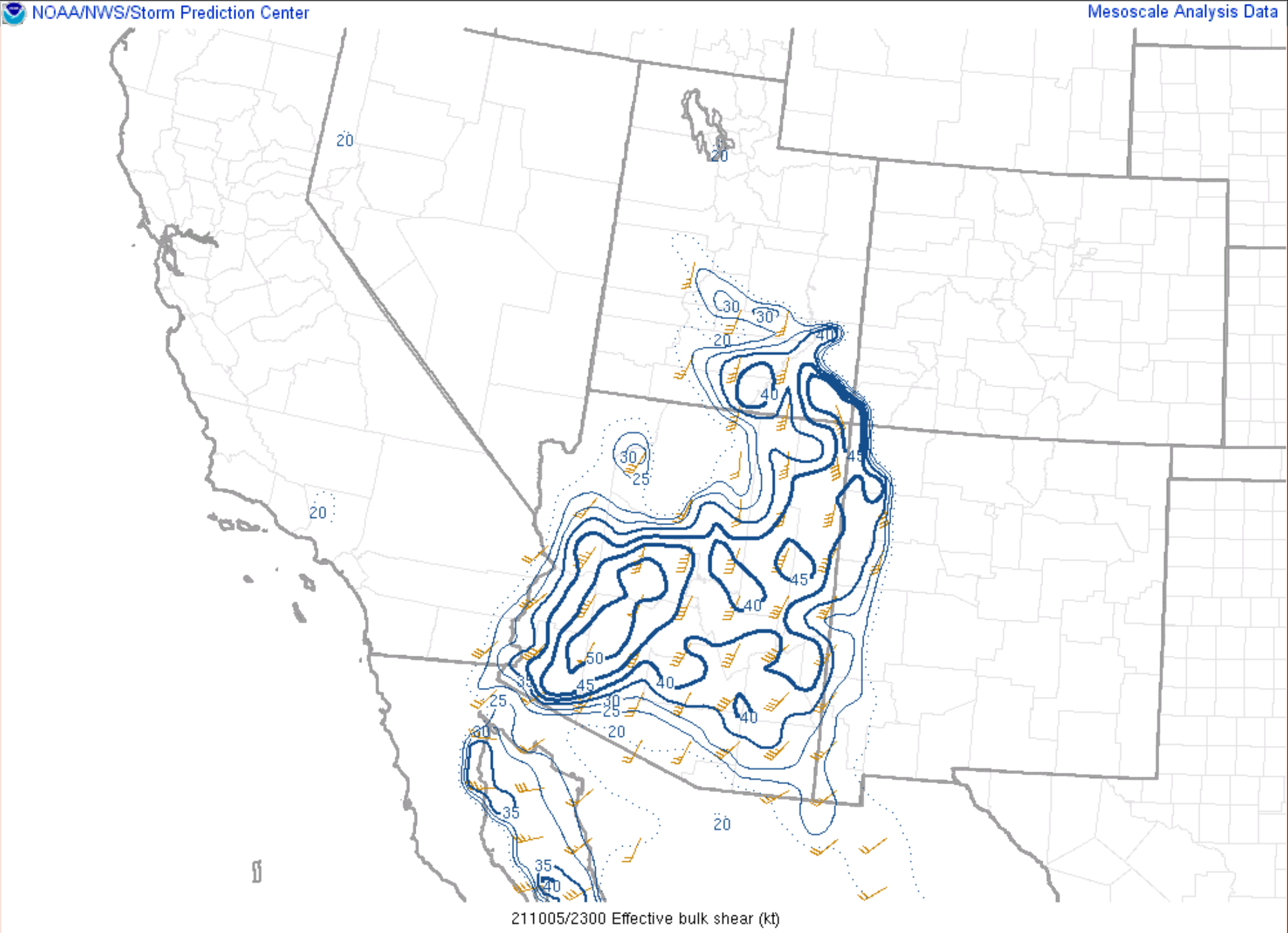
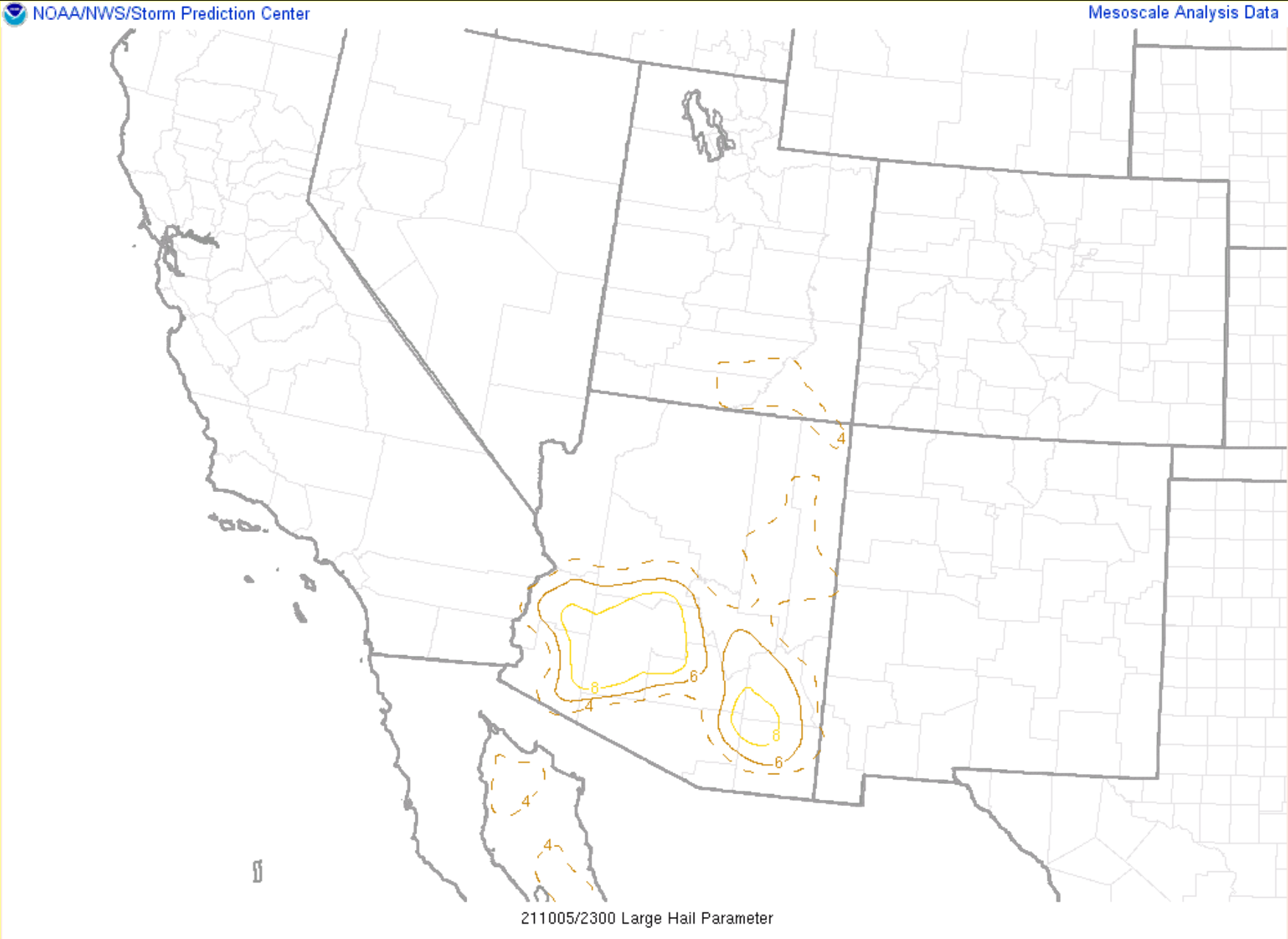
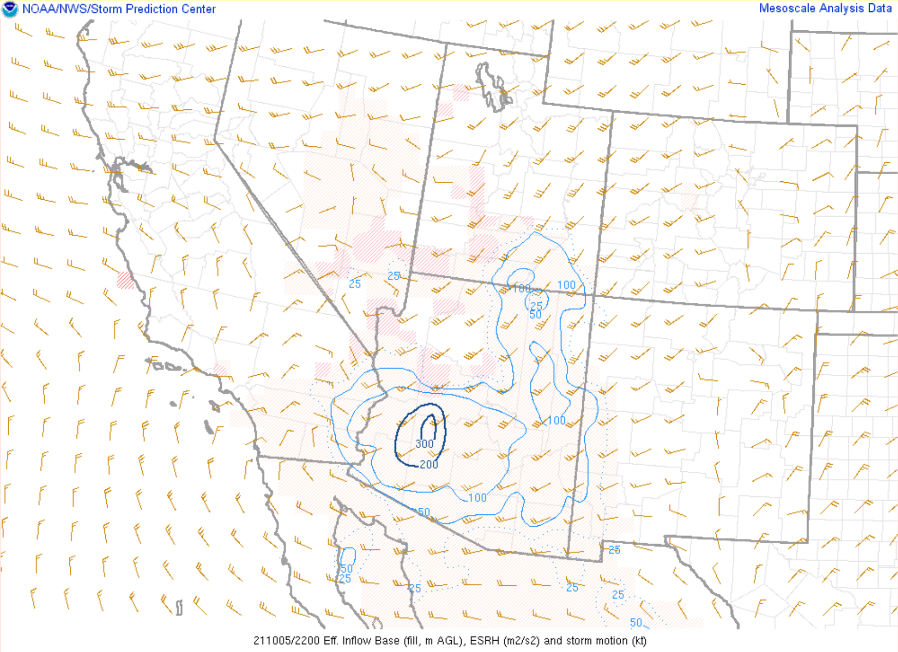
Fig. 6-9. Objective analysis fields at 3-4 PM on Oct. 5, 2021, of (clockwise from top-left): mixed-layer convective available potential energy (MLCAPE) w/ Effective Bulk Shear; Effective Bulk Shear; Large Hail Parameter (LHP); Effective Storm Relative Helicity (ESRH). |
|
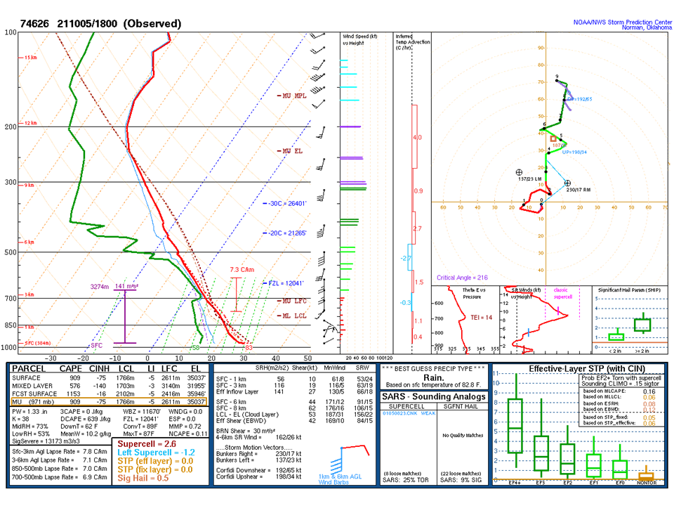
Shear (changing wind direction and/or speed with height) was high for Arizona, with effective bulk shear upwards of 40-50 kts. This promoted tilted updrafts and more organized storm structures than the ordinary storms in low shear seen during the monsoon. Shear magnitudes were also sufficient for supercell development, which are a type of thunderstorm more common in the Plains. A special 18Z sounding (weather balloon observations), launched by NWS Phoenix Tuesday, showed the shear was mostly speed shear with fairly uniform wind directions throughout the tropospheric profile and the hodograph was relatively linear. This type of profile supports splitting storms, which was seen Tuesday afternoon. Additionally, the 18Z sounding and RAP objective analysis had effective storm-relative helicity (ESRH - a measure of the corkscrew motion of air within a storm) magnitudes between 100-300 m2/s2. The ESRH magnitudes were another parameter in support of supercells, which are defined by rotating updrafts.
|
|
|
Fig. 10. 18Z (11 AM MST) sounding launched by NWS Phoenix Tuesday with the thermodynamic and wind profile on the upper-left of the graphic and hodograph in the upper-right. Additional parameters can be found in the lower third of the graphic. |
Hail ended up being the primary impact from storms through the day Tuesday with most storms producing at least pea to dime sized hail, even during the morning hours. Larger hail became a threat by early afternoon when stronger storms began developing in the NWS Phoenix County Warning Area (CWA), with the first severe thunderstorm warning for quarter-sized hail and 50 mph winds issued at 1 PM MST. There were severe winds associated with at least one multi-cell thunderstorm during the early afternoon.
|
|
|
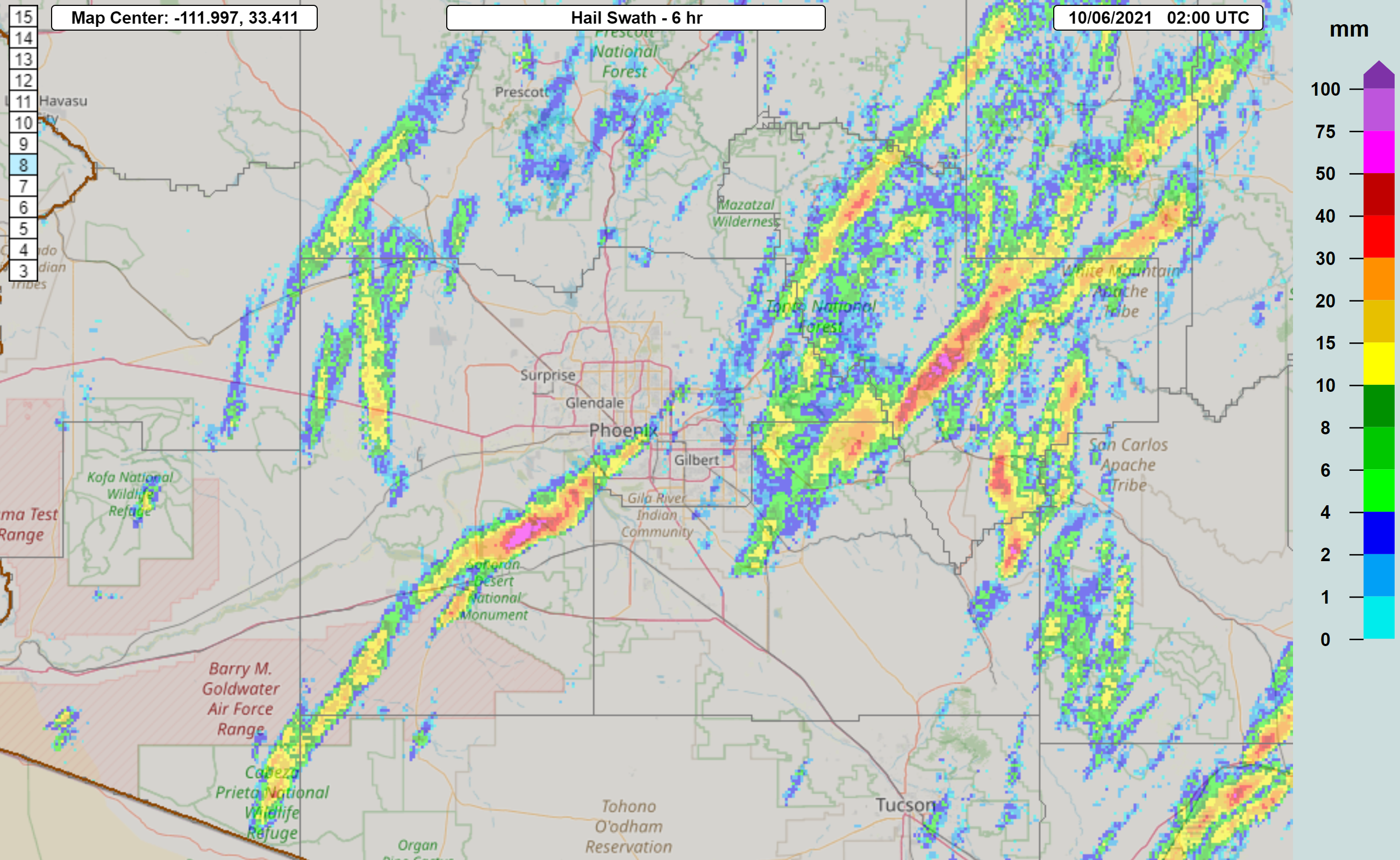
Fig. 11. Maximum Estimated Size of Hail (MESH) tracks from Multi-Radar/Multi-Sensor (MRMS). Yellow is ~0.4” diameter hail (slightly bigger than pea), Red is ~1” diameter (quarter), and Pink is ~2” diameter hail (lime). |
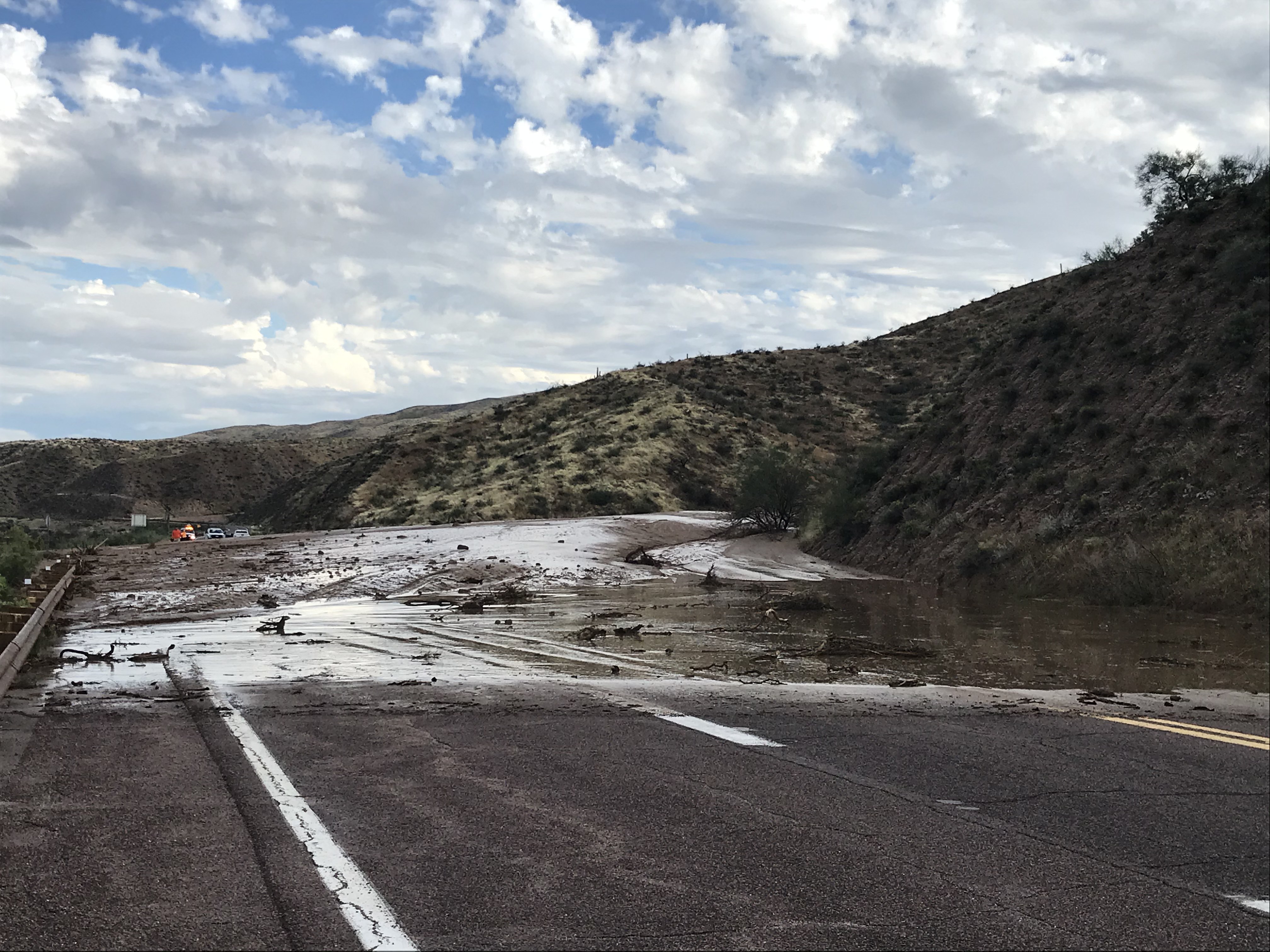
Throughout the afternoon there were a few notable storms. One was the aforementioned multi-cell thunderstorm that developed in northern Pinal county around around 1:30 PM and moved through parts of the far southeast Phoenix metro area and then through central Gila county. This storm produced severe wind gusts with a couple weather stations along the Salt River measuring a 63 mph and 73 mph wind gust. The winds damaged some power poles in Gold Canyon and knocked out power to some areas. This storm also produced localized flash flooding, despite a fast storm motion and below normal moisture content. A low water crossing flooded along SR-88 northeast of Apache Junction and there were a couple mudslides over SR-188 near the north end of Lake Roosevelt. The individual cell on the southern end of the multicell cluster was strongest with a rotating updraft. Radar estimated hail with this cell was upwards of 2 inches in diameter. This cell would also eventually be tornado-warned by NWS Flagstaff.
|
|
|
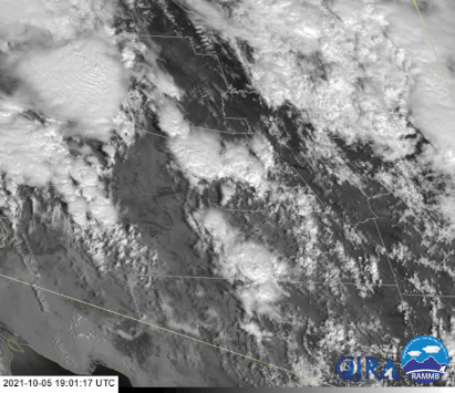
Fig. 12. GOES-West/17 Channel-2 (Visible/Red ABI) from 12:11 PM MST to 6:01 PM MST. |
The other two storms of note developed and moved mostly through Maricopa county. These cells exhibited classic supercell evolutions with one a left split and the other a right-mover, both deviating from the mean storm motion. Both cells developed in the most favorable environment of the afternoon for supercells, where a shear and ESRH maxima was located. The cells were also moving through an environment conducive for large hail. The Large Hail Parameter (LHP - a composite index for hail that factors shear and CAPE) was around 7-8 across south-central Arizona. The left-split supercell initially developed north of Gila Bend around 4:30 PM and tracked due north across I-10 west of Buckeye and up through Aguila.
Fig. 13. Base reflectivity (0.5° tilt) from the Phoenix radar (KIWA) showing the life-cycle of the supercell that moved into Phoenix. Note the rightward deviant motion and large hail spike while the cell was over Rainbow Valley around 00Z (5 PM MST).
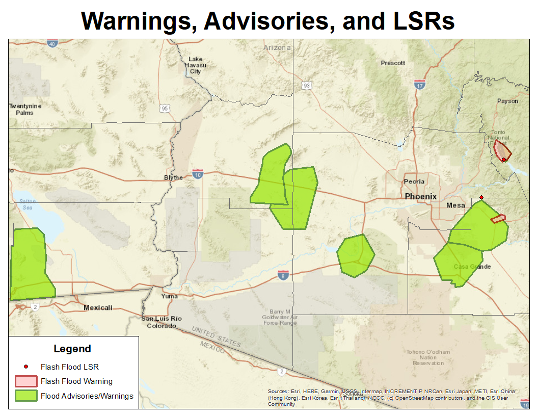
The right-mover supercell generated the most interest across media platforms as it initially developed in far southeast Yuma county around 2 PM MST and tracked up through Gila Bend and eventually through central Phoenix around sunset. This cell was at its most mature stage when it was northeast of Gila Bend over Rainbow Valley, between SR-85 and the Estrella Mountains. During this stage the cell had many radar characteristics of a classic supercell structure. Characteristics included a brief hook echo and weak echo region (WER), echo overhang, a strong mid-level mesocyclone, sharp reflectivity increase along the forward flank, and a V-notch. There was also a large three-body scatter spike (TBSS), or more commonly referred to as a hail spike, around this time that was indicative of large hail. A rear-flank downdraft (RFD - enhanced downdraft winds on the back side of the storm) can also be seen kicking in around this time (particularly around 5 PM MST). If a tornado were to develop from this supercell it would have had the best chance when the RFD kicked in, but low-level rotational velocities (LLRV or Vrot) observed by the Phoenix radar (KIWA) were marginal around 20-25 kts. As the supercell came more within view of Phoenix, it was evident there was a wall cloud, but no tornadoes or even funnel clouds were reported. In total, 15 severe thunderstorm warnings and 2 flash flood warnings were issued by NWS Phoenix on Tuesday, with many more special weather statements and areal flood advisories.
|
|
|
|
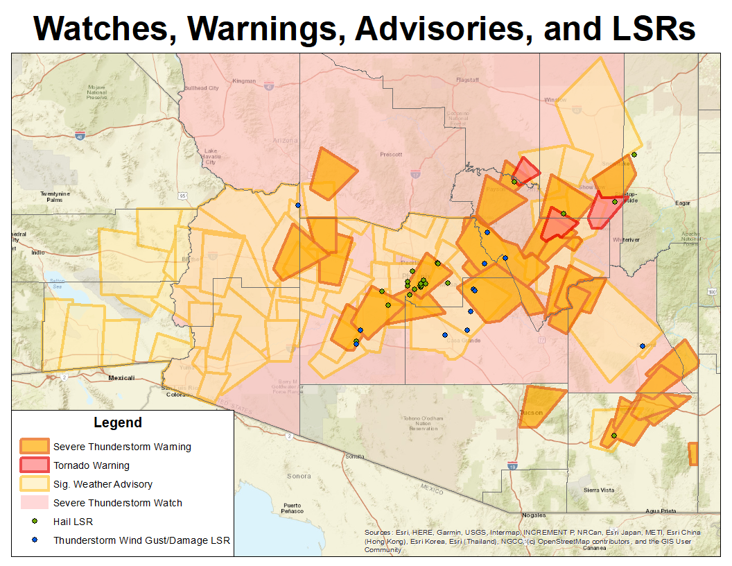
Fig. 14. Spatial extent of Significant Weather Advisories (40-58 mph winds, hail <1”) and Severe Thunderstorm Warnings (58+ mph winds, 1”+ hail) issued for this event by NWS offices in Phoenix, Flagstaff, and Tucson (left). Also the Areal Flood Advisories and Flash Flood Warnings issued by NWS Phoenix (right). Locations of storm impacts reported to NWS noted with green, blue, and red dots. |
|
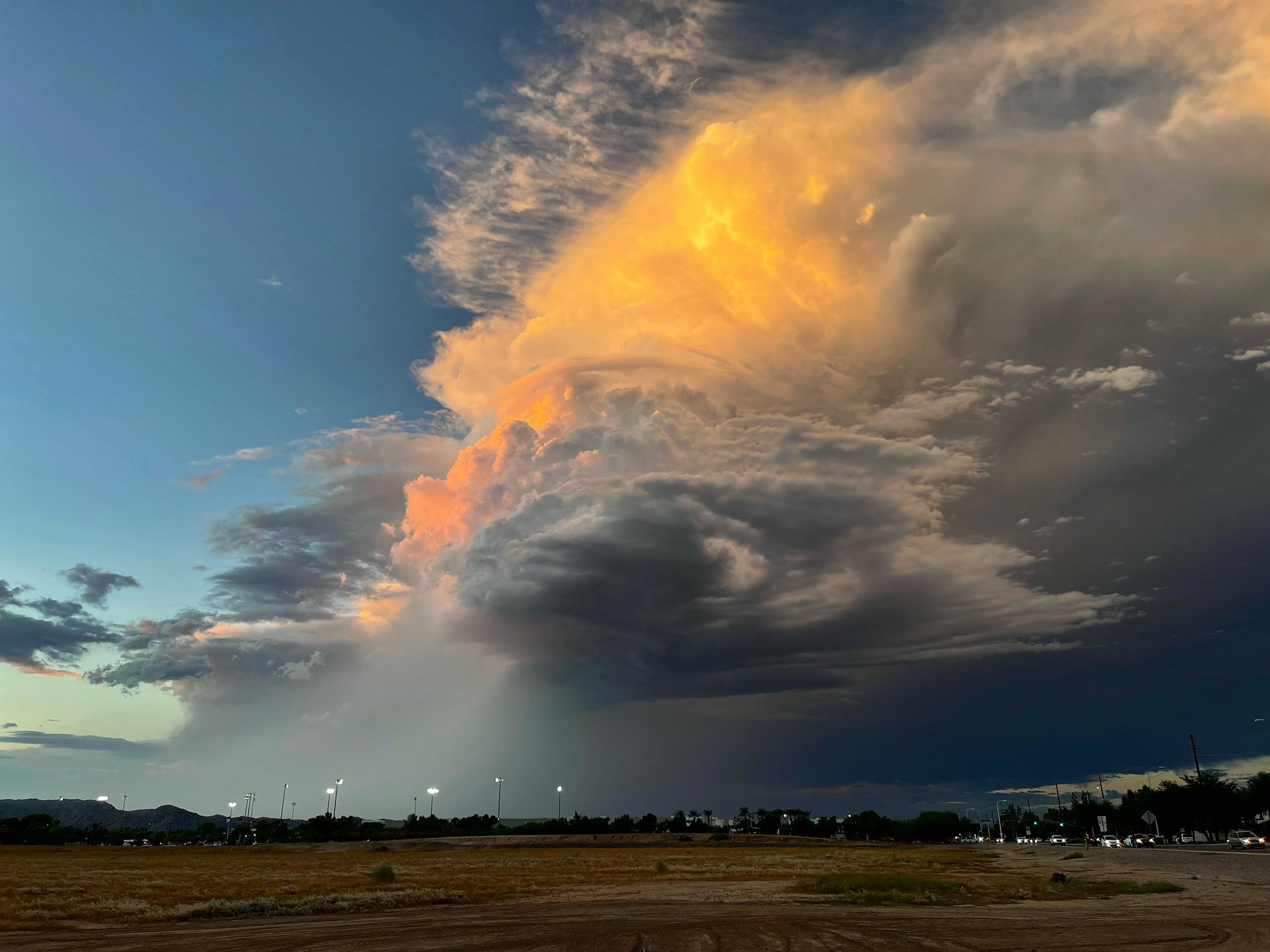
The largest hail reported was golf ball sized, or 1.75” in diameter, in Rainbow Valley west of the Estrella Mountains when the Phoenix supercell was in its mature stage. The supercell did gradually weaken as it pushed east of the Estrellas, but still produced hail up to 1 to 1.5 inches in diameter (quarter to ping-pong ball sized), between the Salt River and South Mountain. Hail up to 0.75 inches in diameter (penny sized) was even reported at Phoenix Sky Harbor International Airport. The supercell also provided quite the spectacle in cloud formations for nearly all to see in Phoenix, including a view of the rotating updraft and mammatus on the underside of the anvil cloud.
|
|
|
|
|
|
|
|
|
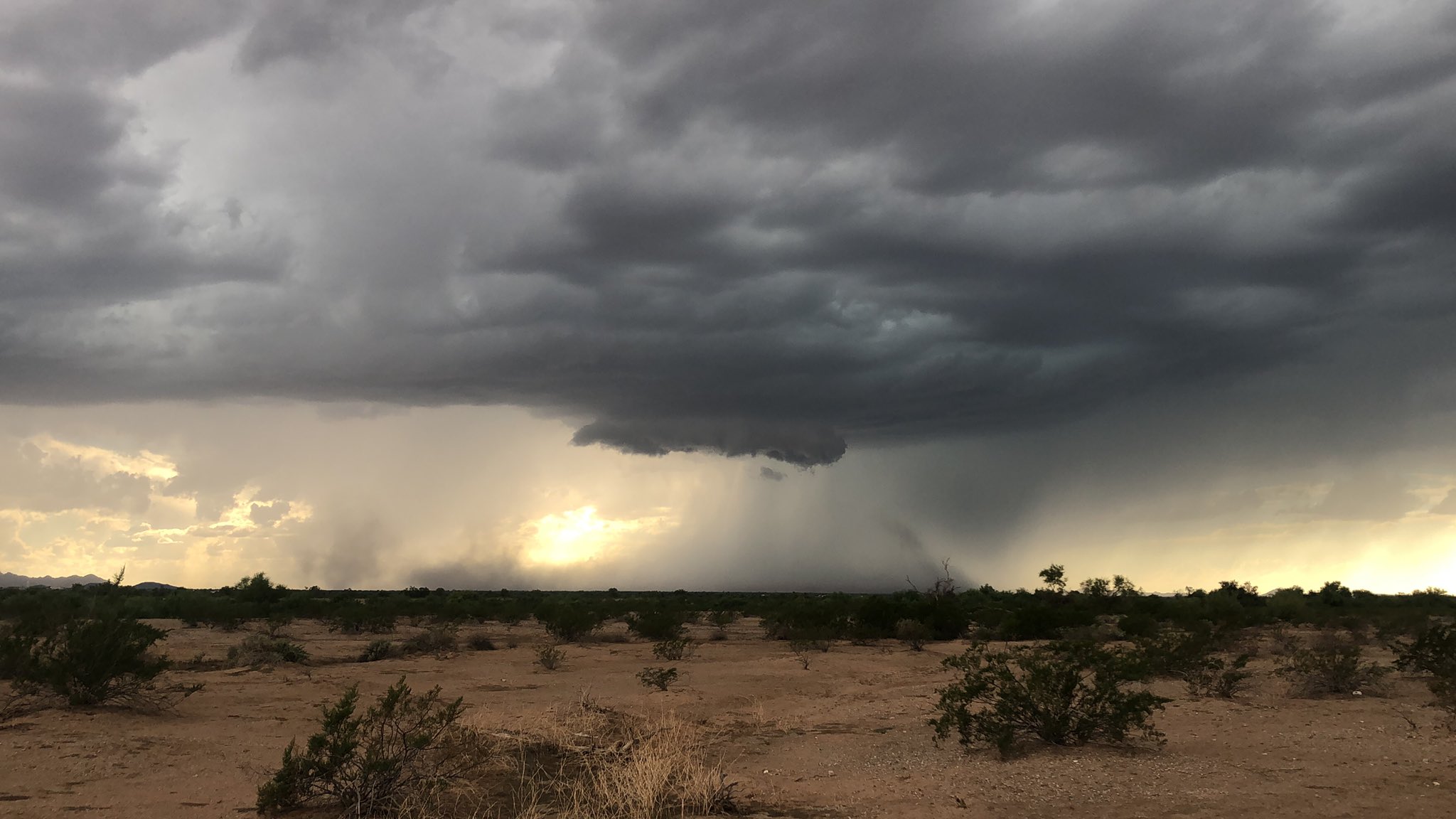
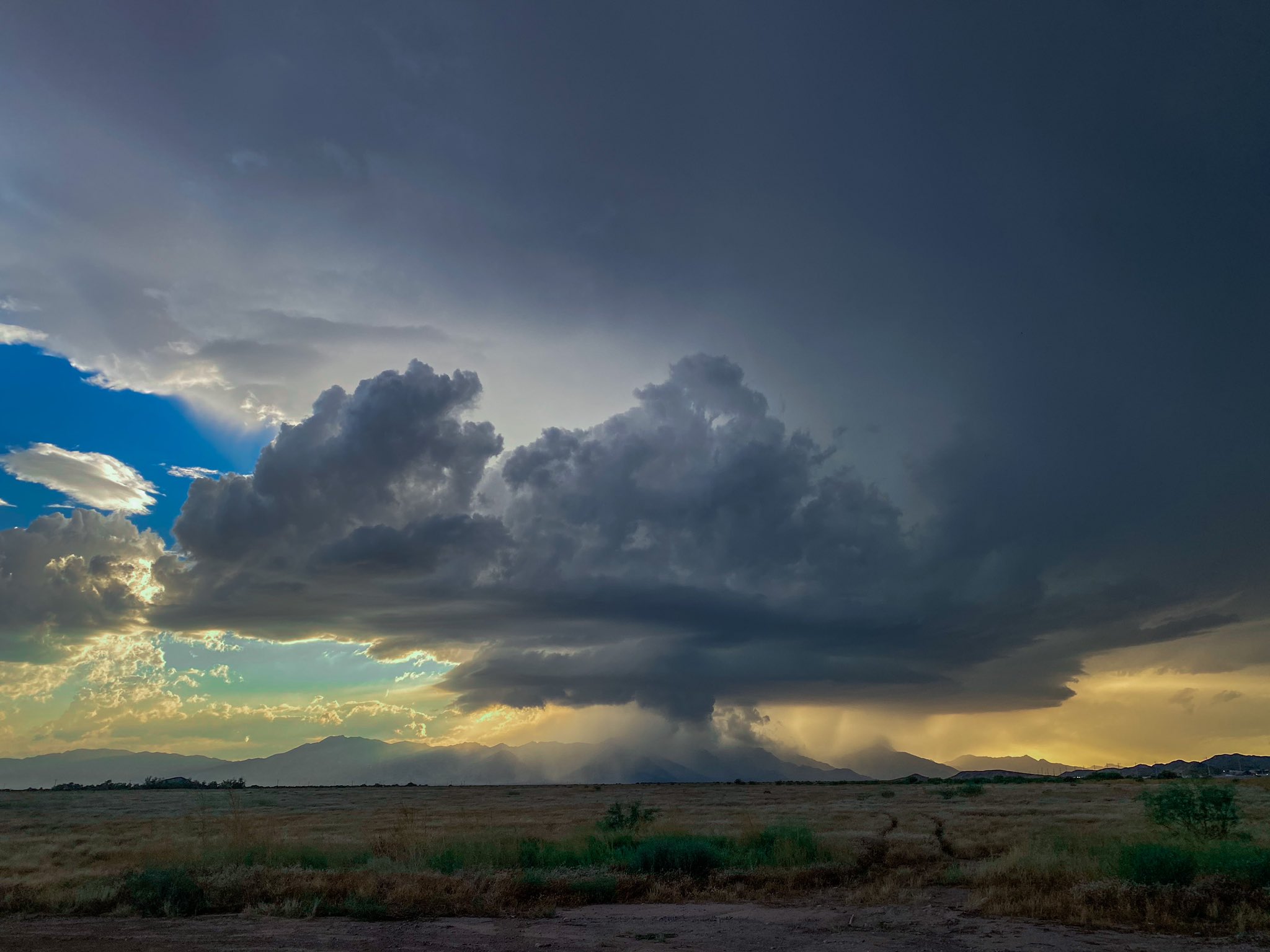
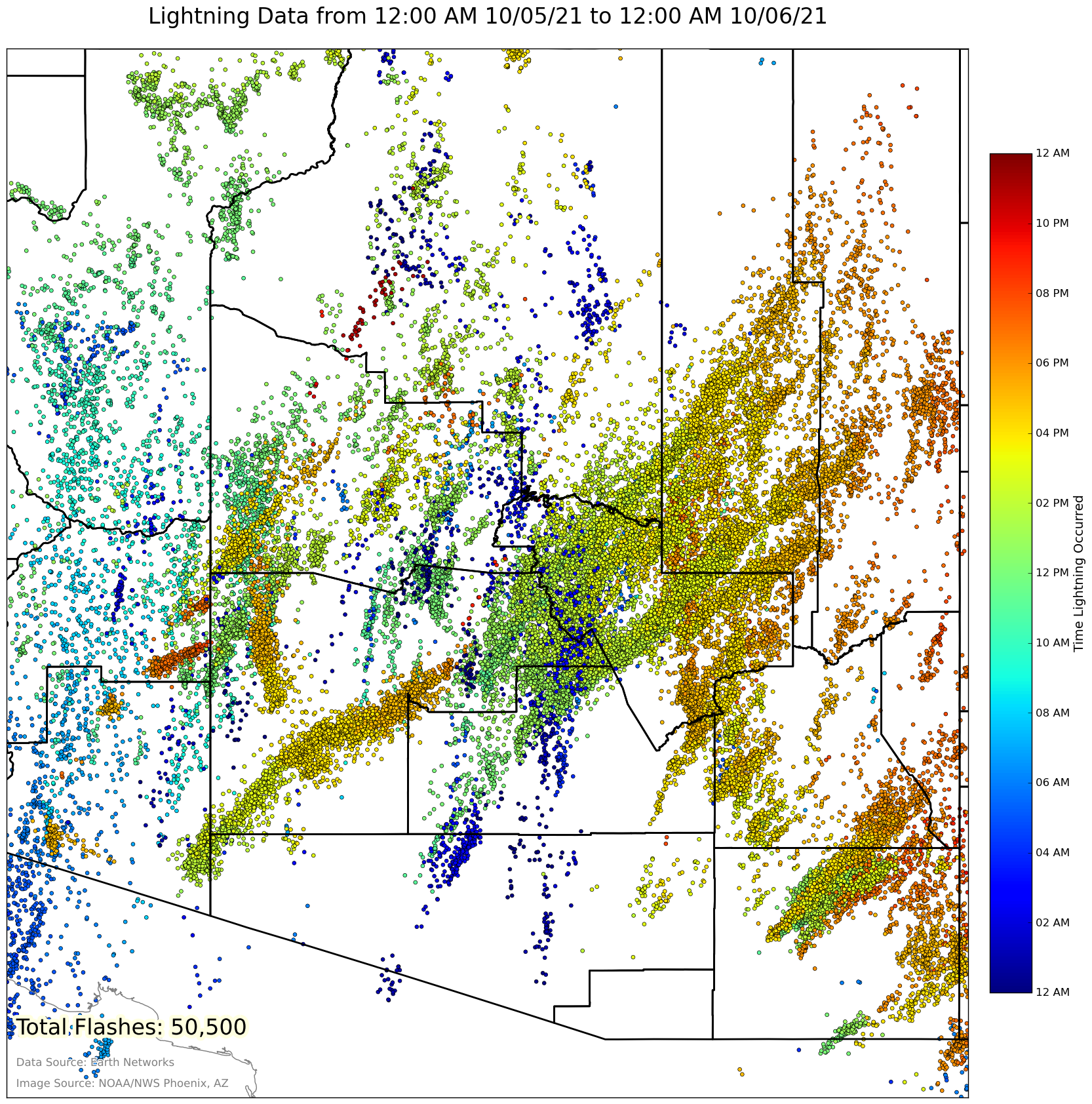
Fig. 15-20. Additional storm photos. Top-left: Early-stages of the Phoenix supercell when it was southwest of Gila Bend (credit: Kevin Rimcoski). Top-middle: Phoenix supercell as it was passing over South Mountain (credit: Spike Davis). Top-right: Mammatus clouds over Downtown Phoenix (credit: Luke Erickson). Bottom-left: Late stages of the supercell in Phoenix as viewed from Chandler (credit: Mark Rebilas). Bottom-middle: Mudslide over SR-188 near the north end of Lake Roosevelt (credit: ADOT). Bottom-right: Tuesday total lightning flashes across Arizona (credit: NWS Phoenix). |
||