
Dangerous, record-breaking heat will intensify across most of the central and eastern U.S this week. Heat indices will likely exceed 100 degrees. Heat is likely to continue across the eastern U.S. through the Independence Day holiday weekend. Critical fire weather conditions will continue today and likely Tuesday across portions of the Four Corners and northern High Plains. Read More >
Pueblo, CO
Weather Forecast Office
On June 4, 2015 several tornadoes occurred over Elbert and El Paso Counties in Central Colorado between 5 pm and 7 pm. The National Weather Service Offices in Boulder and Pueblo coordinated warning efforts for this event. Several Tornado Warnings were issued for this storm as it tracked, initially south, and finally southeast from southern Elbert County, across far northeastern El Paso County, and back into eastern Elbert County.
The damage assessment team found evidence of 3 tornado events with this storm, but could not determine how wide or long the tornado tracks were due their occurrence in open fields with little in the way of damage.
The worst damage was found was just west-northwest of Simla and along the El Paso/Elbert County line to the southeast of Simla. The survey team found barns and other outbuildings flattened with debris thrown a good distance. This damage was preliminarly rated EF1 and located in Elbert County. In El Paso County, the only damage the survery found was tree and sign damage. One street sign was on a thick metal pole and was flattened completely down to the ground.
The damage assessment team will continue to look at video of the tornadoes to determine the exact number that occurred along with determining a final EF scale ratings.
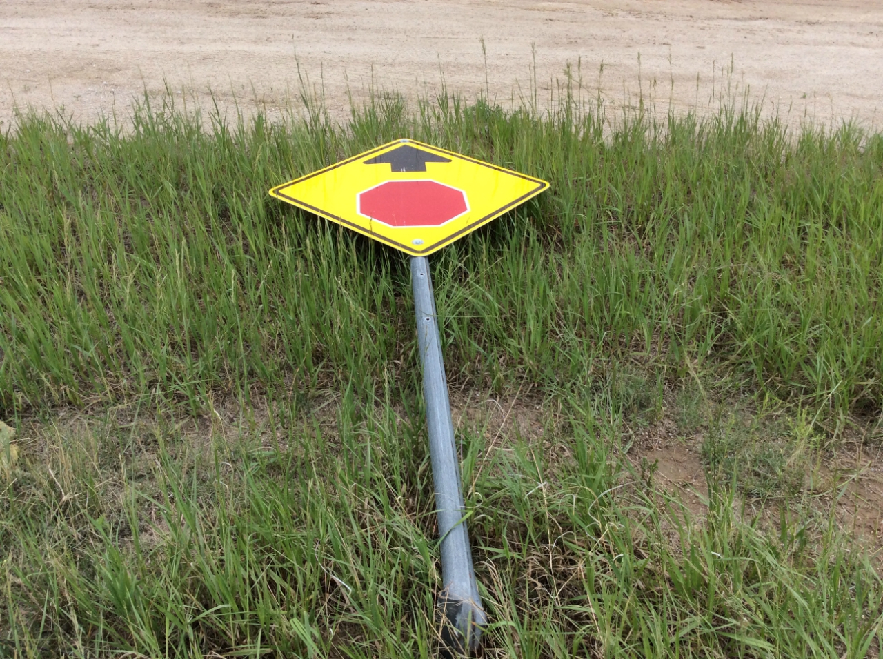
Chelton Road, 0.2 miles south of US Highway 24, preliminary EF0 damage.
Radar imagery at 5:37 pm when the sign was damaged
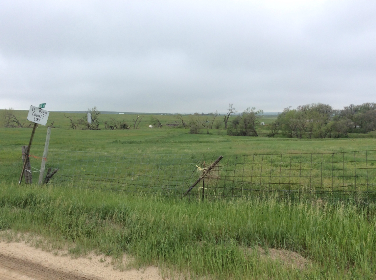
Chelton Road, Elbert-El Paso County border, preliminary EF1 damage
.png)
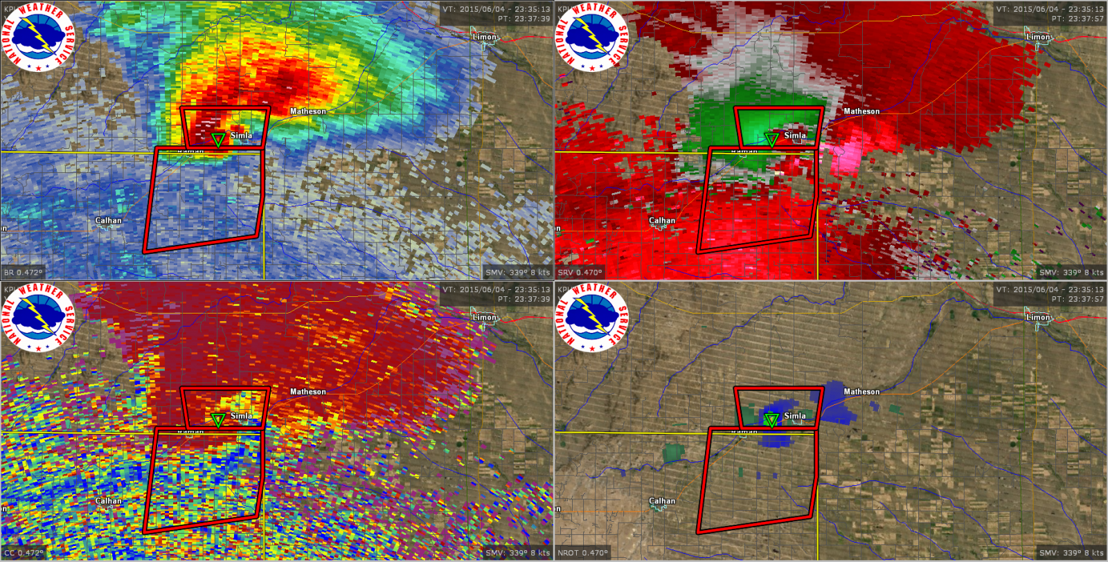
Radar imagery at 5:43 pm when the trees where damaged
Damage determined to be wind driven hail, County Road 133 and County Road 50 on the Elbert-El Paso County Line
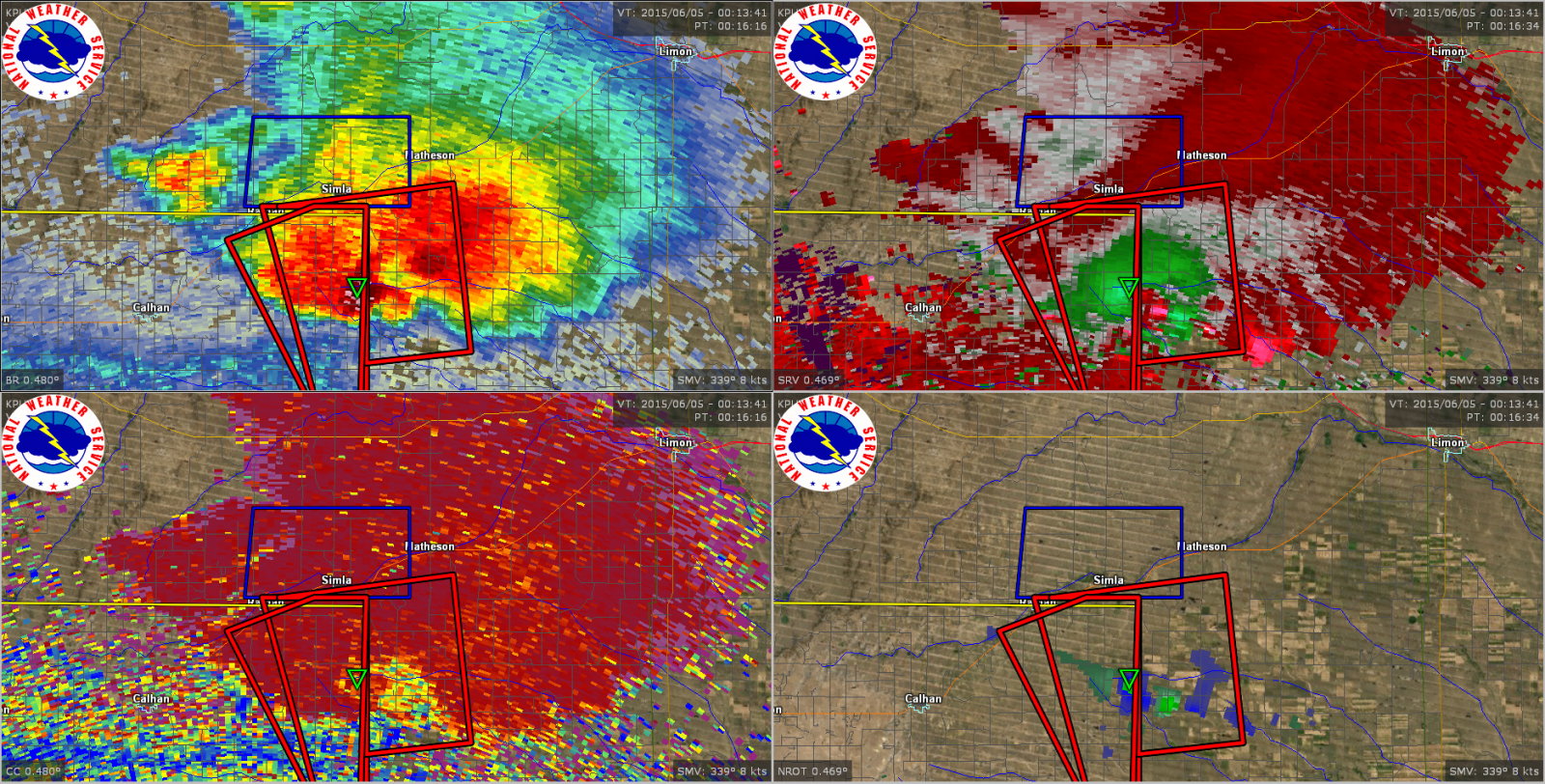
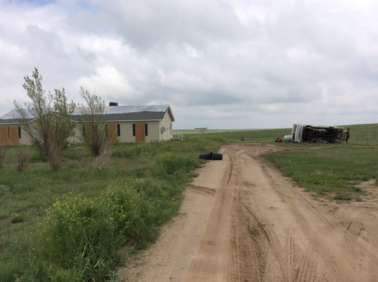
Radar imagery at 6:16 pm when the house and vehicle were likely damaged
Please check back over the coming days to additional information on this tornado event.
ACTIVE ALERTS
Warnings by State - click ATOM button
Excessive Rainfall Forecasts
River Flooding
Convective Outlooks
Hurricanes
Fire Weather Outlooks
UV Alerts
Space Weather
Winter Winter Forecasts
Enhanced Data Display(EDD)
PAST WEATHER
Climate Monitoring
Astronomical Data
Certified Weather Data
CURRENT CONDITIONS
Radar
River Levels
Observed Precipitation
Surface Weather
Upper Air
Marine and Buoy Reports
Climate Monitoring
Snow Cover
Satellite
Space Weather
Enhanced Data Display(EDD)
FORECAST
Severe Weather
Drought
Fire Weather
Front/Precipitation Maps
Graphical Foreast Maps
Rivers
Marine
Offshore and High Seas
Hurricanes
Aviation Weather
Climate Outlook
Enhanced Data Display(EDD)
WEATHER SAFETY
Owlie Skywarn - for kids
NOAA Weather Radio
StormReady
Natural Weather Hazard Statistics
Red Cross
Federal Emergency Management Agency(FEMA)
National Weather Service SafetyBrochures
US Dept of Commerce
National Oceanic and Atmospheric Administration
National Weather Service
Pueblo, CO
3 Eaton Way
Pueblo, CO 81001-4856
(719) 948-9429
Comments? Questions? Please Contact Us.

