Pueblo, CO
Weather Forecast Office
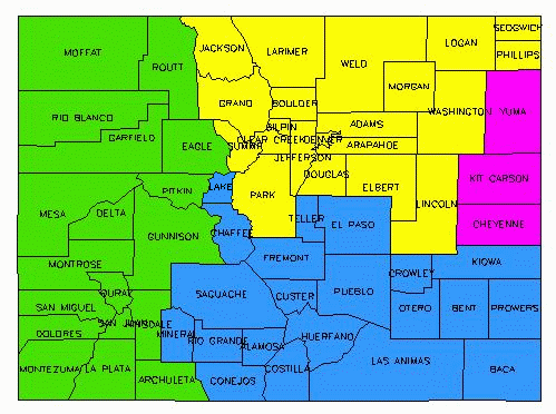
Our area of responsibility covers southeast and south central Colorado. The counties in our area of responsibility are:
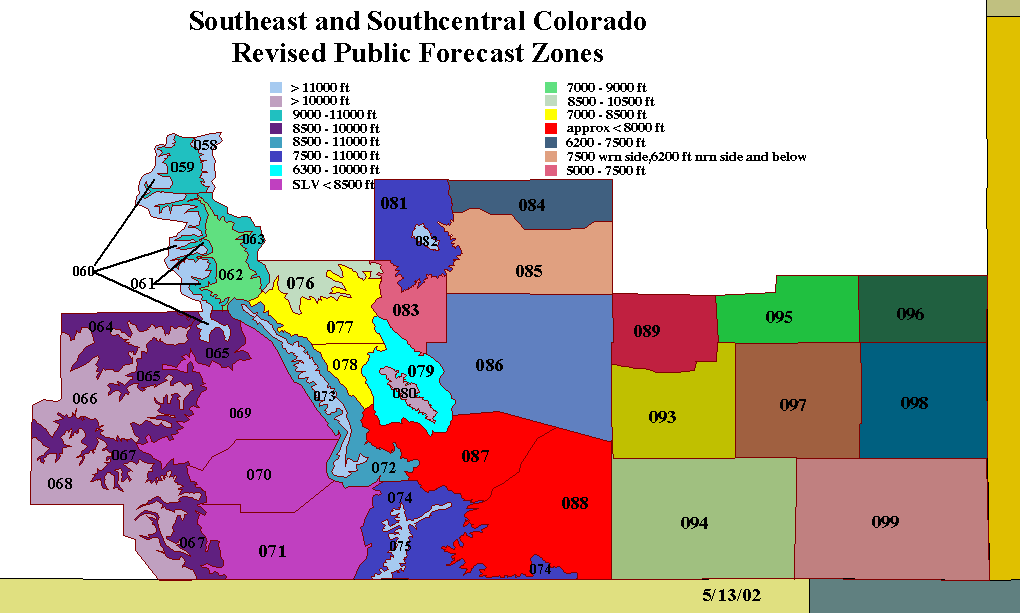
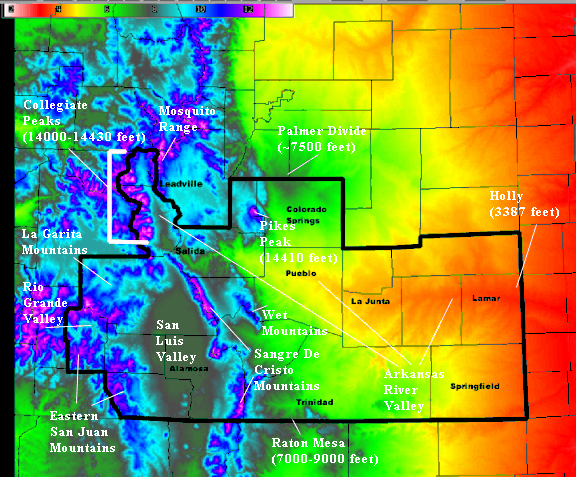
The topography of our area is extremely diverse, as you can see from the topographic map below.
 We recently realigned our zones to reflect the topography better. Many of our zone lines are based on an elevation contour. For a more detailed map showing our zones and related elevations, click on the thumbnail below.
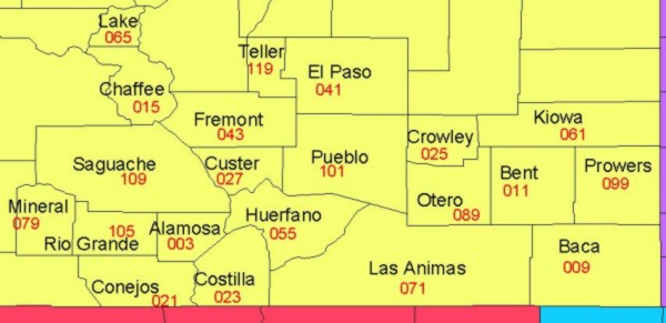
Click above map to enlarge Our products are issued either by zone or by county. Zone codes are listed in the above table. County names, and associated FIPS (Federal Information Processing Standard) codes, are pictured below.
|
ACTIVE ALERTS
Warnings by State - click ATOM button
Excessive Rainfall Forecasts
River Flooding
Convective Outlooks
Hurricanes
Fire Weather Outlooks
UV Alerts
Space Weather
Winter Winter Forecasts
Enhanced Data Display(EDD)
PAST WEATHER
Climate Monitoring
Astronomical Data
Certified Weather Data
CURRENT CONDITIONS
Radar
River Levels
Observed Precipitation
Surface Weather
Upper Air
Marine and Buoy Reports
Climate Monitoring
Snow Cover
Satellite
Space Weather
Enhanced Data Display(EDD)
FORECAST
Severe Weather
Drought
Fire Weather
Front/Precipitation Maps
Graphical Foreast Maps
Rivers
Marine
Offshore and High Seas
Hurricanes
Aviation Weather
Climate Outlook
Enhanced Data Display(EDD)
WEATHER SAFETY
Owlie Skywarn - for kids
NOAA Weather Radio
StormReady
Natural Weather Hazard Statistics
Red Cross
Federal Emergency Management Agency(FEMA)
National Weather Service SafetyBrochures
US Dept of Commerce
National Oceanic and Atmospheric Administration
National Weather Service
Pueblo, CO
3 Eaton Way
Pueblo, CO 81001-4856
(719) 948-9429
Comments? Questions? Please Contact Us.