Ash Wednesday Storm 1962
Name of Flood: Coastal Delaware Set Up: The March 1962 storm is the storm of many names. It's known as "The Great Atlantic Storm" as well as the "Five High Storm" because it lingered off the Atlantic Coast over a period of five high tides. But because the heaviest damages occurred in most areas on Wednesday, March 7, which was the Christian holiday of Ash Wednesday, it's become the "Ash Wednesday Storm of 1962."
The massive storm was caused by merging low pressure systems along the eastern seaboard with a strong surface high to the north. This caused the storm to slow and eventually stall in the mid-Atlantic for almost 3 days, pounding coastal Delaware with continuous rain, high winds, and tidal surges. To make matters worse, the storm occurred at the spring equinox, which created higher tides compared to normal.
Location Impacted: With a long ocean fetch, steady winds of gale force blew from the northeast. Gusts reached 70 mph resulting in storm tides of three to five feet above normal.
Waves more than 40 feet high occurred off of Rehoboth Beach. Waves in the Rehoboth Beach surf zone reached 20 to 30 feet destroying the boardwalk and beachfront homes.
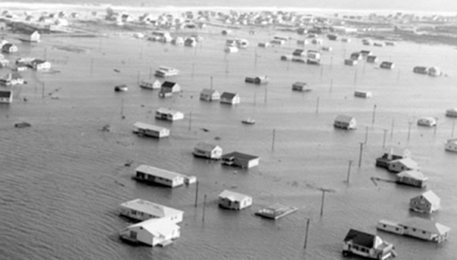
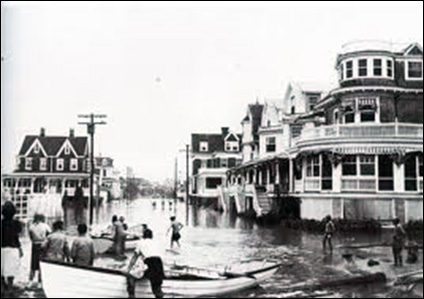
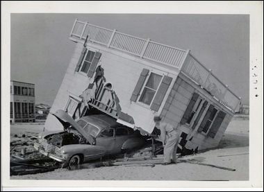
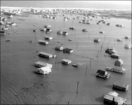
The 1962 storm was the most destructive storm in Bethany Beach's history. The nor'easter arrived on the evening of March 5 with 80-mile-per-hour winds. Destruction was widespread throughout Bethany Beach. Many of the beachfront structures were destroyed, including the bowling alley, many inns and houses, the boardwalk, and the town pavilion. Flood waters penetrated as far inland as Ocean View. Extensive beach erosion occurred, and sand over three feet deep buried streets and cars and filled entire rooms in some houses.
At Dewey Beach, the ocean had breached the dunes, and the storm water cascaded through the resort to Rehoboth Bay. At Fenwick Island, the waves washed over the barrier island and continued into the coastal bay. For a time, an inlet developed just north of town. Many beach cottages were destroyed. Nearly every structure in the resort sustained some damage. The sea had spewed so much sand inland that the northbound lanes of the highway between Fenwick and Bethany were covered.
Number of Fatalities:7
Dollar Damage:More than $70 million or around $500 million in 2013 dollars.