National Weather Service United States Department of Commerce
Click a location below for detailed forecast.

Last Map Update: Mon, Oct 13, 2025 at 12:58:55 am PDT

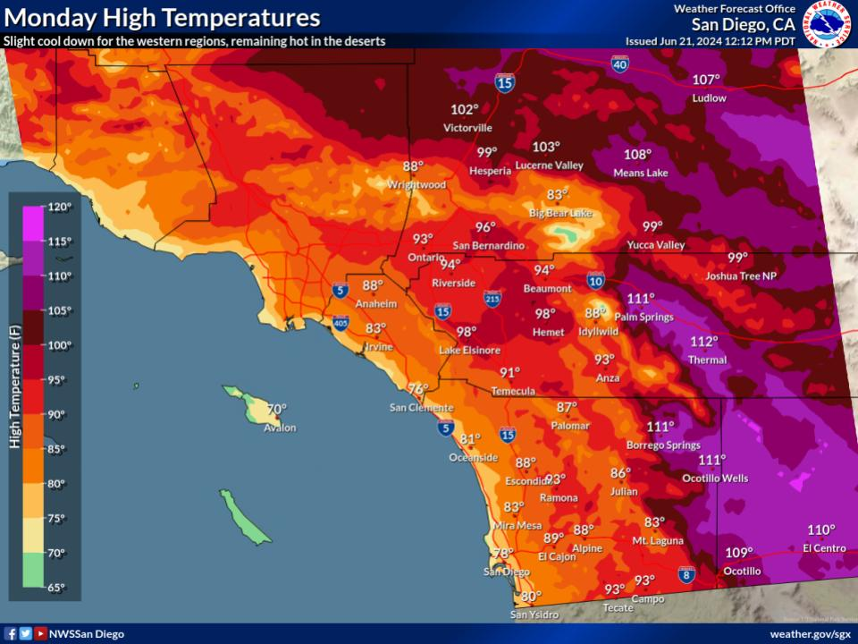
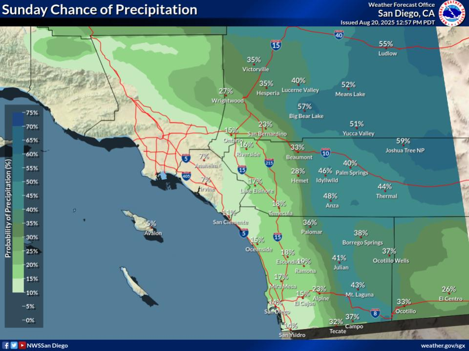
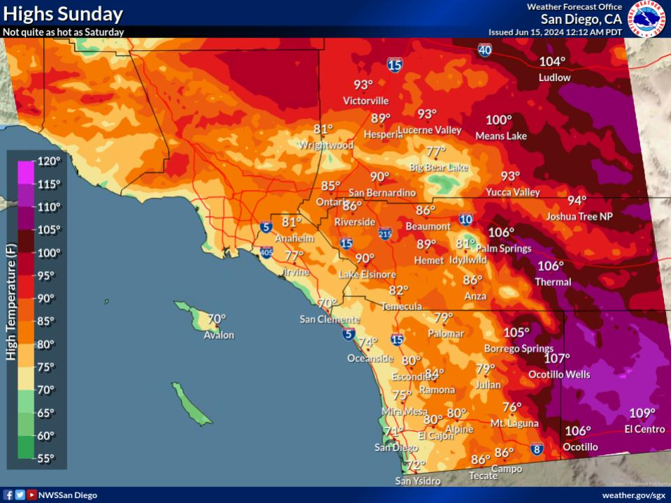
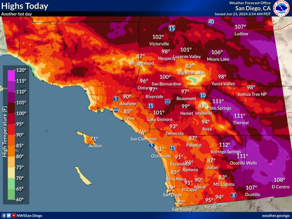
A weather system will move down the coast of California Monday and Tuesday. It will bring increasing winds across the mountains and deserts and a decent chance of rain showers across much of the area. The heaviest rain will fall across the SBD/RIV mountains and the LA basin. Lighter amounts in SD county and desert areas. Chilly morning by Wednesday as the system departs, especially in the mountains and high desert.
High temperatures begin to cool Monday as onshore winds strengthen over the area.
Coolest high temperatures are expected Tuesday afternoon with overcast skies and rain move across the area.
Gusty southwest to west winds develop late Monday and continue through Tuesday. The strongest wind gusts will be early Tuesday morning in the mountain passes and adjacent desert areas where gusts of up to 55 mph are expected.
A low-pressure system from the north will bring widespread light to moderate showers to most of the region beginning as early as Monday evening lasting through Tuesday night.


Text Product Selector (Selected product opens in current window)