Overview of Tropical Storm Elsa
Most images on this page may be expanded with a single click and can be returned to original size with a second click.
Please note, this webpage is preliminary and will change without notice. Data provided on this webpage is also considered preliminary.
For the Tallahassee forecast area Elsa primarily affected portions of the southeast Florida Big Bend and portions of southern Georgia before racing up the eastern seaboard. Elsa was a rare type of storm for late June/early July in several aspects. One was its highly anomalous forward speed across the eastern/central Caribbean, and another was how far east it formed. Tropical systems don't typically form east of the Lesser Antilles in June. Elsa brought a variety of impacts to the local area with the most impactful being storm surge and flooding rains across the Steinhatchee/Suwanee River Basins.
 |
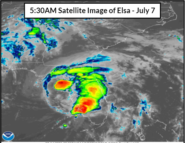 |
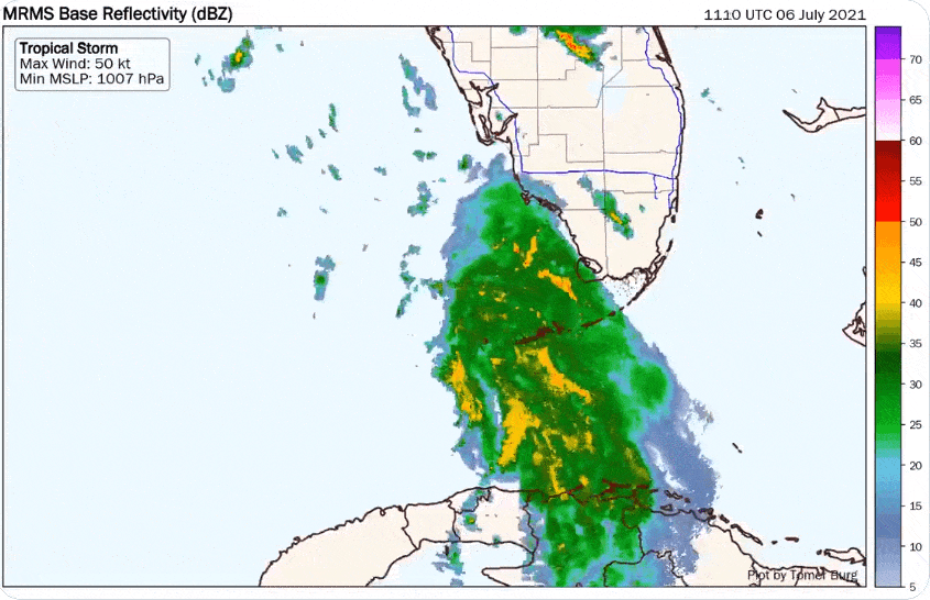
| Radar imagery showing Elsa as it moved up the west coast of Florida and into the Tallahassee NWS Forecast area. Elsa made landfall in Taylor county Florida close to the city of Steinhathcee, FL. Animation credit: Tomer Burg (@burgwx on Twitter) | Satellite imagery of Elsa on the morning of July 7th around 530am. Despite losing much of it's organization hours earlier additional convection developed a few hours prior to landfall. (NOAA GOES Satellite Imagery) |
Storm History
Information is preliminary and could change with the release of the National Hurricane Center's final report of Tropical Storm Elsa (found here when available).
Elsa developed near the Lesser Antilles where it was declared as Tropical Depression Five on June 30th. Elsa briefly became a hurricane on July 2nd while tracking briskly WNW across the northern Caribbean. The center of Tropical Storm Elsa moved between Jamaica and Hispanola, then cut across central Cuba with a NW motion at a decreased forward speed on the 5th. The first Tropical Storm Watches were issued for southeast Big Bend and Apalachee Bay early that morning. Thereafter, Elsa emerged into the FL Straits on the 6th, passing near the Lower Keys, followed by a northward turn paralleling the west coast of FL. Elsa regained short-lived hurricane status prior to landfall along Taylor/Dixie County, FL as a strong, but sheared tropical storm late in the morning on July 7th. Elsa then turned northeast after landfall, moving into north FL/south GA before accelerating along the eastern seaboard where it later became post-tropical on the 9th.
 |
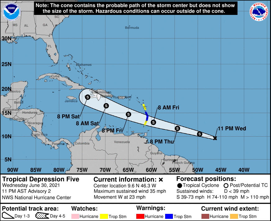 |
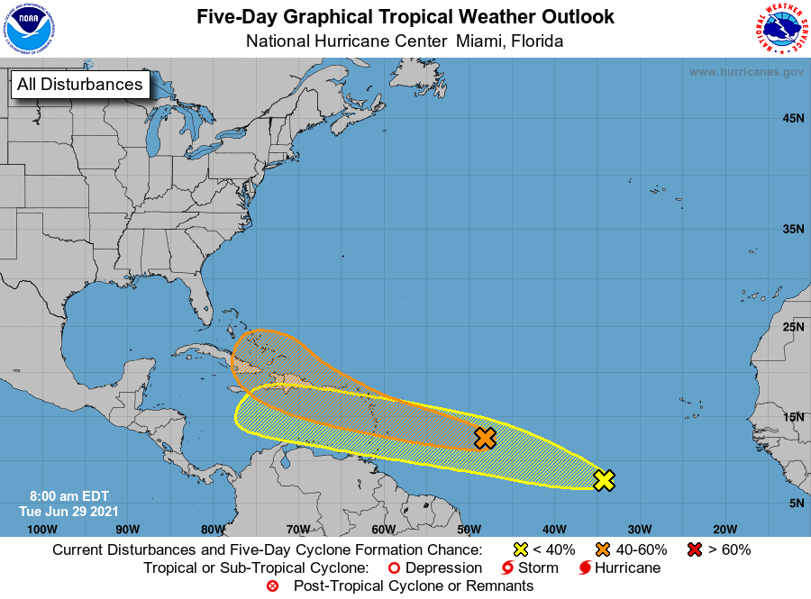
| The first tropical weather outlook that mentioned the disturbance that would eventually become Elsa. This genesis path for June and early July systems is rare. | The history of Elsa from when it first formed as a tropical depression on June 30 and it's history until it departed the Tallahassee forecast area late July 7th. |
National Hurricane Center's Tropical Cyclone Report (This link won't work until report is published).
Reports from neighboring offices will be included here when available.
Wind and Rainfall Reports
Information These wind reports are considered preliminary, a final listing of maximum winds will be listed in NHC's final tropical report after the end of the season.
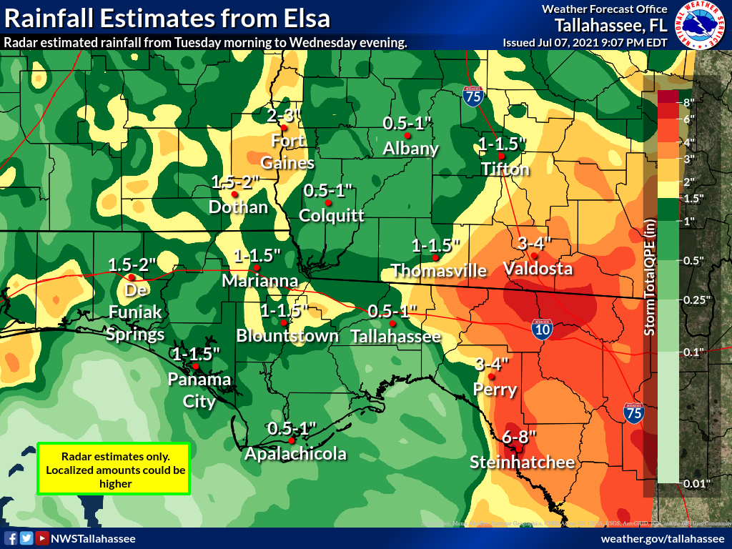 |
| Radar estimated rainfall from Elsa. The heaviest rainfall fell across eastern portions of the forecast area. |
National Weather Service Tallahassee FL
515 PM EDT Wed Jul 7 2021

...HIGHEST WIND REPORTS...

Location                     Speed     Time/Date
Horseshoe Beach              71 MPH    1040 AM 07/07
Valdosta Regiona             41 MPH    0152 PM 07/07
Moody Afb                    41 MPH    0416 PM 07/07
Panacea                      41 MPH    0746 PM 07/06
0.7 NE Perry-Foley Airport   41 MPH    1030 AM 07/07
0.6 E Mayo                   41 MPH    1110 AM 07/07
Keaton Beach                 40 MPH    1100 AM 07/07
2.9 S Eastpoint              38 MPH    0830 PM 07/06
Apalachee Bay - Panacea      37 MPH    0746 PM 07/06
Panama City Beach, FL        37 MPH    0618 PM 07/06
St. Andrew Bay               37 MPH    1028 PM 07/06
Perry-Foley Airport          36 MPH    1215 PM 07/07
Cross City                   36 MPH    1115 AM 07/07
2.8 N Cherry Lake            34 MPH    0920 AM 07/07

Observations are collected from a variety of sources with varying
equipment and exposures. We thank all volunteer weather observers
for their dedication. Not all data listed are considered official.
Impacts and Photos
Information is preliminary and could change with the release of the National Hurricane Center's final report of Tropical Storm Elsa (found here when available).
Elsa developed near the Lesser Antilles where it was declared as Tropical Depression Five on June 30th. Elsa briefly became a hurricane on July 2nd while tracking briskly WNW across the northern Caribbean. The center of Tropical Storm Elsa moved between Jamaica and Hispanola, then cut across central Cuba with a NW motion at a decreased forward speed on the 5th. The first Tropical Storm Watches were issued for southeast Big Bend and Apalachee Bay early that morning. Thereafter, Elsa emerged into the FL Straits on the 6th, passing near the Lower Keys, followed by a northward turn paralleling the west coast of FL. Elsa regained short-lived hurricane status prior to landfall along Taylor/Dixie County, FL as a strong, but sheared tropical storm late in the morning on July 7th. Elsa then turned northeast after landfall, moving into north FL/south GA before accelerating along the eastern seaboard where it later became post-tropical on the 9th.
 |
 |
 |
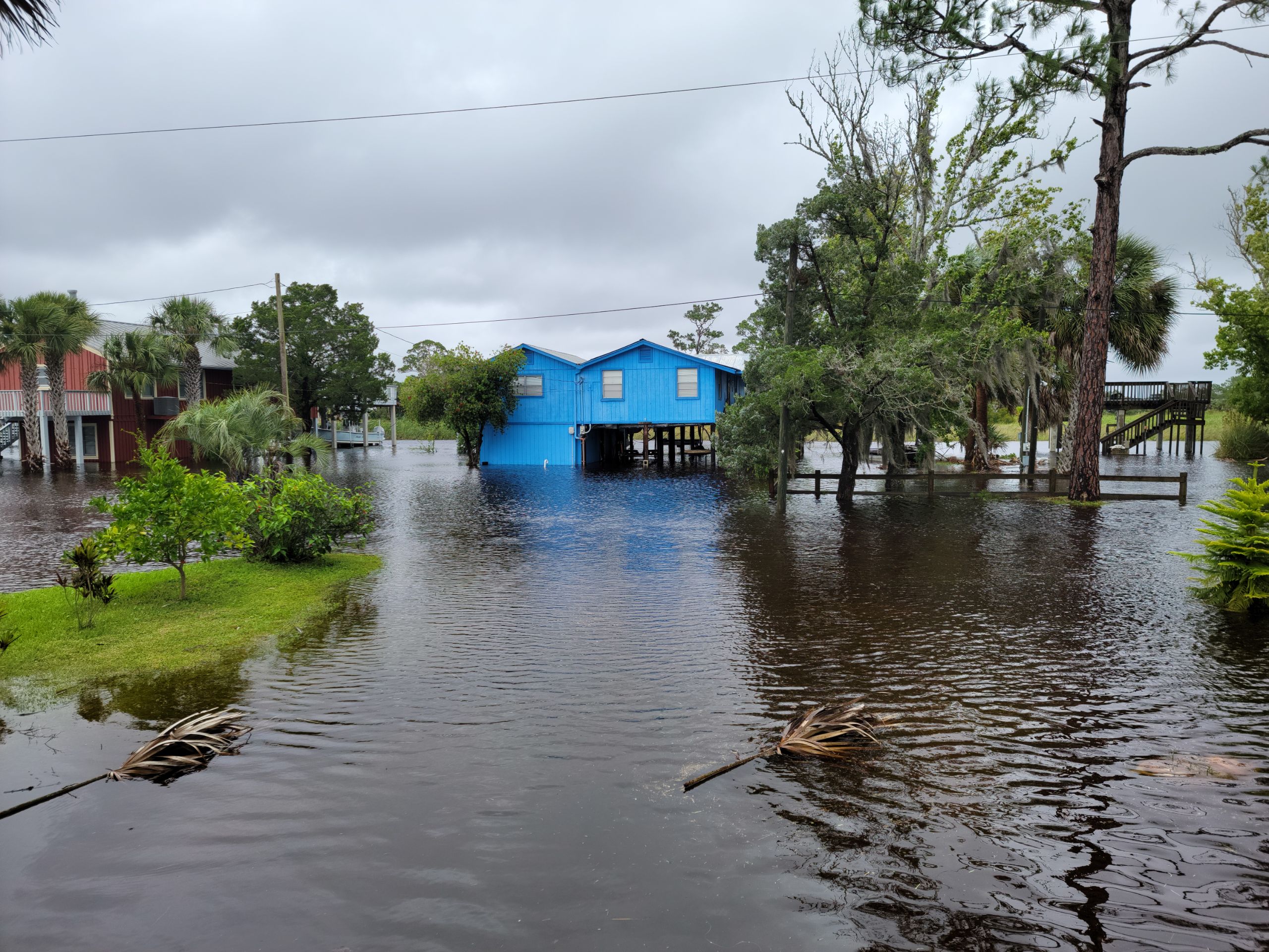 |
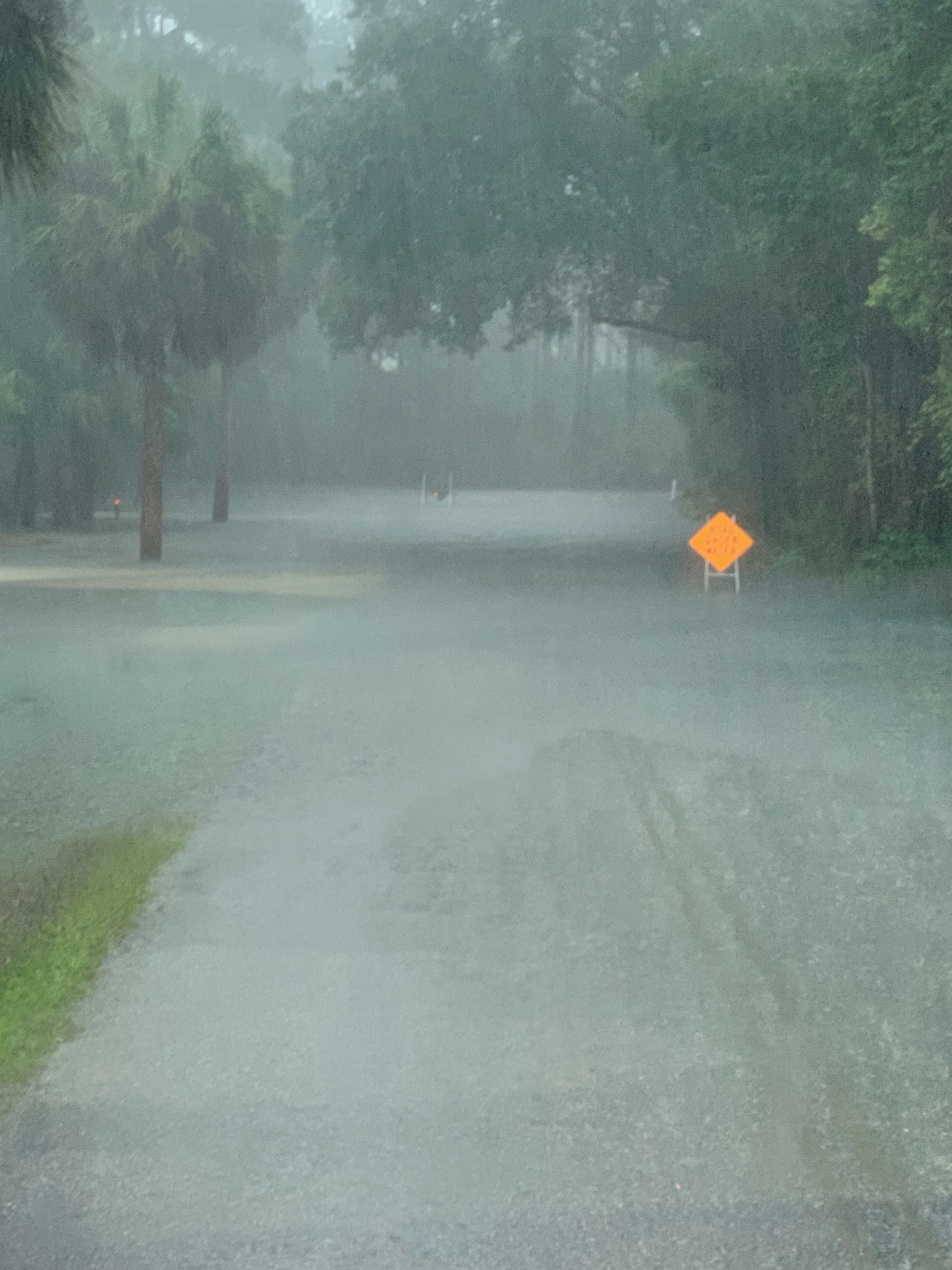
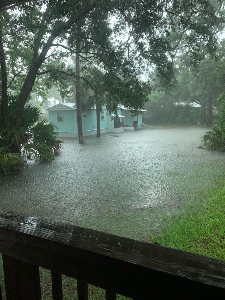
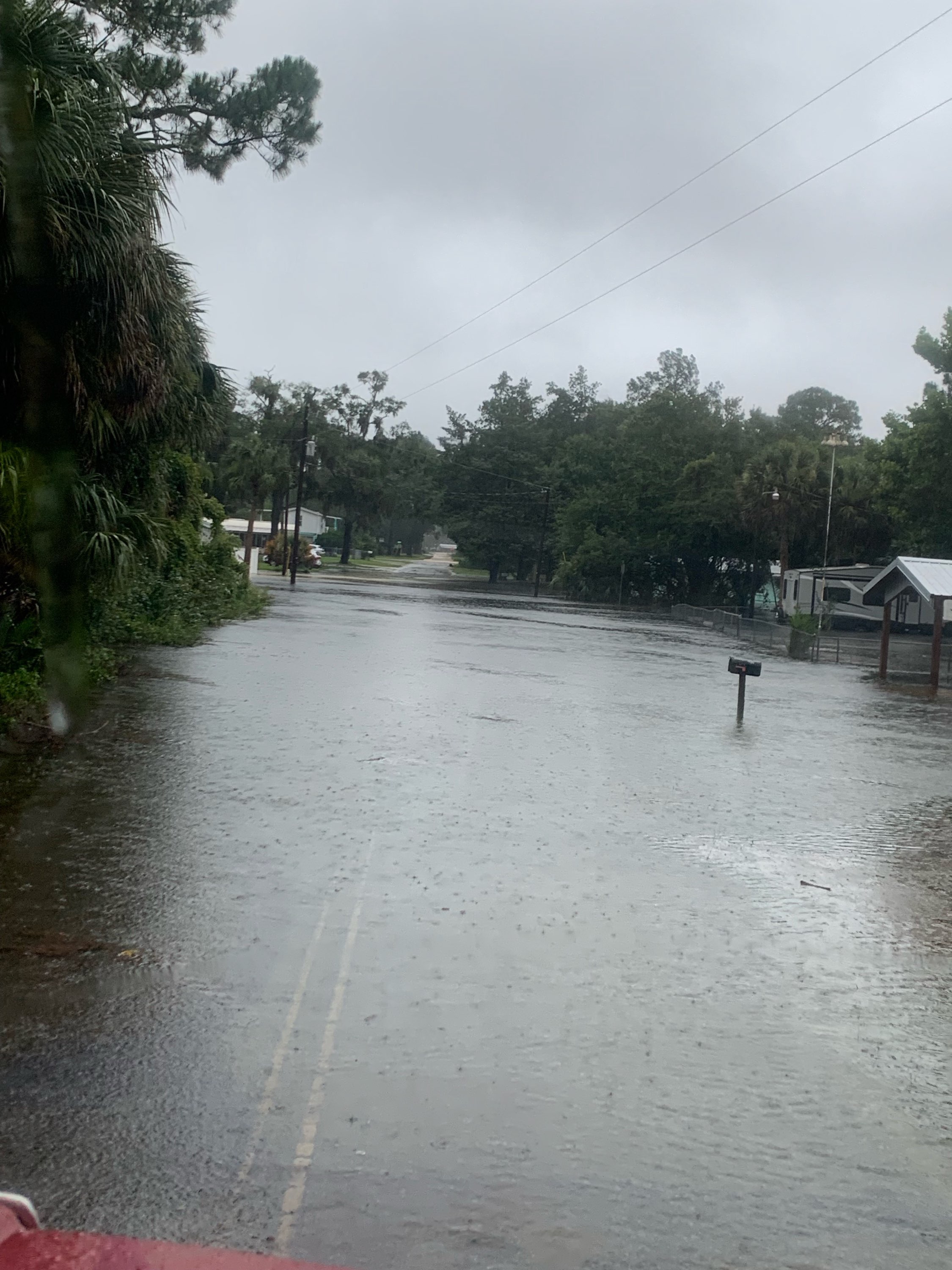
| Flooding in Steinhatchee | Flooding in Steinhatchee | Flooding in Steinhatchee | Flooding in Suwanee |
 |
Media use of NWS Web News Stories is encouraged! Please acknowledge the NWS as the source of any news information accessed from this site. |
|


 Follow us on YouTube