
Scattered thunderstorms with severe gusts, hail and a tornado risk are possible near a cold front from the Ohio Valley to the Mid-Atlantic tonight. Tropical Storm Bertha is expected to bring tropical storm conditions to portions of the Gulf Coast from the panhandle of Florida into Louisiana through Wednesday. Read More >
Hydro Elements |
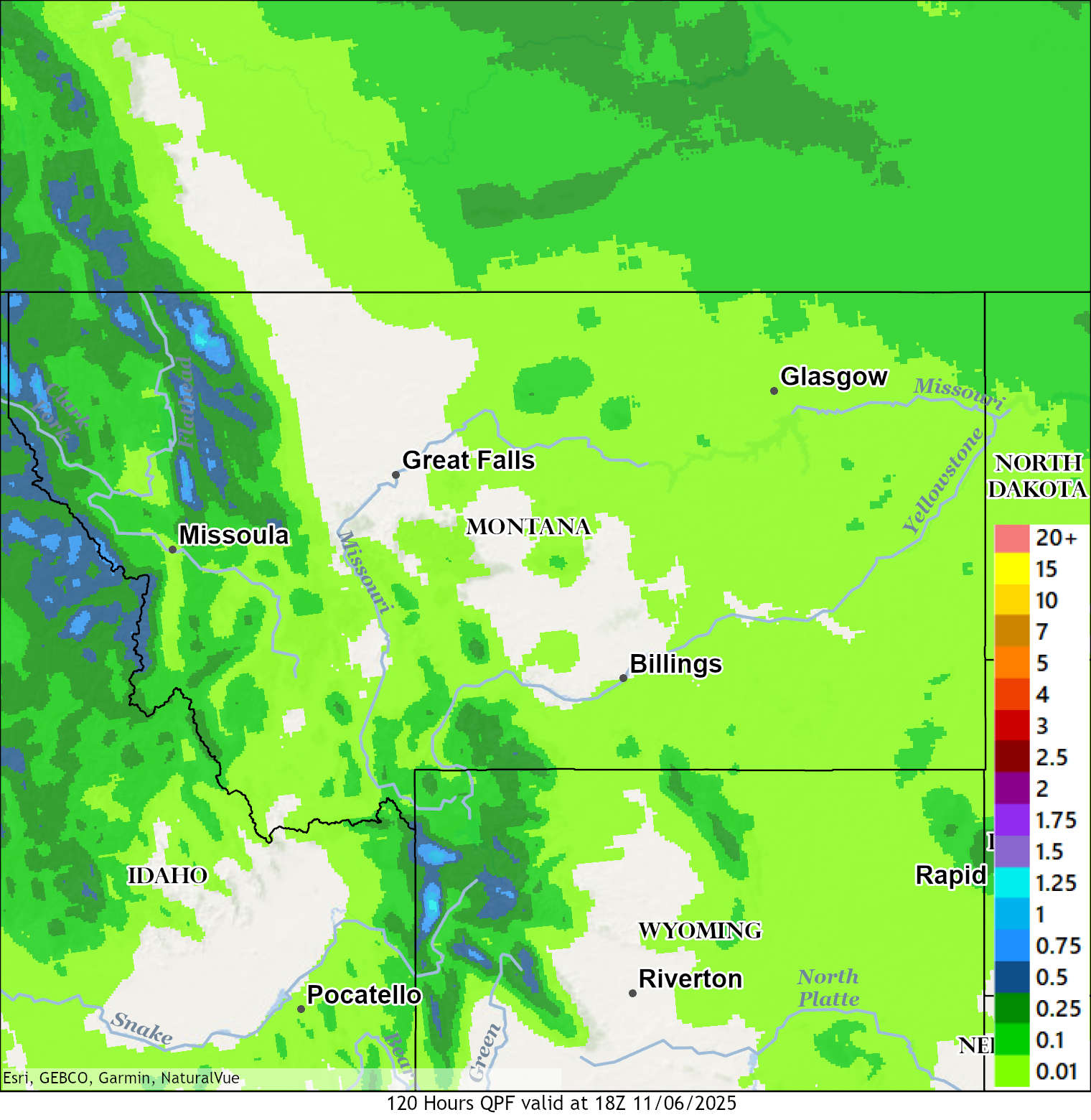
Precipitation Accumulation Forecasts
|
|
| 120 Hour (5 Day) Precipitation Accumulation Forecast | 168 Hour (7 day) Precipitation Accumulation Forecast |
 |
 |
Excessive Rainfall Outlook |
|
| Today's Flash Flooding Potential | Tomorrow's Flash Flooding Potential |
 |
 |
| Day 3 Flash Flooding Potential | |
|
|
|
|
Click to enlarge graphics |
|
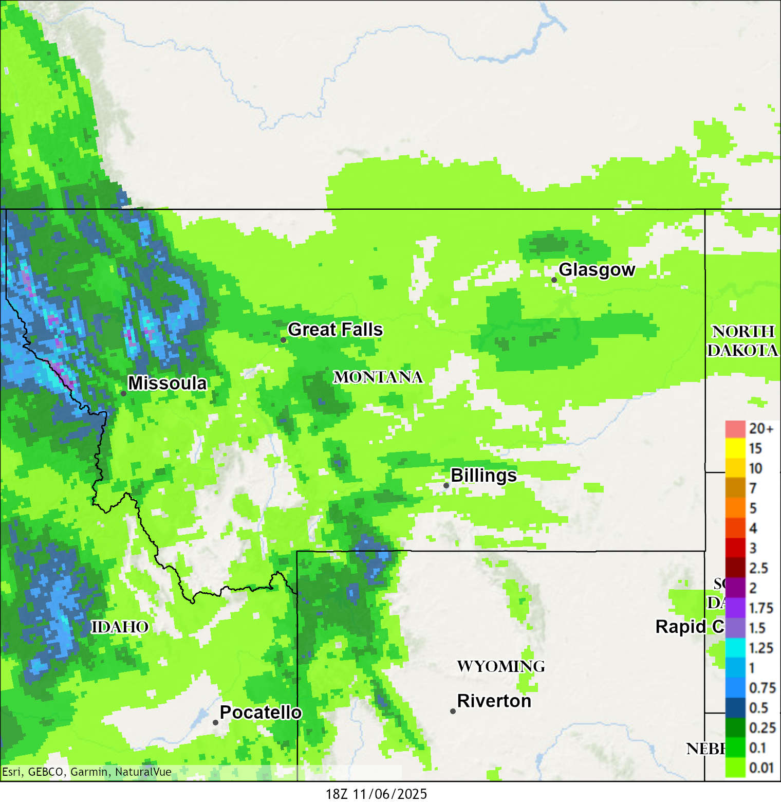
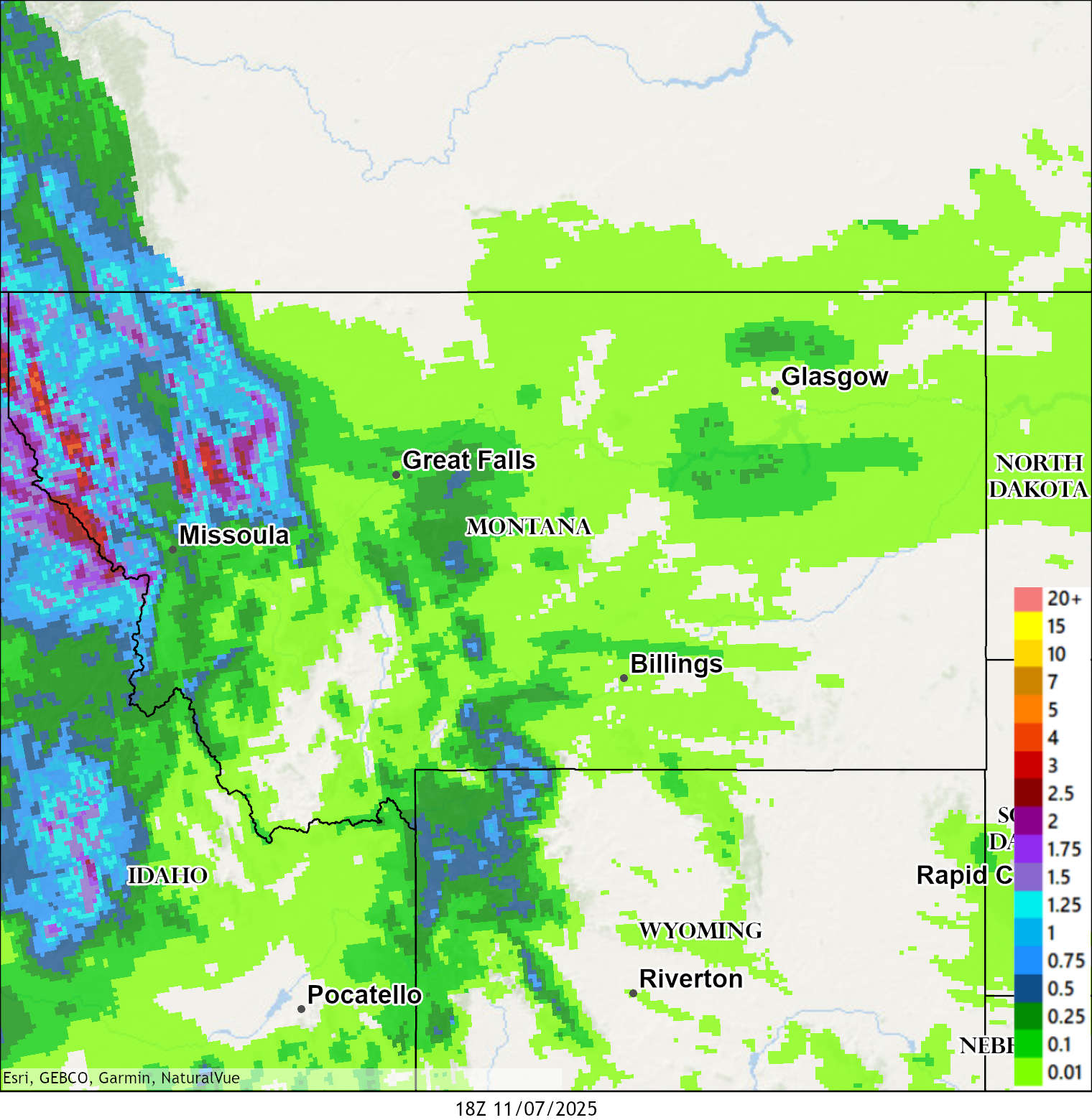
Observed Precipitation |
|
|
48 Hour Observed Precipitation |
120 Hours Observed Precipitation |
 |
 |
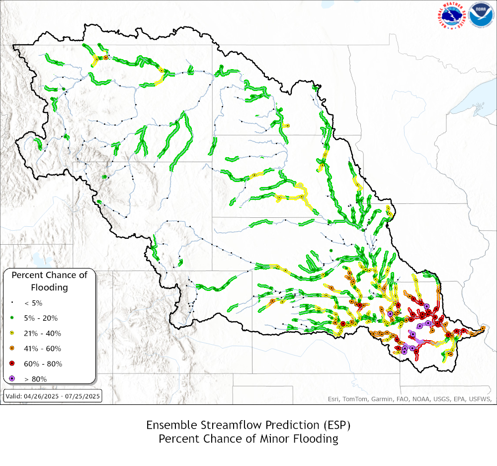
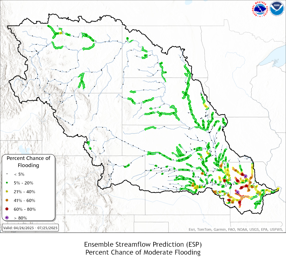
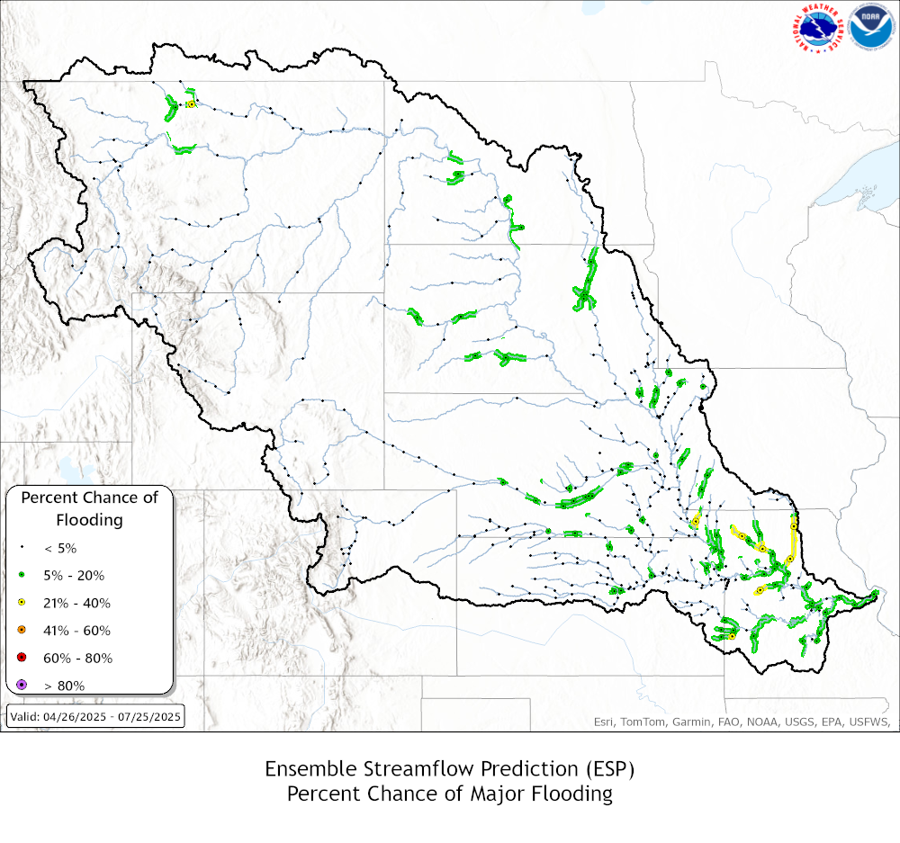
Missouri Basin River Forecast Center Outlooks |
||
| Probabilities of Exceeding | ||
| Minor Flood Levels | Moderate Flood Levels | Major Levels |
 |
 |
 |
|
Click to enlarge graphics |
||
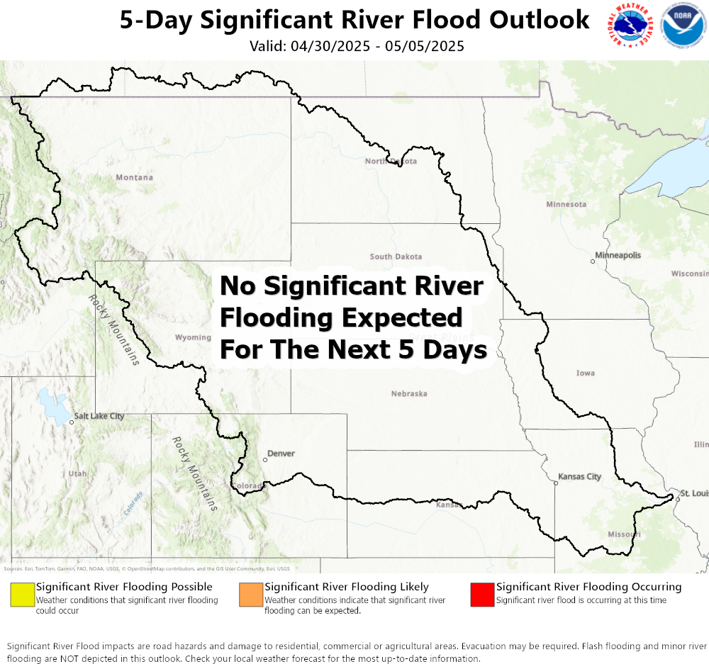
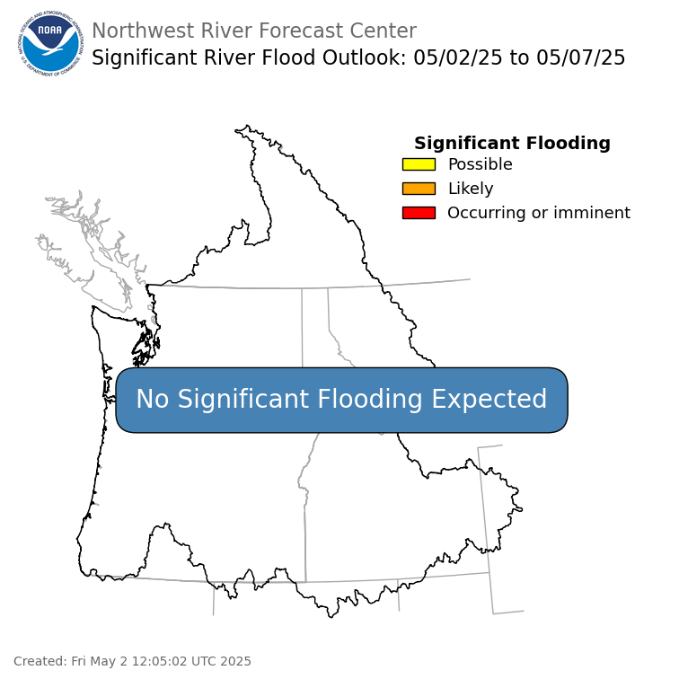
5-Day River Flood Outlook |
|
| Missouri Basin River Forecast Center | Northwest River Forecast Center |
|
|
|
|
*Forecasts may not be available for all locations. Forecasts are updated more routinely when flooding is anticipated or ongoing. Click here for all Northeastern Montana river and lake gauge readings Click here for all Southeastern Montana river and lake gauge readings Click here for all North-Central and Southwestern Montana river and lake gauge readings Click here for all Western Montana river and lake gauge readings For more information about river forecasts and flooding potential, visit Missouri Basin River Forecast Center and visit Northwest River Forecast Center |
|
Missouri River Hydrograhs & HEFS Click on Hydrograph to expand image, click on text below each image to see stage impacts and historic crests. |
|
|
Toston
|
|
|
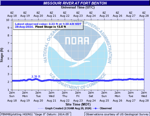
Fort Benton
|
|
|
Landusky
|
|
|
Wolf Point
|
|
| For other hydrographs along the Missouri River click on the following links: Canyon Ferry Reservoir, Hauser Dam, Holter Dam, Cascade, Morony Dam, Virgelle, Fort Peck Reservoir, Culbertson | |
|
Milk River Hydrographs & HEFS Click on Hydrograph to expand image, click on text below each image to see stage impacts and historic crests. |
|
|
Havre
|
|
|
Harlem
|
|
|
Malta
|
|
|
Glasgow
|
|
| For other hydrographs along the Milk River click on the following links: Eastern Crossing, Fresno Reservoir, Dodson, Saco | |
|
Yellowstone River Hydrographs Click on Hydrograph to expand image, click on text below each image to see stage impacts and historic crests. |
|
|
Corwin Springs
|
|
|
Billings
|
|
|
Miles City
|
|
|
Sidney
|
|
| For other hydrographs along the Yellowstone River click on the following links: Livingston, Forsyth, Glendive | |
|
Clark Fork River Hydrograhs & HEFS Click on Hydrograph to expand image, click on text below each image to see stage impacts and historic crests. |
|
|
Missoula
|
|
|
Missoula
|
|
|
Plains
|
|
|
Deer Lodge
|
|
| For other hydrographs along the Clark Fork River click on the following links: Drummond, St. Regis | |
|
Flathead River Hydrograhs & HEFS Click on Hydrograph to expand image, click on text below each image to see stage impacts and historic crests. |
|
|
West Glacier
|
|
|
Columbia Falls
|
|
|
Columbia Falls
|
No HEFS Graphic Avialable |
|
Columbia Falls
|
|
| For other hydrographs along the Flathead River click on the following links: Polson, Candian Border, Perma, Hungry Horse | |
| Explanation of HEFS Graphics |
 |
Basin Snow Water Equivalents |
|||||||
|
|
|||||||
|
Other Resources
|
|||||||


 Great Falls Radar
 Satellite
 Current Observations
 Forecast Discussion
 Montana Weather
 Fire Weather
 Winter Weather Forecasts
 Transportation Forecasts
 Weather Prediction Center
 Storm Prediction Center
 Aviation Weather
 Weather Stats