
Scattered thunderstorms with severe gusts, hail and a tornado risk are possible near a cold front from the Ohio Valley to the Mid-Atlantic tonight. Tropical Storm Bertha is expected to bring tropical storm conditions to portions of the Gulf Coast from the panhandle of Florida into Louisiana through Wednesday. Read More >
Visit the Montana tab on our Probabilistic Snow Website for more snowfall range, potential,
and probability of exceeding specific threshold graphics
|
Winter Elements |
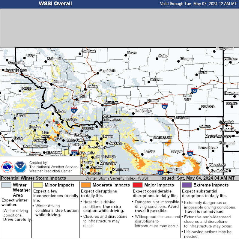
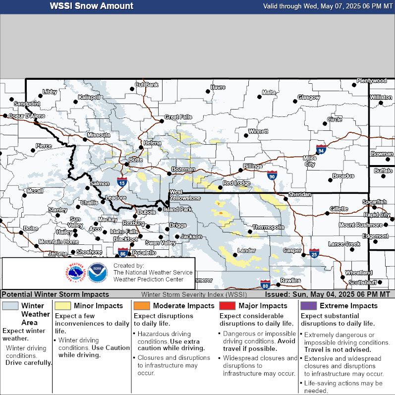
Winter Storm Severity Index (through 72 hours) |
||
| WSSI Overall | WSSI Snow Amount | WSSI Blowing Snow |
 |
 |
 |
| Click to enlarge graphics | ||
Probabilistic Winter Storm Severity Index |
Helpful Links and Other Local Resources |
||
|
Road Conditions (www.mdt.mt.gov/travinfo)
|
Road Condition Maps
|
 |
|
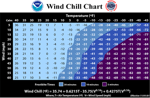
Wind Chill Chart & Frostbite Times
|
Wind Chill Calculator |
|
| Montana SNOTEL Map | ||


 Great Falls Radar
 Satellite
 Current Observations
 Forecast Discussion
 Montana Weather
 Fire Weather
 Winter Weather Forecasts
 Transportation Forecasts
 Weather Prediction Center
 Storm Prediction Center
 Aviation Weather
 Weather Stats