
A High Risk (Level 4 of 4) of Excessive Rainfall has been issued for portions of east Texas into western Louisiana today. For weeks, heavy rainfall has fallen across the Gulf coast states so any additional rainfall today will likely lead to life threatening flash flooding. Severe thunderstorms capable of producing large hail, severe winds and tornadoes will also be possible in central Texas. Read More >
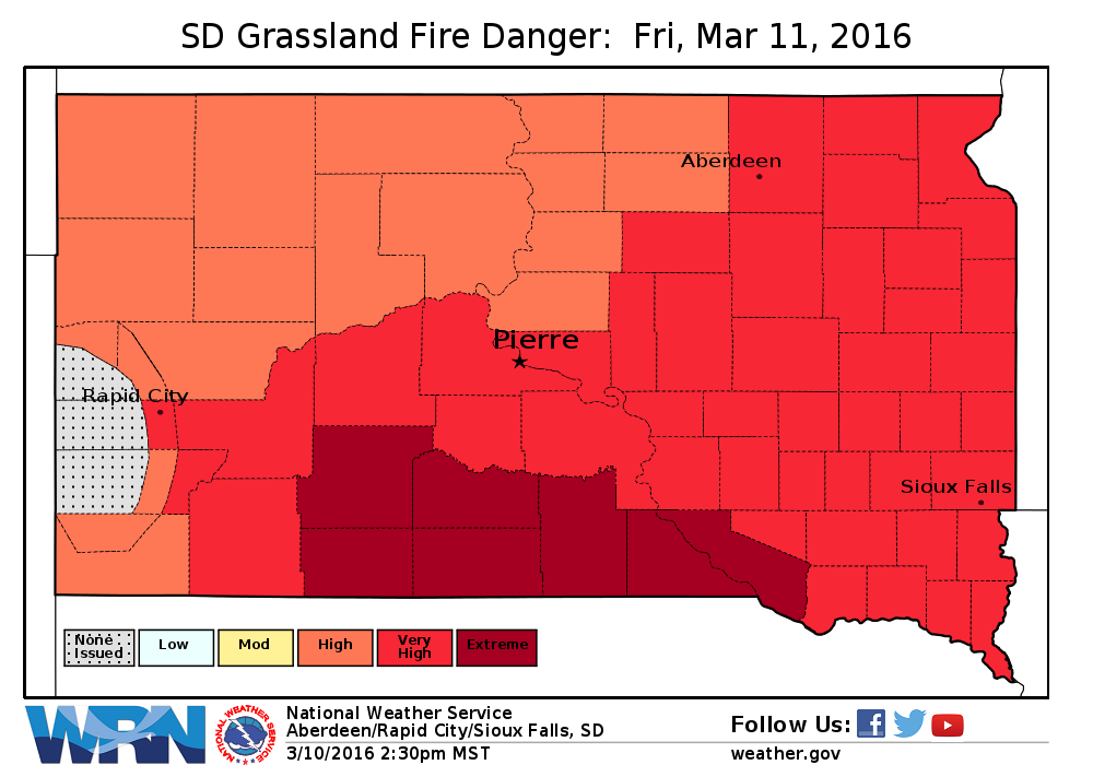
March 10, 2016 - Very dry and breezy conditions are forecast Friday afternoon over south central South Dakota. Relative humidities will drop into the lower teens as southerly winds increase to 15 to 25 MPH with gusts as high as 40 MPH. As a result, critical fire weather conditions are expected.
A map of the Red Flag Warning (bright pink/red color) for Friday, March 11, 2016.
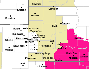
In addition, the South Dakota Grassland Fire Danger Index will be in the high to extreme category.


 Follow us on YouTube