
Dangerous and extreme heat will remain across portions of the southern U.S. this week. Heavy rainfall may bring significant flash flooding across portions of the Mid-Atlantic and Northeast through the night, and additional flash flooding concerns across New England on Wednesday. Monsoonal thunderstorms will bring a flash flood risk to the Four Corners region, especially in burn scar areas Read More >
Memphis
Center Weather Service Unit
| Return to Safety Homepage |
Density Altitude
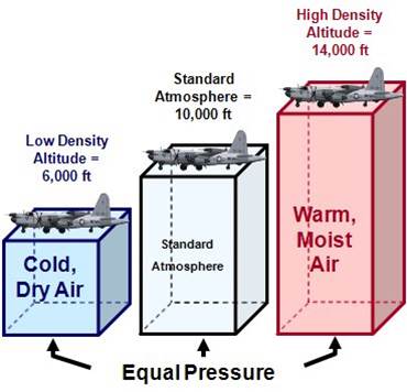 Density Altitude Concept Density Altitude Concept |
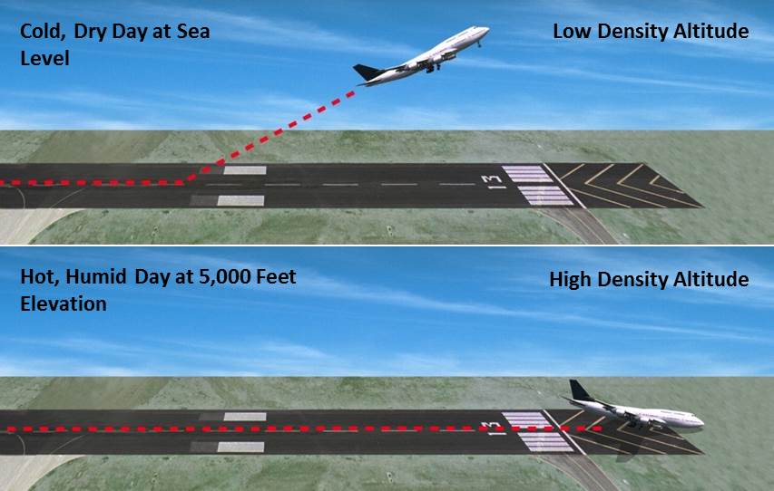 |
On a hot, muggy day, the air becomes “thinner” or less dense, and its density at a pilot’s location is equivalent to a higher altitude in the standard atmosphere. It is hazardous to aircraft during takeoff and climb because:
- Aircraft power is reduced. The engine will ingest less air to support combustion.
- Aircraft thrust is reduced. A propeller will have less "grip" on the air, while a jet engine will will exhaust less mass.
- Lift is reduced. The thinner air will exert less upward force on the airfoils.
As a result, a longer takeoff and landing roll is required, especially for a fully-loaded aircraft. After takeoff, the aircraft will have a smaller rate of climb and will have a lower service ceiling.
Density altitude is usually reported at each AWOS/ASOS station in the Remarks section of the METAR, if the value is greater than 1000ft higher than the elevation of the airfield. Here's an example:
METAR KMSY 291400Z AUTO 18006KT 10SM CLR 28/13 A3001 RMK SLP161 DENSITY ALT 1000FT
Turbulence |
Thunderstorms |
Icing |
Ceiling and Visibility |
LLWS |
Density Altitude |
US Dept of Commerce
National Oceanic and Atmospheric Administration
National Weather Service
Memphis
3229 Democrat Road
Memphis, TN 38118
Comments? Questions? Please Contact Us.

