|
|
|
|
|
|
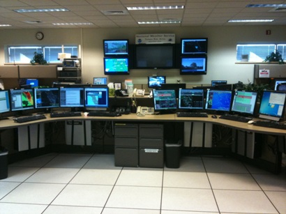
The operations area is the heart of the NWS office. This is where forecasters perform most of their duties, which include conducting analysis and issuing forecasts and warnings. The operations area consists of 5 identical workstations as well as a Situational Awareness Display and various other tools used daily by the staff. As our office is open 24 hours per day, forecasters rotate through 3 different shifts: morning, evening, and overnight. There are always at least 2 forecasters on duty at any given time.
The short term forecaster does the forecast from the current time to 72 hours out. This forecaster will also issue all public and marine products, such as the Zone Forecast Product (ZFP) and the Coastal Waters Forecast (CWF). The ZFP breaks down the entire warning area into separate zones and details weather conditions such as temperature, winds, and rain chance in each zone and the CWF details the wave heights, winds, and general marine conditions expected.
The long term forecaster does the forecast for days 4 through 7 and also issues aviation and fire weather forecasts. Aviation forecasts called Terminal Aerodrome Forecasts (TAFs) detail weather conditions for pilots for the next 24 hours and are issued for 5 of the airports in the area: Tampa International Airport, St. Petersburg/Clearwater International Airport, Sarasota-Bradenton International Airport, Page Field Airport, and Southwest Florida International Airport. These forecasts contain expected cloud cover, visibility, wind speed and direction, and any forecasted weather (such as fog or rain). In addition, the long term side does the fire weather forecast for the area. This involves monitoring the relative humidity and winds around the area and issuing fire weather warnings, watches, and advisories if conditions appear favorable for fires to break out.
Both hydro-meteorological technicians (HMT) and meteorologist interns work at the third desk. This desk is usually staffed only for times when there is a balloon launch, which are the morning and evening shifts. The only exception is when there is a tropical cyclone in the area. During these times, there is a balloon launch every 6 hours, so a third person is needed throughout the night. In addition to the balloon launches, the HMT/Intern also monitors the area rivers and issues warnings or advisories for high water levels. This desk also issues climate products and monitors the status of the radar and the NOAA weather radio transmitters. |
|
| Advanced Weather Interactive Processing System |
|
|
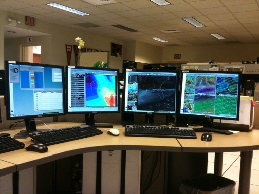
The Advanced Weather Interactive Processing System (AWIPS) is the computer workstation that is used to display a wide range of products used for forecasting. These include graphical products, such as radar, satellite, model data, and observations, as well as text products, which include written forecasts. Forecasters generally spend a good part of their shift at an AWIPS workstation. There are 5 identical workstations in our operations area. |
In addition to AWIPS, forecasters use a program called Graphical Forecast Editor (GFE). GFE is the main tool used to create forecasts. GFE allows forecasters to draw grids of expected weather conditions, such as temperature, dew point, wind, sky cover, probability of precipitation, and wave height. Each NWS office produces these grids, which are all combined to create a nationwide graphical forecast. The grids are also automatically converted to text to give day by day forecasts that go out over the NOAA Weather Radio and onto our webpage. |
|
|
| Hurricane Workstation |
|
|
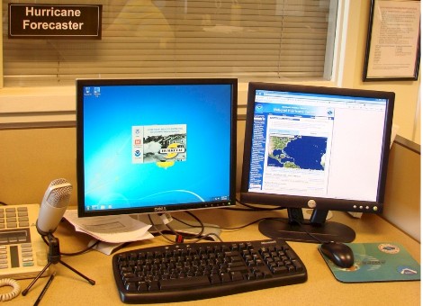
Among the busiest times for the NWS-Tampa Bay office is during hurricane events. When a hurricane is threatening our coasts, this workstation is utilized to conduct briefings with county emergency managers, and media interviews. During the rest of the year, this computer is used for office research and training. |
|
Amateur Radio Workstation
(For a more detailed explanation, click here) |
|
|
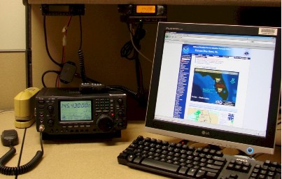
During severe weather events, amateur radio (ham radio) is used to receive storm reports from SKYWARN spotters and law enforcement officials. The local amateur station ID at the office is WX4TOR. Additionally, each Tuesday evening, WX4TOR is used in a practice net conducted with SKYWARN volunteers from across the area. |
|
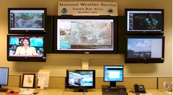
| Situational Awareness Display |
|
|
The Situational Awareness Display is located at the center of the operations area and is used daily for office weather briefings. Local and national news channels are also on display so that forecasters are always apprised of what is happening outside the office. In addition, one of the monitors is usually looping through webcams across the area, so that forecasters can get a look at what weather conditions are actually occurring |
|
| Watches and Warnings |
|
|
Although many NWS forecasts are issued at regular intervals, watches, warnings, and advisories are issued only when the weather calls for special attention.
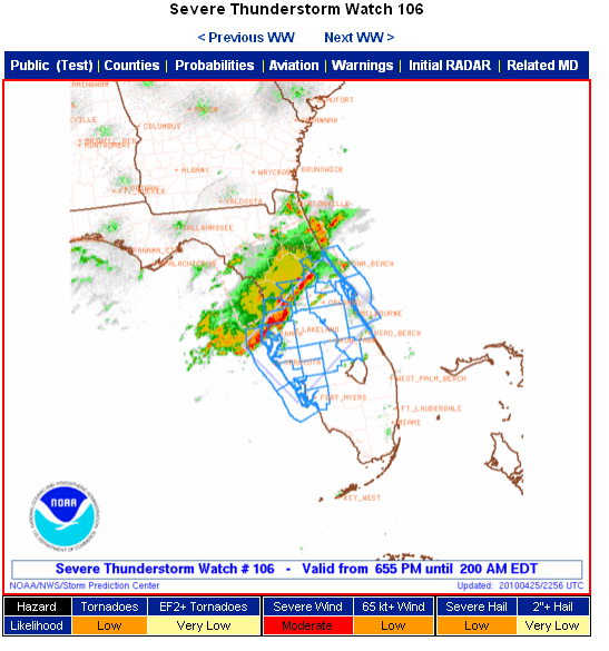
Watches are issued whenever severe weather is possible in the next few hours or days. While watches are not as urgent as warnings, they are designed to give you plenty of time to prepare for a hazard that wonââ�¬â�¢t arrive for some time. When you learn of a watch for your area, keep an eye on changes in the weather and check back for updates from the National Weather Service.
Warnings are issued when severe weather has been observed or is expected soon. Warnings are much more urgent than watches and require the public to take action immediately. For example, during a tornado warning, seek shelter in an interior room on the lowest floor of your house or building, away from windows. Most warnings are issued locally with a few exceptions.
In addition to watches and warnings, forecasters can also issue advisories, outlooks, and statements. Advisories are similar to warnings, but are generally not as severe or life threatening. Outlooks and statements can be issued for a variety of reasons, including:
- When there is too much uncertainty to issue a watch or warning
- When the hazardous weather is too far out
- To update a previously issued watch or warning
- To provide general information, not necessarily about hazardous weather
Although most watches and warnings are issued from a local NWS office, there are a few exceptions where a national center handles the responsibility for the entire United States. This is always done in cooperation with the local NWS forecast offices. Severe thunderstorm and tornado watches are issued by the Storm Prediction Center (SPC) in Norman, OK, with input from the local forecast office. After the watch is issued, the local forecast office makes the decision of if and when to issue warnings. The National Hurricane Center (NHC) in Miami, FL issues watches and warnings for hurricanes and tropical storms for both the Atlantic and the Eastern Pacific Basins. These watches and warnings are then customized by the local forecast offices for the individual areas in the form of Hurricane Local Statements (HLS).
There are a few different ways you can find out about the latest watches, warnings, and advisories. One of the simplest is to visit our webpage at www.weather.gov/tampabay. If your cell phone has a web browser, you can access these forecasts from anywhere. Both mobile.weather.gov and cell.weather.gov are designed for viewing on mobile devices, but may not work on all phones. You can also listen for alerts on NOAA Weather Radio, or if your NOAA Weather Radio supports the SAME function, it will alarm when a watch or warning is issued for your county.
|
|
|
|


 Follow us on YouTube