Albuquerque, NM
Weather Forecast Office
|
|
|||||||
|
UPDATE 1/16/2020: The NWS Albuquerque 5km and 1km WRF-ARW modeling domains will no longer be supported after March 2, 2020. There are various other high resolution modeling resources available, including but no limited to; the Storm Prediction Center 3km WRF-ARW, WRF-NMM, and HREF-2, the Texas Tech University 3km WRF, the Earth Systems Laboratory 3km HRRR, and various high resolution NAM/WRF nests from the Environmental Modeling Center. We would like to send special thanks to Robert A. Rozumalski, PhD, for his invaluable support of our local modeling operations over the past 11 years. Basic Description 1.0km WRF-ARW: Run every 6 hours out to 24 hours using NAM initial conditions and boundary conditions. The default domain is centered over the Albuquerque and Santa Fe metro areas. The domain is moved to support decision support activities. |
|||||||
|
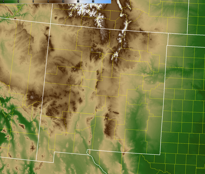
Domain Topograghy |
|||||||
 |
|||||||
| Model Availability | |||||||
|
|||||||
| Computational Domain | |||||||
| WRF Core: | Advanced Research WRF (ARW) | ||||||
| Number of Domains: | 1 | ||||||
| Grid Dimensions: | 150 x 160 / 100 x 100 | ||||||
| Grid Spacing: | 5.0km / 1.0km | ||||||
| Map Projection: | Lambert-Conformal | ||||||
| Center Lat./Lon.: | 5.0km: 34.5, -106.1, 1.0km: Variable for DSS | ||||||
| Time Step: | 5.0km: 3 hours, 1.0km: 1 hour | ||||||
| Vertical Levels: | 45 | ||||||
| Pressure at Model’s Top: | 50 hPa | ||||||
| 5km Dynamics Configuration | |||||||
| Model Dynamics: | Non-Hydrostatic | ||||||
| Time Integration: | Runge-Kutta, 3rd Order | ||||||
| Turbulence and Mixing: | Evaluates Mixing Terms in Coordinate Space | ||||||
| Eddy Coefficient: | Horizontal Smagorinsky, 1st Order | ||||||
| Upper level Damping: | On , W-Rayleigh relaxation layer | ||||||
| Vertical Velocity Damping: | On | ||||||
| 5km Physics Configuration | |||||||
| Cumulus Scheme: | Off | ||||||
| Cumulus Time Step: | 0 | ||||||
| Microphysics Scheme: | New Thompson Graupel | ||||||
| Boundary Layer Scheme: | Yonsei | ||||||
| Boundary Layer Time Step: | 0 min, every timestep | ||||||
| Land-Surface Scheme: | Noah Land Surface Model | ||||||
| Number of Soil Layers: | 4 | ||||||
| Source of Landuse and Soil Data: | Standard Initialization (SI) | ||||||
| Surface Layer Scheme: | Monin-Obukhov (Janjic Eta) Scheme | ||||||
| Longwave Radiation: | Rapid Radiative Transfer Model MCICA (RRTMG) | ||||||
| Short Wave Radiation: | Dudhia | ||||||
| Radiation Time Step: | Auto Minutes | ||||||
Current Hazards
Outlooks
Submit A Storm Report
Severe and Hazardous Weather Info
Current Conditions
Surface Observations
Observed Precipitation
Satellite
Local Satellite Page
Local Observations Page
Map of Latest Wind and Precipitation Reports
Radar
National Radar
ABX Albuquerque Radar
FDX Cannon Air Force Base Radar
Forecasts
Fire Weather Forecasts
Area Forecast Discussion
Hourly View Forecast
Activity Planner
Aviation Forecasts
Local Forecast Page
Graphical Forecasts
Hydrology
Local Hydrology Products
Advanced Hydrologic Prediction Services
Climate and Past Weather
Winter Climatology for NM
NOAA Climate Center
Climate Prediction Center
Climate Graphs
Drought
Severe T-Storm Climatology for NM
Local Data
Local Programs
About Our Office
SKYWARN
NOAA Weather Radio
Local Studies and Features
Winter Weather Info, Safety Tips, and Climo
Severe Weather Info, Safety Tips, and Climo
Center Weather Service Unit
US Dept of Commerce
National Oceanic and Atmospheric Administration
National Weather Service
Albuquerque, NM
2341 Clark Carr Loop SE
Albuquerque, NM 87106-5633
(505) 243-0702
Comments? Questions? Please Contact Us.

