National Weather Service United States Department of Commerce
MAIN PAGE Storm Surveys Radar Imagery Storm Data Storm Images


Event Summary
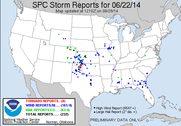
Despite a later than normal start to the severe weather season, June has been a busy month across the Texas and Oklahoma Panhandles.  The biggest event of the month and year occurred on June 22 and 23.  A favorable northwest flow aloft pattern and abudant moisture resulted in one supercell thunderstorm developing across Beaver County during the afternoon hours.  This supercell deviated from the mean storm motion and slowly moved south southwestward.  This storm was responsible for producing several brief tornadoes and hail up to tennis ball size.  As a cold front approached from the north, a line of severe thunderstorms quickly developed across the Oklahoma Panhandle and marched southward.  Supercells embedded with this line produced significant winds across Roberts County and eventually Pampa, TX.  A damage assessment concluded that six tornadoes occurred across the Panhandles and straightline wind damage associated with 100 mph winds caused widespread damage in Pampa.


June 22, 2014 Storm Reports


Did you experience severe weather or do you have any pictures that you would like to share?  If so, there are several ways to send us your report and/or pictures.