Peachtree City, GA
Weather Forecast Office
Prolonged Rain Leads to Flooding Across North and Central Georgia
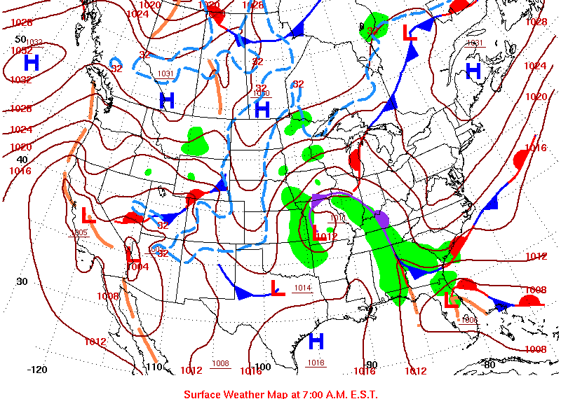
Moisture from the Gulf of Mexico and the Atlantic Ocean ahead of an occluded front brought widespread showers and isolated thunderstorms to north and central Georgia for an extended time period. These showers trained from south to north, dumping copious amounts of rainfall across north and central Georgia. The ground was already wet before this event with recent minor flooding across north Georgia. This additional rainfall associated with the occluded front caused widespread flooding across an already primed north Georgia and areas of flooding across central Georgia.
 |
 |
|
Weather Map for May 4, 2013 |
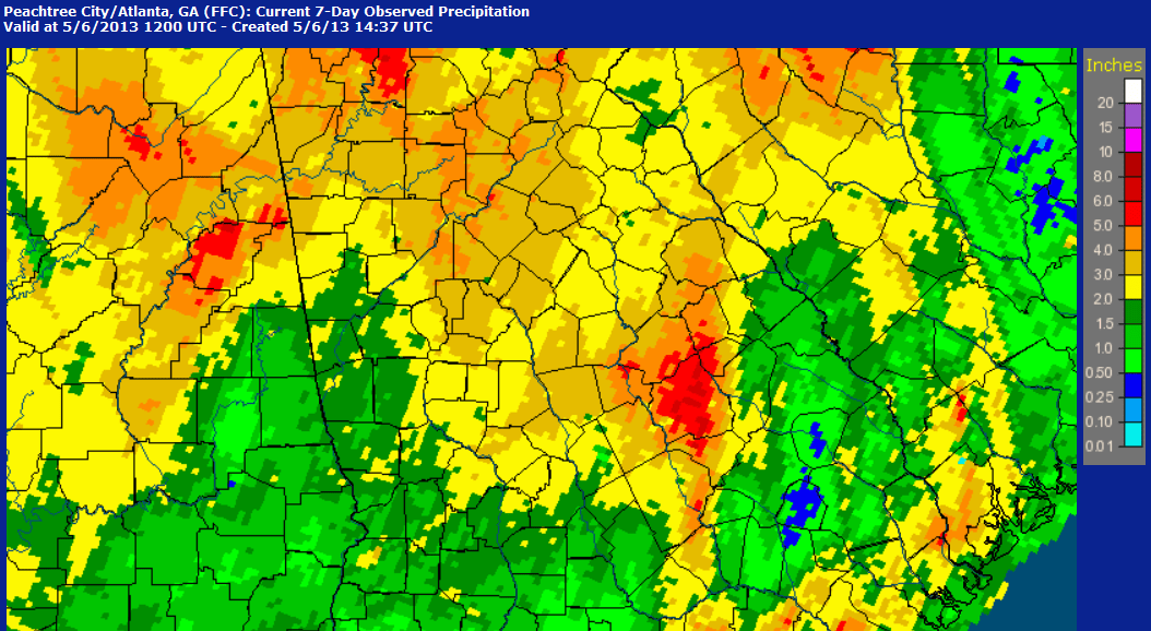
7-Day Rainfall Total as of |
 |
|
|
Radar imagery from May 4, 2013 |
IR Satellite and 500 MB Heights |
An upper level low tracked from Arkansas on Saturday to the Tennessee Valley on Monday, allowing showers to continue on Sunday and Monday, behind the occluded front. Extreme cold air aloft associated with this upper low moved into Georgia and helped to destabilize the area, particularly across north Georgia. Shallow convection was able to form in this environment and with the cold air aloft, small hail fell from many of the cells that developed. Pea-sized hail was observed across many locations in north Georgia including Tallapoosa (Haralson County), Dacula (Gwinnett County), Powder Springs (Cobb County), and Cumming (Forsyth County).
 |
|
Pea sized hail in Southern Forsyth |
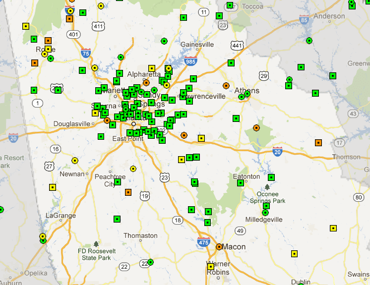
During the long duration rain event, approximately 40 stream gage locations across north and central Georgia exceeded flood stage. As of May 6, 2013, only minor flooding was observed, however Lovejoy (LOVG1) on the Flint River came within 0.2 feet of reaching moderate flood stage. Many points remain in flood as of today (Monday, May 6, 2013) and as points across north Georgia begin to crest, the water will flow downstream into central Georgia where additional sites are expected to reach minor flood stage.
 |
 |
|
Stream gage points in flood across |
Hydrograph for Lovejoy (LOVG1) |
Current Hazards
Georgia Road Conditions
Nationwide
Local Storm Reports
Local
Submit Storm Report
Outlooks
Forecasts
Tropical Weather
Local
Computer Models
Graphical
Aviation Weather
Activity Planner
Recreational Forecast
Fire Weather
Forecast Discussion
Incident Support
Current Weather
Satellite Images
Observations
Maps
Rivers/Lakes
Radar Imagery
Regional Loop
Nationwide
Warner Robins
Peachtree City
US Dept of Commerce
National Oceanic and Atmospheric Administration
National Weather Service
Peachtree City, GA
4 Falcon Drive
Peachtree City, GA 30269
770.486.1133
Comments? Questions? Please Contact Us.


