A second Pacific cold front will cross the Pacific Northwest Wednesday followed by another atmospheric river. Each of these features will bring additional periods of gusty winds, mountain snow, and heavy to excessive rainfall with renewed flooding. Heavy lake effect snow continues into Tuesday east of Lakes Erie and Ontario. Read More >
| Reports | Rainfall | Photos | Radar | Meteorology | Links |
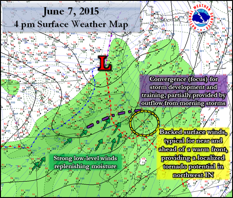
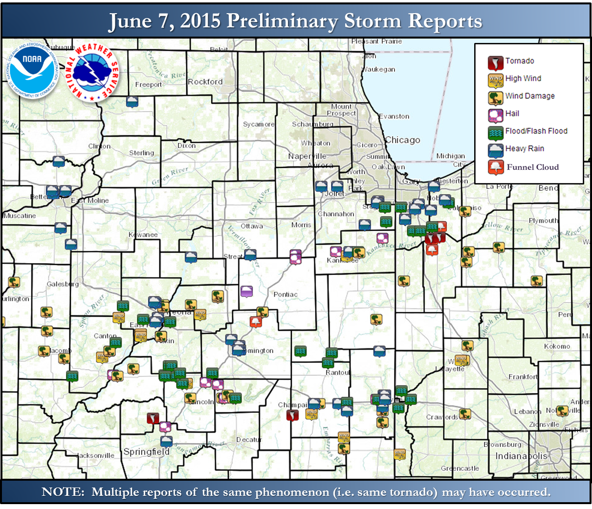
After a morning complex of non-severe storms on June 7th, redeveloping storms in the early afternoon intensified just south of I-80 and slowly evolved southeastward through the night, producing heavy rainfall rates and at times severe straight-line winds.
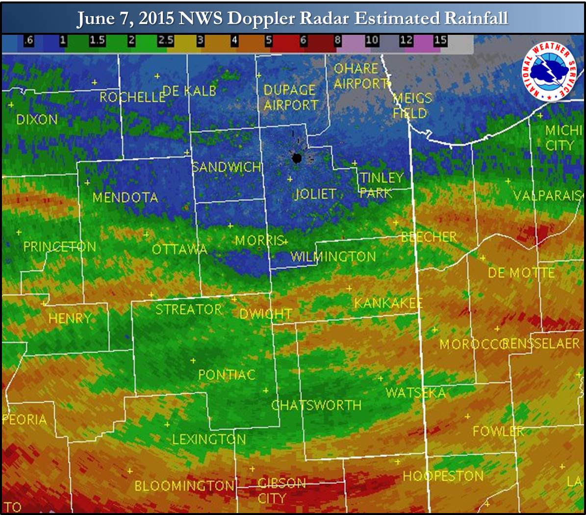
Widespread rainfall of one and a half to four inches, with isolated totals higher fell across areas south of I-80. This produced flooding, some of it flash flooding in that it happened rapidly and thus particularly dangerous. Flash flood warnings were issued for these areas. Scattered reports of roads closed during Sunday mid-afternoon through evening were received. There were a couple reports of water rescues and stranded vehicles. As of early this morning, we have not received any reports of injuries.
The highest rainfall reports were 4.95 inches near Kouts, IN and 4.07 in. near Hebron, IN, both from CoCoRaHS volunteer observers.
There has been video confirmation of a brief tornado in northern Jasper County, a few miles north of the community of De Motte. There was additional video of a tornado from a different vantage point near that same time. It is possible that was a brief second tornado from the same storm.
The potential for severe storms and heavy rainfall was mentioned by the NWS in Area Forecast Discussions beginning June 4th, and within a multitude of forecast products and messages beginning June 5th.
 |
 |
Text Listing of Rainfall Reports
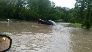 |
| Near Cedar Lake, IN |
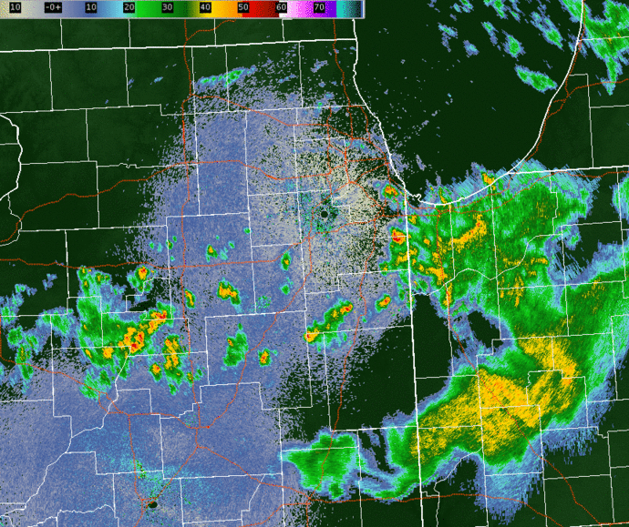
| NWS Doppler Radar Loop from June 7, 2015: 12 pm - 10:30 pm |
 |