|
National Weather Service Cooperative Observer - A perspective 
The National Weather Service (NWS) has been tasked with the issuance of severe weather watches and warnings designed to protect life and property. To this end, the collection and dissemination of timely and accurate surface weather data is vital. In addition to protection of life and property, under Department of Commerce's National Oceanic and Atmospheric Administration, the NWS has been given the job of maintaining a national database of climatic weather information. This too is used by the NWS in preparing medium and long range forecasts.
The Coop Program was formally created in 1890 under the Organic Act. Its mission is two-fold:
- To provide observational meteorological data, usually consisting of daily maximum and minimum temperatures, snowfall, and 24-hour precipitation totals, required to define the climate of the United States and to help measure long-term climate changes
- To provide observational meteorological data in near real-time to support forecast, warning and other public service programs of the NWS.
The first network of cooperative stations was set up as a result of an act of Congress in 1890 that established the Weather Bureau, but many Coop stations began operation long before that time. John Campanius Holm's weather records, taken without the benefit of instruments in 1644-45, were the earliest known observations in the United States. Subsequently many persons, including George Washington, Thomas Jefferson, and Benjamin Franklin, maintained weather records. Thomas Jefferson maintained an almost unbroken record of weather observations between 1776 and 1816, and George Washington took his last observation just a few days before he died. In 1849, the Smithsonian Institution set up a system for receiving weather data from telegraph companies, via the telegraph, and used the data to produce weather charts. The National Weather Service (then known as the Weather Bureau) eventually took responsibility for volunteer observations in the late 1800s.
Two of the most prestigious awards given to Cooperative Weather Observers are named after Holm and Jefferson. Because of its many decades of relatively stable operation, high station density, and high proportion of rural locations, the Cooperative Network has been recognized as the most definitive source of information on U.S. climate trends for temperature and precipitation. Cooperative stations form the core of the U.S. Historical Climate Network (HCN) and the U.S. Reference Climate Network.
What is the job of a cooperative observer?
Being a NWS cooperative observer can be a demanding job. To provide accurate and complete weather data, observations are required seven days a week 365 days a year, and at the same time each day for consistency. This does not mean that someone has to be monitoring the weather all the time; instruments are provided to monitor precipitation and/or temperature. The recording and submission of data at cooperative sites is between 6-9am.
Observers generally record temperature and precipitation daily and electronically send those reports daily to the NWS and the National Center for Environmental Information (NCEI). In special cases, data can be submitted to the local NWS office via telephone or mail. Volunteer weather observers conscientiously contribute their time so that observations can provide the vital information needed.
What equipment is used?
Cooperative observers use a variety of equipment types. The type used will depend on what services are needed at a particular station. All observers report at least 24-hour precipitation and snowfall, while some also report high, low, and at observation temperatures. Few observers report evaporation measurements, river stages, or soil temperatures.
Precipitation Gages
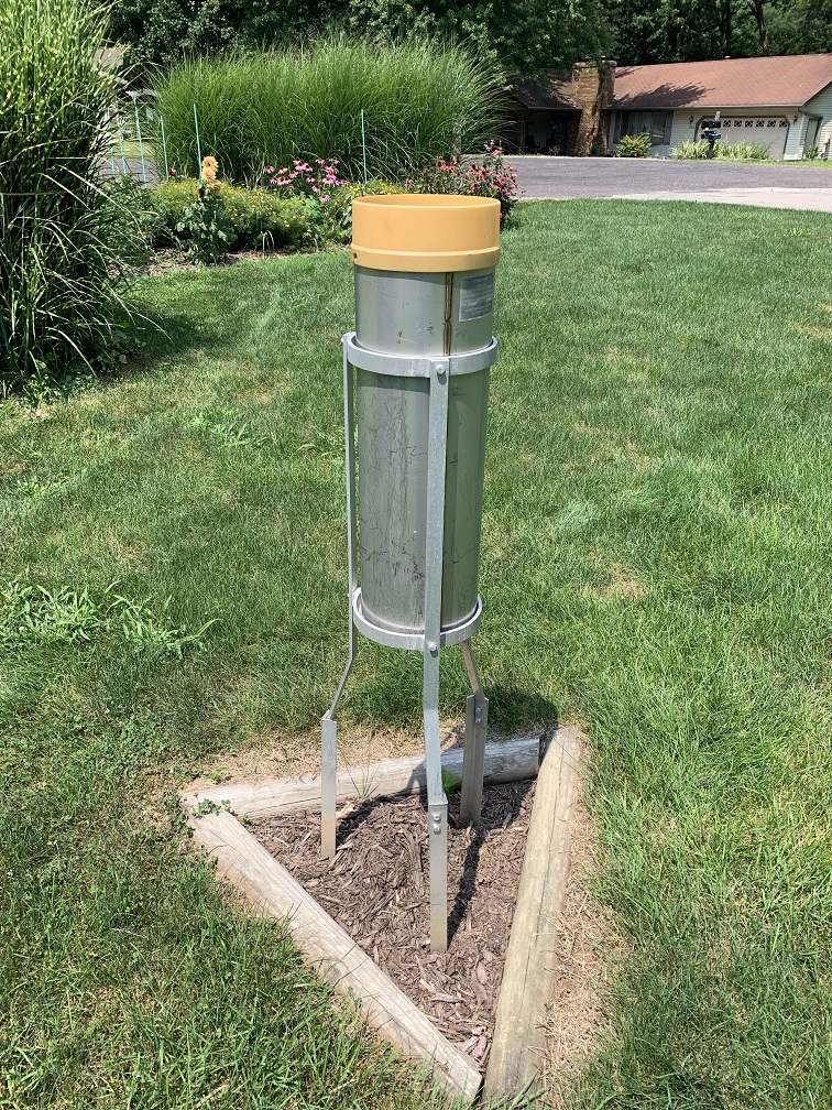 This rain gage is what most observers use. It is called a "Standard Rain Gage" (SRG), and consists of a funnel 8 inches in diameter, leading to a tube inside the gage. The inside tube can hold up to 2 inches of rain; any excess will flow into the main container to be measured after the inside tube is emptied. The rainfall is measured using a specially calibrated dipstick. This rain gage is what most observers use. It is called a "Standard Rain Gage" (SRG), and consists of a funnel 8 inches in diameter, leading to a tube inside the gage. The inside tube can hold up to 2 inches of rain; any excess will flow into the main container to be measured after the inside tube is emptied. The rainfall is measured using a specially calibrated dipstick.
During the winter, the funnel and inside tube are removed; snow falls into the main container, and then is melted to determine the liquid equivalent of the snowfall. The main container is also used to obtain snow core measurements, which give a representation of the total liquid content of the snow pack.
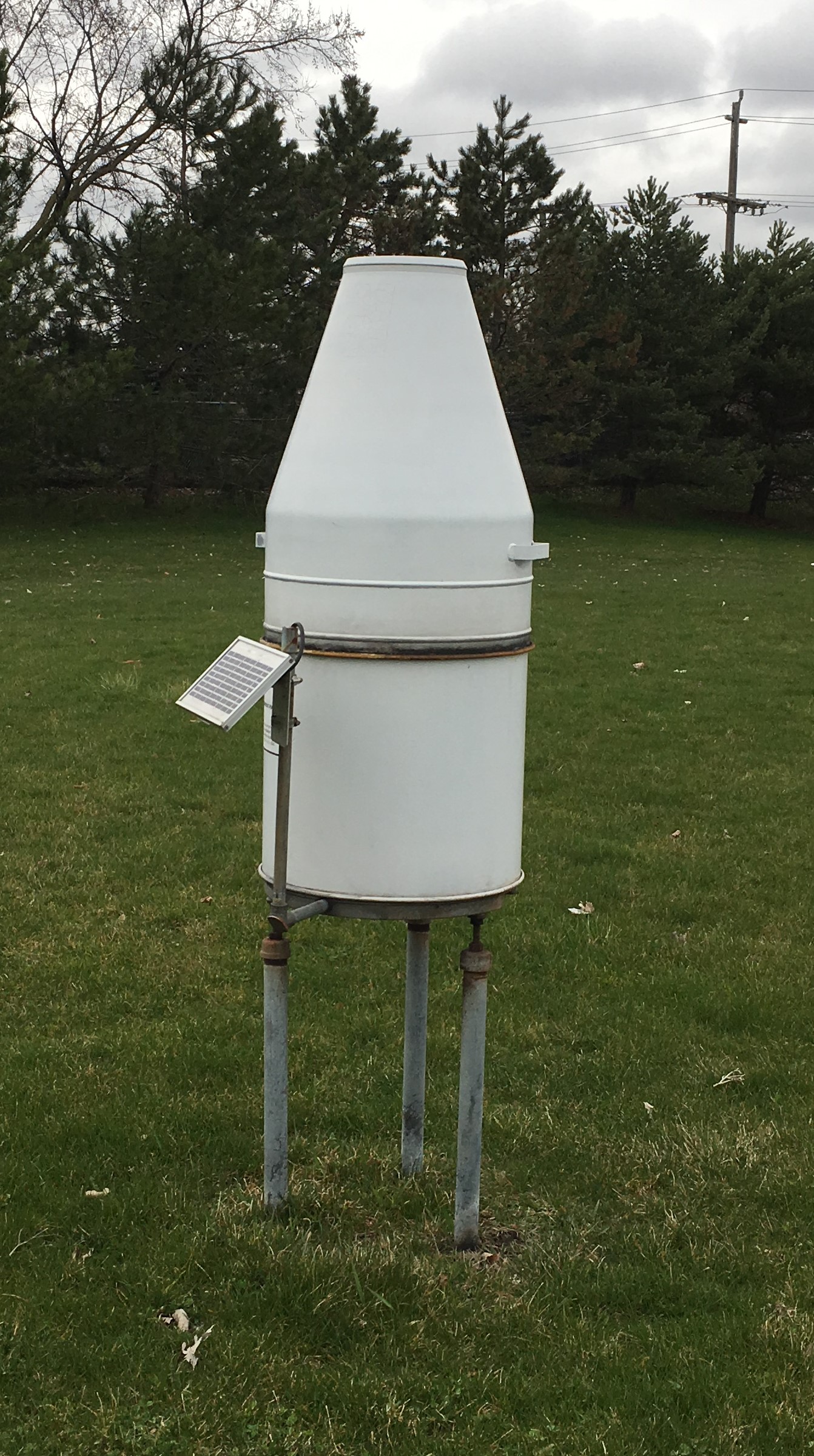
The Fischer Porter rain gage is a weighing rain gage that, through a mechanical and electrical system, tracks and translates the weight of water in a bucket into a water equivalent amount in hundredths of an inch.
These observations are then downloaded onto a SD card/USB flash drive and e-mailed to the local NWS office. After the data on the card/flash drive is quality controlled, the NWS office transmits the data files to the National Centers for Environmental Information.
Temperature Gages
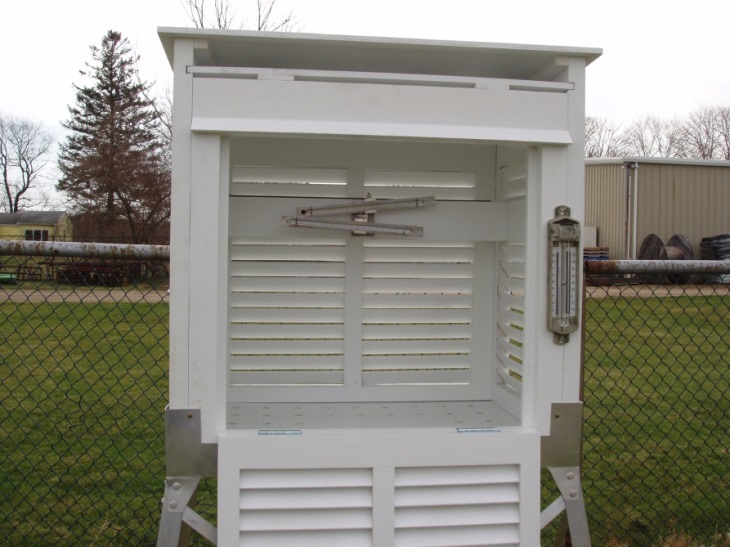
Some stations use mercury and alcohol thermometers to register high and low temperatures. The thermometers are kept inside a ventilated box called a Cotton Region Shelter (CRS, named because of the location where they were first used). The maximum thermometer pushes the mercury to the highest temperature observed that day, where it stays until it is reset by the observer. The minimum thermometer has a small pin inside, which marks the low temperature.
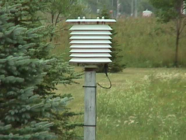 Many temperature-reporting stations use electronic thermistors in place of the mercury thermometers. This particular system is called a Maximum-Minimum Temperature System (MMTS). The sensor is mounted outside, and cables are routed underground to a digital display inside a nearby building. The digital readout logs the high and low temperatures until reset by the observer, while providing a continuous readout of the current temperature. The newer version of this system stores high and low temperatures for 35 days via the memory feature. Many temperature-reporting stations use electronic thermistors in place of the mercury thermometers. This particular system is called a Maximum-Minimum Temperature System (MMTS). The sensor is mounted outside, and cables are routed underground to a digital display inside a nearby building. The digital readout logs the high and low temperatures until reset by the observer, while providing a continuous readout of the current temperature. The newer version of this system stores high and low temperatures for 35 days via the memory feature.
River Gages
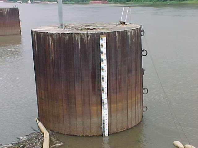
Some observers read river levels using a staff gage. These gages are basically large rulers mounted or painted onto objects such as bridge supports, walls, etc. River levels are read from this gage to the nearest tenth of a foot.
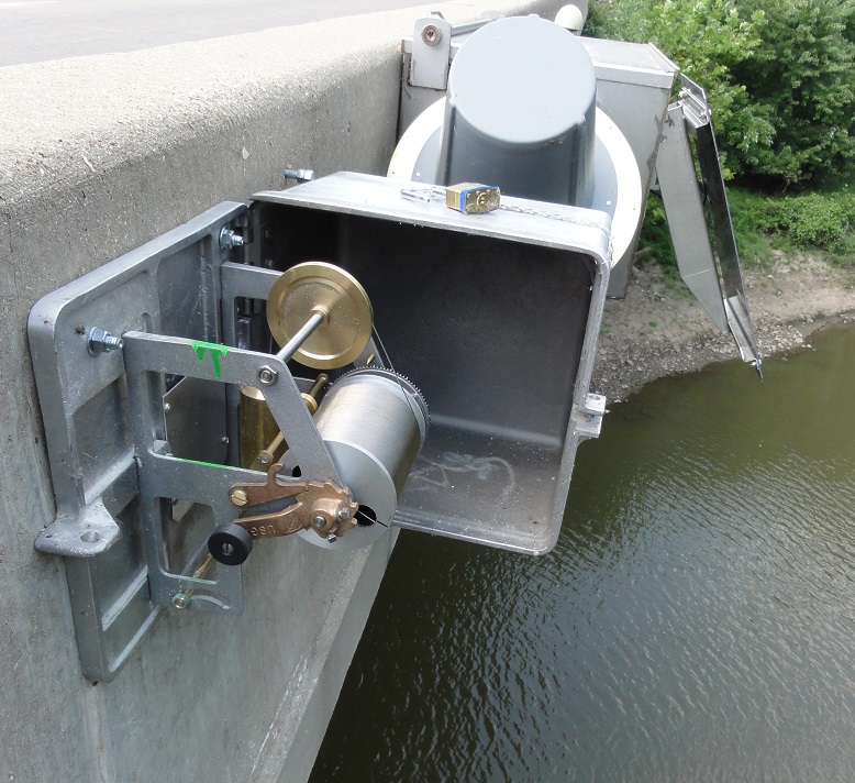
At some locations, river levels are read using a wire weight gage. This type of gage has cable wound around a drum; a brass or bronze weight is attached to the end of the cable. A crank is used to lower the weight to the surface of the water; a counter and disk on the crank handle indicates the river reading, usually to a hundredth of a foot.
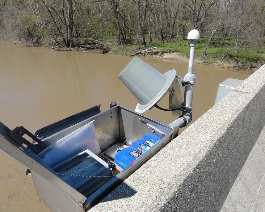
Many river levels are read using automated methods. Data Collection Platforms (DCP) collect the river level readings, and relay them via satellite or telephone lines. Inside the DCP houses, river levels may be determined using nitrogen gas, voltmeters, or electrical tapes. Many of these DCP sites also have a staff or wire weight gage for backup purposes, especially if river forecasts are issued.
What happens with the information collected daily?
This near real-time data is used to support the day-to-day operations of the NWS in its forecast and warning decisions, and various other users such as state climatologists, broadcast media, and other governmental agencies. This data is invaluable in learning more about the floods, droughts, heat and cold waves affecting the world. This data is also used in agricultural planning and assessment, engineering, environmental-impact assessment, utilities planning, and litigation. Coop data plays a critical role in efforts to recognize and evaluate the extent of human impacts on climate from local to global scales.
Daily precipitation (rain and snow) reports are important inputs to NWS river forecast models used in river flood warning operations.
What kind of training is involved?
Training consists of on site, hands on instruction with the designated cooperative observer and their backup. This usually is done the same day as the equipment is installed and takes about one hour. Basic equipment maintenance is discussed and the cooperative observer is provided with contact information for the local NWS office should additional questions or problems arise.
|


