Scattered thunderstorms and widespread showers are expected from the Texas coast to the central Appalachians today. Heavy to excessive rainfall will continue in southern California into the Desert Southwest through Saturday. Heavy rain will pose a risk of flash flooding, especially across burn scar and urbanized regions. Read More >
|
Winter Weather Preparedness Take some time to review winter weather preparedness and safety information as well as learn about the different winter weather hazards that can impact northern Illinois and northwest Indiana! |
|
|
National Weather Service Winter Weather Headlines Winter weather related Warnings, Watches and Advisories are issued by your local National Weather Service office. Each office knows the local area and will issue Warnings, Watches or Advisories based on local criteria. For example, the amount of snow that triggers a “Winter Storm Warning” in the Northern Plains is typically much higher than the amount needed to trigger a “Winter Storm Warning” in the Southeast. |
|
|
National Weather Service Extreme Cold Headlines Extremely cold air comes every winter into at least part of the country and affects millions of people across the United States. The arctic air can be dangerous. Combined with brisk winds, dangerously cold wind chill values can result. People exposed to extreme cold are susceptible to frostbite and can succumb to hypothermia in a matter of minutes. Areas most prone to frostbite are uncovered skin and the extremities, such as hands and feet. Hypothermia occurs when the body loses heat faster than it can produce it. |
|
|
NWS Chicago Winter Headline Criteria |
||
|
Extreme Cold |
||
|
Cold Weather Advisory |
Extreme Cold Watch |
Extreme Cold Warning |
|
The following condition is expected to occur:
|
There is increasing potential that the following condition may occur:
|
The following condition is expected to occur:
|
|
Snow & Sleet |
||
|
Winter Weather Advisory |
Winter Storm Watch |
Winter Storm Warning |
|
Impacts to travel are expected due to falling snow and/or sleet. Typical scenarios include:
|
There is increasing potential for falling snow and/or sleet which may lead to dangerous travel conditions and school/business closures. Typical scenarios include:
|
Falling snow and/or sleet is expected to lead to dangerous travel conditions and school/business closures. Typical scenarios include:
|
|
Blowing Snow, Blizzard |
||
|
Winter Weather Advisory |
Winter Storm Watch |
Blizzard Warning |
|
Blowing snow is expected to reduce visibilities as low as 1/4 mile or lead to drifting snow resulting in hazardous travel conditions. |
There is increasing potential that the following conditions may occur: Sustained wind or frequent gusts greater than or equal to 35 mph accompanied by falling and/or blowing snow frequently reducing visibility to less than 1/4 mile for three hours or more. |
The following conditions are expected: Sustained wind or frequent gusts greater than or equal to 35 mph accompanied by falling and/or blowing snow frequently reducing visibility to less than 1/4 mile for three hours or more. |
|
Icing |
||
|
Winter Weather Advisory |
Winter Storm Watch |
Ice Storm Warning |
|
A glaze of ice accumulation <1/4" is expected to result in hazardous road conditions and slippery walkways. |
There is increasing potential that ice accumulations of a quarter inch may occur on elevated flat horizontal surfaces. |
Ice accumulations of a quarter inch or more are expected on elevated flat horizontal surfaces. |
|
Snow Squalls |
||
|
Snow Squall Warning |
These are short-fused, smaller warnings (i.e. considerably smaller in space and time than Winter Storm Warnings) and issued for localized, intense areas of snow/wind expected to cause sharply reduced visibility of 1/4 mile or less often with sub-freezing road temperatures. These are not issued when Winter Storm or Blizzard Warnings are in effect. |
|
|
Criteria for all NWS Chicago Warnings, Watches, and Advisories |
||
|
Winter Hazards Learn about the different winter weather related hazards we experience here in the Great Lakes region! |
|
|
|
|
|
Are you prepared for a winter storm? If the forecast calls for winter weather, begin preparing NOW. Don’t wait until the last minute. |
Did you know that not all blizzards involve falling snow? Whether or not the snow falls during the blizzard, dangerous conditions can result. |
|
|
|
|
|
|
|
Snow squalls are intense bursts of snow and wind with whiteout visibility that are extremely dangerous, especially while on the road. The National Weather Service helps you be ready by issuing Snow Squall Warnings that can trigger a Wireless Emergency Alert on your phone. If you receive one, know that a snow squall is occurring or imminent and slow down or delay travel. |
Ice jams are common during the winter and spring along rivers, streams, and creeks in the higher latitudes of the continental U.S. as well as in Alaska. Once formed, water can rise VERY quickly. Stay Weather-Ready and never cross flooded roads. |
|
|
|
|
Sneaky Winter Hazards |
|
|
First Snow |
Snow Squalls |
|
|
|
|
While lots of snow in the middle of winter can cause dangerous travel conditions, the first snow of the season can also cause accidents. Be careful as you and other drivers adjust to driving in poor conditions. |
Snow squalls are short, intense bursts of snow and wind that can reduce visibility and cause dangerous travel conditions. Delay travel if possible. |
|
|
|
|
Rain with Temperatures Near Freezing |
Freezing Drizzle |
|
|
|
|
Rain may seem like less of a winter driving hazard than snow, but when temperatures are near freezing, that’s not the case. Ice can form quickly and make roads slick. Be extra careful in these conditions. |
Freezing drizzle can cause difficult-to-see ice to form on roads, creating very dangerous travel conditions. When it’s drizzling in the winter, slow down! |
|
|
|
|
Flash Freeze |
Sun Glare |
|
|
|
|
Wet roads can quickly turn to ice as temperatures fall below freezing. Slow down and don’t use cruise control. |
The low sun angle, especially combined with freshly-fallen snow, can cause a glare that makes driving difficult. Keep a pair of sunglasses handy and slow down |
|
Home Safety in the Winter |
|
|
|
|
|
Prepare your home for winter weather emergencies! Winter storms can knock out power and keep you from traveling for days. Keep enough non-perishable food, water, medications for at least 3 days. |
As winter approaches, there are steps you can take to prepare your home for the cold weather ahead. |
|
|
|
|
|
|
|
Prepared for a possible polar plunge? As temperatures drop, remember to protect the 4 P’s: People, pets, pipes, and plants. |
Is your home ready for an ice storm? Ice storms can cause power outages that can last several days and pose a threat to tree branches and anything underneath. |
|
|
|
|
|
|
|
Power outages are common after a big winter storm. Be careful with alternative heat sources, practice portable generator safety, and check in with neighbors to ensure that everyone stays safe. |
When the power goes out in winter, the cold can be deadly--but even without power, there are still ways to warm things up. |
|
|
|
|
|
|
|
Slipping on an icy sidewalk can lead to serious injuries or even death, especially for the elderly. Help prevent the formation of ice by salting walkways and turning off sprinklers in advance of cold weather. |
Shoveling snow can be a health risk as well. Remember to stay hydrated, take frequent breaks, and move only small amounts with each shovel pass. |
|
|
|
|
|
|
|
Sleet can be deceptively dangerous - it’s much more dense than snow, so take it easy when shoveling. Use extreme caution when driving during or after sleet. |
Be alert for snow loading and ice damming on roofs! Ice dams can develop at the edges of roofs due to large icicles, which can result in water damage! |
|
Driving Safety in the Winter |
||
|
|
|
|
|
Winter driving can be hazardous. Slow down to keep yourself and everyone on the road safe. Remember, “Ice and snow, take it slow”. |
During a snow squall, the last place you want to be is on the road. |
|
|
|
|
|
|
|
|
|
|
Even trucks and SUVs with four-wheel drive can still lose traction in the snow. Stay Weather-Ready by always using extra caution when driving in wintry conditions — no matter what you’re driving. |
Take some time to build an emergency supply kit for your car! You never know when you will encounter winter weather or an emergency road closure. |
|
|
|
|
|
|
|
|
|
|
Please thoroughly clean snow off your car — including the roof. Snow left on car roofs can fly off your vehicle when in motion, creating potentially dangerous situations for you and those driving behind you. |
If you’re going to be driving this winter, know how to stay safe. Winterize your vehicle and pack an emergency supply kit. Share your travel plans with friends and family. Before leaving, check road conditions and the weather forecast so you know to expect. |
|
|
|
|
|
|
|
|
|
|
That first snow is beautiful, but beware the Unique Hazards of Early Season Cold and Snow! The main risks are: falling tree limbs from leaf-loaded trees, icy roads catching drivers off guard, and unstable outdoor recreational areas. Slow down and be prepared! |
Travel During Blizzards is DANGEROUS! Your safest option: Stay home and off the roads. If you MUST travel, be prepared: Tell someone your route, check conditions, keep a full tank/charge, and ensure your emergency kit is on board. Don't risk it! |
|
|
Extreme Cold Learn how to protect yourself and others from the outdoors in the winter! |
|||
|
|
|
||
|
Protect yourself from extreme cold, whether it's the wind chill or air temperature – both are dangerous! |
Bundling up and staying dry are two of the best things you can do to stay safe from cold temperatures this fall and winter. |
||
|
|
|
||
|
|
|
||
|
If you notice someone exhibiting warning signs of hypothermia, get them to a warm place right away. |
Cold outside? Avoid the risk of frostbite and hypothermia by dressing in layers, covering exposed skin, and limiting time outdoors. If someone might be experiencing either condition, seek medical attention immediately — and know your actions. |
||
|
|
|
||
|
|
|
||
|
When caught outdoors in a winter storm, there are life-saving actions you can take to protect yourself. Find (or make) shelter, cover exposed body parts, melt snow for drinking water, and exercise occasionally. |
Everyone is at risk from the dangers of extreme cold, but these groups are more vulnerable than most. Age and certain conditions make the body less able to regulate temperature. |
||
|
|
|
||
|
|
|
||
|
Don't forget about your pets this winter! Make sure they have a warm, dry place to rest with plenty of food and water. |
Cold weather can be life-threatening. If you can’t avoid being outside, remember to follow these 3 steps and make sure to always tell someone where you’re going. |
||
|
|
|
||
|
|
|||
|
|
For those working outside during cold temperatures or winter weather, stay Weather-Ready and prepared. |
||
|
Science |
|||
|
|
|||
|
Be wary of forecast snowfall maps shared several days before an event! Forecasts can and will change as the system nears and higher resolution model data and surface observations help refine the details. |
|||
|
|
|
||
|
Will there be rain, ice, or snow? This graphic explains how having different layers of warm and cold air between the clouds and the ground determines the type of precipitation that hits the ground. nssl.noaa.gov/education/svrwx101/winter/types/ |
Extremely cold air affects millions of people across the United States every winter and even into parts of the spring. This Arctic air, together with brisk winds, can lead to dangerously cold wind chill values, which can cause your body to lose heat quickly. |
||
|
|
|
||
|
|
|
||
|
Lake Effect snow occurs when cold air moves across warmer water. Warmth and moisture rise into the air, condensing into clouds that can produce 2 to 3 inches of snow per hour or more. Learn more weather science at weather.gov/jetstream |
The snow ratio is simply the percentage of water within a sample of snow. For example, a wetter and heavier snow has lower ratios (i.e. 7:1) and drier fluffy snow has higher ratios (i.e. 20:1). |
||
|
|
|
||
|
|
|
||
|
Did you know that while no two snowflakes are exactly the same, they are all six-sided? Snowflakes’ hexagonal shapes are due to the molecular structure of ice. Learn more about the science behind snowflakes: noaa.gov/stories/how-do-snowflakes-form-science-behind-snow |
Did you know that in the northern hemisphere, winter actually occurs when the Earth is closest to the Sun? This is possible because of the way the Earth tilts on its axis. During winter, the northern hemisphere is tilting away from the Sun, causing the Sun’s rays to hit the northern hemisphere at a lower angle, which results in far lower temperatures. |
||
|
Reporting |
|||
|
Accurate and timely snowfall and ice measurements are extremely important to us in the National Weather Service, your community, local media, and many others. Curious how to properly measure snow or to measure ice when there is freezing rain? These graphics explain how! |
|||
|
|
|
||
|
The steps to properly measure snow. |
The steps to properly measure both radial and flat ice accretion. |
||
|
|
|||
|
Citizen Science |
|||
|
|
Do you love the weather? Interested in actually participating in the science? Well, citizen science may just be for you! Citizen science is a form of open collaboration in which anyone can take part in the scientific process to address real-world problems. You can help by taking real-time weather observations, alerting officials about severe weather occurring where you are, and contributing to NOAA research using an app on your phone. Citizen science involves everyday people and plays a vital role in protecting lives and property. |
||
|
|
|||
|
Join the CoCoRaHS Community
The Community Collaborative Rain, Hail, and Snow Network is a volunteer network of observers who measure precipitation from their backyard. Any age can volunteer. CoCoRaHS sells low cost equipment to help volunteers get started. Observers enter their observations onto a website. Data is used by a wide variety of users ranging from meteorologists and hydrologists to insurance adjusters and engineers. For more information visit: www.cocorahs.org/ |
|
||
|
|
|
||
|
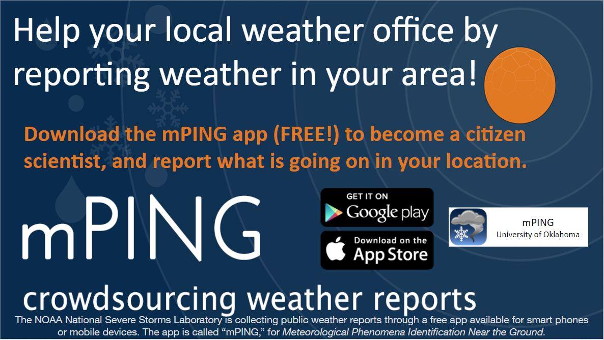
Use mPING to Report Precipitation
mPING. (Meteorological Phenomena Identification Near the Ground project). Weird name, cool app! Users can report the type of precipitation they are experiencing. No need to measure! Use the free mobile app to send reports anonymously. Reports are automatically recorded into a database, which improves weather computer models. The information is even used by road maintenance operations and the aviation industry to diagnose areas of icing. For more information visit: mping.nssl.noaa.gov/ |
|
||
|
|
|
||
|
River Ice Spotting NWS Chicago is looking for individuals that live or work along rivers to become part of our river ice spotter network! River gauges often struggle to reflect the conditions of ice affected rivers. Ice cover extent can only be obtained from visual observations! |
|
||
Other Helpful Resources
 |
Media use of NWS Web News Stories is encouraged! Please acknowledge the NWS as the source of any news information accessed from this site. |
|