Lubbock, TX
Weather Forecast Office

Map displaying the average last freeze dates for various locations across the South Plains, Rolling Plains and Southern Texas Panhandle. Click on the map for a larger view. Additional freeze information for the entire nation can be FOUND HERE and HERE.
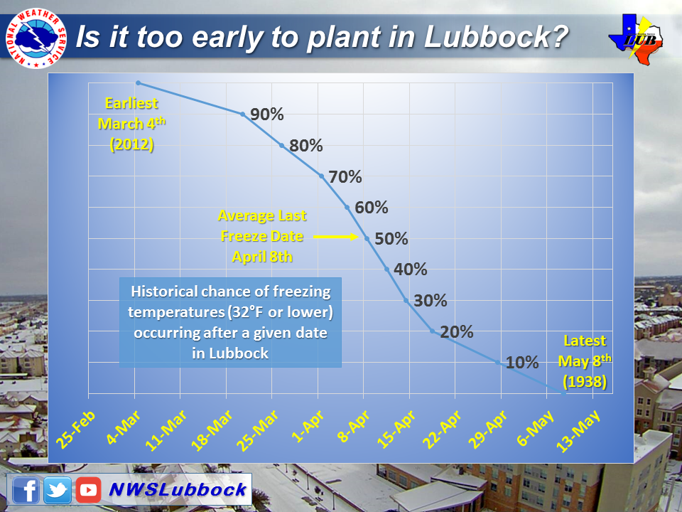
A breakdown of the last freeze data for Lubbock (over 100 years worth of information) can be VIEWED HERE.
US Dept of Commerce
National Oceanic and Atmospheric Administration
National Weather Service
Lubbock, TX
2579 S. Loop 289
Suite 100
Lubbock, TX 79423-1400
806-745-4260
Comments? Questions? Please Contact Us.

