
A heat wave over the Southwest will intensify late week, peaking and expanding into the Intermountain West and northern High Plains this weekend. Severe thunderstorms and heavy rain are expected over portions of the Plains and Mississippi Valley tonight, which will shift to parts of the Upper Midwest and mid-Mississippi Valley Friday. Monsoonal showers and flooding persist in the Desert Southwest. Read More >
West Gulf RFC
River Forecast Center
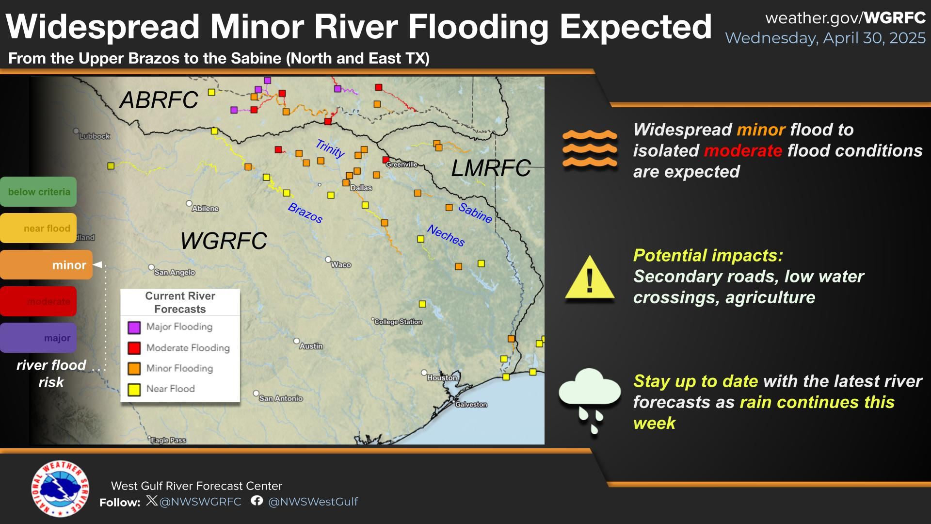
WGRFC River Flood Summary: Minor: 0 (0%)
Moderate: 0 (0%)
Major: 2 (0%)
Use the map below to view forecast locations experiencing flooding and link to detailed forecast information.
US Dept of Commerce
National Oceanic and Atmospheric Administration
National Weather Service
West Gulf RFC
3401 Northern Cross Blvd.
Fort Worth, TX 76137
Comments? Questions? Please Contact Us.


 Weather Story
 Year in Review
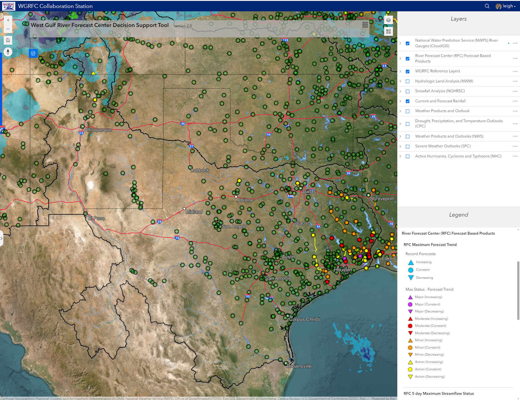 RFC Decision Support Tool
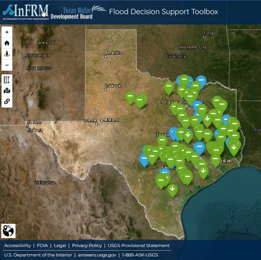 InFRM Flood Decision Support Toolbox
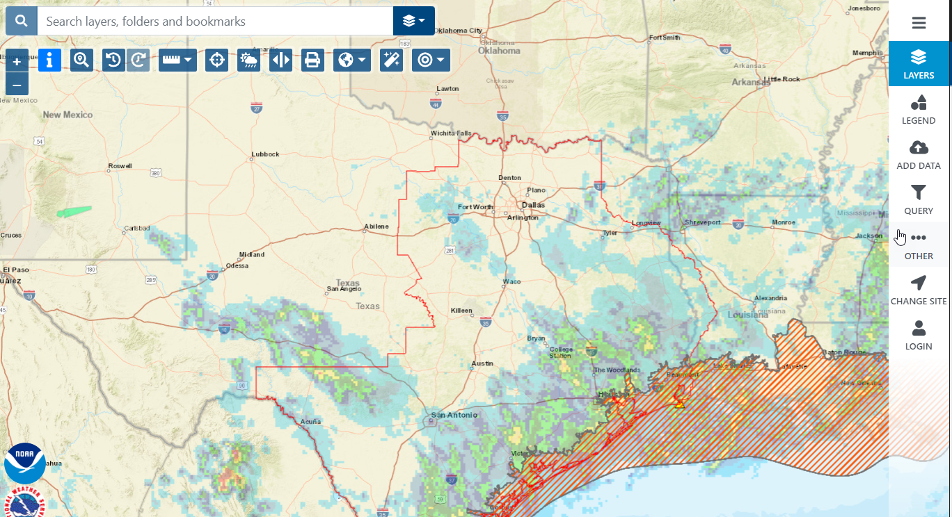 National Weather Service GIS Viewer (Water)
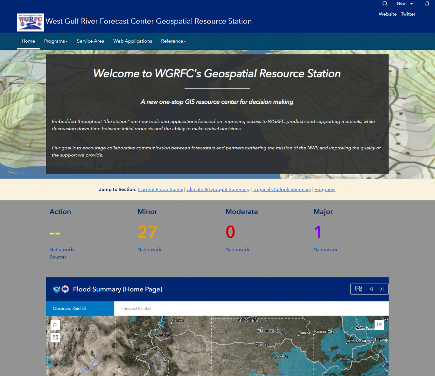 Geospatial Resource Station