| Winter Returns to West Texas with Cold and Snow 5-6 January 2017 |
|
 |
|
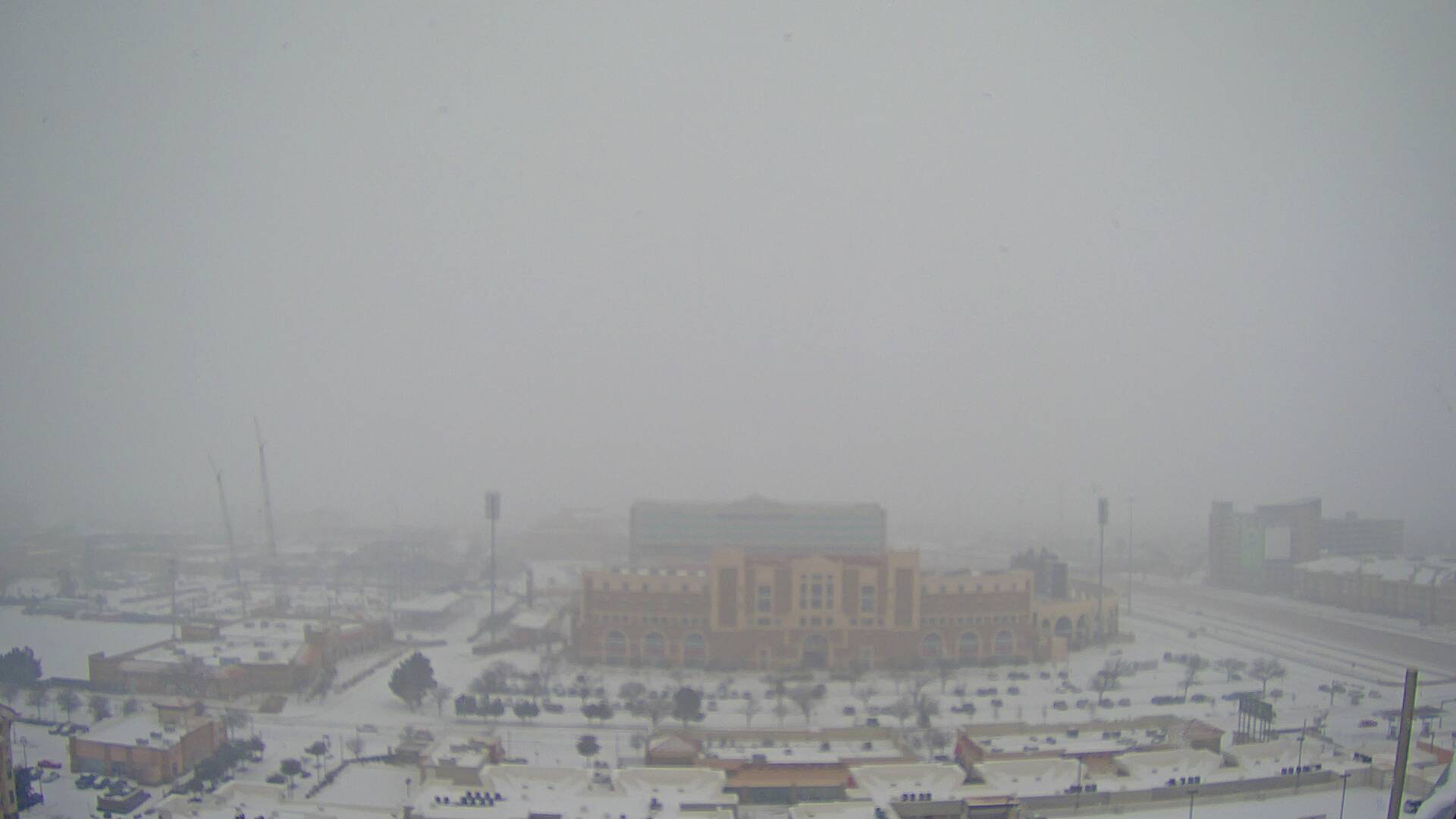
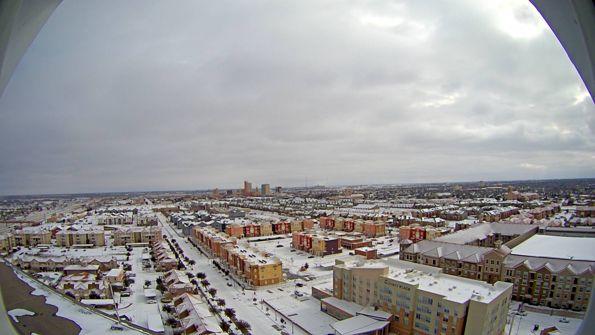
| Snow falling across Lubbock Friday morning (6 January 2017). The picture is looking west from the Overton Hotel, courtesy of KAMC. Another view from the Overton after the snow ended (and looking east) can be FOUND HERE. | |
| After a warm start to the year the weather took a turn back to the wintry side. Cold air built into the region during the course of a few days as a couple of cold fronts moved through. The coldest air moved in behind an early day front on Thursday (5 January 2016), with this Canadian air continuing to build into the South Plains through Friday. Temperatures sunk well below freezing, into the teens and even a few single digits Thursday night. Additionally, an approaching storm system brought enough Pacific moisture with it to fuel bands of snow Thursday night into Friday. | |
 |
|
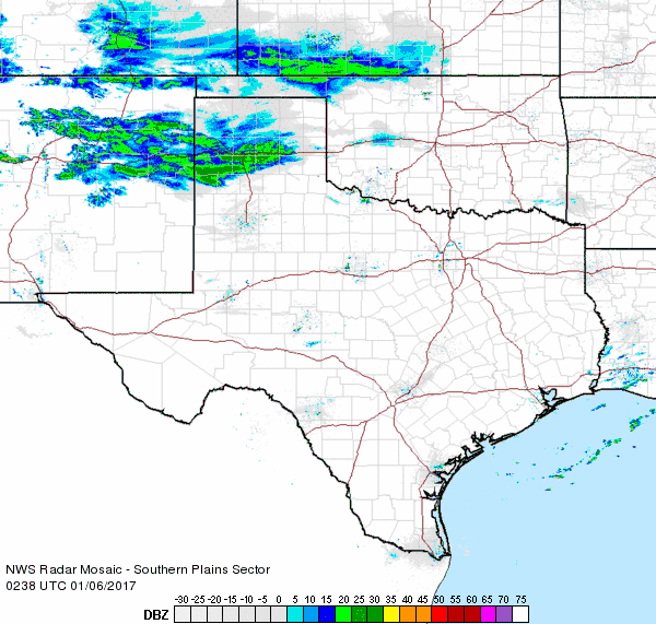
| Regional radar animation valid from 8:38 pm to 9:48 pm on Thursday, 5 January 2017. An additional radar animation valid from 5:28 am to 6:38 am on the 6th can be VIEWED HERE. | |
| The initial thrust of the snow was across the Panhandles Thursday night into early Friday morning. Many spots in the Texas Panhandle picked up a quick 2 to 4 inches of dry powdery snow with this first wave. | |
 |
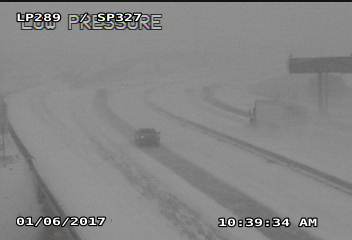 |
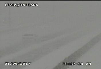
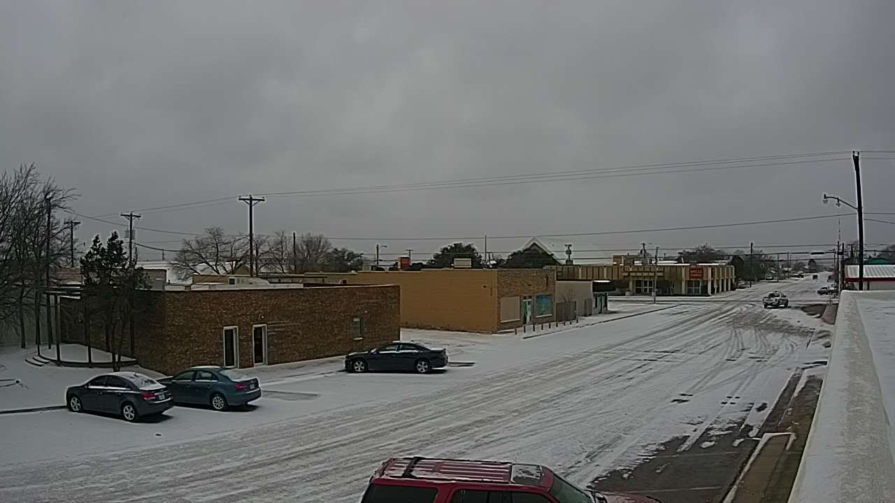
| A couple of pictures around Lubbock while a heavy snow band was moving through Friday morning. | |
| A final round of strong lift then spread further south and eastward Friday morning. This generated a band of moderate to heavy snow that raced across much of the South Plains and Rolling Plains Friday morning before diminishing and shifting eastward during the afternoon. This band of snow produced a quick 0.5 to 1 inch in about a half hour as it moved through. | |
 |
|
| Regional radar animation valid from 9:08 am to 10:18 am on Friday, 6 January 2017. An additional radar animation valid from 10:58 am to 12:08 pm on the 6th can be VIEWED HERE. | |
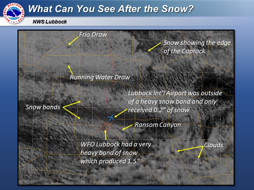
| After all was said and done, skies quickly cleared from north to south leaving behind a wintry wonderland. The below satellite image shows several features readily visible from space. In addition to many geographic features a few east-to-west oriented bands of heavier snowfall are readily apparent. | |
 |
|
| Summary of the different features visible from satellite imagery Friday afternoon after the clouds began to clear. | |
| Snow totals within the heavier swaths generally ranged from 1/2 to 2 inches, with 2 to 3 inches more common with the band across the southern Texas Panhandle. Where locations largely missed out on the heaviest snow bands totals varied from a dusting to 1/2 inch. The Lubbock International Airport was one such place that missed out on heaviest snow, only recording a total of 0.2 inches. | |
 |
|
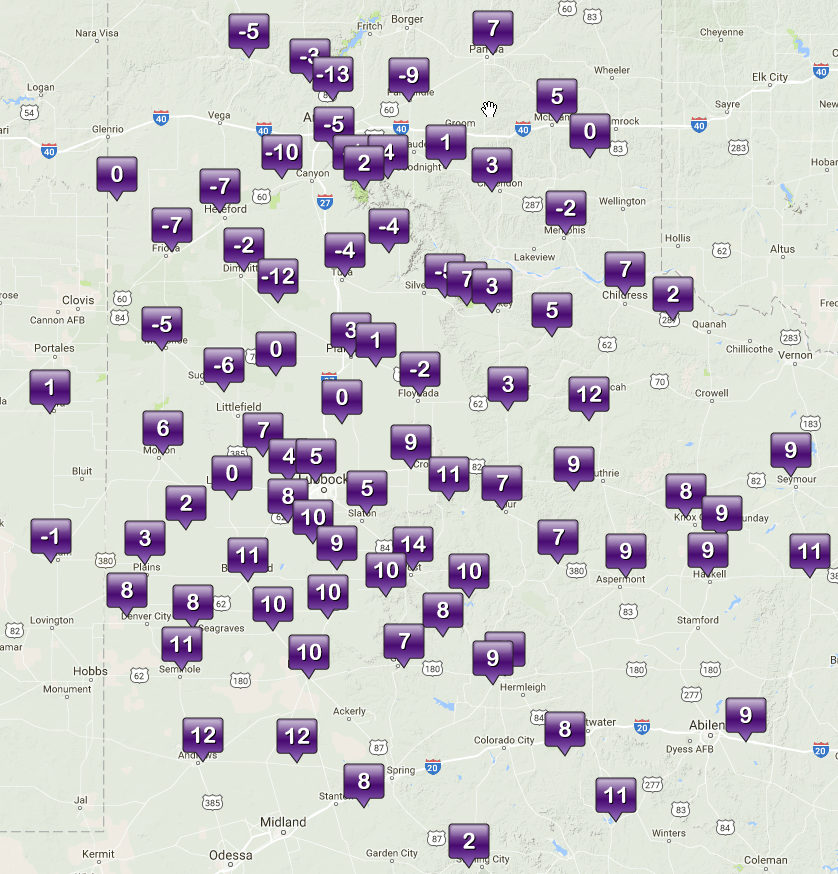
| Preliminary snow totals from the quick hitting 5-6 January 2017 snow event. | |
| Given the relatively cold air that was in place during the snow event (temperatures were mostly in the teens), very little liquid moisture went into making the resultant snowfall. In fact snow to liquid ratios were on the order of 15 to 20 inches of snow to 1 inch of rain (15:1 to 20:1). Normally snow to liquid ratios in West Texas are closer to 10:1. So, with the same amount of liquid moisture falling from the sky, snow totals were about doubled what they would normally be. | |
 |
 |
| (left) Observed lows Saturday morning (7 January 2017). (right) Wind chill readings around 8:30 am Saturday. The data are courtesy of the West Texas Mesonet. A plot of the high temperatures for Friday (6 January 2017) can be VIEWED HERE. Observed low temperatures Friday morning can also be ACCESSED HERE. | |
| Follow the snow Friday morning and early afternoon, skies quickly cleared and winds became light. This created the perfect setup for temperatures to crater Friday night. Lows by early Saturday were mostly in the single digits, while much of the western Texas Panhandle and northwest South Plains fell below zero. The Hart West Texas Mesonet site recorded a bone-chilling low of -12°F. Although winds were relatively light, this still caused wind chill values to dip into the -10°F to -30°F range for a period Friday night into Saturday morning. | |
 |
|
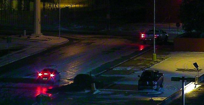
| Icy streets were the net result from the snow and cold in Lubbock Friday night. | |
| Though the snow did create a pretty scene, it also led to slick conditions on many area roadways. The low water content snow was quickly packed down and turned into a layer of ice on many streets. In Lubbock along 64 crashes were reported on Friday. The slick conditions continued into Saturday morning as the bitter cold retarded the snow from melting. | |
 |
 |
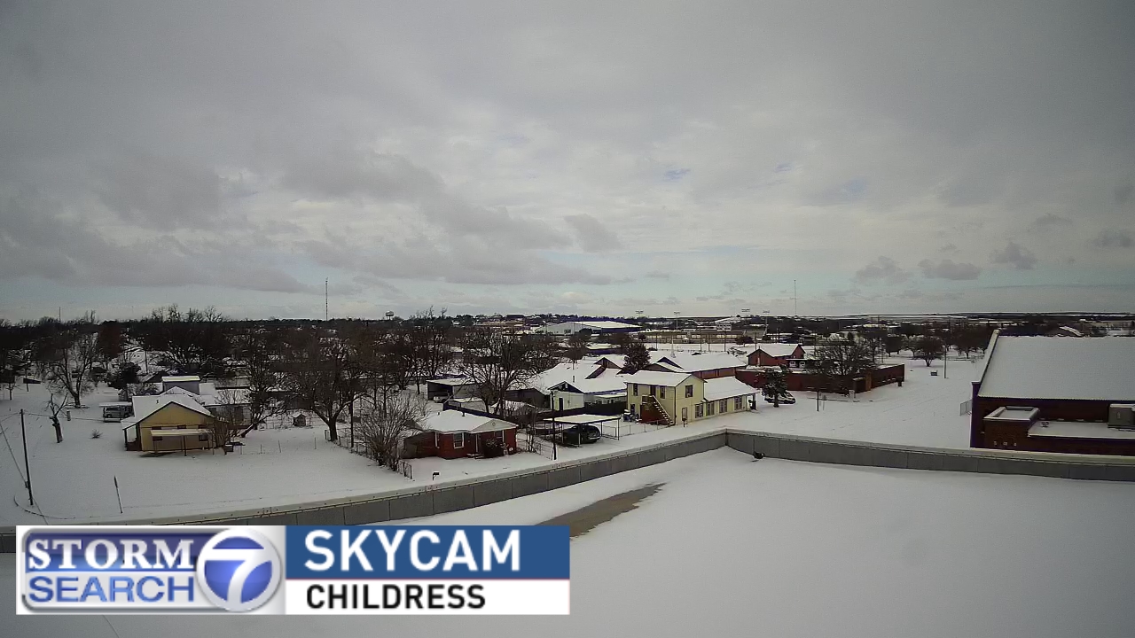
| The wintry scene in Childress (left) and Denver City (right) Friday afternoon. The images are courtesy of ABC7 and KAMC, respectively. | |

