
Scattered thunderstorms with severe gusts, hail and a tornado risk are possible near a cold front from the Ohio Valley to the Mid-Atlantic tonight. Tropical Storm Bertha is expected to bring tropical storm conditions to portions of the Gulf Coast from the panhandle of Florida into Louisiana through Wednesday. Read More >
|
Rounds of thunderstorms generate landspouts and widespread rain |
|
 |
|
|
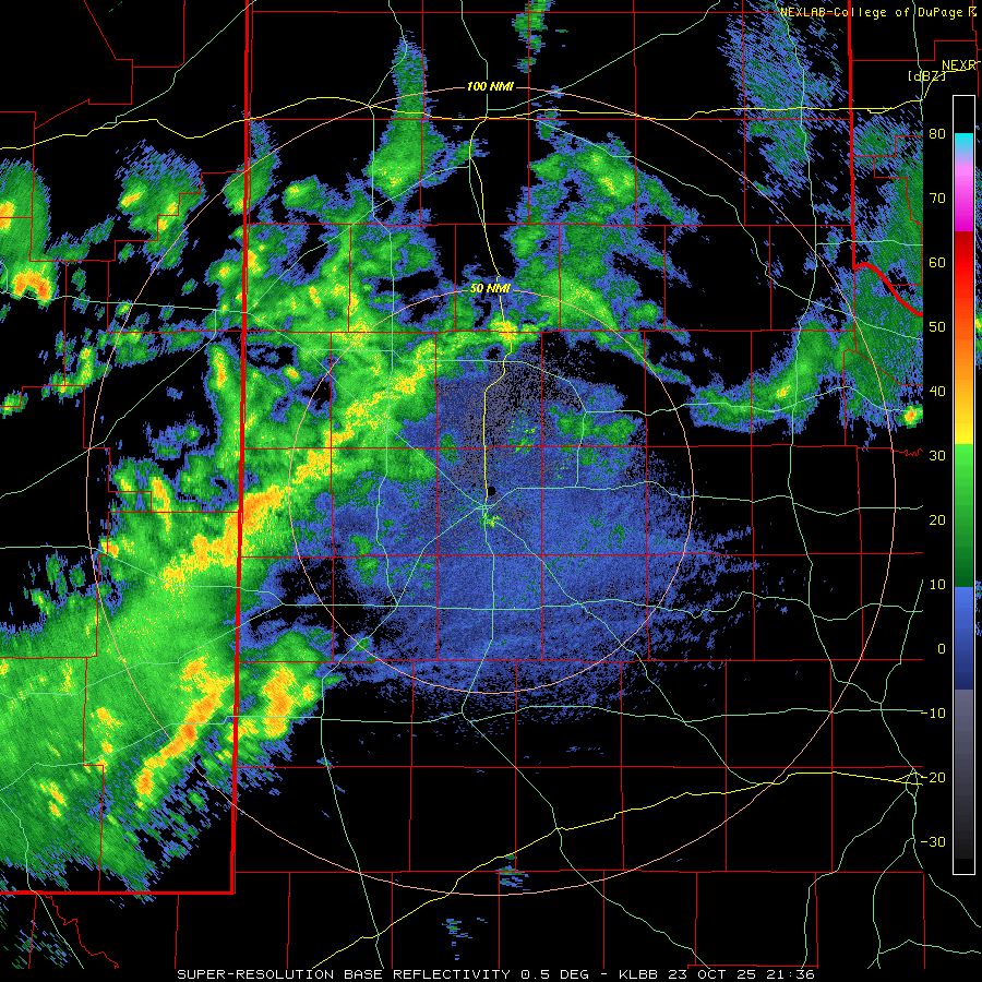
Lubbock WSR-88D radar animation valid from 4:36 pm to 9:57 pm on Thursday (23 October 2025). |
|
|
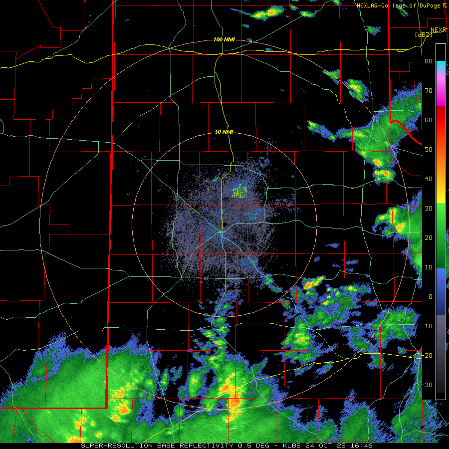
A robust, slow-moving, upper level storm system approaching via the Four Corners and southern Rockies brought unsettled weather to West Texas in late October 2025. In advance of the system, abundant mid-upper level moisture streaming off of the Pacific Ocean provided thick cloud cover and scattered sprinkles and light showers for much of the southern Texas Panhandle and South Plains Thursday morning and afternoon (23 October). South of the cloud deck, temperatures warmed well into the 80s over the southern South Plains and central and southern Rolling Plains. The warmth, in combination with improved low-level moisture, provided the instability to fuel scattered to numerous thunderstorms Thursday evening. A few of these storms likely generated hail, as well as localized heavy rain. |
|
 |
|
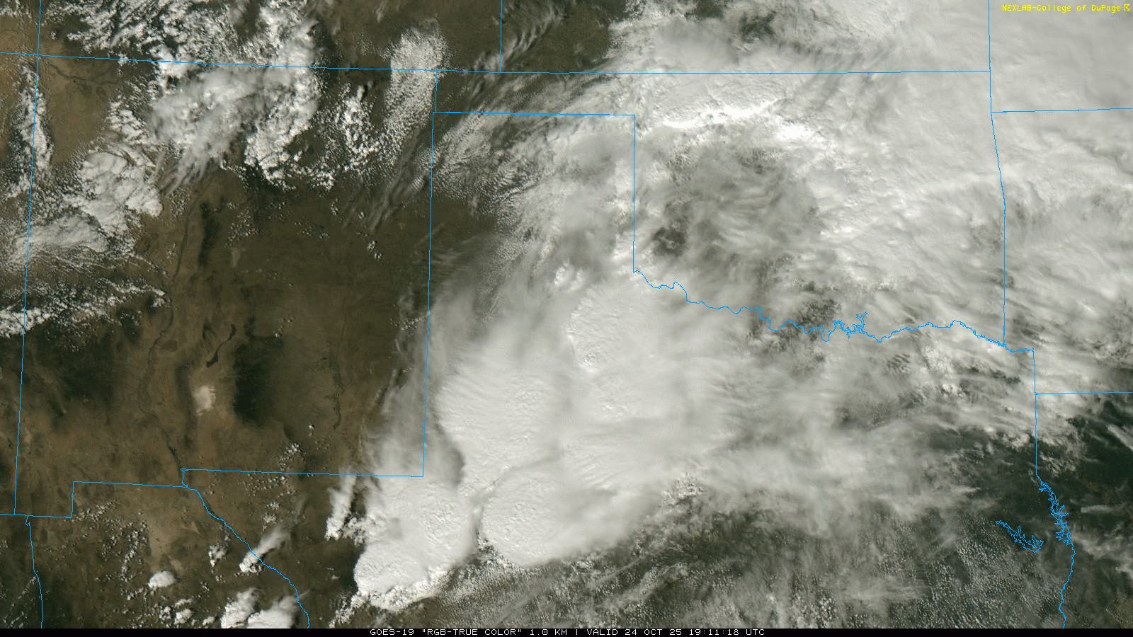
| "RGB True-Color" satellite animation valid from 2:11 pm to 3:31 pm on Friday (24 October 2025). | |
| The following day remained active as lift from the approaching mid-upper level trough continued to interact with abundant moisture residing over the region. The most widespread coverage of showers and thunderstorms targeted the southeast South Plains and the Rolling Plains, though most locations experienced at least a little rain. | |
 |
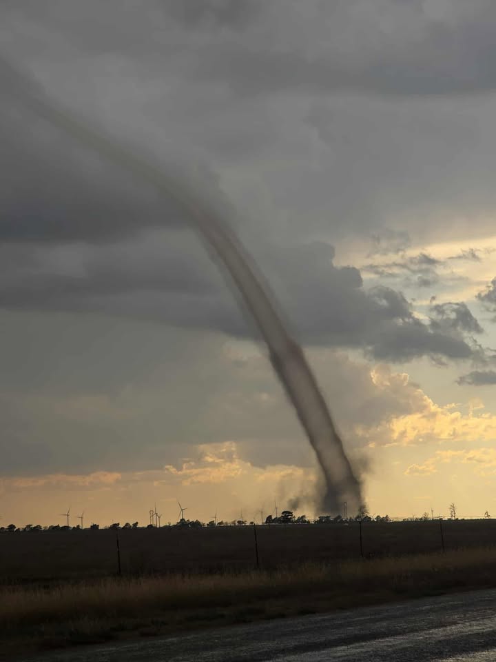 |
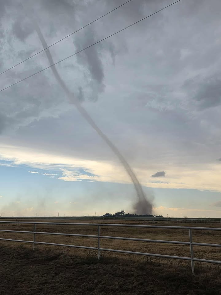
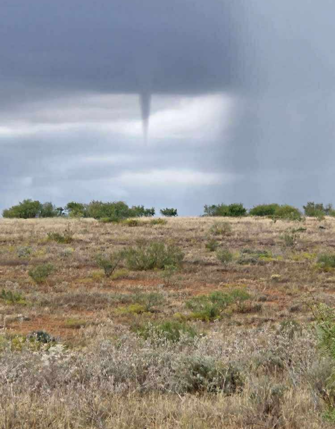
| Landspout-type tornado photographed near Dimmitt late Friday afternoon (24 October 2025). The pictures are courtesy of Ben Elmore. | |
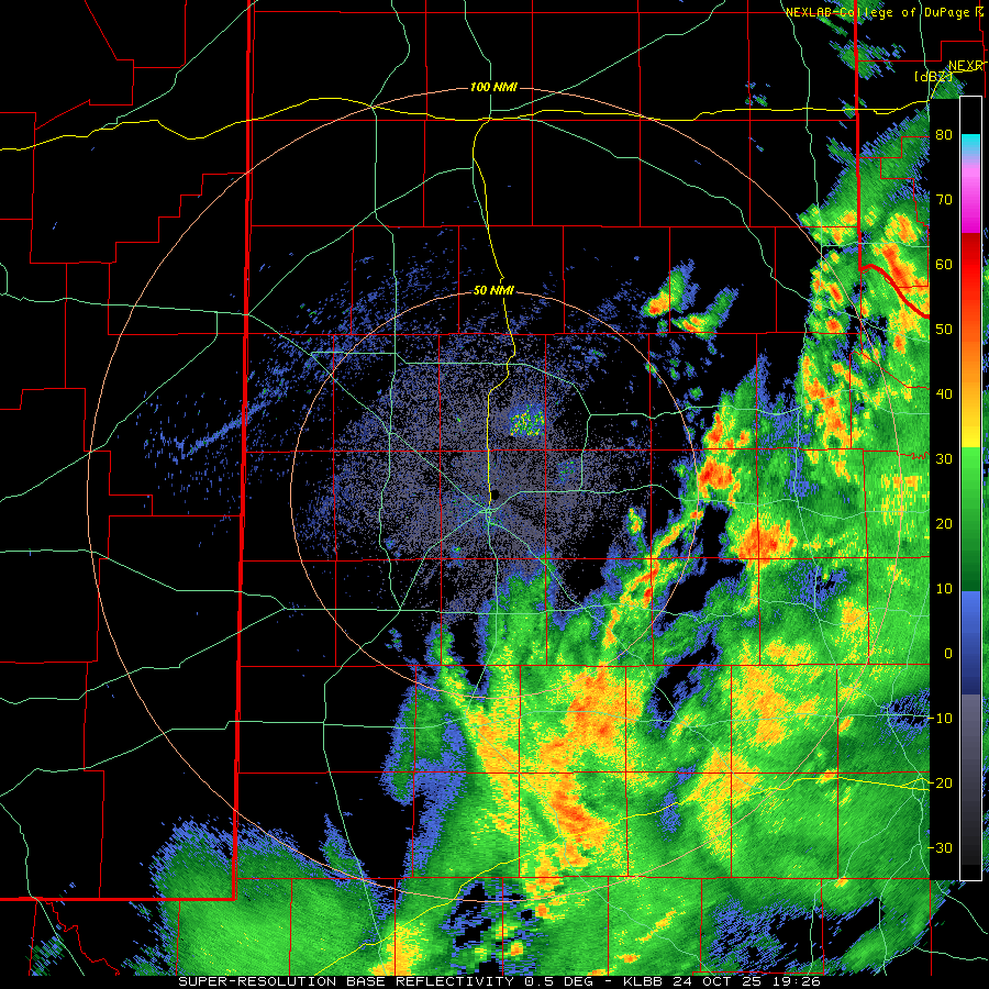
| The blanket of clouds kept temperatures mild overnight and cool during the day on Friday (24 October). Where sunshine did make an appearance in the afternoon, temperatures warmed into the middle 70s across the southwest Texas Panhandle and northwestern South Plains. The heating, along with converging winds along a weak front, served as a focus for additional thunderstorm development Friday afternoon. Spin along the nearly stationary southwest-to-northeast oriented front was utilized by developing thunderstorms to generate several landspout tornadoes from near Muleshoe to Dimmitt late Friday afternoon. Additionally, the most intense activity produced small hail, generally under 1 inch in diameter and brief heavy rain. Although ominous, the landspout-type tornadoes inflicted no known damage. | |
 |
|
| Lubbock WSR-88D radar animation valid from 2:26 pm to 4:40 pm on Friday (24 October 2025). An additional radar animation, valid from 11:46 am to 1:58 pm on Friday, can be VIEWED HERE. | |
|
The activity over the northwestern South Plains gradually faded as it approached the central South Plains Friday evening. However, additional isolated thunderstorms spread out of New Mexico into the western South Plains late Friday night into early Saturday morning, bringing rain and likely pockets of small hail to a few spots, including near the Muleshoe Wildlife Refuge. |
|
 |
|
| Funnel cloud observed about 10 miles west of Guthrie on Saturday afternoon (25 October 2025). The picture is courtesy of Susan Harbert and Telemundo Abilene. | |
|
Keeping things interesting, scattered showers and thunderstorms persisted across much of the South Plains region on Saturday (25 October), as the cold-core disturbance moved directly over. Small hail, lightning and brief heavy rain accompanied the stronger activity. Lightning near Jones AT&T Stadium delayed the start of the Texas Tech and Oklahoma State football game. In addition, another funnel cloud (and possible landspout) was sighted west of Guthrie Saturday afternoon. |
|
 |
|
| MRMS radar animation valid from 1 pm to 6 pm on Saturday (25 October 2025). | |
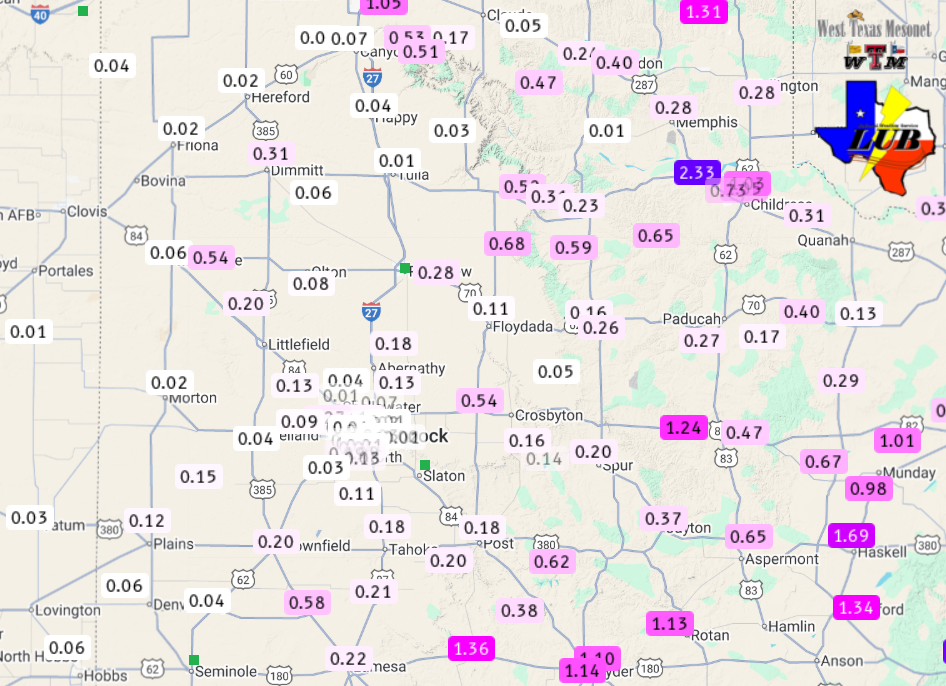
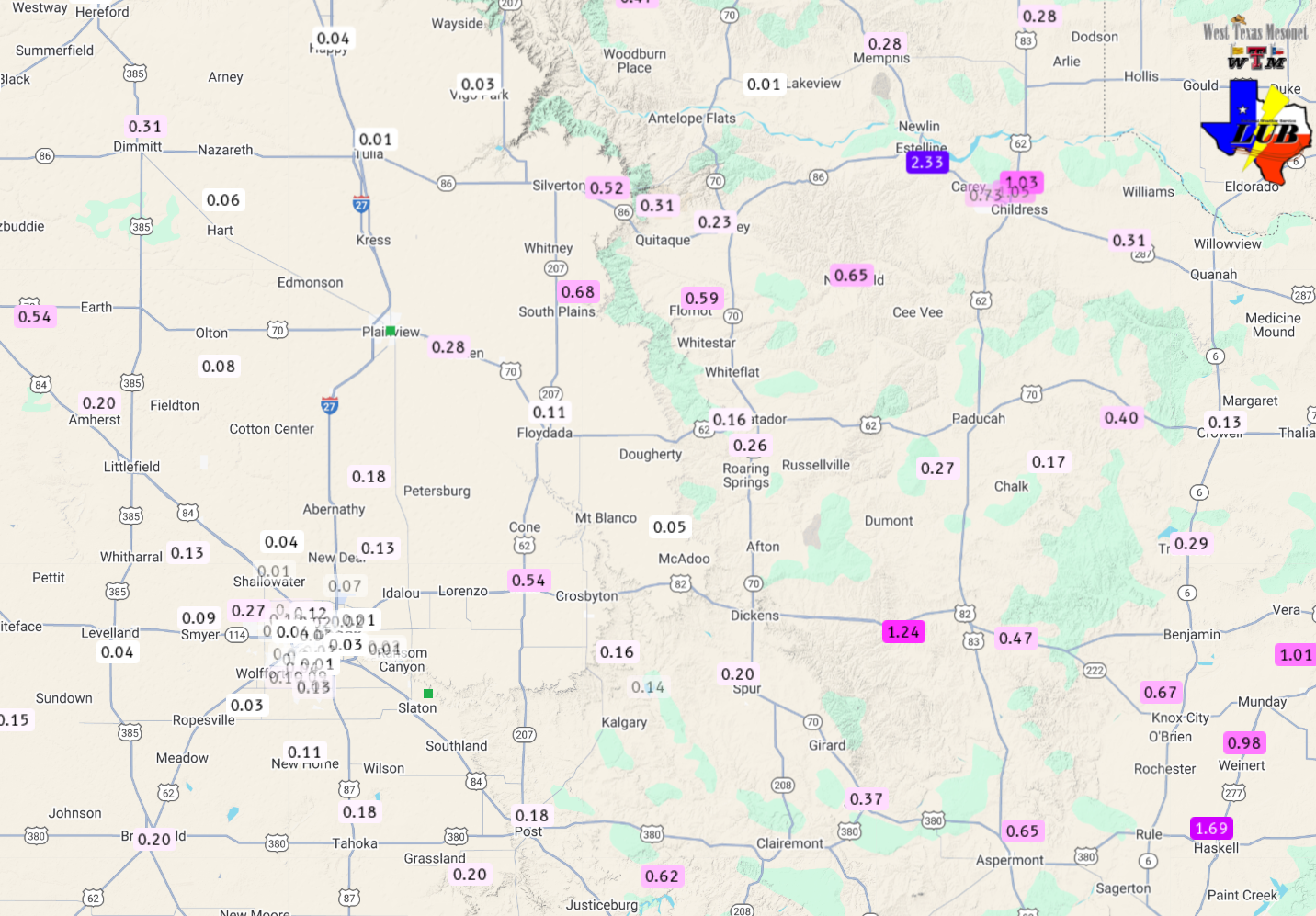
| Eventually the active weather came to an end as the showers and thunderstorms diminished Saturday evening, but not before most of the region recorded some rainfall. The heaviest rain over this 3-day stretch was spotty, but tended to affect the southeast Texas Panhandle, southern Rolling Plains and northwestern South Plains, where totals in excess of a half inch were common. On the high end, the West Texas Mesonet (WTM) site 10 miles west of Guthrie measured 1.24 inches, while the site 3 miles south-southeast of Estelline had 2.33 inches. Many spots in and around Childress also tallied around an inch, though the airport officially only recorded 0.69 inches. | |
 |
|
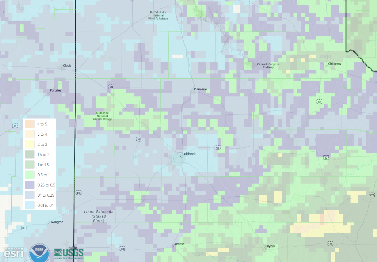
| Radar-estimated and bias-corrected 4-day rainfall ending at 7 am on Monday (27 October 2025). Measured rainfall over this same stretch, courtesy of the West Texas Mesonet (WTM) and the National Weather Service (NWS), can be FOUND HERE. A close up of the Rolling Plains can as be VIEWED HERE. | |
| The south-central Texas Panhandle and central and southwestern South Plains largely missed out on the meaningful rain, with many locations only tallying a few hundredths to a tenth of an inch of rain. Officially, the Lubbock airport measured 0.10 inches over the 3-day stretch, with even less seen over much of the city. | |
Preliminary Local Storm Report
National Weather Service Lubbock TX
142 AM CDT Sat Oct 25 2025

..TIME...   ...EVENT...      ...CITY LOCATION...     ...LAT.LON...
..DATE...   ....MAG....      ..COUNTY LOCATION..ST.. ...SOURCE....
            ..REMARKS..

0345 PM     Landspout        4 SE Muleshoe           34.19N 102.68W
10/24/2025                   Bailey             TX   Public


0430 PM     Landspout        1.5 NW Dimmitt          34.56N 102.33W
10/24/2025                   Castro             TX   Broadcast Media

            First of three landspouts near Dimmitt. This
            lasted for 20 minutes.

0450 PM     Landspout        2 W Dimmitt             34.55N 102.35W
10/24/2025                   Castro             TX   Broadcast Media

            Occurred simultaneously with earlier
            landspout. This lasted for 12 minutes.

0504 PM     Landspout        1 W Dimmitt             34.55N 102.33W
10/24/2025                   Castro             TX   Broadcast Media

            Third and final landspout observed near
            Dimmitt for two minutes.

