|
Potent system brings a little rain for many, wind and dust for others |
|
 |
|
| Water vapor satellite animation valid from 3:21 am to 6:41 am on Thursday (20 November 2025). | |
|
A mid-upper level storm system emerging from the Desert Southwest provided cooler temperatures, along with the first rainfall in nearly a month for many locations. In advance of the system, low level moisture slowly advanced northwestward through Texas, making it as far as the southern Rolling Plains on Wednesday (19 November). This moisture return, coupled with lift along a warm front and weak upper level support, fueled scattered thunderstorm development Wednesday afternoon and evening from the eastern Permian Basin through the southern Rolling Plains and into western North Texas. Sufficient instability and stout vertical wind shear encouraged several of these storms to become strong to marginally severe, while good moisture levels promoted brief heavy downpours. |
|
 |
|
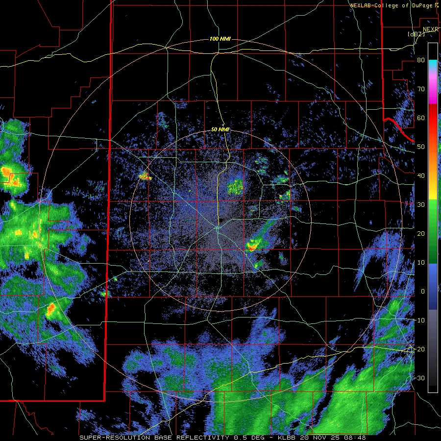
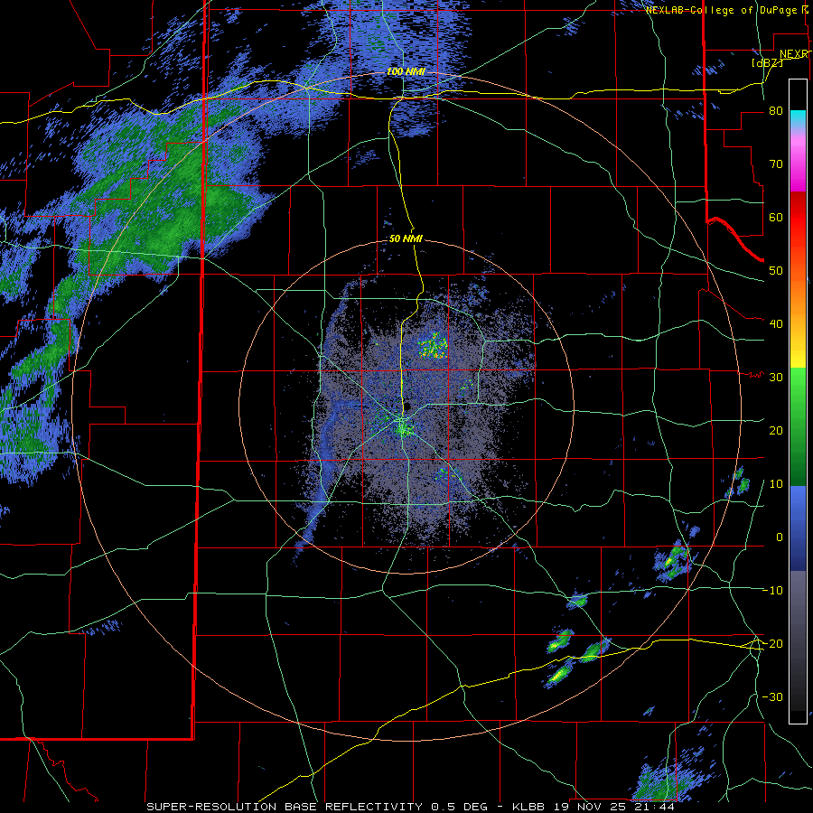
| Lubbock WSR-88D radar animation valid from 2:48 am to 6:41 am on Thursday (21 November 2025). Additional radar animations can be found at: 3:44 pm to 10:07 pm on Wednesday (20 November); and 5:46 pm on Wednesday to 6:55 am on Thursday (19-20 November). | |
| Following a lull through much of the overnight, additional rain and embedded thunderstorms formed and tracked across the southwest Texas Panhandle and northwest South Plains Thursday morning. This activity wasn't too intense, but did bring meaningful rainfall to locations in and around Muleshoe, Friona, and spots northwest of Dimmitt. | |
 |
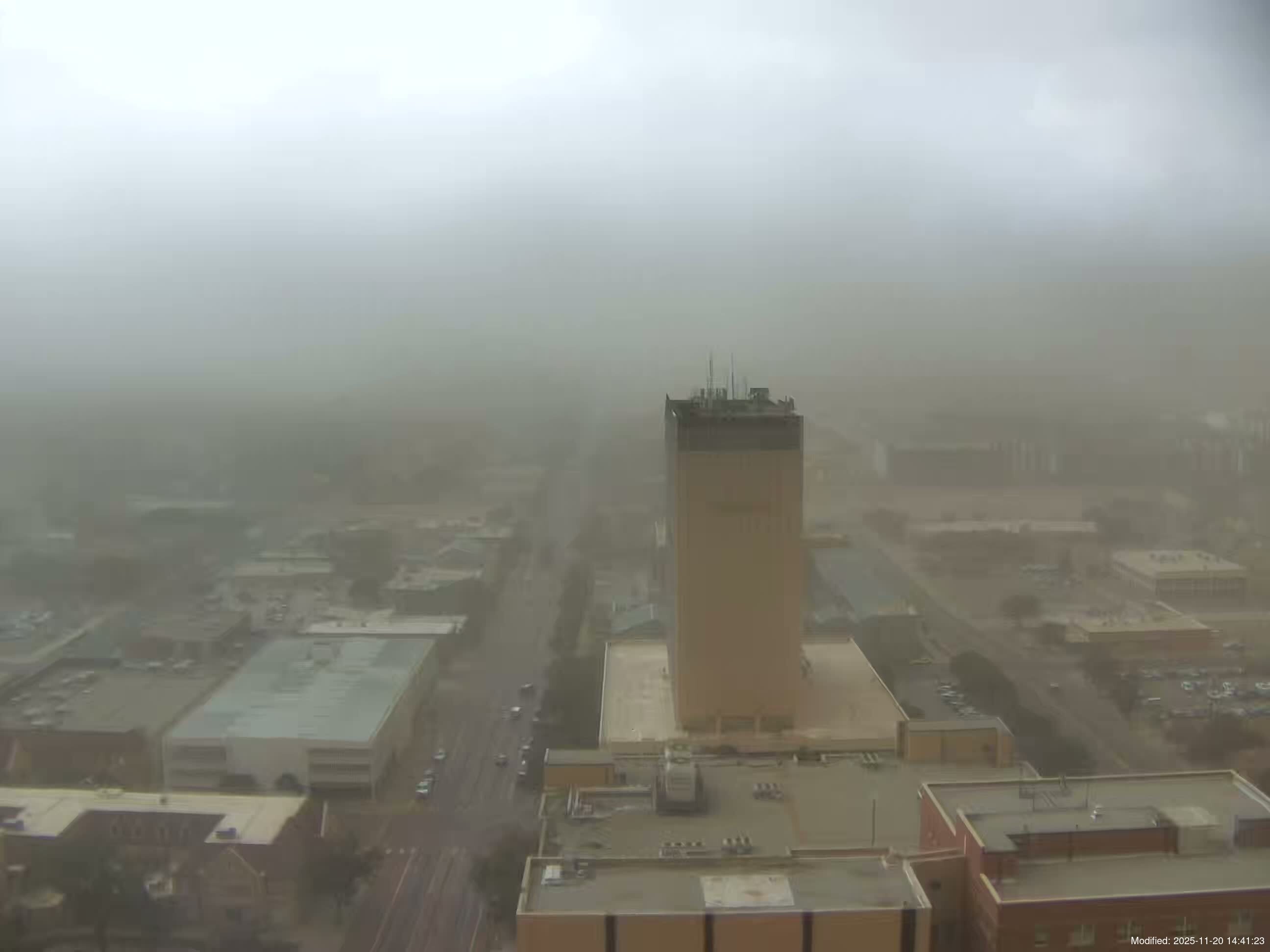 |
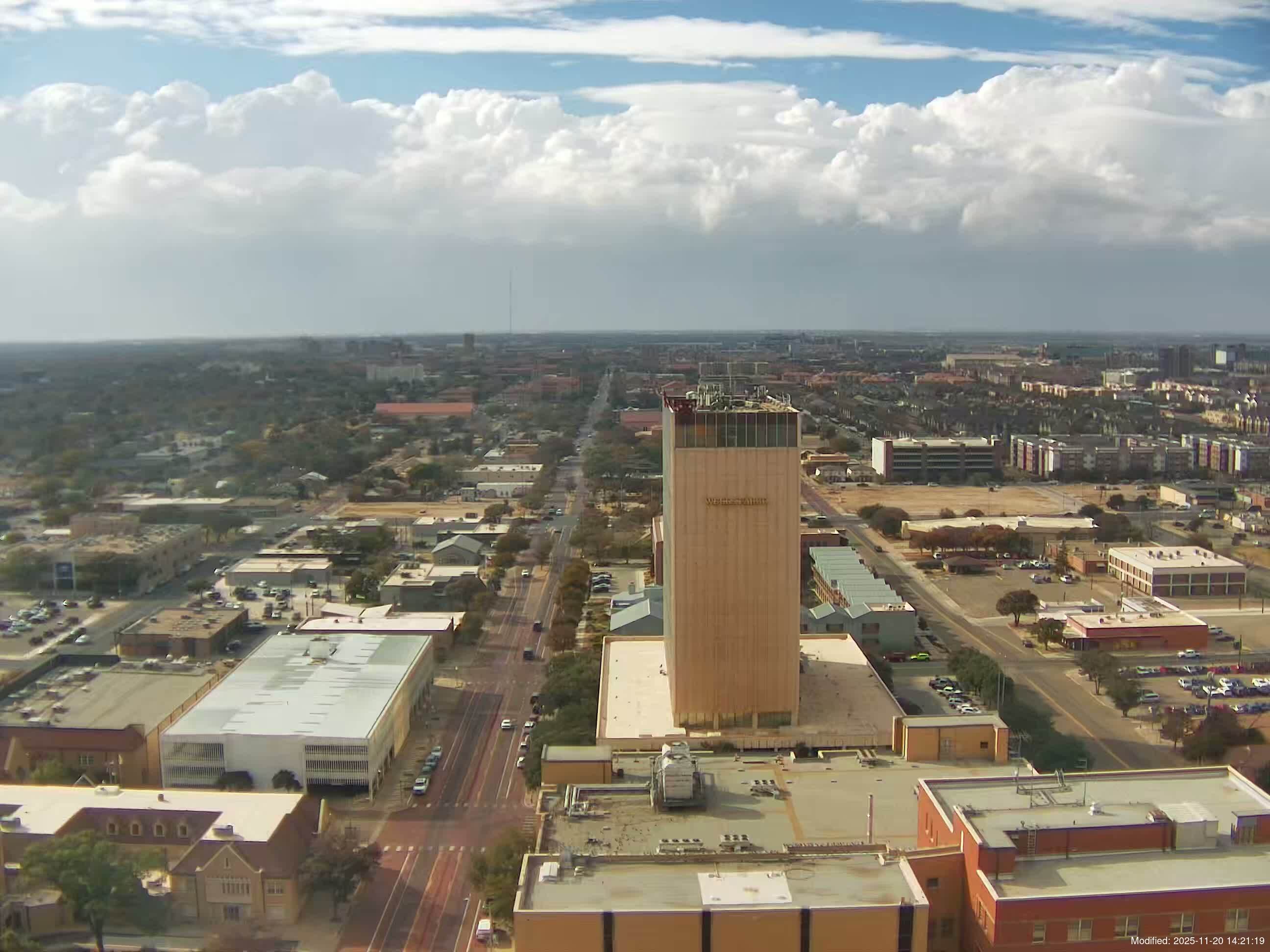
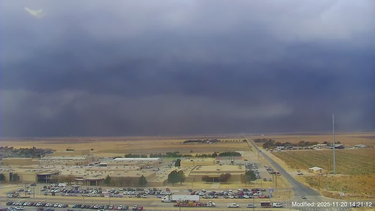
| Looking west from the Metro Tower in Lubbock at 2:27 pm (left) and 2:40 pm (right) on Thursday (20 November 2025). The images are courtesy of the KAMC Sky-View Network. | |
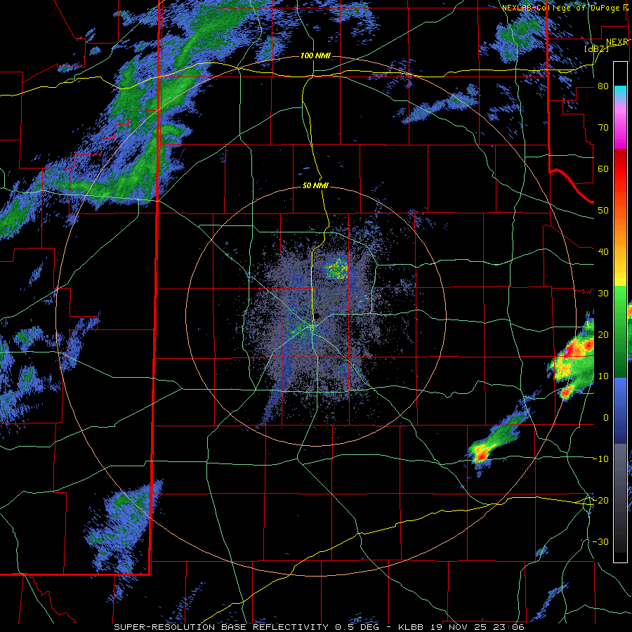
| The final round of stronger lift, associated with the upper level system and a Pacific cold front, kicked off the most widespread showers and thunderstorms of the event for the South Plains region. A quasi-line of low-topped convection formed over eastern New Mexico and raced east and northeast into the western South Plains Thursday afternoon. Where the outflow/front outran the rain/storms, little to no precipitation occurred, but strong winds did loft copious amounts of dust. Lubbock was at the epicenter of this, seeing very little rain, but getting a shot of thick dust on the leading edge of gusty westerly winds. The Lubbock Airport officially measured a peak wind gust of 67 mph at 2:44 pm, along with blowing dust that briefly reduced the visibility to 1/4 mile, but only a trace of rain. | |
 |
|
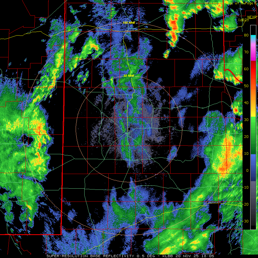
| Lubbock WSR-88D radar animation valid from 12:05 pm to 6:02 pm on Thursday (20 November 2025). A "RGB-True Color" satellite animation, valid from 12:11 pm to 2:16 pm on Thursday, can be FOUND HERE. | |
|
The outflow/front did trigger the rapid development of a narrow squall line when it encounter better moisture and instability levels off the Caprock. The squall line weakened as it quickly moved into western North Texas and southwest Oklahoma, but not before providing a quick shot of heavy rain to many locations. |
|
 |
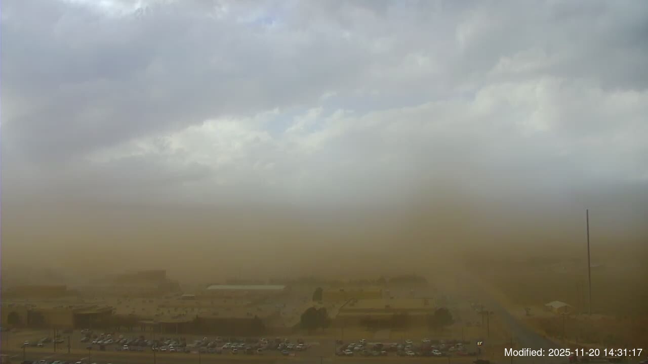 |
| Looking west from Wolfforth at 2:21 pm (left) and 2:31 pm (right) on Thursday (20 November 2025). The images are courtesy of the KAMC Sky-View Network. | |
|
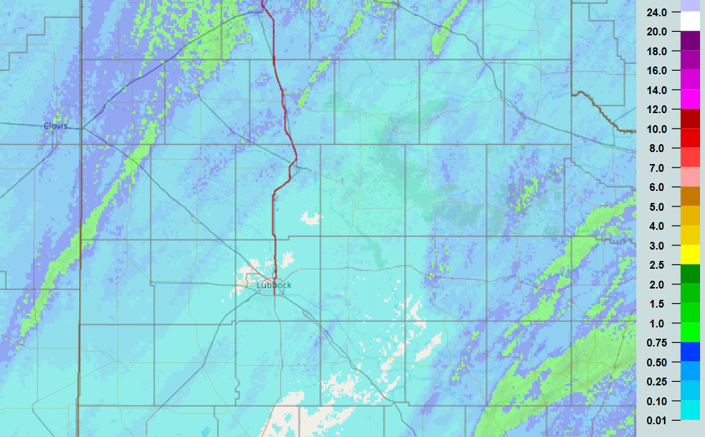
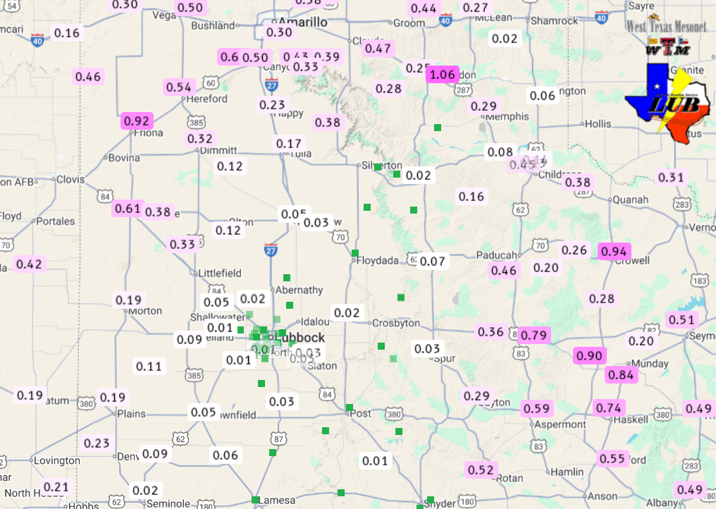
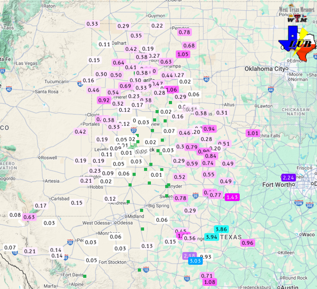
Over the course of this mid-November event, sprinkles and light showers were fairly widespread over West Texas, but the more significant rainfall was confined to the central and eastern Rolling Plains as well as the northwest South Plains and southwest Texas Panhandle, where totals of 0.25 to 0.50+ inches was common. The highest rain total received within the Lubbock County Warning Area (CWA) was a respectable 0.92 inches at the Friona West Texas Mesonet (WTM). |
|
 |
|
| Multi-Radar Multi-Sensor (MRMS) estimated 48-hour rainfall ending at 8 am on Friday (21 November 2025). Measured rainfall over this same stretch, courtesy of the West Texas Mesonet (WTM) and the National Weather Service (NWS), can be FOUND HERE. | |
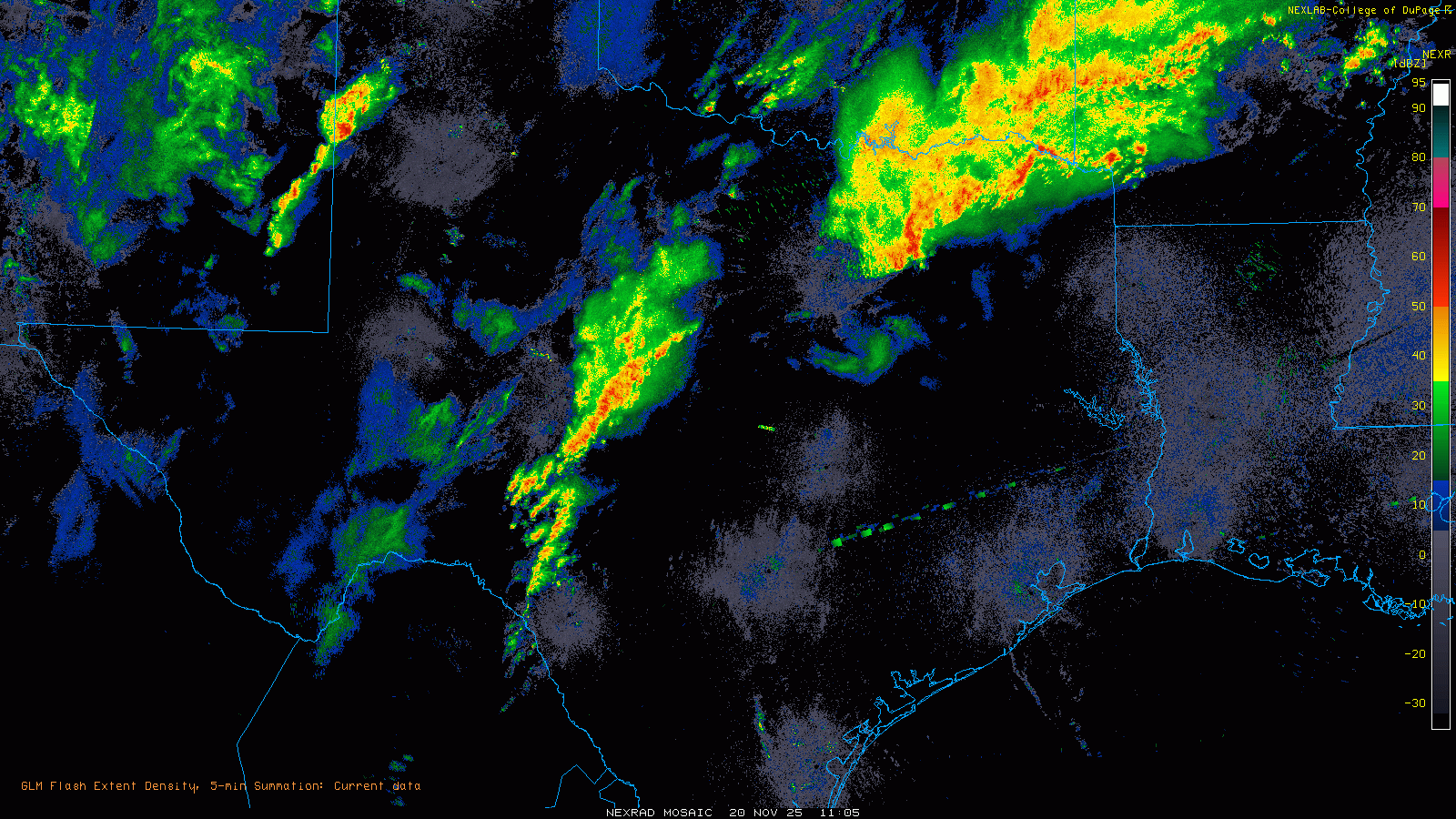
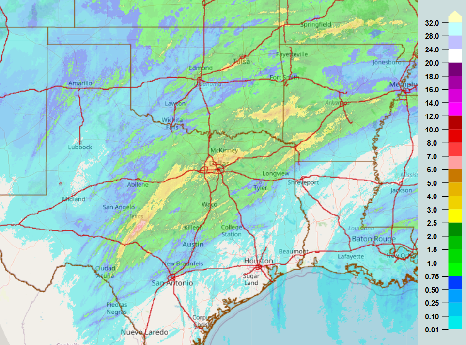
| Farther downstate, where richer moisture was able to be tapped, a swath of torrential showers and thunderstorms repeatedly tracked over parts of Central and North Texas. The heavy rain, and resulting runoff, did create flash flooding and rapid creek and river rises. | |
 |
|
| Regional radar animation valid from 5:05 am to 10:25 pm on Thursday (20 November 2025). | |
| The heaviest rain, from 2 to 3+ inches, fell from in and around DFW through Brownwood, Brady, Menard and Rocksprings. Locations from west of Brady through Menard to east of Sonora were hardest hit, receiving 6+ inches. The Menard WTM measured 9.93 inches, much of which fell between 7 am and 1:30 pm on Thursday. | |
 |
|
| Multi-Radar Multi-Sensor (MRMS) estimated 48-hour rainfall ending at 8 am on Friday (21 November 2025). Measured rainfall over this same stretch, courtesy of the West Texas Mesonet (WTM) and the National Weather Service (NWS), can be FOUND HERE. | |
| Preliminary storm reports collected by WFO Lubbock for this event can be found below. | |
Preliminary Local Storm Report...Summary
National Weather Service Lubbock TX
939 AM CST Fri Nov 21 2025

..TIME...   ...EVENT...      ...CITY LOCATION...     ...LAT.LON...
..DATE...   ....MAG....      ..COUNTY LOCATION..ST.. ...SOURCE....
            ..REMARKS..

0334 PM     Tstm Wnd Gst     2 ENE Tulia             34.54N 101.74W
11/20/2025  M62 MPH          Swisher            TX   Mesonet


0227 PM     Tstm Wnd Gst     Reese Center            33.61N 102.05W
11/20/2025  M62 MPH          Lubbock            TX   Mesonet

            Measured by the West Texas Mesonet. A gust
            to 58 mph was also observed at 2:26 PM. The
            parent convection had minimal lightning, but
            the outflow was lofting copious amounts of
            dust.

0244 PM     Dust Storm       1 NNW Lubbock Int. Airp 33.67N 101.82W
11/20/2025                   Lubbock            TX   ASOS

            Visibility was briefly reduced to 1/4 mile
            in dust as a gust front associated with
            low-topped convection moved through.

0244 PM     Tstm Wnd Gst     1 NNW Lubbock Int. Airp 33.67N 101.82W
11/20/2025  M67 MPH          Lubbock            TX   ASOS

            Associated with low-topped convection with
            minimal lightning. Blowing dust also reduced
            the visibility to 1/4 mile.

0201 PM     Tstm Wnd Gst     4 S Levelland           33.53N 102.36W
11/20/2025  M60 MPH          Hockley            TX   Mesonet

            Measured by the West Texas Mesonet as
            low-topped convection, with minimal
            lightning, moved through.

0318 PM     Tstm Wnd Gst     1 SE Ralls              33.67N 101.38W
11/20/2025  M73 MPH          Crosby             TX   Mesonet

            Measured by the West Texas Mesonet.
            Associated with low-topped convection with
            minimal lightning.

0356 PM     Tstm Wnd Gst     7 ESE Silverton         34.45N 101.19W
11/20/2025  M64 MPH          Briscoe            TX   Mesonet

