| A Chilly and Wet Winter Weekend 14-15 January 2017 |
|
 |
|
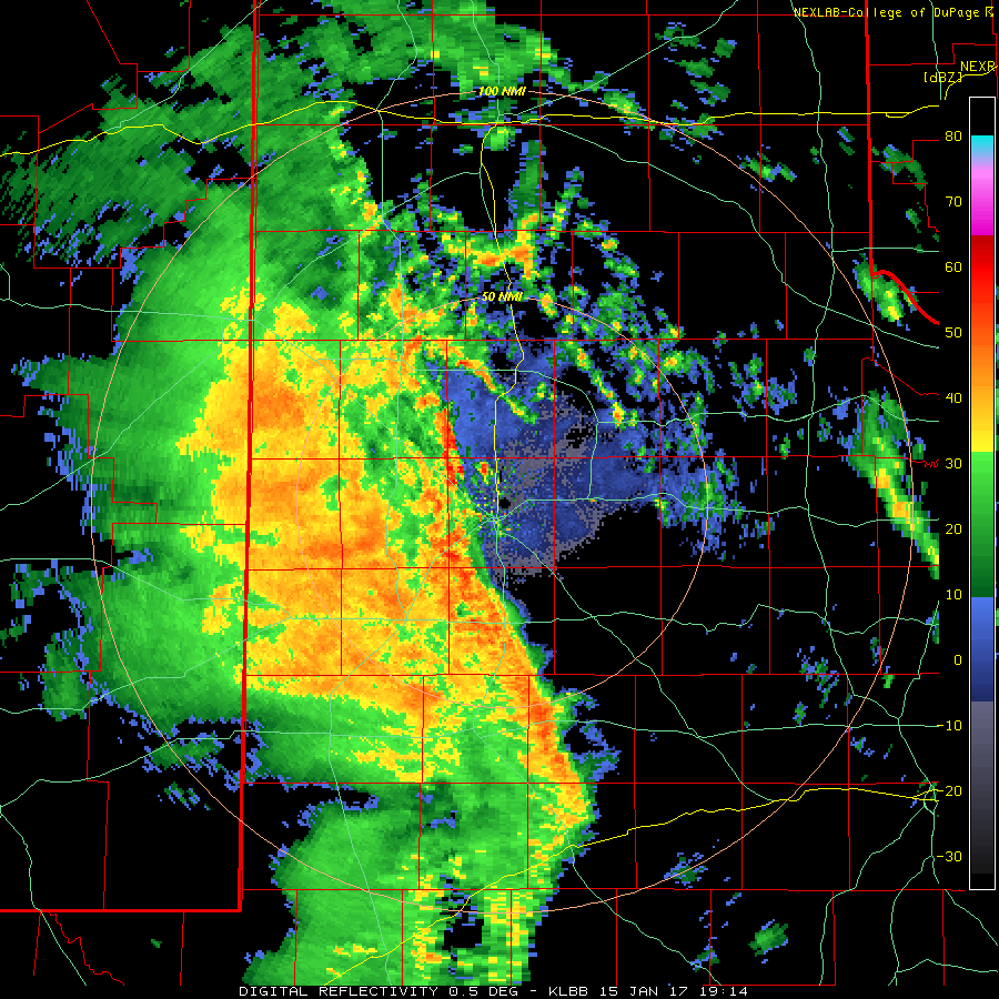
| Radar animation valid from 1:14 pm to 2:56 pm on Sunday, 15 January 2017. | |
| A slow moving upper level low joined forces with abundant moisture and a lingering frontal boundary to bring several rounds of precipitation to West Texas during the mid-January weekend. The initial cold front moved through Thursday night and early Friday carrying in much cooler air. Temperatures dipped from record levels, in the 70s and 80s, on Tuesday afternoon (11 January) to mere 30s and 40s by Friday. Clouds quickly filled in behind the front, but much of Friday was dry. | |
 |
|
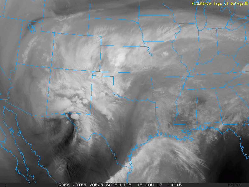
| Water vapor satellite animation captured from 8:15 am to 2:45 pm on Sunday, 15 January 2017. | |
| Things quickly changed early Saturday as the storm system slowly approaching through northern Mexico helped to draw improved moisture up and over the cool air at ground level. Scattered showers and thunderstorms began to develop over the region, fueled by 50 degree air located a few thousand feet above ground level. | |
 |
|
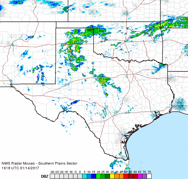
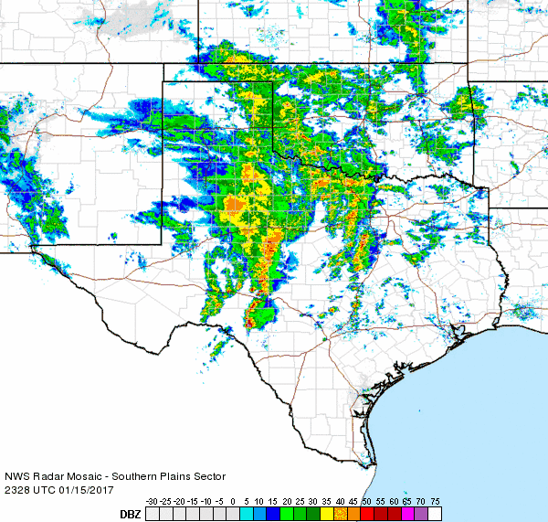
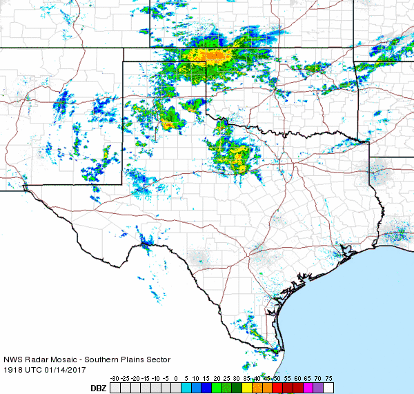
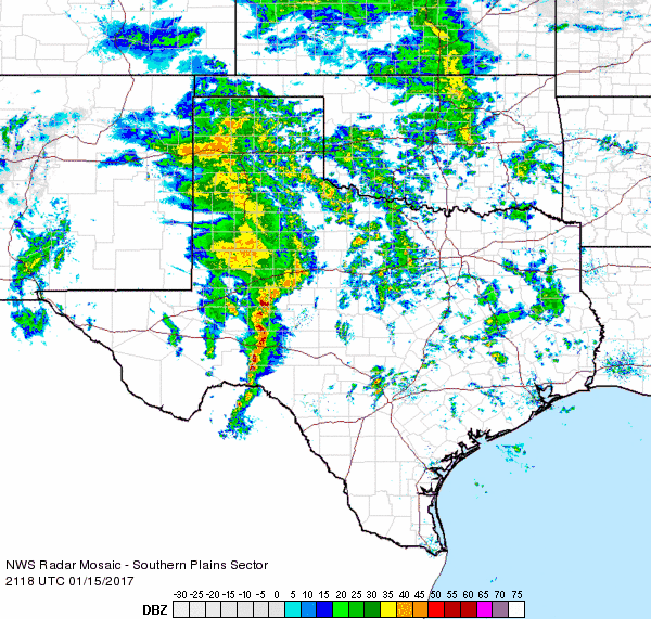
| Regional radar animation valid from 10:18 am to 11:28 am on Saturday, 14 January 2017. Additional radar animation can be found at: 1:18 pm to 2:28 pm Saturday afternoon and 4:08 pm to 5:18 pm Saturday evening. | |
| The scattered showers and storms continued through Saturday afternoon and evening, with the greatest coverage gradually shifting northward in the Panhandles. The warm temperatures aloft ensured that everything that fell to the ground was in liquid form, but where temperatures were below the freezing mark at ground level, the result was freezing rain. Many locations north and northeast of Lubbock stayed near or just below freezing from much of Saturday into Sunday morning. Thankfully, though, with the relatively warm ground and temperatures holding near freezing, most roadways stayed mostly wet, though some light ice accumulations were noted on elevated surfaces including on trees, fences and vehicles. More significant icing was reported over portions of the eastern Texas Panhandle into northwest Oklahoma where temperatures remained a few degrees cooler. | |
 |
|
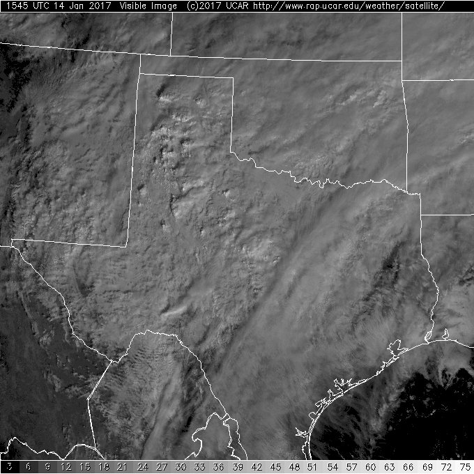
| Visible satellite image captured at 9:45 am on Saturday, 14 January 2017. | |
| The above image nicely depicts those taller clouds (showers and thunderstorms) that bubbled up and over the lower cloud deck that was so persistent over the region from Friday through Sunday. After a bit of a lull in activity over the South Plains late Saturday into early Sunday, widespread shower and thunderstorms spread across West Texas as the upper level low drew closer (see the animation at the top of the page). A few of these storms even produced small hail in places, but overall instability was limited and prevented the storms from strengthening to severe levels locally. This was not the case further east. One particularly intense storm produced a couple of tornadoes and numerous reports of damaging winds as it moved northeastward through the Dallas area. Another intense storm dropped up to Grapefruit size hail as it track eastward into Central Texas. | |
 |
|
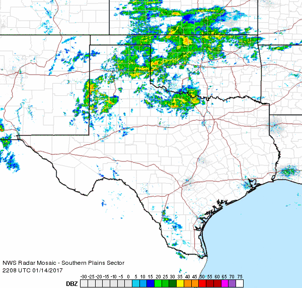
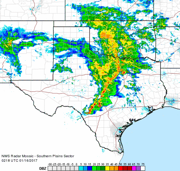
| Regional radar animation valid from 5:28 pm to 6:38 pm on Sunday, 15 January 2017. Additional radar animation can be found at: 3:18 pm to 4:28 pm Sunday afternoon and 8:18 pm to 9:28 pm Sunday evening. | |
| The upper low that spurred all of the rain finally accelerated up and over the South Plains Sunday evening, providing one last round of rain. However, the air aloft cooled just enough to allow the rain to change over to snow across parts of the Texas Panhandle Sunday evening. The snow developed as far south as Friona, Easter, Nazareth, Tulia and Vigo Park, which all saw a quick 1/2" to 1", with isolated higher amounts. This did create some tricky travel for a short while before the snow quickly came to an end shortly after midnight Monday morning. Further north, where the snow lasted longer, many spots across the northwest half or so of the Texas Panhandle recorded 1 to 3 inches of snow. | |
 |
|
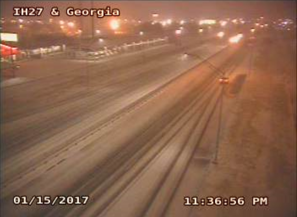
| Interstate 27 and Georgia Street in Amarillo at 11:37 pm on Sunday, 15 January 2017. | |
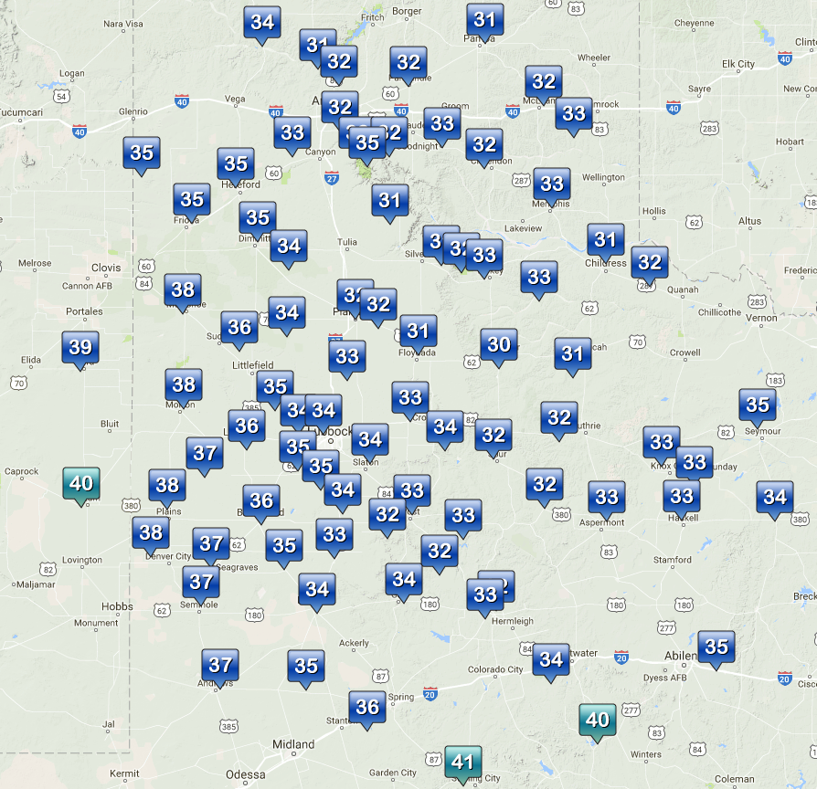
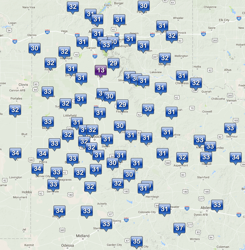
| The below images show the cool temperatures that invaded and held tough through the weekend. Skies eventually cleared and temperatures warmed more significantly into the 40s, 50s and even lower 60s on Monday afternoon. | |
 |
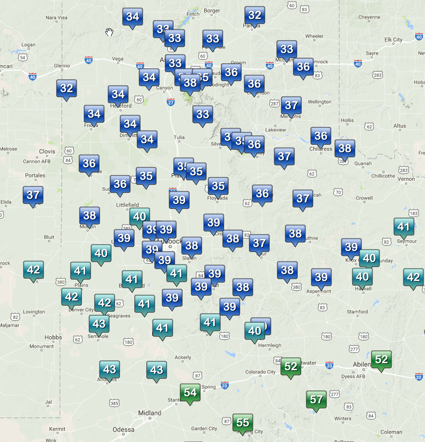 |
| West Texas Mesonet observed highs on Saturday, 14 January 2017 (left) and Sunday, 15 January 2017 (right). The lows the morning of the 15th can also be VIEWED HERE. | |
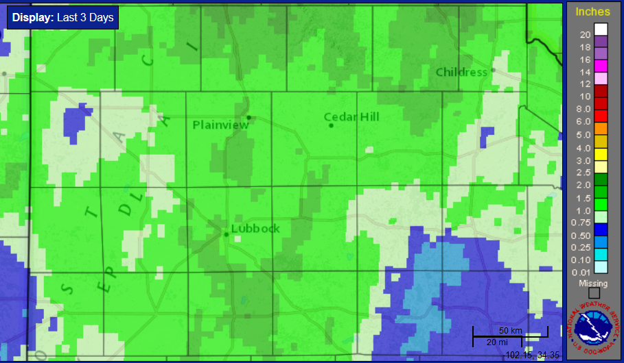
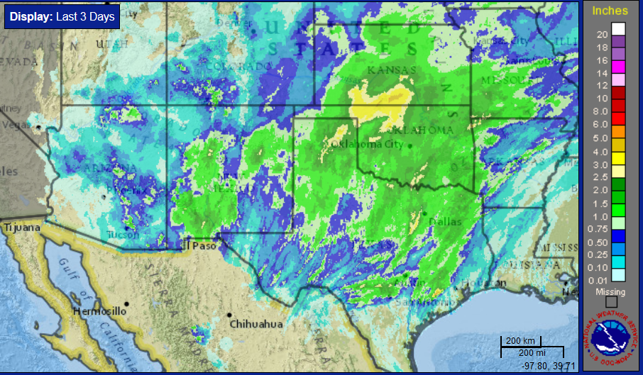
| By the time all was said and done bountiful amounts of moisture had fallen over the area. Rain totals in excess of 1 inch were common over all but parts of the Rolling Plains as well as a few spots across the western South Plains. Many locations along and near the I-27 and U.S. 87 Corridor saw totals near or in excess of 1.50 inches. | |
 |
|
| Radar-estimated and bias-corrected three day rainfall total ending at 6 pm on Monday, 16 January 2017. A regional view of the same image can be ACCESSED HERE. | |
| Officially, the Lubbock International Airport record 1.55 inches over the weekend. This amount of rain in January, climatologically the driest month of the year, is impressive. To impart this point, the 2-day rain total of 1.55 inches ranks as the 4th highest such total ever recorded in January. This rain, coupled with 0.40 inches that fell early in the month, already has January 2017 as the 4th wettest January on record. The wettest January occurred in 1949 when 4.05 inches fell. | |
 |
|
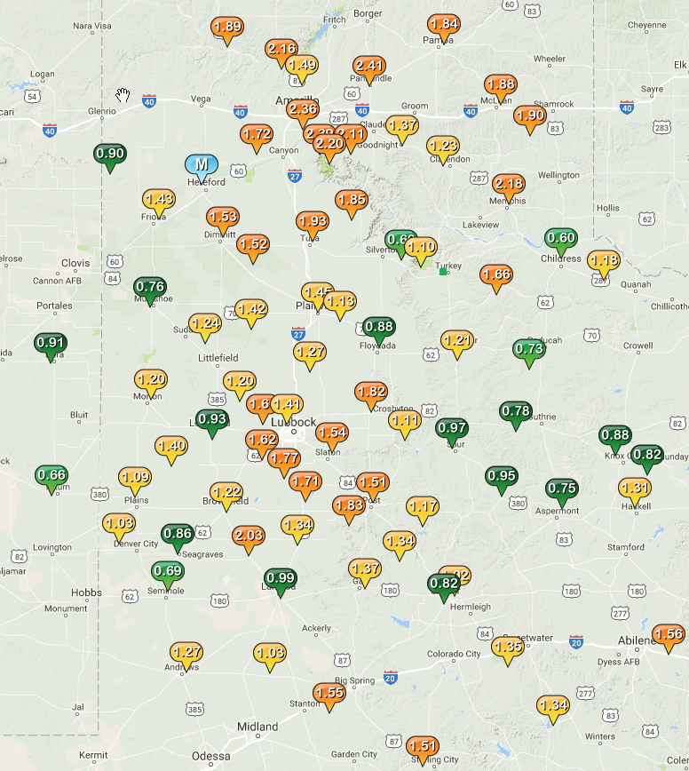
| West Texas Mesonet 72-hour rainfall totals ending at 7 pm on 16 January 2017. | |

